
If you would like to receive notification of future posts, please sign up below. I will not share your email address information with anyone.
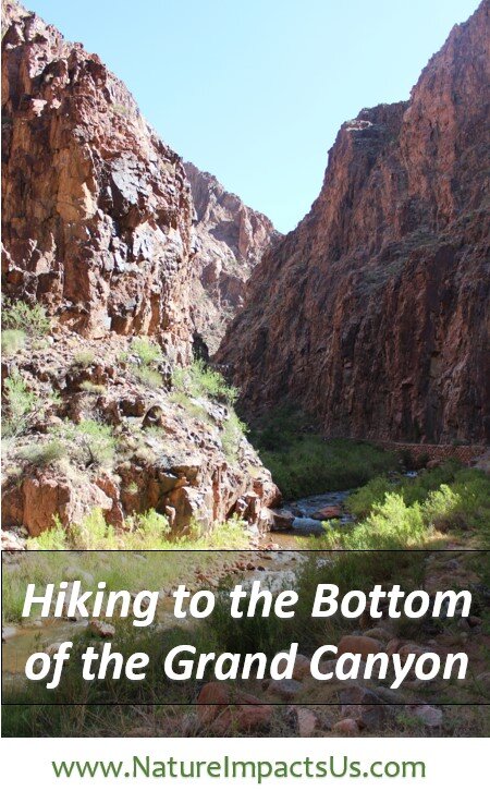
The Grand Canyon is a mile-deep hole that I fell in love with when I was 14. My parents took me on Spring Break to Zion, Bryce and the Grand Canyon. Zion and Bryce are beautiful parks that have captured my heart as I’ve gotten older, but the Grand Canyon stole my breath away immediately and I’ve never gotten it back. We hiked down the South Kaibab Trail a little past Cedar Point. Far enough into the canyon to grab hold of my imagination forever, but not far enough down the trail to glimpse the river that had the audacity to carve such a wonder. Ever since having to turn around, I’ve wanted to go back.

My first return trip was 18 years later. I was married with two boys (ages 6 and 2), and we had two exchange students living with us. We went on an epic road trip from Minneapolis, MN, to the Grand Canyon, stopping at 10 other National Parks along the way. It involved 70+ hours of driving, but is still one of my favorite Spring Break trips.
This time we hiked down the Bright Angel Trail, but we were carrying my youngest most of the way and there was quite a bit of snow on the trail. We only made it about a mile down before turning around - the river continued to evade me.

The next year we hosted another exchange student. When she told me she wanted see the Grand Canyon while in the US, I was sure my heart could not take a third trip without getting to put my feet in the Colorado River.
While planning another Spring Break trip to the Southwest, a separate part of me started plotting how to get to the bottom of the Grand Canyon. I read story after story of how people safely made it down to the river and back in one day, despite the signs warning of imminent death if one tried such a feat. What I was surprised to learn as I read reviews of this hike was that there are two bridges that cross the river, which allow a person to hike from the South Rim to the North Rim of the Grand Canyon. The goal in my head grew from 17 miles to 21.5 miles.

There isn’t an easy way to get to the North Rim. It’s only open seasonally May through October. There are no towns close by it, and there’s only two options for sleeping - camping and the Grand Canyon Lodge. There was no way I would plan to hike out of a canyon with camping gear, but on a whim, I looked up room availability at the lodge. I found one room available that I could book with no cancellation fees. Without asking my husband, I booked the room, just in case…

Step one complete. Step two involved convincing my husband that he also wanted to hike the Grand Canyon Rim to Rim. I don’t know that I ever actually accomplished step two. I think Chris agreed to come with more to uphold our vows where he promised to be with me for “the best and worst of what is to come…” Step three was to convince my parents to watch the boys for us. It’s a parent’s job to worry. You can imagine how well this plan went over.

While planning for the hike of a lifetime, we travelled to Arizona for Spring Break as promised. We drove out to Sedona, Monument Valley, Canyonlands, and Arches. On our way back to Phoenix, we went on a tour of Antelope Canyon, and had just enough time to see the Grand Canyon from the rim as the sun was setting before heading to Phoenix. As I gazed out at the vastness, I questioned my plan. It wasn’t regret I felt looking out at the canyon this time; it was fear.

I trained for 6 months leading up to this hike – running, climbing stairs, lifting weights, doing squats, push-ups, and sit-ups, and walking everywhere with an 18 lbs weight vest that I thought looked like a bullet proof vest and made me feel ridiculous. Chris and I went on a training hike up on the Superior Hiking Trail – hiking 18 miles on the first day and another 10 on the second. Nothing like what we’d be tackling in the canyon, but up until then I’d never hiked that far in a day.
I researched hiking gear – boots, socks, water filters, water sterilization, poles, etc. I learned which foods to eat while hiking in the heat and read about how best to stay hydrated with both water and electrolytes. I refreshed my first aid knowledge and read up on the early signs of heat stroke. Before bed each night, I would read trail guides, reviews, and blogs, memorizing pictures of landmarks where we would find water stations. I even laminated maps of the trails we would be taking.

Chris and I flew into Phoenix the morning of June 15, 2016. This was the weirdest trip I have ever packed for. We had a bunch of stuff piled on the bed, and instead of trying to see what we could fit into a suitcase, we were having the conversation – “Will I die if we don’t bring this?” And if the answer was “No” – then we asked, “Do I want to carry this on my back?” We rented a car and headed North, stopping in Flagstaff for a carbo-load at Olive Garden, before driving to the South Rim.

We talked with some park rangers to find out the best place to park overnight while we were on the North Rim and verified with them how to navigate the buses. Our plan was to hike down the South Kaibab Trail and up the North Kaibab Trail, spending the night on the North Rim at the Lodge. We hadn’t yet decided if we would take the bus back or attempt hiking back. If we hiked back we would take the Bright Angel Trail up. As we’d be leaving before dawn and likely hiking back up after the bus service ended if we made the return trip, we needed the car near the Bright Angel Trailhead that was close to a bus route to the South Kaibab Trailhead. We settled on Parking Lot C. We walked out to Mater Point before calling it a night and checked into the Red Feather Lodge to repack our bags and get an early night’s sleep.

3:15am - We woke up, drove into the Park, and parked in Lot C, right next to the Bright Angel Trailhead, and took the Hiker’s Express Bus to the South Kaibab Trailhead. At this point, I was terrified.
4:30am (0.0 miles) - Trailhead - We were the first to get off the bus, but were stopped by a mule train before even starting down the trail. Following the mules, excitement overtook the fear as we headed down the first switchbacks.
4:45 am (0.9 miles) - Ooh Aah Point - The sun started to illuminate the canyon walls and the colors were amazing. I’d highly recommend hiking to Ooh Aah to see the sunrise – you won’t regret it.
There were other 3 maybe 4 groups of hikers that we saw after Cedar Point, but most of the way it seemed like it was just us in the canyon. The morning was still cool, the sky cloudless, our bags were heavy with water and supplies, but we were exhilarated – going down is easy!

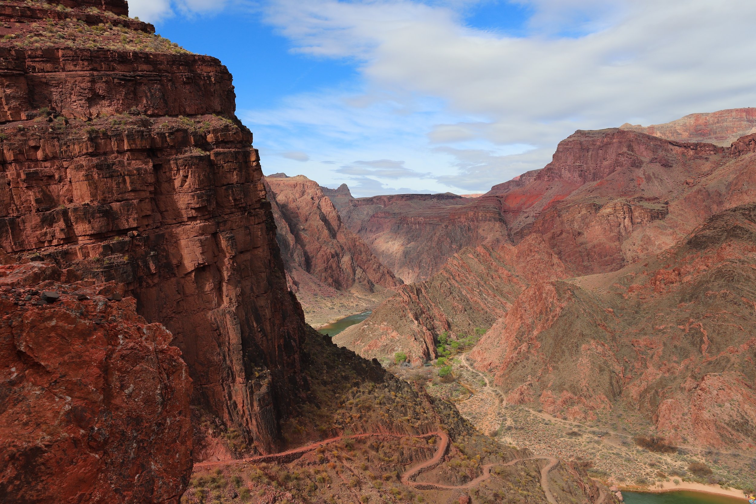
5:40am (3.0 miles) - Skeleton Point – Our first glimpse of the Colorado River from the trail. This is also the halfway point to the river, our first decision point, and we kept going. We continued downward, and the final descent from Tip Off to the river took us another hour. Happily there was no plan for us to return going up the South Kaibab Trail, therefore we didn’t worry that we’d just hiked down 4,780ft in elevation… That realization would come later.

7:30am (6.3 miles) – At the Bottom - I finally got to put my feet into the river that carved the Grand Canyon and stare up at the walls that stretched a mile high. I felt so small and unimportant in such scenery. The further I hiked away from society, I could feel the stress of my everyday life melt further and further away. The only goal I needed to focus on was climbing myway back out of the canyon.

7:45-8:45am (7.4 miles). If we made a mistake on our hike, it was spending an hour at Phantom Ranch. We ate “lunch” – peanut butter and jelly sandwiches while we waited for the building to open at 8, and then wrote out postcards that were stamped “Mailed by Mule.” We also enjoyed chatting with a couple from Switzerland that we had passed a few times on our hike down. While we idled at the bottom, the sun kept rising. There is a reason the Park tells you to get through the Inner Canyon by 10am - we would soon discover why for ourselves.

To hike rim to rim and stay at the Grand Canyon Lodge, your options are May - October. The thing about hiking at this time of year is that the bottom of the Grand Canyon is hot, even in the morning.
The first 3 miles on the North Kaibab Trail are known as “the box.” This is the belly of the earth. The rocks, known as the Vishnu Schist, are 1.75 billion years old. The canyon is narrow and the trail was loud due to the water flowing from Bright Angel Creek and several cicadas.

We made it through the inner canyon before the sun rose over the walls, keeping us mostly in the shade. The trail has several bridges which cross the creek, and stays fairly flat. The only thing which was very intimidating was the height of the walls, which we started to realize that we would be somehow climbing out of. We kept up a quick pace to get through this portion of the hike to avoid being baked by the sun.
The trail widens out, and as it departs from the creek, it climbs relentlessly upwards. Now in the sun, we felt like we were walking in a crock pot. This would be the part of the trail where the excitement of hiking the Grand Canyon began to wear off.

There was absolutely no shade as all the plants remain very small. Combined with a seemingly never-ending trail that continued to ascend, we wore out quickly. We wanted to rest and take a break, but there was no place to do this out of the sun, and if we idled, the temperature continued to rise.
Quitting is not an option. Our option was to not hike all the way to the bottom, and we past that decision point a long time ago. We soaked our shirts and bandanas in the cold creek water and kept moving.

11:20am (13.0 miles) – At the advice of hikers going the other direction, we took the bypass to Ribbon Falls. We cooled off in the creak and found shade behind the water fall. We lost the trail once trying to get there, but by this time we had joined up with another group of hikers, and we figured it out how to get there together.
Throughout our Grand Canyon adventure, we found that we had exactly what we needed each time we needed something. And at this moment, it was rest from the hike, the sun, and the heat. It was moment to breathe and to just be.

2:00pm (16.0 miles) – Where is the shade? This was the hardest part of the hike mentally. I’d known from reading blogs that this hike was as much a mental game as a physical challenge – and this came to be very true. At this point in the hike it was a slow but constant uphill climb in the sun and it was hot. , but we didn’t stop until we reached Cottonwood Campground. We kept our shirts and bandanas wet, and we were excited to find a break in the water pipe that provided an extra water stop mid-way. By the time we’d reached the Pump House, we had climbed high enough in elevation that it finally began to cool off.

2:45pm (16.7 miles) – Roaring Springs - The water seems to flow straight out of the rocks – magical in the middle of the desert. This was the point in the trail where we started to look up and tried to figure out how possibly we were supposed to climb out of this hole. But looking up was better than looking down. The trail was wide, but on the other side of it, it dropped off so suddenly you could no longer see the bottom. I reached out and kept my left hand on the rocks for some stability.
We slowed our pace and took breaks now that the temperature had cooled off. I’m not sure how many peanut butter and jelly sandwiches I’d eaten by this point in our hike.

5:05pm (19.7 miles) – Supai Tunnel – We cheered at this mile marker, but from this point on it was incredibly steep. The hardest part of hiking any canyon is that you go down first, and while down is optional, up is mandatory. After 16 miles of hiking in the Grand Canyon you must now walk up the equivalent of the Empire State Building 3 times… One foot in front of the other, we kept the pace of walking for 30 minutes then taking a 10-minute break. We alternated between bottles of water and Gatorade, ate an entire box of wheat thins between us, and tried to focus on the beautiful scenery instead of how much our legs hurt. The tunnel was a sign of hope that we’d almost made it.

6:30pm (21.5 miles) – North Rim Trailhead – In the last mile of the hike, we found a couple who had a car on the North Rim and they offered to give us a ride to the lodge. This kept us going up the last incline without complaint. The ride ended up not working out (as they’d gotten too far ahead of us), but it was the motivation we’d needed to keep us going at the end. Here at the top we’d done it – Rim 2 Rim!

7:20pm (23.0 miles) – North Rim Grand Canyon Lodge – There isn’t a bus from the trailhead to the lodge. After already hiking 21.5 miles, what more is another 1.5? What I didn’t expect though was the continued incline to get to the lodge. Quitting was still not an option. We wanted to see the sunset along the North Rim, and we had a dinner reservation at 8:00pm so despite much complaining from me, we kept going. The heat had taken its toll though – my stomach was upset and my knees were in a lot of pain.

This is what success looks like – we were dirty, tired, and everything hurt, but we’d made it safely, and I’d accomplished my goal of putting my feet in the river. We were not able to even consider thinking about hiking back in another day of heat, so we called the bus company and scheduled a return ride to the South Rim the next day. We celebrated our day with an amazing supper, conversation with other hikers, and we used the golf cart service instead of walking back to our cabin.

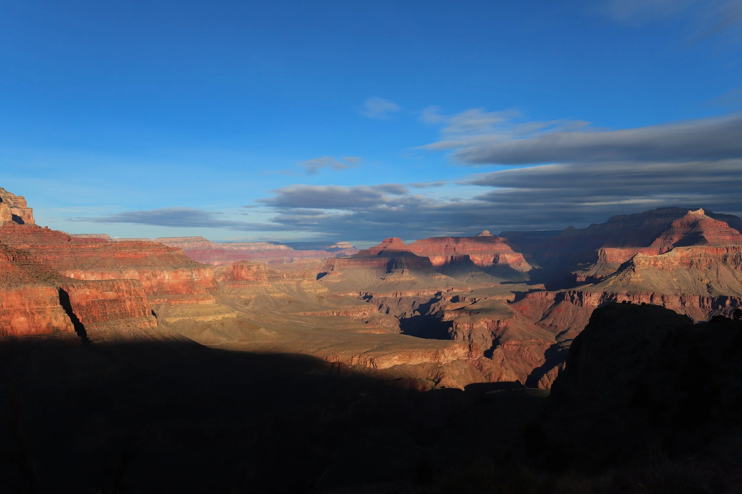
June 17, 2016, 8:30am – We were greeted in the morning by an incredible view. We went on several small rim walks to overlooks and stopped at the gift store. We both felt refreshed, hydrated, and even my knees were doing ok. We hadn’t taken any pain medication the night before because we didn’t want to make decisions with the pain masked, but even without it, we were doing pretty well.

We went to breakfast at the lodge where giant windows overlook the rocks, and there I am staring out over the canyon that has been calling to me since I was 14. We talk with other hikers – “If I never go back into that hole again, it will be too soon…” “But you’re going to hike back aren’t you?” How could we possibly leave this behind and get on a bus? It wasn’t about a goal (we’d already accomplished it), it was another opportunity to spend a day in the Canyon. So we called the bus company back (they kept $10 from our moment of weakness) and we spent the next hour planning on how to hike back safely.

12:40pm (24.5 miles) – Trailhead. Here we are again, staring at the trail wearing our boots, poles out, knee braces on, and hoping we aren’t the stupidest people ever. Our plan was simple. Stay in the higher elevations through the warmest part of the day, and then drop into the inner canyon in the late afternoon when the trail was in the shadows. We planned to hike out at night when it was coolest. We talked through our plan with a park ranger as well, and she added that it would be a beautiful night hike with the full moon.

1:10pm (25.4 miles) – Coconino Overlook – The second day was less stressful as we were trying to go slow. We stopped frequently to take pictures and encourage the hikers who were going up. 14 miles would be downhill today, and most of it was would be out of the sun. We took our time and enjoyed where we were at.

4:40pm (29.9 miles) – Pumphouse – Although this part of the hike wasn’t hard, we were starting to get up there in the miles that we’d been walking in our boots. This was a good place to rest our feet in the water, pop blisters, and wrap our toes in moleskin. The river still flows through my blood today.

5:30pm (31.3 miles) – Cottonwood Campground – Now down at the lower elevations, it was warmer, but the sun was behind the walls. The trail continued to descend but at a much less steep pace, and the hardest part of day 1 was the easiest part of day 2. There were surprisingly few people in the camp ground and we didn’t see any park rangers. We refilled with more Gatorade and I started to think I might never be able to eat another PB&J sandwich.

7:00pm (35.5 miles) – The Box – We were completely in the shade, but a full day of the Vishnu Schist in the sun resulted in an amazing amount of heat coming off of the rocks, and there wasn’t any breeze. We started to slow down again, and I wondered if this part of the trail might never end as the sun began to set. I could only focus on getting to Phantom. I couldn’t imagine how I was possibly going to climb out of the canyon a second time.
8:30pm (38.5 miles) – Phantom Ranch – We were surprised and excited to find that Phantom Ranch was open when we got there. The ice cold sweet lemonade was exactly what we needed. But inside we were surrounded by people who had reached the end of their day’s destination while we had the hardest part of the day left to go. We quietly moved outside. I laid down on one of the park benches, and I stared at the canyon walls bathed in moonlight. I was torn between feeling so blessed to be able to be at the bottom of the canyon to see it in such an unexpected form of beauty and the other part of me was wondering how the hell do I get out of this hole that I decided to climb into a second time??? Both Chris and I hurt so much we were surprised to observe we could still keep moving.
We crossed over the silver bridge and entered the Bright Angel Trail. This was different than the trail we’d gone down so we were relying on the moon, our headlamps, and well-marked trails. The next 1.5 miles to the River Rest House were flat, but this was my mental breaking point, as the trail goes up and then back down along the river without making any overall progress in in elevation gain. I could not focus on just the next trail marker and I could only see the 10 miles ahead of us and the 4,380 ft left to climb. As I wasn’t concentrating on where I was at, I slipped and fell while crossing a small creek. I didn’t get hurt, but my foot was soaked. I reached into my bag and pulled out a clean pair of dry socks. I realized again that I had everything that I needed. The panic went away and didn’t return.
We made our way to the rest house and started our ascent. 30 minutes of walking, 10 minutes to rest, re-fuel, and pop blisters. We cheered each other on and only thought of the next trail marker. Complaining wasn’t allowed. We heard a mountain goat, saw a deer and almost stepped on a scorpion. We had the trail to ourselves except for a few headlamps we could see on sections of the trail behind us.

June 18, 2:49am (48.5 miles) – Trailhead. There were no whoops, no high 5s, no tears. We just looked at each other when we got to the top and asked how far we still had to walk to get to the car. We hobbled together, happy to reach the car so we could turn the heat on – it was surprisingly cold at the top.
The only restaurant open at this time was McDonalds, but they had food other than PB&J sandwiches. We checked back into the Red Feather Lodge, and they gave us a free late check-out, so we could get some sleep. After a shower, we slept till noon.

Rim2Rim2Rim = Temperature swings (43-106 deg F), High altitude (8,297ft), Low humidity and likely dehydration, Prolonged endurance (48.5 miles), Extreme elevation change (20,682ft) and No quitting

It was a hike of extremes, a hike of a lifetime, a hike where we gave ourselves to the canyon and the canyon gave back to us, a hike that we loved, a hike that we hated, and hike that forever changed us.

And you’d think that would be the end of my story, if I were a normal person… But guess where we were in March 2018? Yep, back at the bottom of the Grand Canyon. On my way back up I cursed being in love with this hole, and swore I’ll never go back. I don’t think Chris believes me.
If you enjoyed this, check out my other posts
There are posts linked to each pin below.