
Last Updated: 15Feb2025

St. Croix River from Wisconsin’s Interstate State Park
If you enjoy my posts, please consider signing up below to get email notifications of my latest posts. I will not share your email.
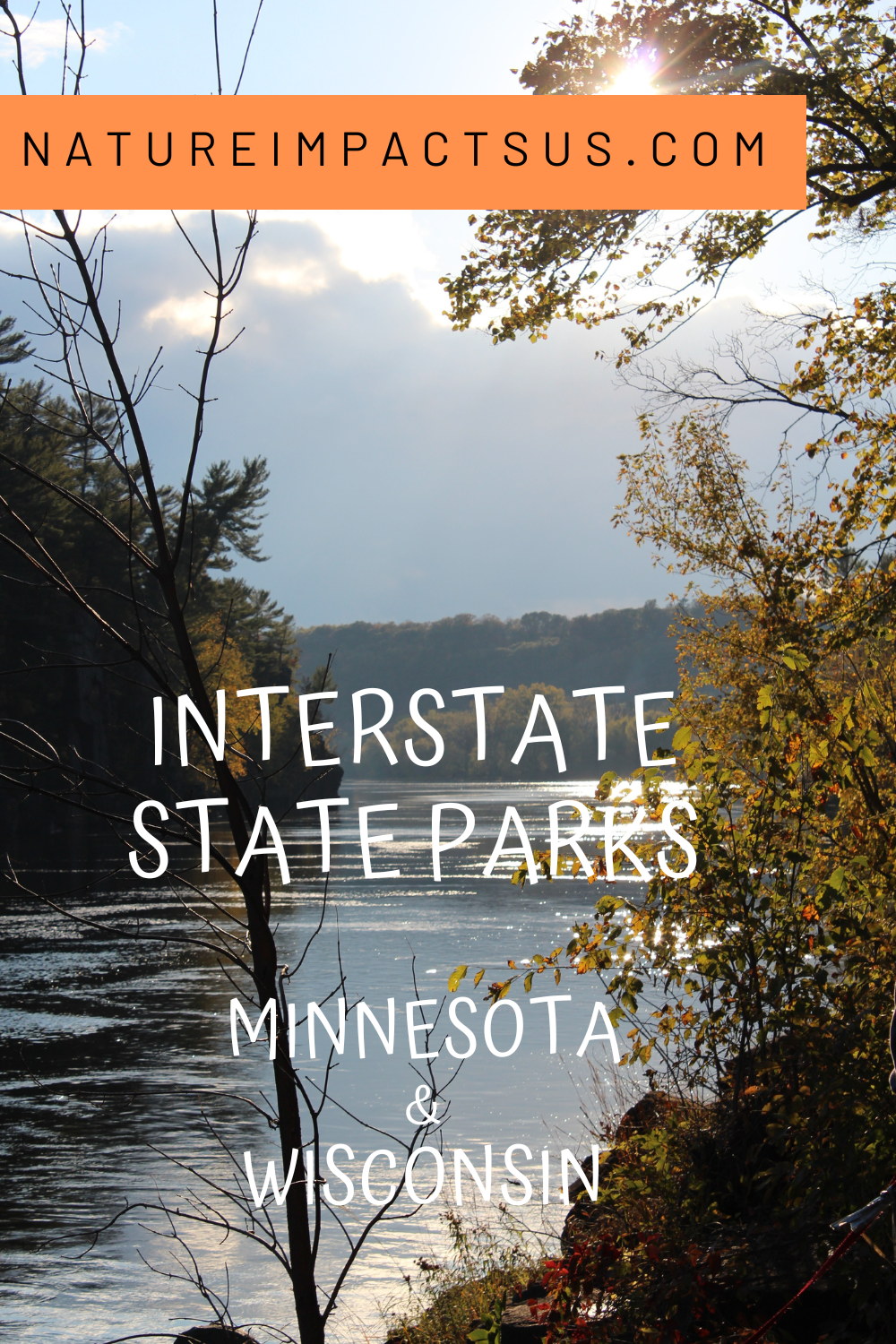
Interstate State Parks - Minnesota and Wisconsin
One of my family’s favorite places to hike near the Twin Cities (Minneapolis and St. Paul) are the Interstate State Parks. There are actually two state parks with the same name. One is in Minnesota and the other is in Wisconsin. They sit across from each other on opposite sides of the St. Croix River. The bluffs along the river are beautiful, the bald eagles are amazing to watch, boating is a nice way to stay cool in the summer, and rock climbing looks quite fun, but I think the best part of these parks are the unique glacial potholes. The trails at both Interstate State Parks go past through, around, and into small, medium, large, and huge perfectly spherical holes. Some are the perfect size to climb into, some you can explore to the bottom with the aid of steps, and some are so deep that you won’t be able to see the bottom. The exact depth of Bottomless Pit is unknown, but it measures at least 60ft deep, and is the largest known pothole in the world. Bottomless Pit can be be found in the Minnesota State Park along the Pothole Trail.
Link to MN Interstate Park Map: MN Map
Link to WI Interstate Park Map: WI Map

The perfect sized pothole
Location and Logistics
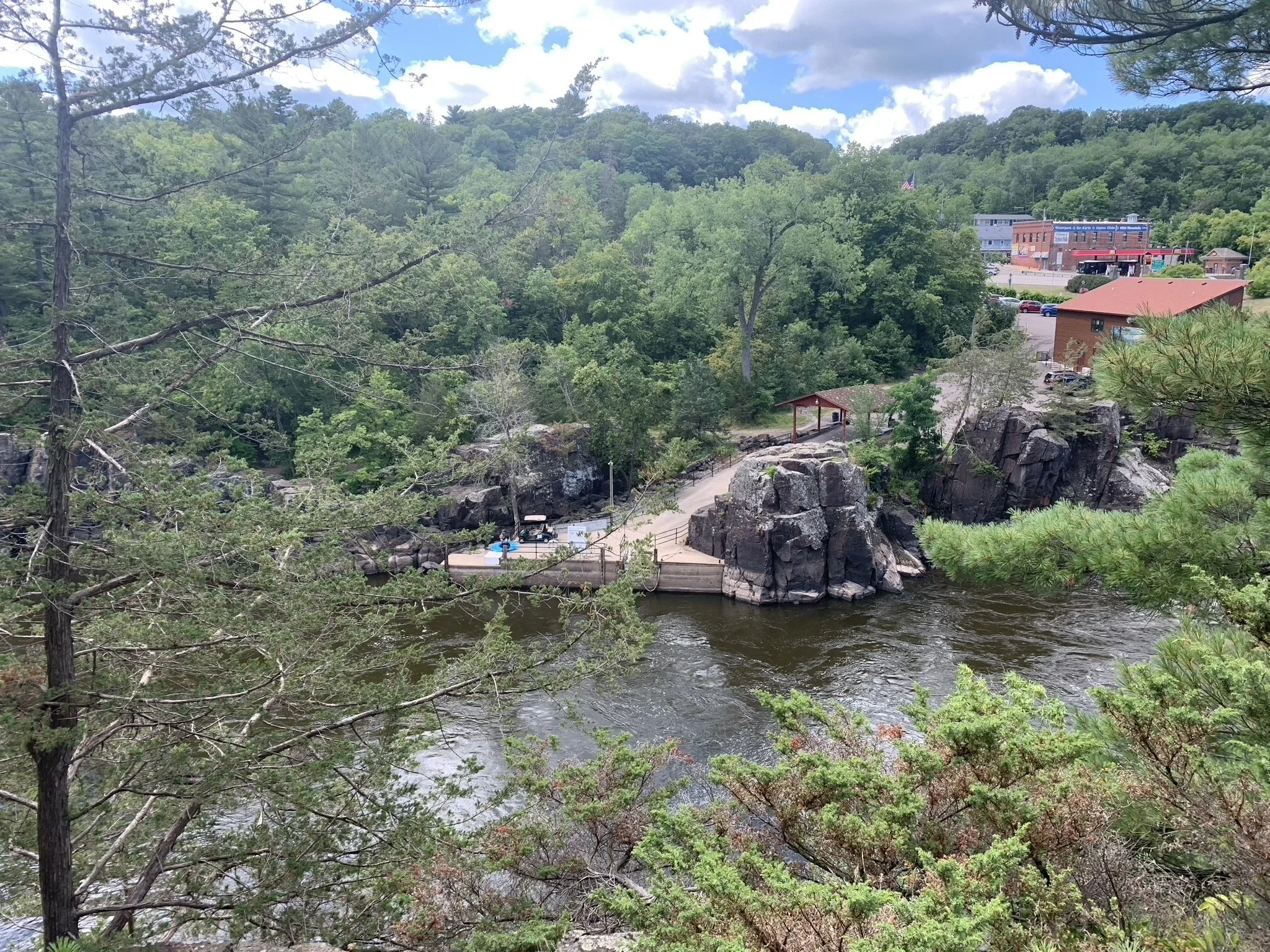
Minnesota and Wisconsin Interstate State Parks are located across the St. Croix River from each other, and a bridge over the river along US-8 connects them. The visitor center on the Minnesota side is in the town of Taylors Falls, where there are a handful of small restaurants.

Clarifying Taylors “Falls” - it’s not a waterfall - the falls the town is named after is really just a set of rocky rapids as seen in this picture under the US-8 bridge
Although both parks are right next to each other, because they are each in unique states, they each require their own state park’s entrance fees. The Minnesota Park can be accessed with an annual Minnesota State Park Pass, and the Wisconsin Park can be accessed with an annual Wisconsin State Park Pass. Or daily passes can be purchased at both parks. As we live in Minnesota, I always have a MN State Park Pass, so it’s free for me to visit the MN-side, therefore I’ve been there multiple-fold more times. I’ve used the daily fee option for the handful of times I’ve been on the Wisconsin side.

Taylors Falls, Minnesota
Which park is better? There is a video in the Wisconsin Interstate State Park visitor center that lists all of the reasons why their park is better, the humbleness of which made us laugh out loud while watching. I think the potholes are more impressive on the Minnesota side. The best place to swim is the beach on Lake O’ the Dalles in the Wisconsin park. Canoe rentals are available with a shuttle return in the Minnesota park. I’ve seen people rock-climbing in both parks. The Wisconsin park has more trails to hike and a waterfall, although it’s quite small. The trails in the Minnesota park are just as pretty, but not as long.
Below is a map of both parks. I use hyperlinks in the captions for people to be able to easily move within my posts. For anyone interested specifically in hiking at Minnesota’s Interstate State Park, click on the link in the captions. There is a similar quick option for navigating to trails in the Wisconsin Interstate State Park. If you want to learn about both state parks and and things to do other than hiking, just keep reading.

Parking is marked with black stars. Visitor centers are marked with red stars. Below are hyperlinks to specific sections within this post for quicker navigation options.
Minnesota Interstate State Park
Things to Do
There are so many different ways to to fill up a day between the Interstate State Parks. Of course there are hiking trails at both parks. There is a beautiful sandy beach on Lake O’ the Dalles in the Wisconsin State Park, where people can swim and play in the water. There are canoe and kayak rental options, and both parks have boat launches. There is also a separate ferry operating right next to Minnesota’s State Park visitor center. For those that are a bit older and slightly more brave, private guides also operate rock climbing businesses at the state parks. Both the Minnesota and Wisconsin State Parks also have nice campgrounds, which can be reserved in advance.

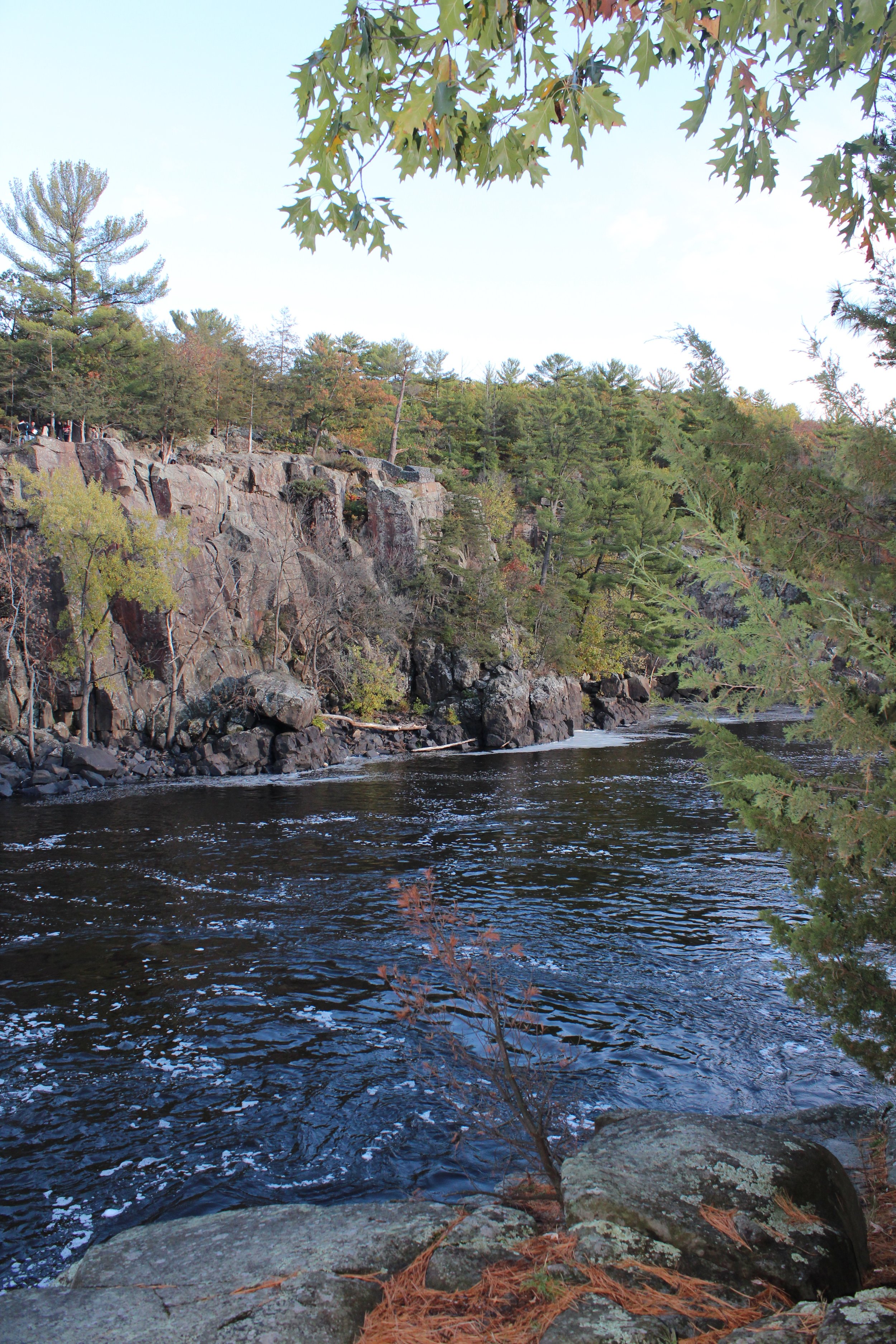
St. Croix River
Camping
We’ve stayed at the Minnesota Interstate Park campground twice. Both times the campground was quiet in the evening and the bathrooms were clean. That’s all I’m really looking for in a good campground. I would recommend booking early and reserving a riverside campsite to have your own waterfront access.
One of the nicest aspects of this campground is that if you live near Minneapolis or St. Paul, this makes a great “trial run” for camping. If you haven’t camped before, especially if you haven’t taken your children camping before, this a great, low-stress place to start. If your night isn’t going well, if you forget something, or whatever the issue is, just leave and drive home and head back in the morning to take down your tent. This was the first place Chris and I ever went camping as a married couple, specifically to try it out as the shake-down camping trial. No issues though, and we had a great weekend. Camping is a part of summer I look forward to every year.
For any first-time campers out there, here is my camping packing list, in case it might be helpful.

Kayaking up the St. Croix River from our riverside campsite
Boating
With the St. Croix River in-between the Minnesota and Wisconsin Interstate State Parks, boating is going to be a great option to stay cool in the summer months.
There are boat launches onto the St. Croix River from both the Minnesota and Wisconsin Interstate State Parks. On one of our camping trips, we brought our own kayaks. We paddled upstream to the falls and then floated back to the launch. This was a short water trek, but kayaking upstream is harder than it sounds. We also have a portabote (boat that folds flat and lays on top of a car carrier). We brought the portabote and a small motor up to Minnesota’s Interstate Park for a day trip. We floated downstream and then motored back to the boat launch.

Motoring up the St. Croix River
If you don’t have your own boat, there is a place you can rent both kayaks and canoes from the boat launch in the Minnesota Interstate Sate Park. This is a private company (Taylors Falls Canoe & Kayak Rental) that operates right next to the boat launch inside the park. These boats are reserved based on exit point, so you float downstream, and a shuttle bus picks you up at the exit point (there are a few different options) and brings you back to the boat launch. We’ve enjoyed this excursion a few times as well. It’s relaxing to float, but it’s also easy to get out of the boats and play in the water. There are several sand bars and places where the river is not very deep.

Kayaking down the St. Croix River
One last boating option for those that want to stay dry but still enjoy the view from the St. Croix River is the ferry. The ferry is run by Taylors Falls Scenic Boat Tour, and it’s right next to the Minnesota State Park visitor center. Note that there is a separate parking lot for those taking the tour, which does not require a state park parking pass.
I’ve taken this tour a few times during work outings. It’s a nice way to sit and talk with people while watching scenery, but might not be the best family activity for younger and potentially squirrely children, where there is limited space to explore and running isn’t an option.

Ferry rides can be booked through Taylors Falls Scenic Boat Tours.
Swimming
For anyone looking to swim, the best and probably safest spot is in Wisconsin’s Interstate State Park on Lake O’ the Dalles. There is a nice sandy beach, and the lake is separate from the river.
It’s possible to jump in the St. Croix at the boat launches, but they are not designated swim areas. There are several sand bars though along the St. Croix River where it’s fun to get out of your boat and splash around. These sand bars do require a boat to get to them, but canoes and kayaks can be rented out of the Minnesota State Park. The price of boat rentals includes a shuttle back to the parking lot.

Beach and swimming area at Lake O’ the Dalles in Wisconsin’s Interstate State Park

What am I doing swimming in the St. Croix River in early October? Our exchange student from Switzerland was egging me on - trying to say she was better adept at swimming in cold water. I was still young enough to take offense at that as someone who grew up in Minnesota, and yep, I jumped in. This water was not “scream-it’s-really-cold" cold,” it was “take-your-breath-away” cold. Not the best time of year or best location for swimming in the Interstate State Parks…
Rock Climbing
Both the Minnesota and Wisconsin Interstate Parks have some fantastic cliffs for rock climbing. Over the years, we’ve seen several people who are both experts and just enjoying the day rock climbing, as well as small groups that are learning with a guide.
We haven’t had the opportunity to try this yet, but we are booked in May 2025 for an all-day private lesson in rappelling with Forged Guides. We’ve tried repelling once, a couple of years ago, near Zion National Park, and had an absolute blast. We used a private guide, similar to how Forged Guides is operated. We loved the entire experience and are really looking forward to the weather warming up this year to give it a try at Interstate Park.
Hiking Minnesota Interstate State Park Trails
All of Minnesota’s Interstate State Park trails can be hiked in a half day. My favorite place to explore, especially with kids, is the Pothole Area. After exploring the Pothole Area, there is a spot nearby to get down towards the river, which has pretty views of the St. Croix River lined by bluffs.
There are two longer hike options (Walter Mondale River and Railroad trails) that can be combined together to make a loop, and they connect the two different sections of the park - the visitor center (where the potholes are) and the campground. There are parking areas in both locations, although it’s useful to know ahead of time that the parking lot at the visitor center is closed in the winter months. Parking is available at the campground year round.
The Sandstone Bluffs hike can be either added in from the Railroad Trail, or hiked on its own as a loop from the campground.
I will use the below map with colors to explain where things are in the Minnesota park. Within the captions are hyperlinks. Click on the trail name, and the link will bring you to that section of the post, which will have pictures and more trail information. There will be a link back to the map at the end of each trail description. To read the entire post, just scroll as normal.

Map of Minnesota’s Interstate Park hiking trails. Parking is marked with black stars. The Visitor Center is marked with a red star. Wisconsin’s Interstate State Park trails are on the east side of the map.
Pothole Region (lime green) - Short stroll over rocks to various potholes - this is more of an exploration than a hike along a specific trail.
Road to the River (pink) - There is access to the St. Croix River along a short road from the main parking lot next to the potholes. This is a pretty spot to see the river, but there is not a beach.
Unnamed Trails behind the Visitor Center (dark blue) - Short trail loops lead through more rocks, pine trees, and with additional views of the river.
Walter Mondale River Trail to Railroad Trail Loop (purple) - A longer but still moderately easy trail.
Sandstone Bluff Trail (grey) - Moderately easy loop hike from the campground into the bluffs. There may be a really small waterfall if it has recently rained.
Minnesota’s Pothole Trail
Distance / Elevation Gain - The Pothole Trail isn’t actually a formal trail. Most of it involves just wandering around on the rock surfaces, and then walking along the base of the cliffs. There are some trail sections, but mostly this is just a space to explore. Seeing the whole region takes about 0.5 miles of walking with approximately a gain in elevation of 100ft. This area is marked in lime green in the map below.
Trailhead Location - The Pothole region is located next to the visitor center. The visitor center parking lot is closed in the winter, which is fine. While I love hiking on the Walter Mondale River, Railroad, and Sandstone Bluffs trails in the winter, I wouldn’t suggest exploring the Pothole region during these months due to icy, slippery rocks with rather large drop-offs.

Minnesota Interstate State Park - Pothole Trail Map (lime green)
Pothole Trail is a series of interconnecting trails along the bluffs. Some portions of the trails are better marked than others, but most people walk off the trail and explore on the rocks. These bluffs are quite high so if you are hiking with little ones, don’t let them wander off without you. There are not many guard railings.
From the bottom of the Bake Oven Pothole
There are several small unnamed potholes and also very large potholes such as Devil’s Alcove, Hourglass, Lily Pod, Devil’s Parlor, and Bottomless Pit. You can even walk down the steps into the Bake Oven pothole in the later months of summer when the water drains out.

Walking down into Bake Oven Pothole

At the bottom of Bake Oven Pothole

Walking around some of the larger potholes

Walking down at the base of the rocks

There are a lot of small potholes to play in
In addition to the potholes, there are some amazing view of the the St. Croix River, and places to just walk freely along the rocks.

Enjoying the St. Croix River views
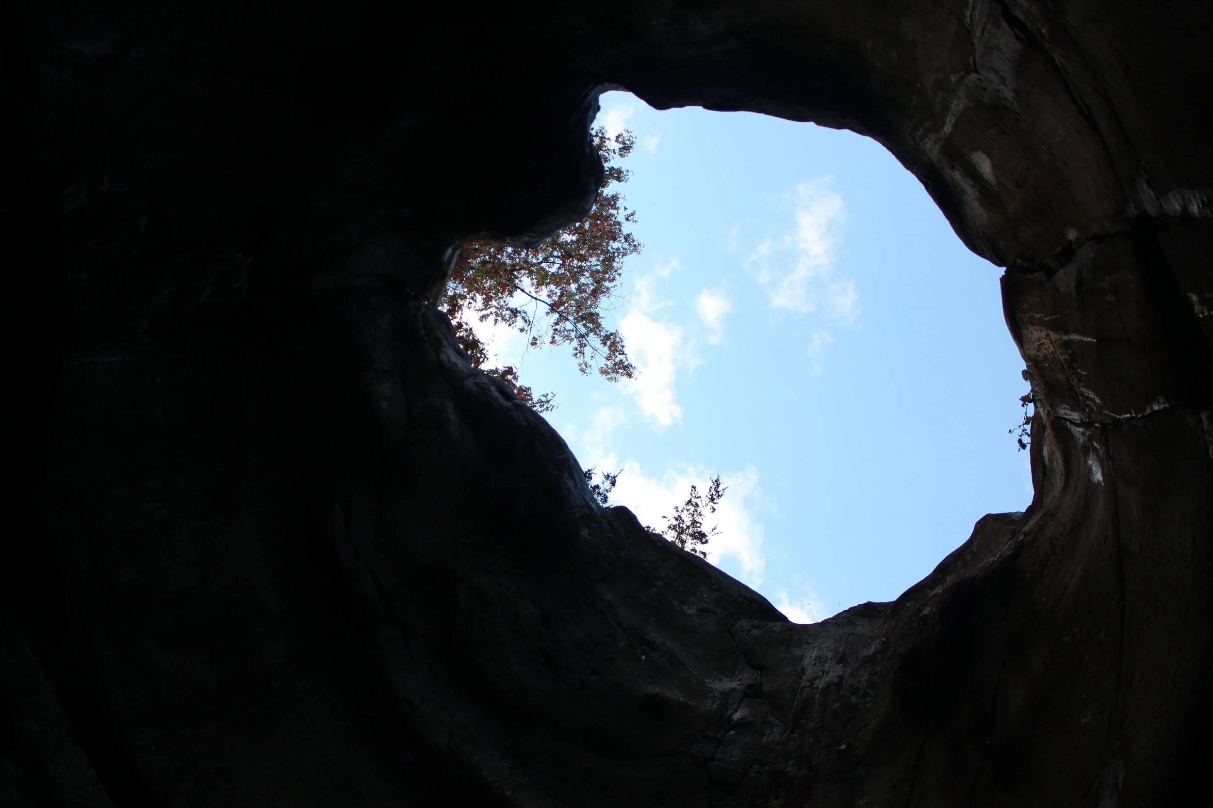
Along the Pothole Trail, there is also a small arch. I’m going to keep this location a secret so you have something fun to look for.

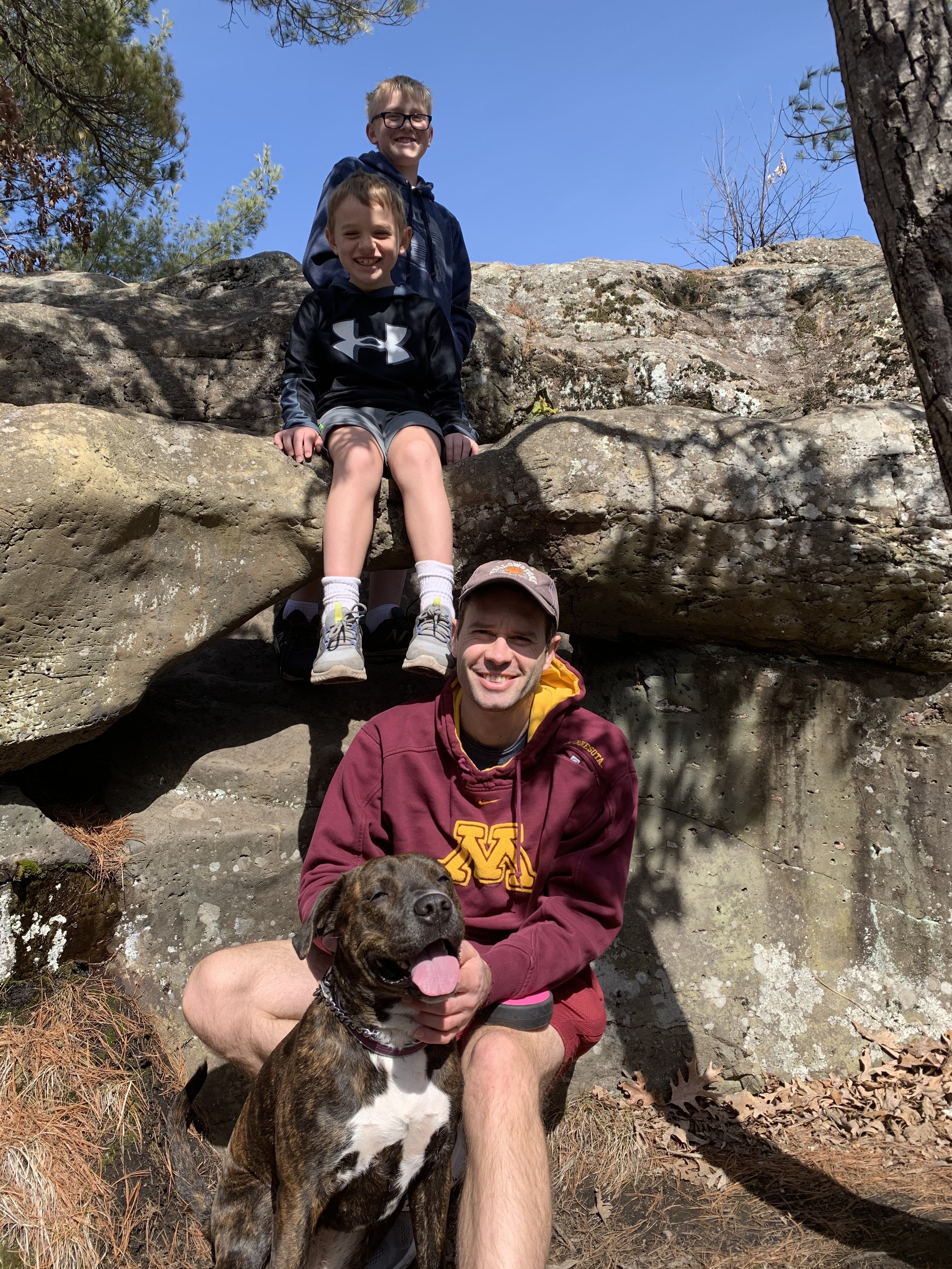
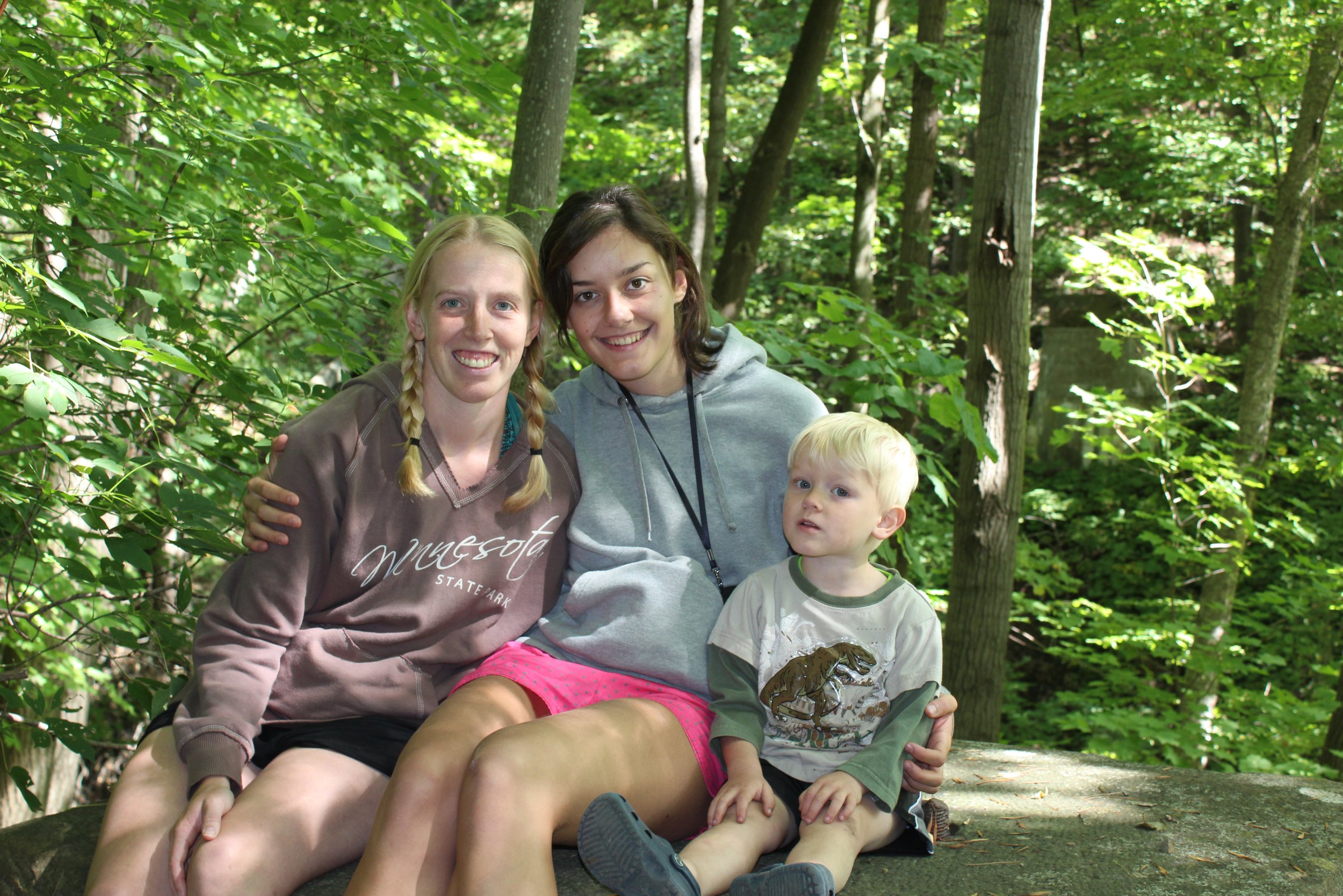
Hiking with our nieces
Same arch, several years later. Zion loves Interstate too. She doesn’t get to go on many trips with us, but Interstate is close enough for a day trip, so she’s been hiking here many times too. One happy dog!

Crawling up and down the rocks - Places, like Interstate State Park, that have rocks to climb up and down are hard to find near the Twin Cities, and these spaces are so much more fun for kids to explore than long, easy, flat hikes.
Road to River
Distance / Elevation Gain - To get down to the St. Croix River from the visitor center, follow the paved path / small road past the visitor center straight to the river. This is a 0.2 mile out-and-back easy walk with minimal change in elevation.
Trailhead Location - This road can be accessed from the visitor center parking lot.

Minnesota Interstate State Park - Road down to the River (pink)
From the Pothole Trail, I would suggest wandering down the short road to the St. Croix River. There are some pretty views of the bluffs that drop straight into the river, and this walk won’t add much extra effort.

River view from the end of the road

From the river, looking back towards the viewing area from the picture above at the end of the road.

View of the St. Croix River from the viewpoint along the road from the visitor center

Same viewpoint in the winter months
Unnamed Trails behind Visitor Center
Distance / Elevation Gain - There are unnamed trails behind the visitor that can be made into either 0.15 mile or 0.4 mile loops with minimal changes in elevation. These trails are marked in dark blue in the map below.
Trailhead Location - This trail can be accessed from the visitor center parking lot. The trails take off behind the visitor center.

Minnesota Interstate State Park - Unnamed Trails behind the Visitor Center (dark blue)
Behind the visitor center there are a couple of unnamed trails that can be explored. They go through a pine forest and down to the river. There is a short loop and longer loop option. I would recommend the Walter Mondale River and Railroad Trail Loop over this trail system for someone looking for a longer hike, but for a family with younger children that just want to play in the woods and by the river for a bit longer after the Pothole Trail, this is a nice option.

Hiking behind the visitor center along the rocks
The trail goes downhill to the river
Walter Mondale River Trail to Railroad Trail Loop
Distance / Elevation Gain - Hiking both the Walter Mondale River and Railroad trails as a loop results in a 2.75 mile hike with an approximate gain in elevation of 370ft. Note that the full loop will require walking along the street sidewalks for a short distance, which connect the Railroad trailhead and the visitor center. This trail is marked in purple in the map below.
Trailhead Location - There are three different trailheads for this loop hike. The easiest option is the visitor center for anyone already at the Pothole region. Walk a short distance along the road that leads to the St. Croix River, and the trail will take off to your right, going up a hill.
The second trailhead option is from the campground. Access to the Railroad Trail, from the campground, can be found next to the Ranger Station. Head to the right and there will be a tunnel that goes under US-8. This tunnel will be closed in the winter months due to frozen water. Winter hiking will require running across the highway (not recommended), or just do out-and-backs along both the Walter Mondale River Trail and the Railroad Trail.
The third trailhead is off of Government Street. From US-8, turn onto St. Croix Scenic Byway, and then take a quick left on First Street, followed by a left on Government Street. There will be a small parking lot.

Minnesota Interstate State Park - Walter Mondale River Trail to Railroad Trail loop (purple)
Unless I’m hiking in the winter, I typically park by the visitor center to enjoy the potholes, so that’s the starting location I will use in this trail description.

St. Croix River from the MN Interstate State Park - River Trail
The Walter Mondale River Trail is 1.25 miles one-way. Although it’s called the “River” Trail, most of the views of the St. Croix River are at the beginning, near the visitor center. The trail does not go near the river, rather it starts out quite high above it. There are several sections of the trail that wander through the woods, and the river is not visible. The trail drops in elevation as it gets closer to the campground.

St. Croix River viewed from the Walter Mondale River Trail - Minnesota Interstate State Park

Same view as above in the winter

St. Croix River - viewed from the Walter Mondale River Trail
There is a split in the trail, and both ways can be taken to form the loop with about the same distance. Pick the trail option that goes directly to the campground. This section of the trail will be right along the water, and is one of my favorite spots in the park.

The trail eventually goes down in elevation as it nears the campground

At the beginning of the pandemic, when the concept of social distancing was still humorous to the boys. This is that section of the River Trail going to the campground, where it goes directly along the St. Croix River.
To make it a loop, take the 1.5 mile Railroad Trail back to the visitor center. The Railroad Trail is on the other side of US-8. To get across the highway, there is a tunnel going under the road. From the campground, walk towards the ranger station. The tunnel is along the trail, just past the ranger station.

Railroad Trail
The St. Croix River will not be visible from the Railroad Trail, but the forest is pretty. There are some up and downs along the trail, making it just a little harder than what I would rank as easy. The trail also goes past some sections of old railroad ruins and sandstone bluffs.
Hiking with littles requires a slower pace and frequent rests, but this is the perfect park to take young children.

Zion says Interstate Park is dog friendly too
Sandstone Bluffs Trail
Distance / Elevation Gain - Sandstone Bluffs is a 1 mile loop trail with an approximate gain of 320ft in elevation.
Trailhead Location - The closest parking lot for Sandstone Bluffs is from the campground. Access to the trail is via a tunnel under the highway, near the campground ranger station. This can also be added to the River / Railroad hike to make it a longer loop.

Minnesota Interstate State Park - Sandstone Bluffs Trail (grey)
Probably unsurprisingly, the Sandstone Bluffs Trail goes up into the hills near the sandstone bluffs. I’ve hiked this trail a handful of times, but usually we spend just a few hours at Interstate State Park, and we skip Sandstone Bluffs, in favor of the shorter Railroad Trail.
This is a great trail for anyone staying in the campground that wants something quick to do between supper and bedtime.
There is not a formal waterfall on this trail, but there is one spot where you may see a small amount of water falling if it has rained recently or as a result of snow melt.

Sandstone Bluffs Trail - spur to potential small waterfall
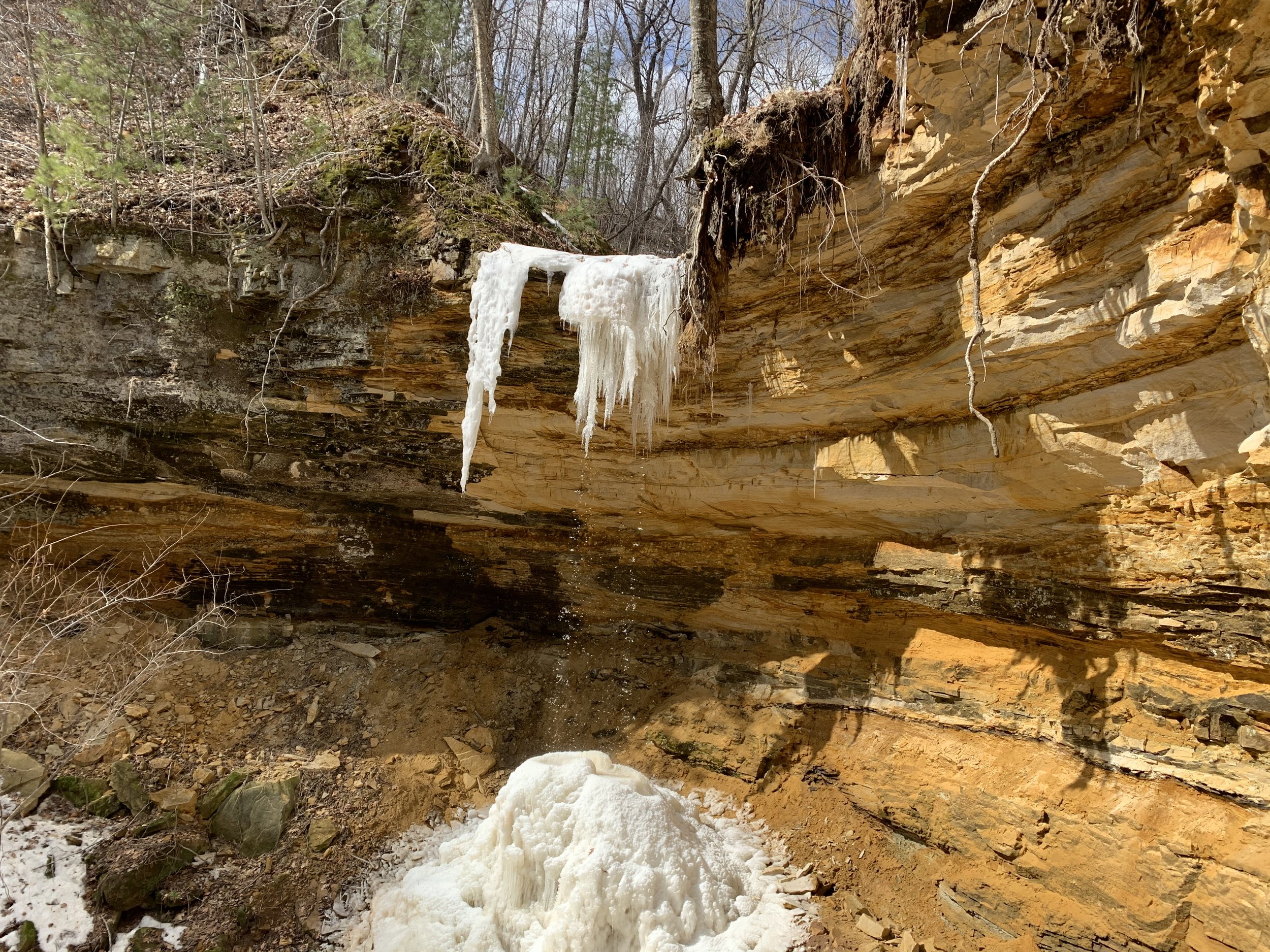
View from the end of the spur pictured above

You never know what you might find hiking out in the woods - this Christmas Tree made us laugh as we went for a winter trek on the Sandstone Bluffs Trail.
Hiking Wisconsin Interstate State Park Trails
There are over 12 miles of hiking trails in Wisconsin’s Interstate State Park, and additional cross-country skiing trails in the winter months. This park is either going to take a couple of days to hike through each of the trails, or some prioritization is going to be needed.
The Pothole Loop is my favorite trail, followed by the loop around Summit Rock, Echo Canyon, and River Bluff. I also like the Silverbrook Trail, but the waterfall wouldn’t be my reason to hike out there - it isn’t very impressive. The trail around Lake O’ the Dalles is an easy walk, but for anyone wanting to swim, the parking lot is right next to the beach. I would skip the Meadow Valley, Ravine, and Skyline Trails, and instead hike in the Minnesota Interstate Park along the Walter Mondale River - Railroad Loop trail.
I will use the below map with colors to explain where things are in the Wisconsin park. Within the captions are hyperlinks. Click on the trail name, and the link will bring you to that section of the post, which will have pictures and more trail information. There will be a link back to the map at the end of each trail description. To read the entire post, just scroll as normal.

Map of Wisconsin’s Interstate Park hiking trails. Parking is marked with black stars. The Visitor Center is marked with a red star. Minnesota’s Interstate State Park trails are on the west side of the map.
Wisconsin Pothole Loop (yellow) - This is a short, fun, and easy hike past the potholes and along the St. Croix River
Summit Rock, Echo Canyon, and River Bluff Trails (green) - This is another fun trail, moderately difficult just due to the elevation gain and slightly tougher terrain.
Lake O’ the Dalles Trail (orange) - This is an easy trail around the lake. The beach can also be accessed for swimming without hiking required.
Silverbrook Trail (brown)- This is a longer, but still easy trail, which overlooks a small waterfall .
Meadow Valley, Ravine, and Skyline Trails (red)- This is the hardest trail in the park, with lots of ups and downs and a rougher trail terrain. Part of this trail is also groomed in the winter for cross country skiing.
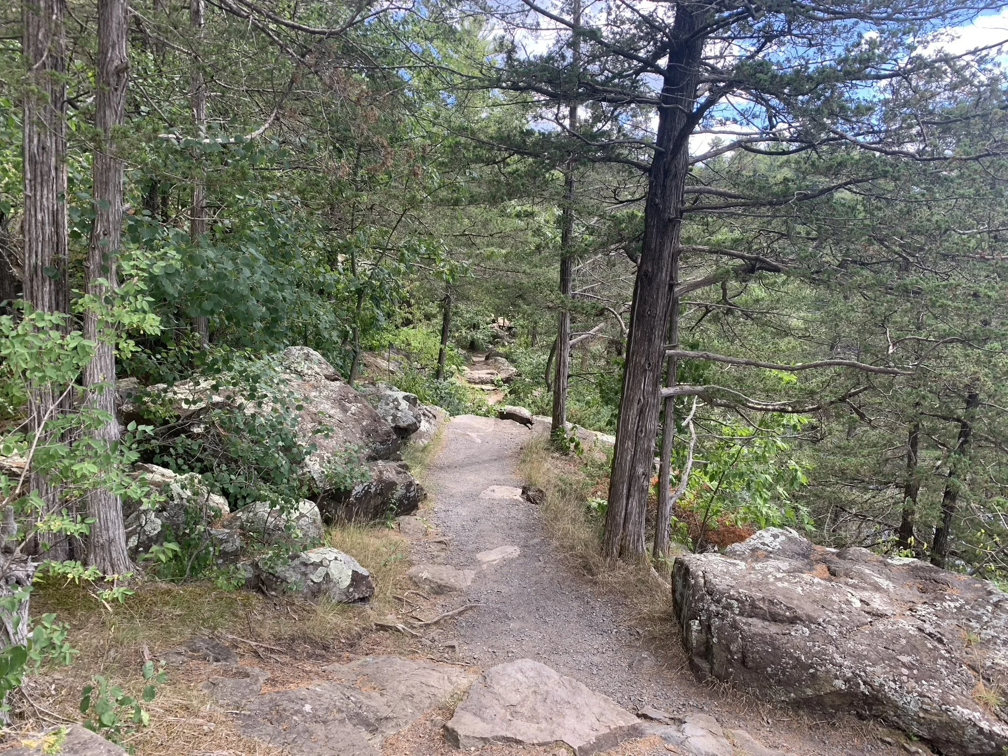
Wisconsin’s Pothole Loop Trail
Distance / Elevation Gain - The Pothole Loop Trail in Wisconsin’s Interstate State Park is a fun and easy 0.4 mile hike with an elevation gain of 100ft.
Trailhead Location - There is a parking lot just for this trailhead, which is located off the main park road. A short ways after the visitor center, there will be a right turn for the North Campground. Take that road, and the parking lot will be just after the intersection.

Wisconsin Interstate State Park - Pothole Loop Trail Map (yellow)
It’s a short walk from the parking lot to the start of the loop, marked by this stone. The loop can be hiked in either direction. This is a pretty easy hike. The prettiest section is the stretch by the river. I don’t think there is reason to pick one direction over the other. I’ve walked counter clockwise both times I’ve hiked along this trail, so that’s the order that my pictures will be presented in.
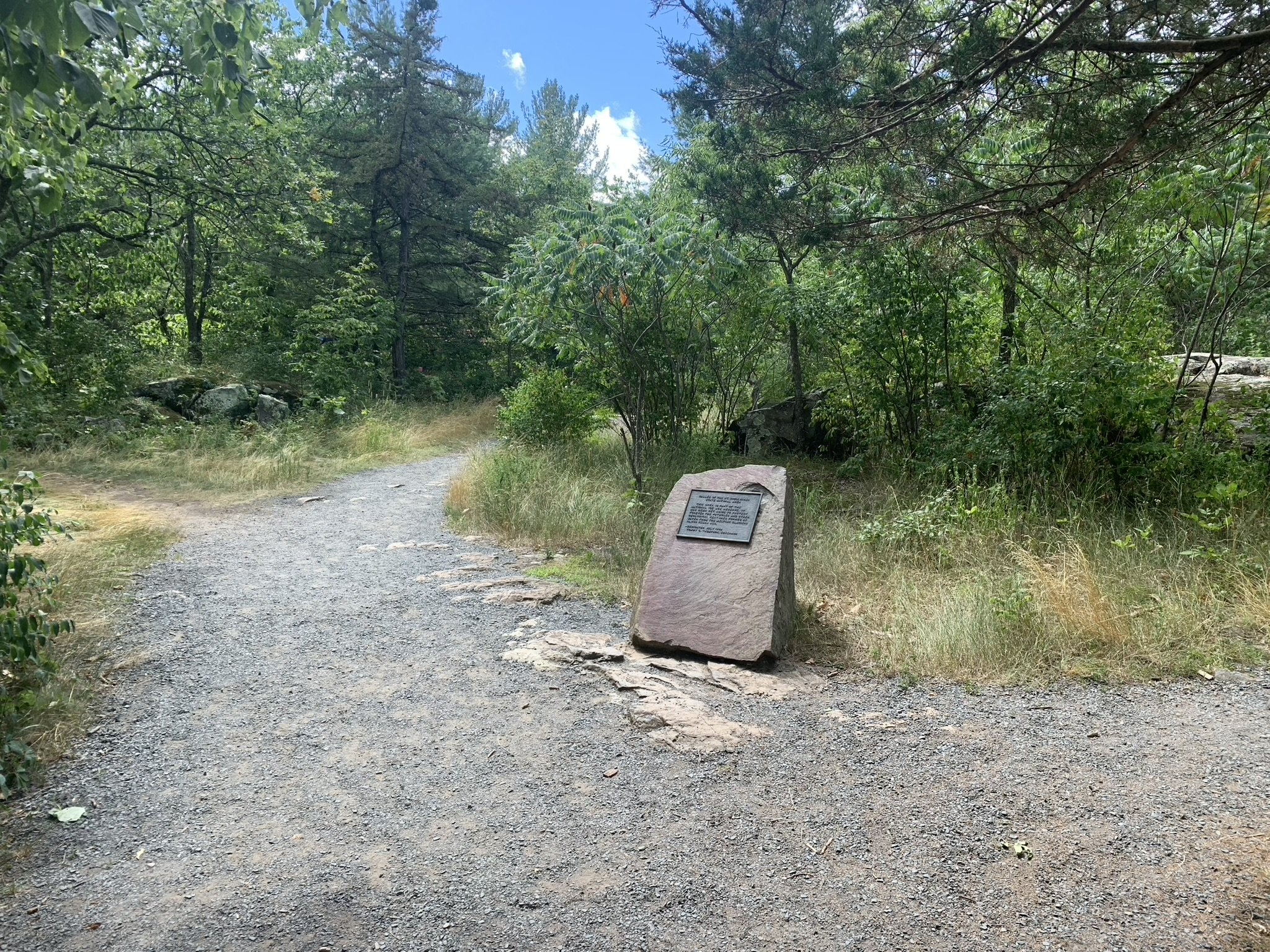
Wisconin’’s Pothole Trail - marker at the beginning of the loop section
This is a fun, imaginative trail through the forest, with potholes, rocks to scramble off trail, and beautiful bluffs dropping into the St. Croix River.

Short set of stone steps along the Pothole Loop Trail
The terrain is mainly hard-packed gravel, with some sections on the top of rocks.

Wisconsin’s Pothole Loop Trail
Looking across the St. Croix River, you will be able to see Minnesota’s Interstate State Park pretty well, as the bluffs are higher along the Wisconsin side.
Looking at Minnesota where the Ferry takes off from along the St. Croix River
The potholes on the Wisconsin side of the river are smaller, and there aren’t as many of them, but they are still fun to explore. I think I’m fascinated by potholes because of how perfectly spherical and smooth they are, due to being formed by swirling water.

Several small potholes
Some more pictures of the trail below. Nothing spectacular, but a really pretty trail in general, and a fun place to take younger children to explore.
Wisconsin’s Interstate State Park Pothole Loop

One of the larger potholes on the Wisconsin side of the St. Croix River

My nieces joined us for a day of hiking in Wisconsin

Crossing the bridge along the Pothole Loop Trail

One of the more dramatic potholes on the Wisconsin side - to see bigger potholes, head across the St. Croix River to Minnesota’s Interstate State Park.

It’s hard not to climb inside of potholes…
In addition to the potholes, my other favorite part of this trail is the section that follows directly above the river. This is a beautiful state boundary.

St. Croix River from Wisconsin’s Interstate State Park Pothole Trail
Summit Rock, Echo Canyon, and River Bluff Trails
Distance / Elevation Gain - There are several different loop options between the Summit Rock, Echo Canyon, and River Bluff Trails. The option I have hiked is highlighted in green, which is a just over 1 mile with 150ft in elevation gain.
Trailhead Location - There are two main parking options. The first option with the least amount of driving is the Summit Peak Parking. If that happens to be full, the parking lot for the boat launch into the St. Croix River could also be used without any additional walking needed.

Wisconsin Interstate State Park - Summit Rock, Echo Canyon, and River Bluff Trails (green)
Summit Rock, Echo Canyon, and River Bluff trails can be turned into a large loop hike.

Trailhead to Summit Rock - Noting the sign statin no food or beverages (excluding water of course) are allowed. I’m assuming this is to keep trash off the trails.
This trail has some dramatic ups and downs, therefore there are a lot of rock steps, such as those shown in the picture below. I love when pine needles cover the trails.

Hiking up to Summit Rock in Wisconsin’s Interstate State Park
There are several steps up to the final summit.

Steps up to Summit Rock

View from Summmit Rock
From Summit Rock, the trail goes back into the woods and heads downhill.

Me and the pups hiking along Echo Canyon Trail
There is one more summit to a peak on Echo Canyon Trail.

Hiking up Echo Canyon Trail

View of the St. Croix River from the top of Echo Canyon Trail
The River Bluff Trail slowly descends back to the river and eventually becomes level with it near the boat launch.

Near the Wisconsin Interstate State Park boat launch onto the St. Croix River, along the River Bluff Trail
Next to the boat launch, there is also a picnic area with shelters. The River Bluff Trail heads right through this area.

Picnic area near the boat launch
Lake O’ the Dalles Trail
Distance / Elevation Gain - For anyone wanting to swim, there is parking right next to the beach. Hiking around Lake of the Dalles is 1 mile with no change in elevation. This can also be combined with the trail to Summit Rock, Echo Canyon, and River Bluff Trails for a 2 mile loop.
Trailhead Location - There is an option to park right next to the beach, and if that is full, the boat launch or Summit Rock trailheads can be used as well.

Wisconsin Interstate State Park - Lake O’ the Dalles Trail (orange)
I hiked the Lake O’ the Dalles Trail with Rock Summit, Echo Canyon, and the River Bluffs trails, so my pictures start at the intersection of these trails, near the boat launch. The swimming beach is visible from across the lake.

The swimming beach is across the Lake O’ the Dalles
There is also a fishing pier on the part of the Lake O’ the Dalles Trail that I have marked on my map with both the orange and green trails.

Fishing Pier on Lake O’ the Dalles
On the south side of the lake, the trail cuts through long grass. I’m not a huge fan of ticks, so I was a little less than thrilled when I realized my dog was going to be hiking through this grass. We both got lucky on this trip though, and I never found any ticks.

Grassy trail along the Lake O’ the Dalles Trail
There are a couple of sections of the trail that go right by the water’s edge. I enjoy these types of trails where you can look in the water and sometimes see fish.

Walking around Lake O’ the Dalles Trail
Eventually the trail makes its way to the beach. I was here on a weekend by myself - if I remember right the boys had boy scout activities, otherwise I would have stopped to swim. It was a nice beach, with a shelter for changing and bathrooms right next to it. There’s also a parking lot nearby. Hiking isn’t required to get to the beach.

Swimming Beach at Wisconsin’s Interstate Sate Park on Lake O’ the Dalles
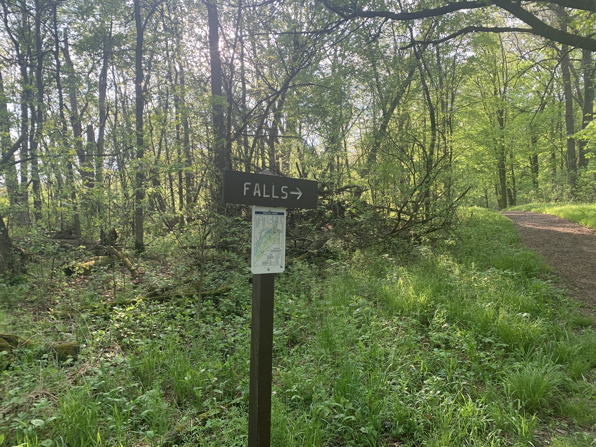
Silverbrook Trail (waterfall)
Distance / Elevation Gain - Out-and-back to the Silverbrook Falls is 2.4 miles, with an elevation gain of 100ft. To add in the Silverbrook Loop, the total hike is 3.4 miles.
Trailhead Location - There is a parking lot for group camping right next to the Silverbrook Trail. I was hiking here in early May, and there was no one camping, so I chose to park here. If you are hiking in the summer, there is another lot in the South Campground. This will add 0.4 miles to the trail in each direction.

Wisconsin Interstate State Park - Silverbrook Trail (brown)
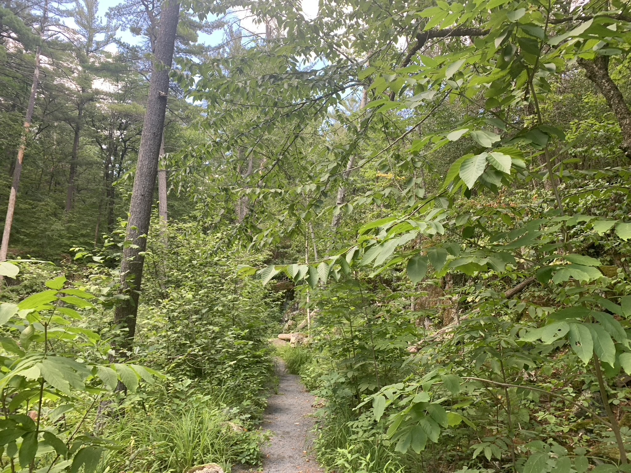
Silverbrook Falls is the only actual waterfall in either of the Interstate State Parks, although there may be a small amount of water flowing over at the Sand Bluffs Trail in Minnesota. I enjoyed my hike on the Silverbrook Trail, but it wasn’t because of the waterfall. More impressive waterfalls exist nearby, such as Wilke Glen and Cascade Falls in Osceola, Willow River Falls, and Vermillion Falls. If you are in the mood for hiking to waterfall, I would suggest one of those over Silverbrook Falls.
I did really like Silverbrook as a trail through the woods, though.

Bridge along the Silverbrook Trail
There is a small creek flowing near the Silverbrook Trail. Maybe this is “Silverbrook”? It’s not named on the map, but that would make sense.

Small creek running past the Silverbrook Trail
To get to Silverbrook Falls, there is a short spur trail, that is well-marked with a sign.
Spur trail to Silverbrook Falls
Silverbrook Falls is a pretty small waterfall. Like I said, I enjoyed the trail, but I liked the loop portion near the pond more than the falls.

Silverbrook Falls in Wisconsin’s Interstate State Park
I hiked the whole way out to and around the Silverbrook loop, and it was beautiful. Even though it was a weekend, I had this whole trail and peaceful place to myself.

Silverbrook Loop
There is a pretty pond that the trail goes past. Overall, Springbrook is a fantastic trail, despite an underwhelming waterfall.

Little pond near Silverbrook Trail
There is also a short spur to old mine ruins, which I stopped at on my way back. It’s near the waterfall spur. It was semi-interesting. There are interpretive signs, but the fence limits the ability to explore the space.

Old mine ruins along the Silverbrook Trail
Meadow Valley, Ravine, & Skyline Trails
Distance / Elevation Gain - The loop marked in red follows the Meadow Valley, Ravine, and SKyline Trails. This is a 3 mile loop with 350ft in elevation gain.
Trailhead Location - The easiest place to park for this trail is at the visitor center. There is a second option as well, near the Lake O’ the Dalles swimming beach.

Wisconsin Interstate State Park - Meadow Valley, Ravine, and Skyline Trails (red)
I started this loop at the Meadow Valley Trailhead, near Lake O’ the Dalles beach. Of all the trails in the Minnesota and Wisconsin Interstate State Parks, this loop was my least favorite. I didn’t feel like there was much that made it special.

Meadow Valley Trailhead
Most of the trail looks like the below picture - dirt trail through a pretty wooded area.

Skyline Trail
More of the same - just a walk in the woods
Near the visitor center, I came across these ruins. I don’t remember what this building used to be.

Ruins along the Skyline Trail
There were some prettier overlooks close to the Visitor Center.


Skyline Trail
But then the trail descend back into the woods, the remainder of the way back to the Meadow Valley trailhead.

Meadow Valley Trail

Meadow Valley Trail

Steps along the Meadow Valley Trail
Return to WI Interstate Park Map
Quarry and Point Trails (Winter-only)
If you look on the Wisconsin Interstate State Park Map, it looks like there is a trail right along the St. Croix River. It’s listed as “Winter Only” but what does that mean? I went to the Quarry trailhead to check it out. And it looks like the picture below… There are plants everywhere and no trail. This is an area that is groomed for cross country skiing, but it is not passible for hiking in the summer. Just passing on information for anyone thinking it might be an option to hike here. It certainly didn’t seem like I could get very far, so I didn’t try.

Quarry and Point Trails are only cross country ski trails, and they do not exist as hiking trails
Other Things to Do Nearby
Franconia Sculpture Gardens
The Fraconia Sculpture Gardens are free to stop at. The sculptures are all designed to be interacted with. This is art that you experience. It’s very off-the-wall, creative, and fun. I would highly encourage people to stop and take a peak.
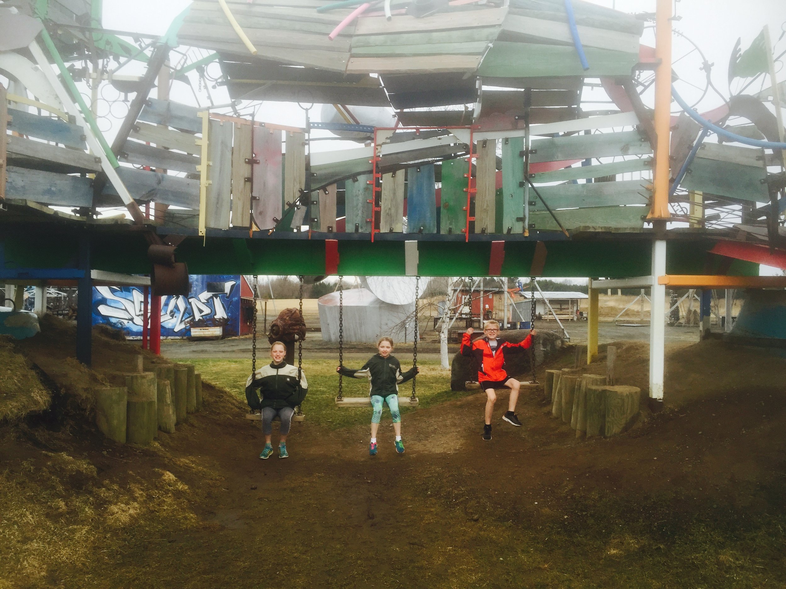
Swing set built under a playfully designed “picnic shelter”

Not functional, but having fun pretending
The following are additional places to hike within an hour of the Interstate State Parks.
Banning State Park (MN)
Wilke Glen and Cascade Falls (WI)
William O’Brien State Park (MN)
Willow River State Park (WI)
Afton State Park (MN)
Other Posts from NatureImpactsUs.com
There are posts linked to each pin in the map below.