

View from Eagle Mountain
If you enjoy my blog, please consider signing up below for email notifications of my latest posts. I will not share your email.

Ascending to the Top of Minnesota
Minnesota’s highest point is the top of Eagle Mountain at 2,301ft. Not to be confused with the Eagle Mountain within the Lutsen Mountain Ski Resort, this Eagle Mountain is further northwest and resides within the Boundary Waters Canoe Area (BWCA) Wilderness. This is not your typical hiking trail along the North Shore as is it several miles west of MN-61. There are no waterfalls and no views of Lake Superior. As this trail is tucked well away from anything else and within a wilderness area, this is going to be an extremely quiet hike.
I would rank this hike as moderate to moderately difficult. The 500ft ascent occurs in a span of less than a mile, making this a bit of kick-your-butt kind of hike.

View from Eagle Mountain
Location and Parking
GoogleMaps shows the trail head in the correct spot, if you search for “Eagle Mountain Trailhead”. Check you have pulled the correct location by making sure Grand Marais is listed as the city. Also, have back-up directions written down as you will likely loose cell service out on the dirt roads. Lastly, know where you are going before you leave, as you likely won’t have service at the parking lot to route to your next destination. I did have service for moments as I was walking up the mountain.
The trailhead to Eagle Mountain is 2 hours and 15 minutes from Duluth. Grand Marais, the closest city is about a 35-minute drive.
There are two ways to get to the trailhead depending on if you are coming from the south or the north along MN-61. If you are coming from the south, you will turn left on Caribou Trail, just after Tofte. Take this for 17 miles, and then turn right on The Grade. Drive 3.8 miles, and the trailhead parking lot is on your left on Bailey Creek.
If you are coming from the north, you will take Gunflint Trail for 4 miles. Turn left at Devil Tracks and drive 5 miles. Turn right at Ball Club Road and drive another 5 miles. Then left on The Grade. The trailhead parking lot will be on your right in 5 miles on Bailey Creek.
Eventually the paved roads will turn to gravel roads, but the gravel roads were well maintained. The drive out to the trailhead is really pretty. You won’t find much around. I could have sworn I saw a wolf as I was getting near the parking lot, but I didn’t get a good look before it jumped from the road into the woods. It could have just been a large dog, but I was not near any homes. Regardless, this trailhead, which leads into the BWCA, will feel pretty remote.
Logistics matter as well, so I’ll note that there is a pit toilet available at the parking lot, which is useful as it’s a long drive from the parking lot to the nearest city.
This post stands on its own, but it is a part of a larger network of posts I’ve written regarding things to do along Minnesota’s North Shore. This is a link to my full North Shore Guide for anyone interested. It’s an external link so you won’t lose your spot. I will also re-post this link at the end.
Eagle Mountain is in the Boundary Waters Canoe Area Wilderness
Hiking Eagle Mountain
Eagle Mountain is just over 6.5 miles and ascends 500ft in a rather steep climb the last 1/3 of the trail. This is an out and back hike.
Below is my trail recording from the GAIA GPS app. Each dot represents 0.25 miles (some dots being captured on my way up and the rest on the way down).

Trail recording from my GAIA GPS app.
I think this is a great trail for those that like to hike. It’s nice and long, decently challenging, and very quiet. A lot of the trail though is through the woods, and there are not many viewpoints along the way. The exceptions are an otter den just within the boundary of BWCA, Whale Lake, and there is one view from the mountain close to the top. I don’t think I would recommend this hike for young children due to the length of the trail through the woods, probably being a bit boring for them. I would suggest Oberg Mountain for younger children instead, if you want to get up into the mountains.
You will need to fill out a free permit before you start your hike, as the trail goes into BWCA. You will find the permits and the instructions at a kiosk next to the trailhead.
Beginning of Eagle Mountain Trail
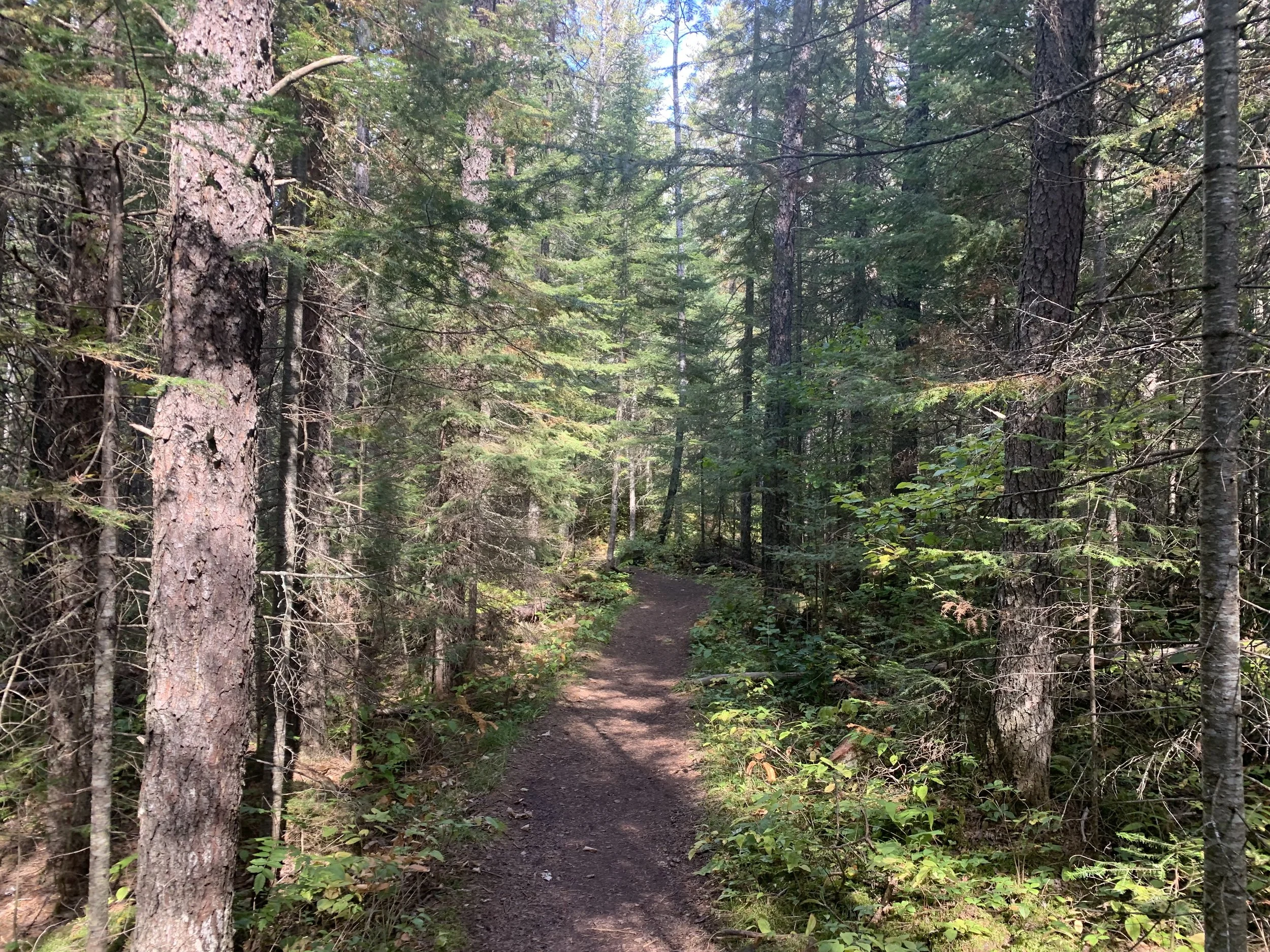
As I mentioned, a lot of this trail is through the woods. Lots and lots of pine trees line the trail, making it difficult to see much else, but the trail smelled fantastic.

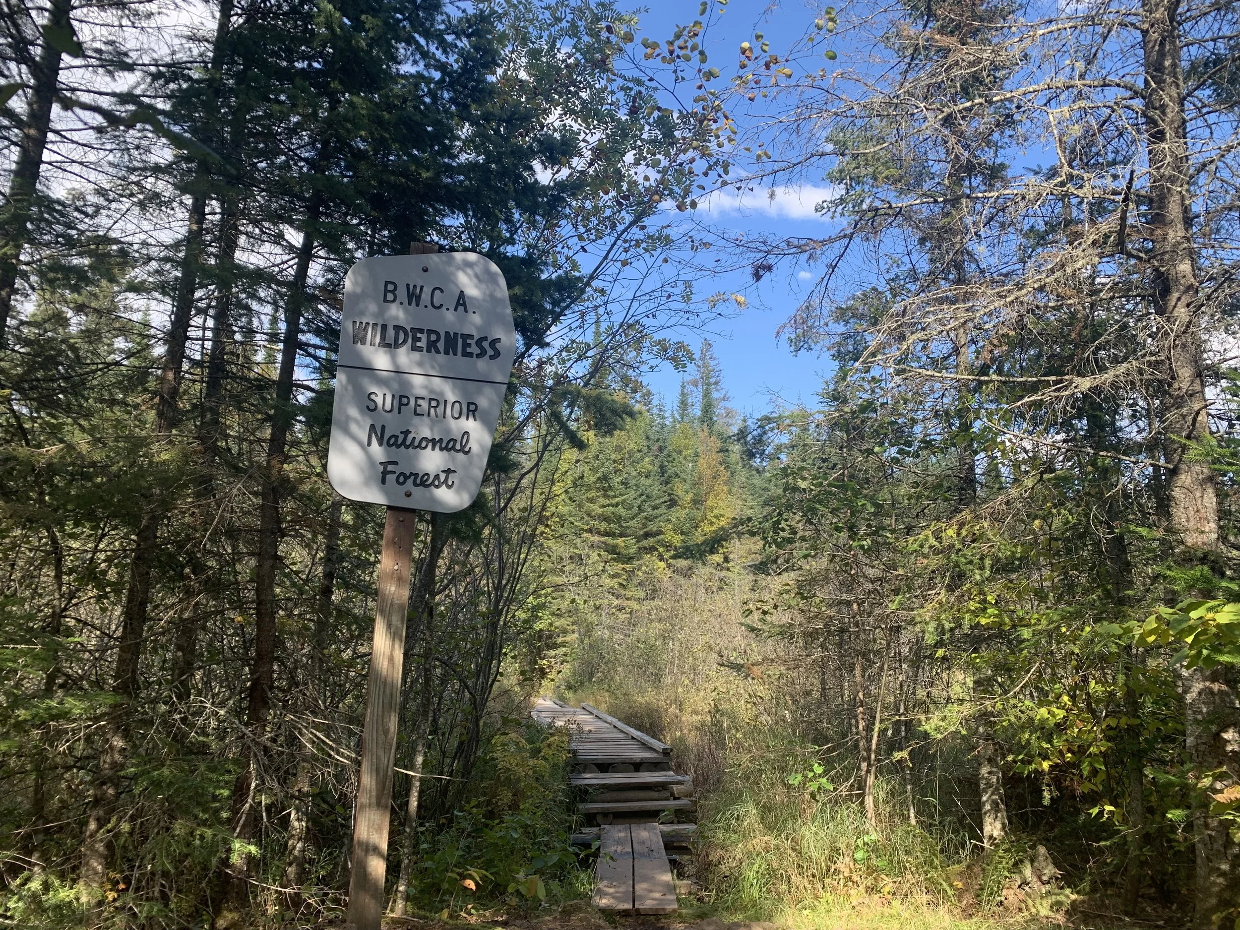
Entering the BWCA Wilderness
The parking lot is about a mile from the BWCA boundary. You will know when you are entering as there is a sign, and it is marked with this bridge. For the next mile, there are several small ponds and swamps. There are several small bridges so your feet should stay dry, although the trail may get a bit muddy in a few places.

River Otter
There’s another bridge that you will cross next to what I was sure was a beaver dam on my way out to Eagle Mountain. As I was crossing it on the way back to my car, I heard a huge splash, followed by a second splash. I had been in complete silence solo hiking for more than two hours by this point, and I was so surprised, I just about screamed. Then I saw to creatures quickly scale up and over the dam and you can see that this ended up being two otters, not beavers, that were not happy at all with me. While I ended up covering up my surprise without audibly yelling, these otters made up for my noiselessness. I had no idea they could make such a racket. Even though I was being yelled at, I watched them for quite a while. This was my first time getting to see otters in the wild.

Eagle Mountain Trail
And more forest. Lots and lots of forest.

Whale Lake on the Eagle Mountain Trail
Eventually the trail will bring you to Whale Lake, and there are a couple of points where the trail goes right next to the water. I was really hoping to see a moose, as it seems like the perfect spot to be if you are a moose. No luck though.
At this point in the hike, you can see there was this really big dark cloud that went over head, despite it being a beautiful sunny day. It thundered quite a bit, but never did rain. Always a good reminder to carry a lightweight rain jacket in your bag while on a longer hike, as this was not in the weather forecast.
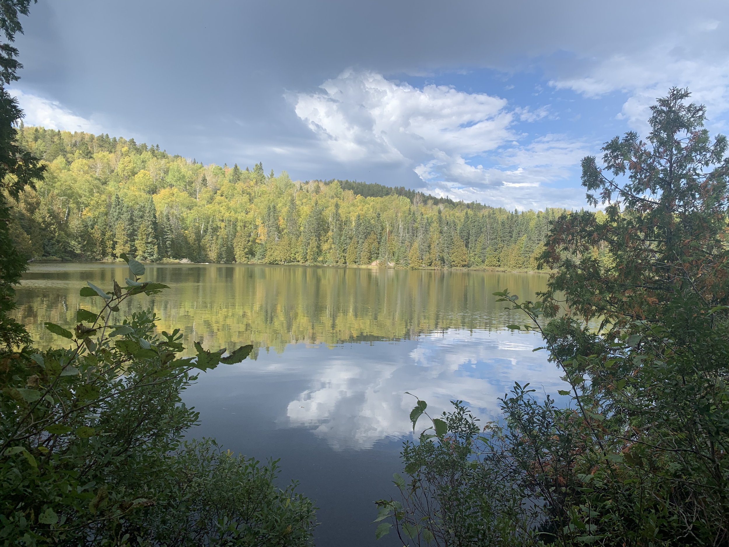
Whale Lake
There is one trail junction at Whale Lake after you’ve walked the southern shore. You will want to stay to the left, and you’ll know you are on the correct trail as it starts going up at this point. The trail is well marked as well.
I don’t tend to take pictures while I am hiking up steeper hills, and apparently this was a hard hike as I now realize I didn’t take any pictures until I got to the top. For about 0.75 miles this trail ascends up Eagle Mountain at a tough ascending angle. There is one really great viewpoint near the top of the mountain. The actual top of Eagle Mountain is flagged with a geological marker and yep, more trees. So, if you are looking for a pretty spot to eat lunch or a snack, do it here, not at the exact top of the mountain.

View from Eagle Mountain

View from Eagle Mountain
The trail is really easy to follow until the very top. You can see where the viewpoint is on the map below as I wondered off of the trail to the left to get some pictures. To find the geological marker, you need to keep curling around the mountain to the right.

Finding the Geological Marker for the Highest Point in Minnesota
This is the trail at the top. It still looks trail-ish, but sometimes trails are hard to keep following when they turn into natural rock surfaces.

Just about to the top the trail looks like this.
You will know you are at the top, as there is a sign marking the highest point in the state.

Geological Marker for Highest Point in Minnesota
This is an out-and-back trail, so this is the point to turn around and head back to your car. At least the way down is easier.
Other Outdoor Things to Do within an Hour Drive
Below are hyperlinks to other posts I’ve written about things to do that are located within an hour’s drive from Eagle Mountain.
Cascade River State Park
(south) This park has multiple waterfalls that cascade, making it difficult to provide an actual waterfall count. Similar to Temperance, most of the waterfalls are within a hike less than a mile long. This is also the only MN State Park with a true hike along the Lake Superior Shoreline.
Lutsen Ski Resort
(south) Lutsen is the best ski resort in Minnesota. During the summer months, the gondola continues to run. There are hiking trails and a half-mile Alpine Slide.
Oberg Mountain
(south) This is overlook hike is part of the Superior Hiking Trail, and therefore parking is free. This is a busier trail, especially in the fall..
Temperance River State Park
(south) This is the most unique State Park along MN-61 where seven waterfalls can be seen in a hike less than 2 miles. Several of these waterfalls occur in dramatic pothole formations. The official MN State Park map undersells this state park, as does the size of the parking lot off of MN-61.
Sawbill Canoe Outfitter
(southwest) The closest entry to the Boundary Waters Canoe Area from MN-61 is Sawbill Lake. There is a canoe outfitter on the lake where canoes and other gear can be rented. There is a 4.5-mile three-lake trek for a single day exploration, and multiple options for multi-day canoe trips.
Sugarloaf Cove
(south) A privately owned section of Lake Superior with an interesting bay protected by rock formations. This park has a small fee and includes its own visitor center.
Caribou Falls State Wayside
(south) An easy hike to large but quiet waterfall..
George Crosby Manitou State Park
(southwest) This is a rustic, quiet, and less travelled MN State Park with one of the more impressive waterfalls in Minnesota.
Tettegouche State Park
(south) This is my favorite MN State Park. There are four waterfall hikes within the park, amazing views of Lake Superior along the cliffs above the water, secret beaches with sea caves, and more inland there are some incredible views from above of smaller lakes (especially gorgeous in the fall colors).
Bear and Bean Lake Loop
(south) Part of both the Superior Hiking Trail and Tettegouche State Park, the Bear and Bean Lake Loop is one of the most popular trails along the North Shore. The views are amazing, and the trail is fun to hike. Be warned though this is a 7-mile loop trail with an elevation gain of 900ft.
Black Beach
(south) This is a free beach on Lake Superior’s shoreline, lined with black rocks. There is an island that can be explored by foot. There are also tables right on the beach, making this my top recommendation for a picnic location.
Grand Marias, MN
(north) My favorite pizza along MN-61 is at Swen & Ole’s Pizza in Grand Marias.
Lake Walk - Superior Hiking Trail
(north) The only section of the Superior Hiking Trail that is along Lake Superior’s shoreline is the Lake Walk, a 1.5 mile stretch of sand / loose gravel, just south of Judge Magney State Park. Note that this is an awesome beach, but a hard place to hike long distances due to the soft ground.
Judge C.R. Magney State Park
(north) This park has two large waterfalls - Upper Falls and Devil’s Kettle.
Grand Portage National Monument
(north) When visited in the summer months, this National Monument includes an interactive fort that depicts the life of British fur traders from the 1780s. Outside of the fort is an exhibit on the Ojibwe Native Americans, which is open year-round.
Link to Full North Shore Guide from NatureImpactsUs.com
For more ideas of things to do up and down MN-61 along Lake Superior, visit my North Shore Guide.
More from www.NatureImpactsUs.comOther Hiking Ideas
If you are looking for more hiking suggestions, please check out my below map which has additional posts linked to each pin.