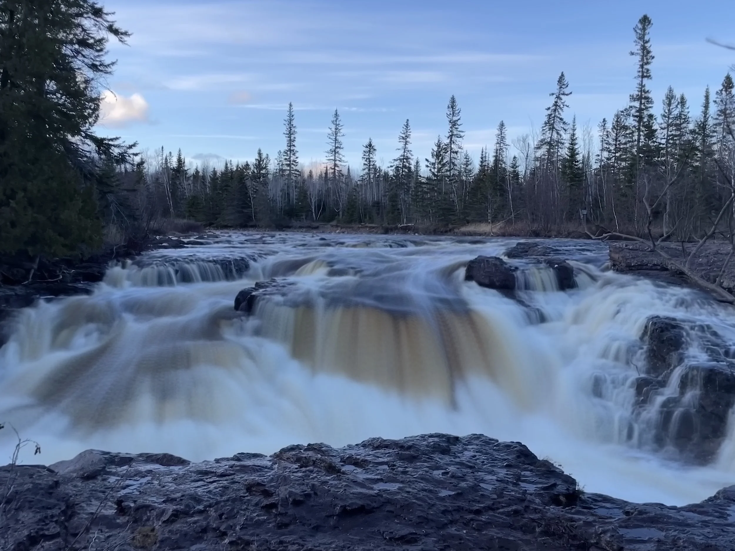
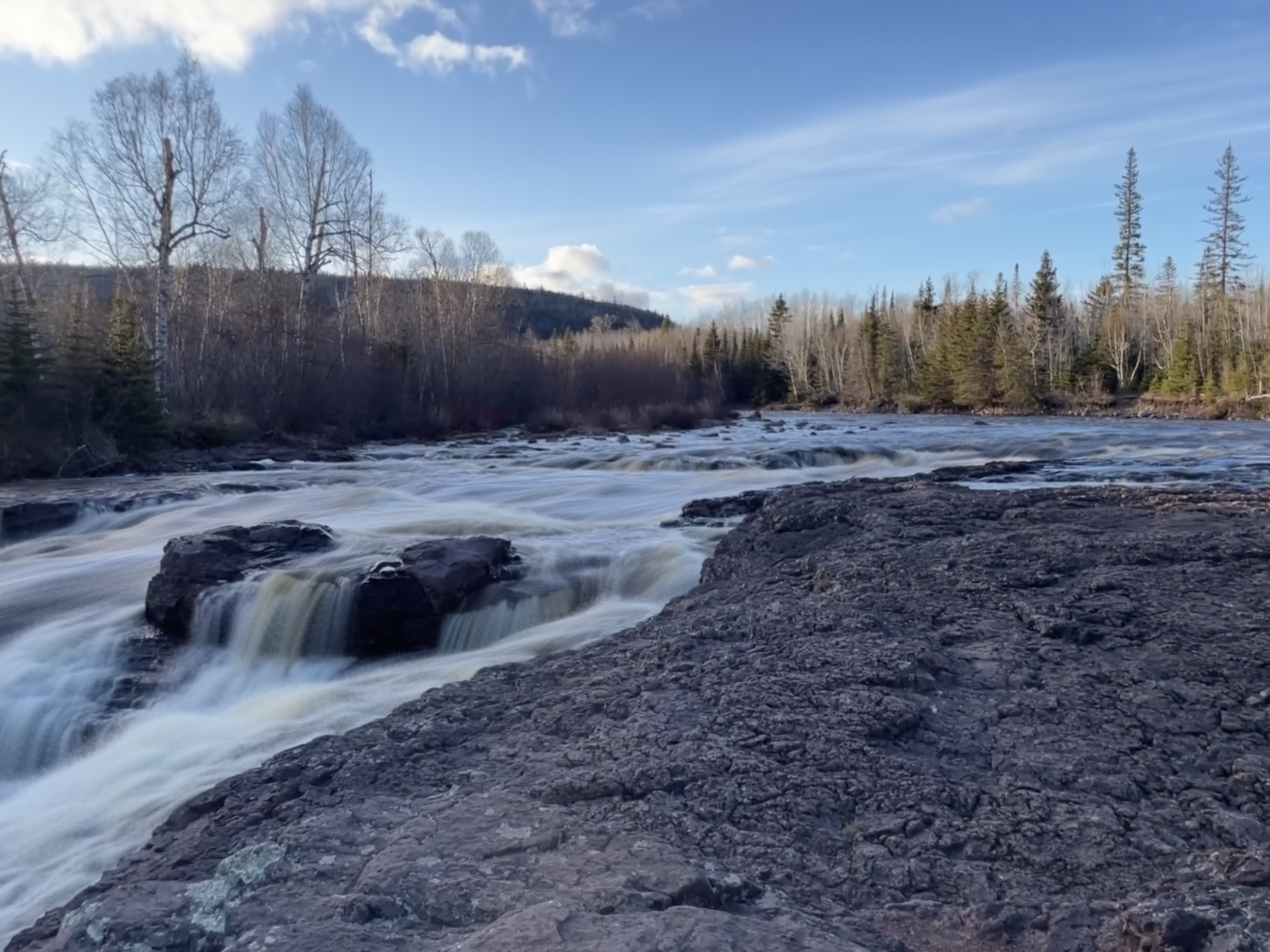
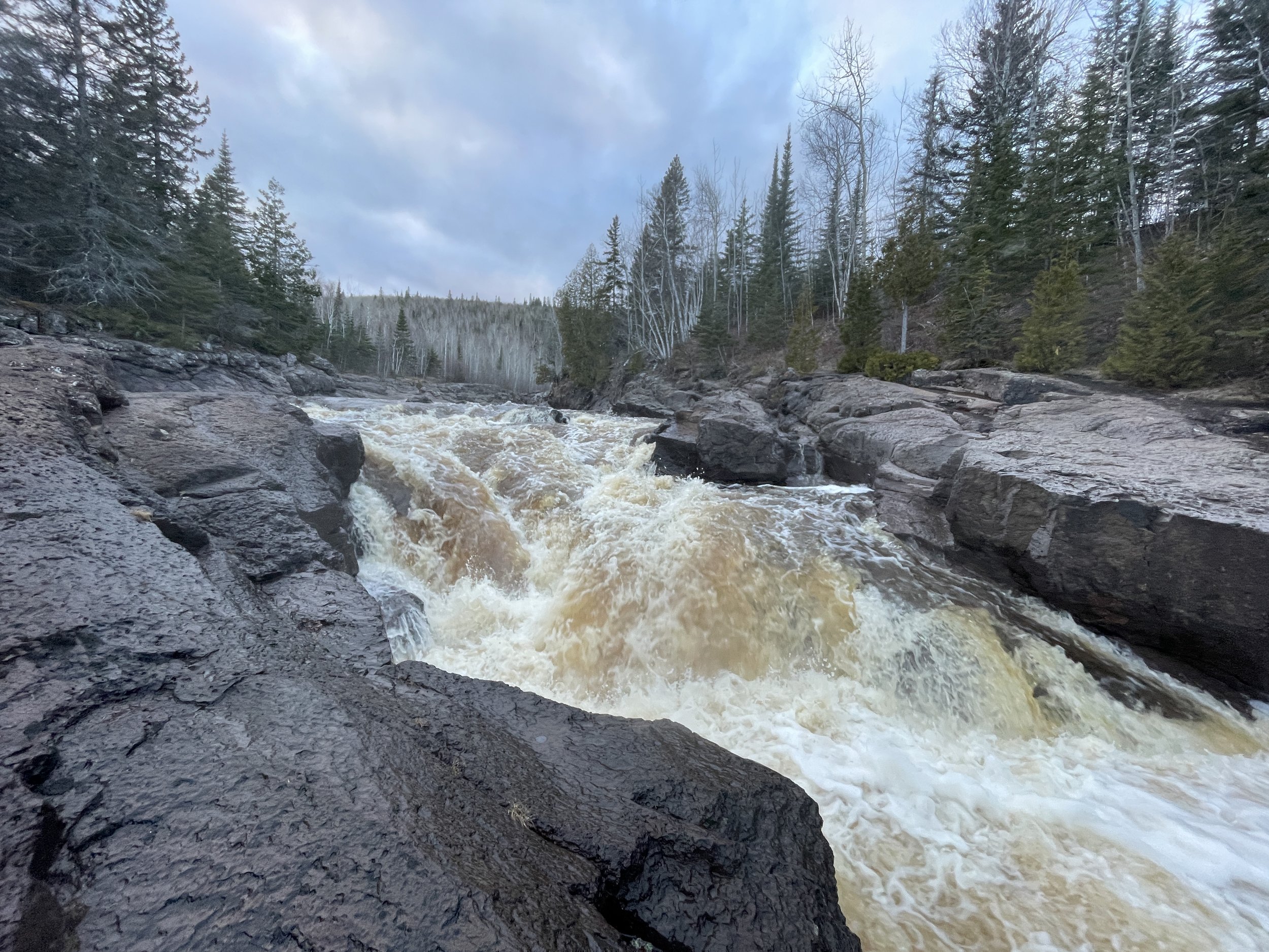
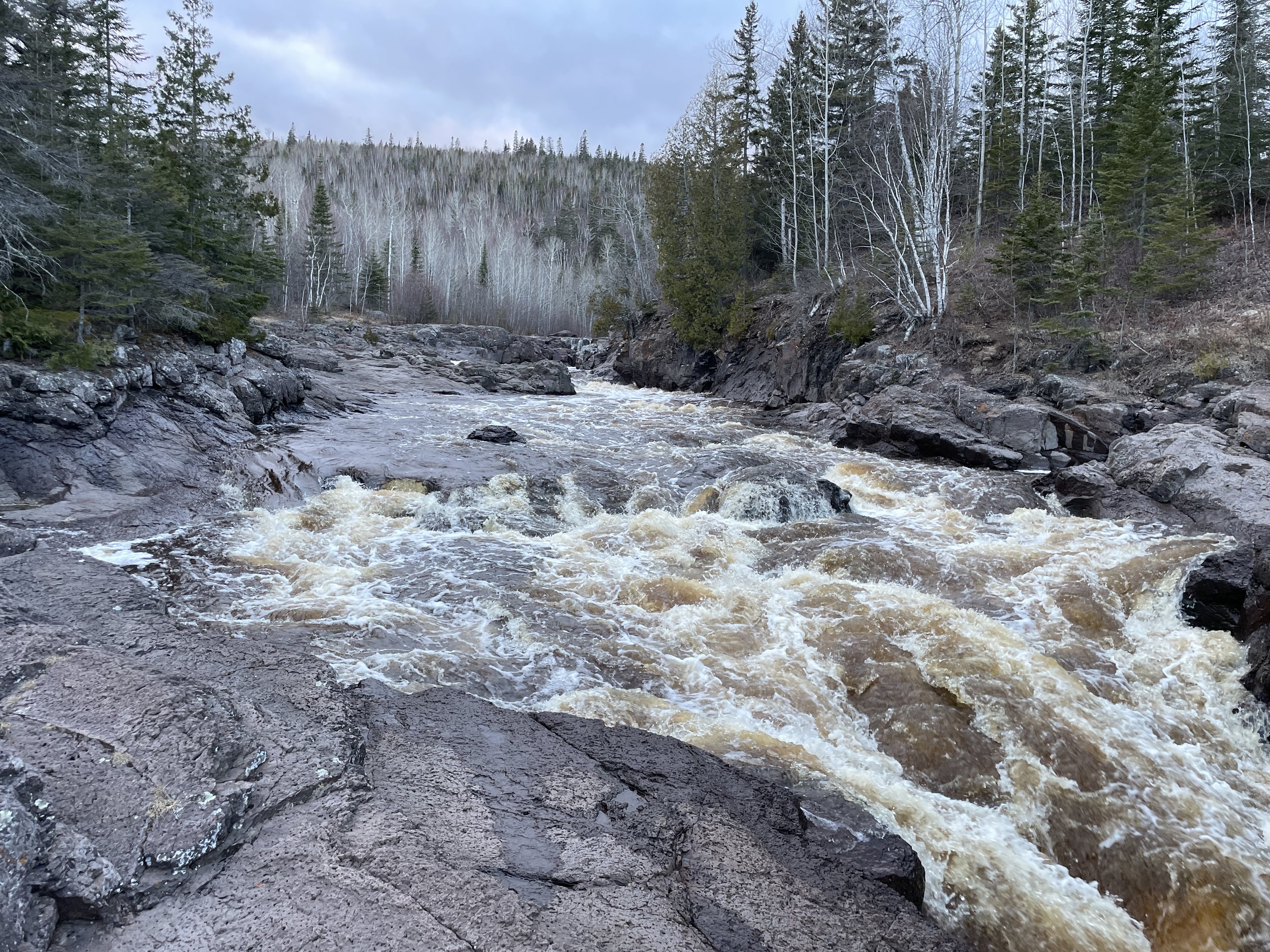
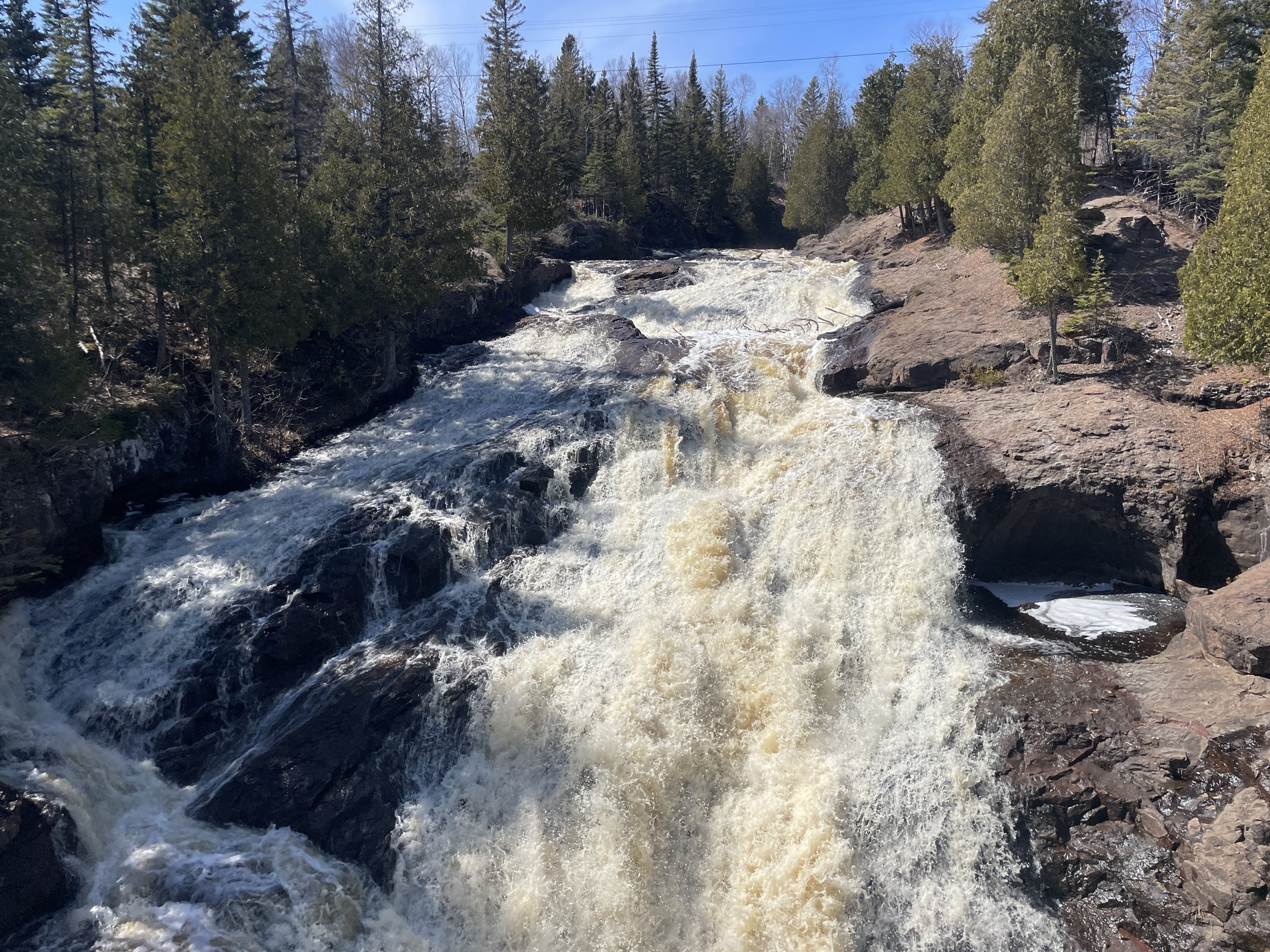
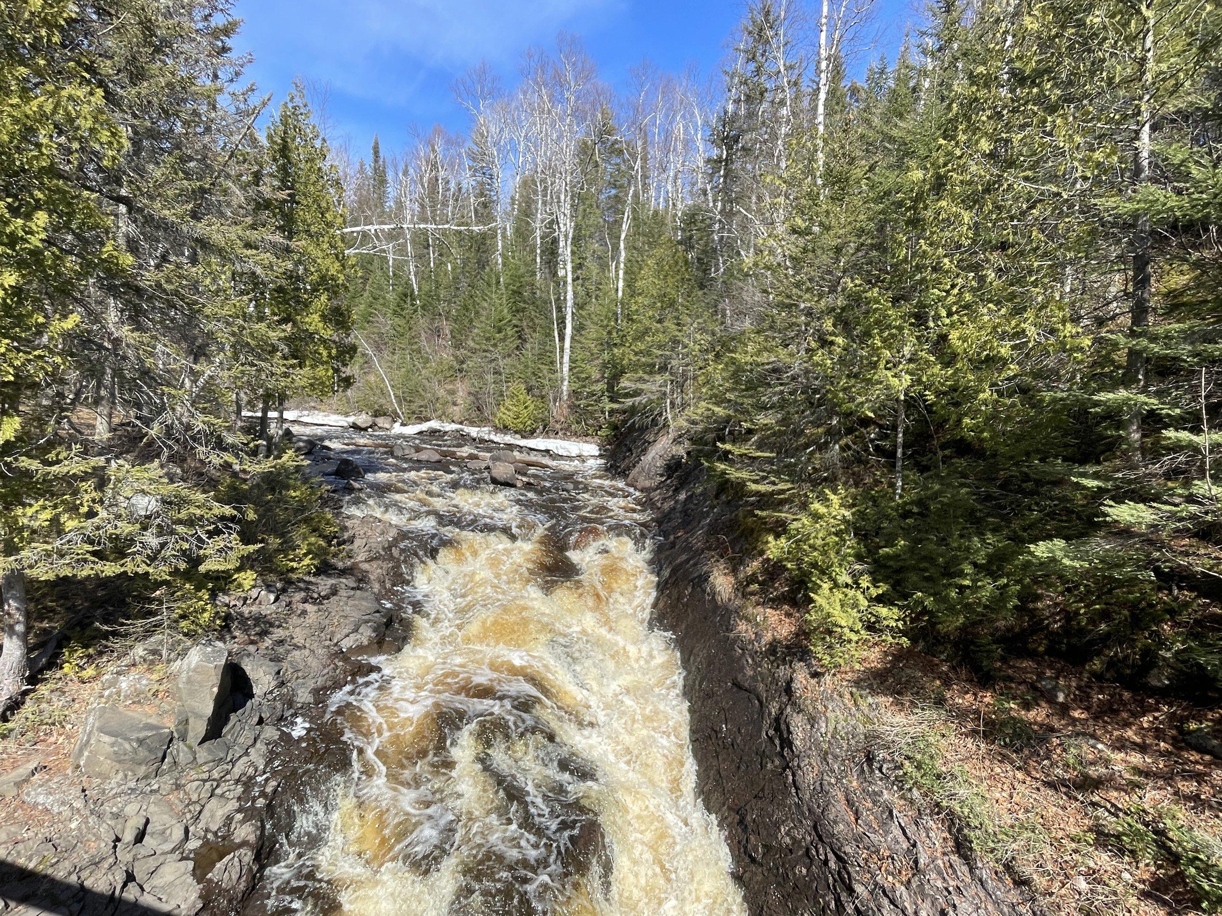
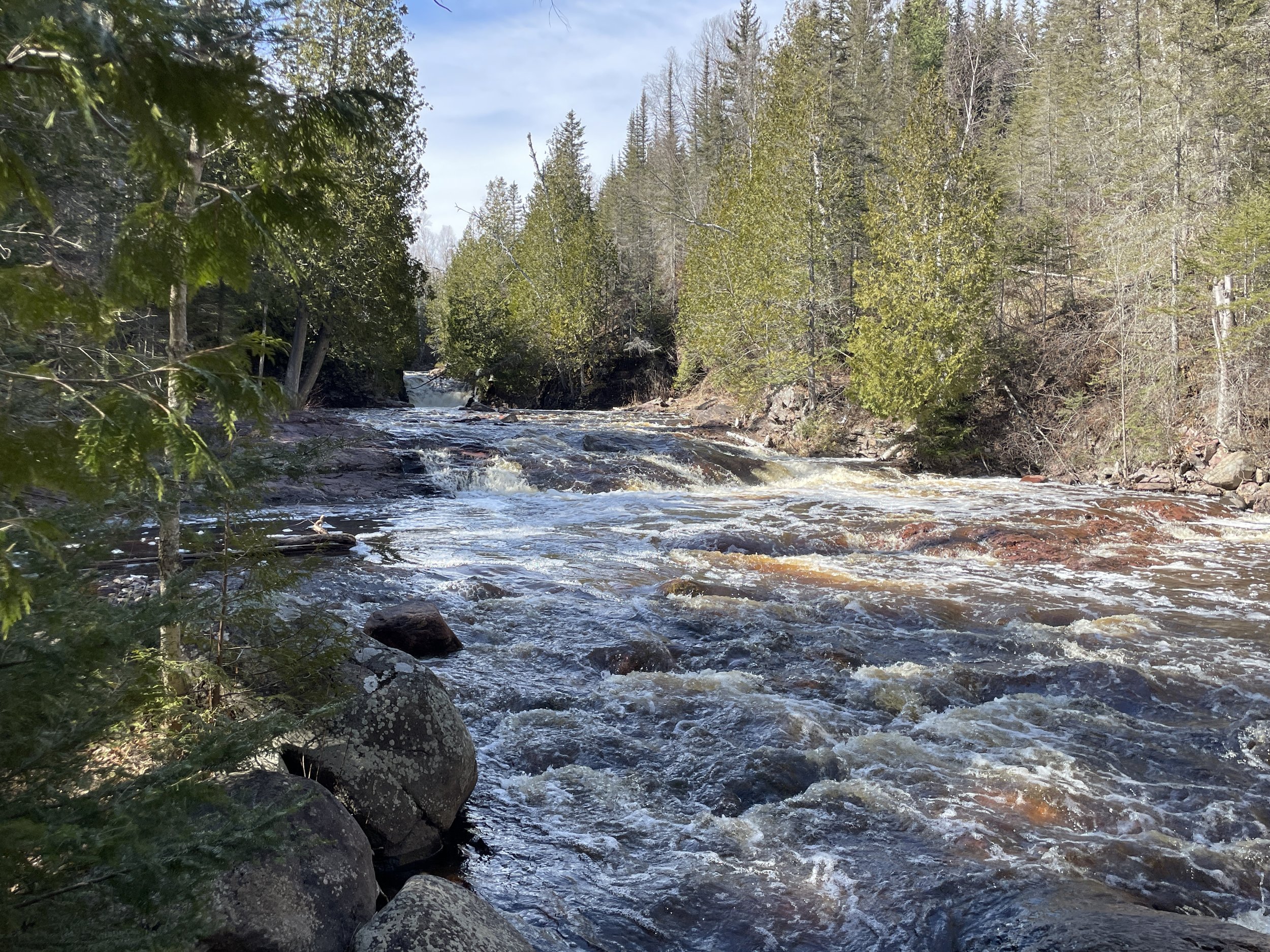
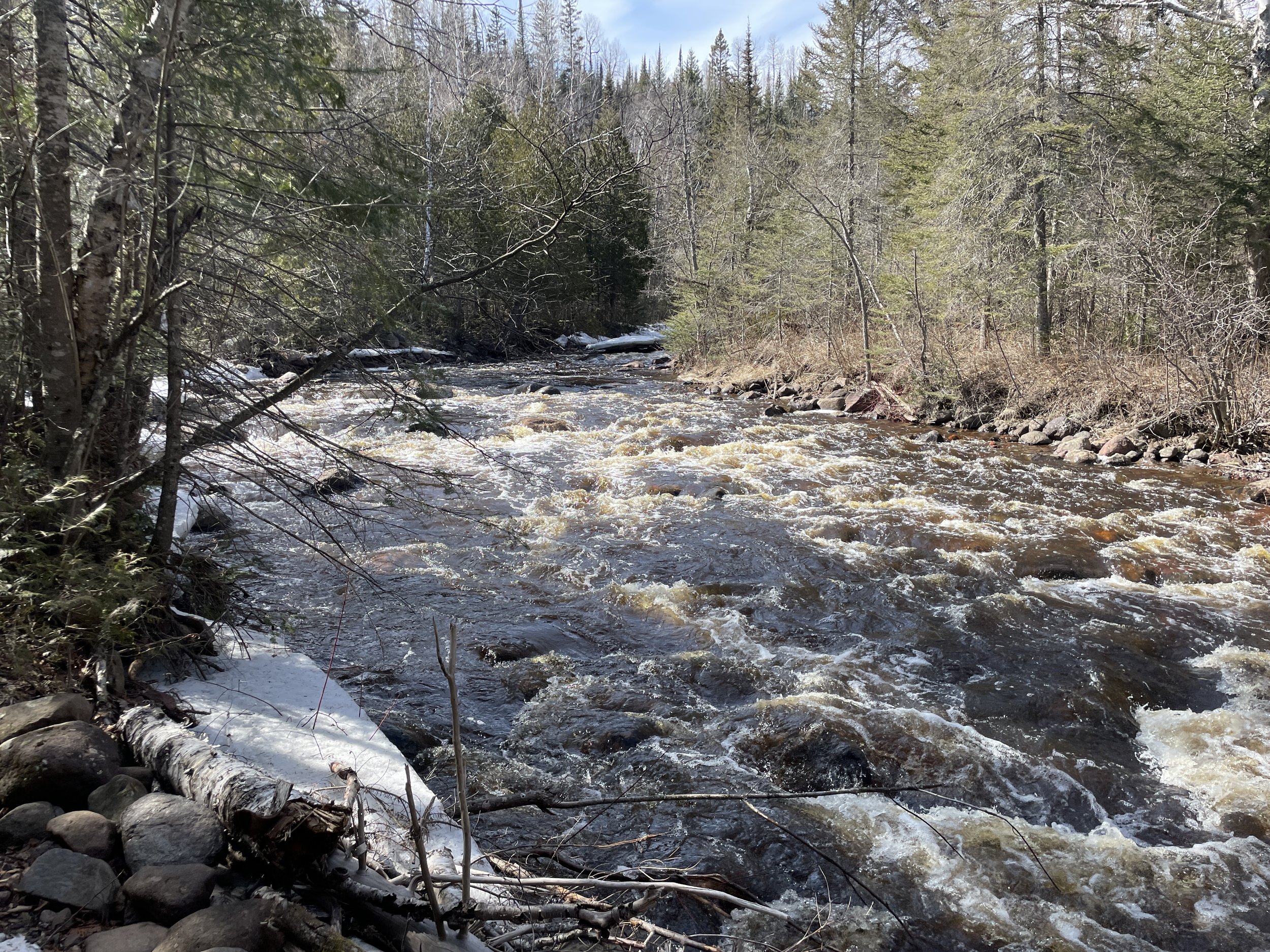
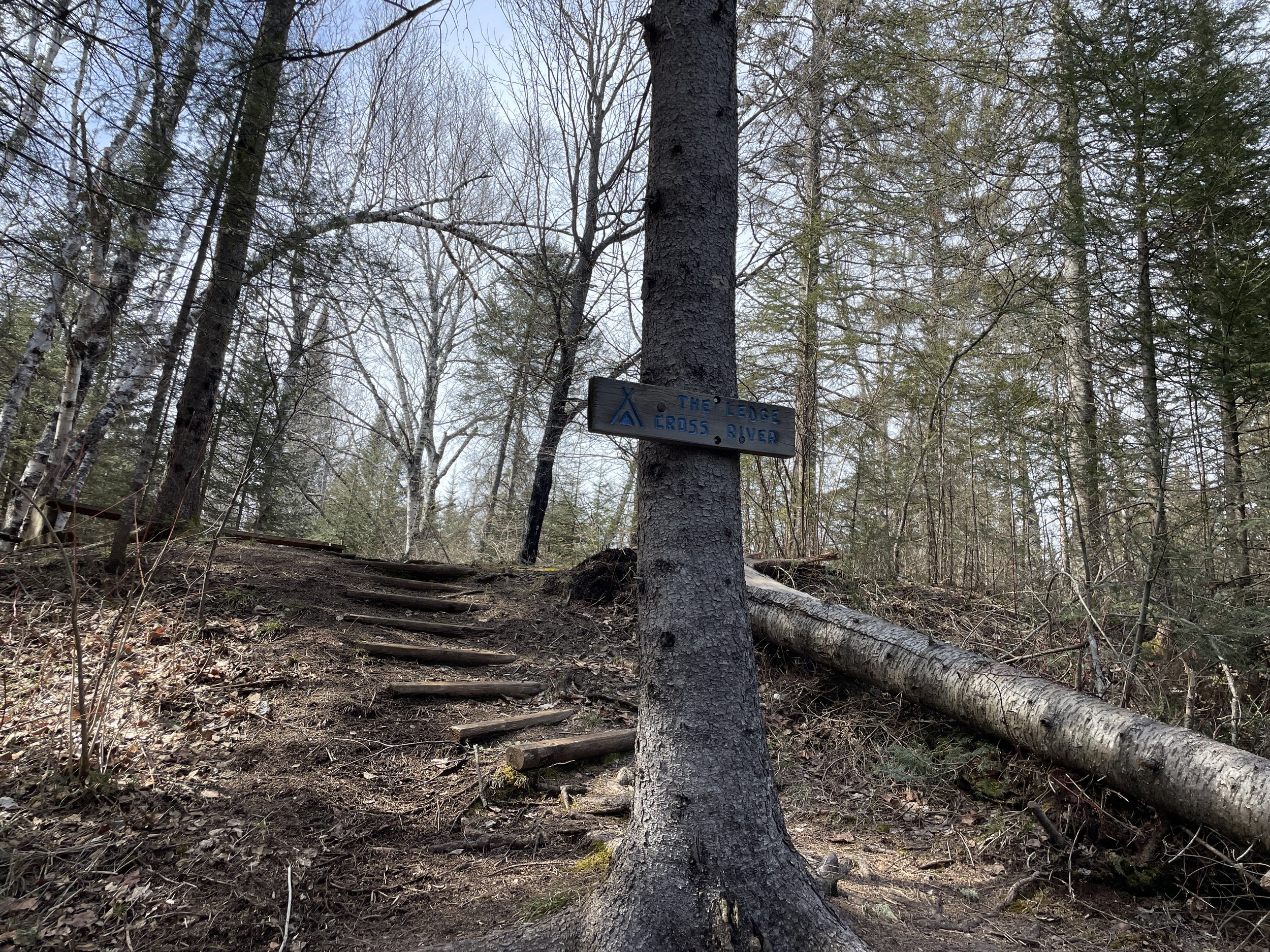
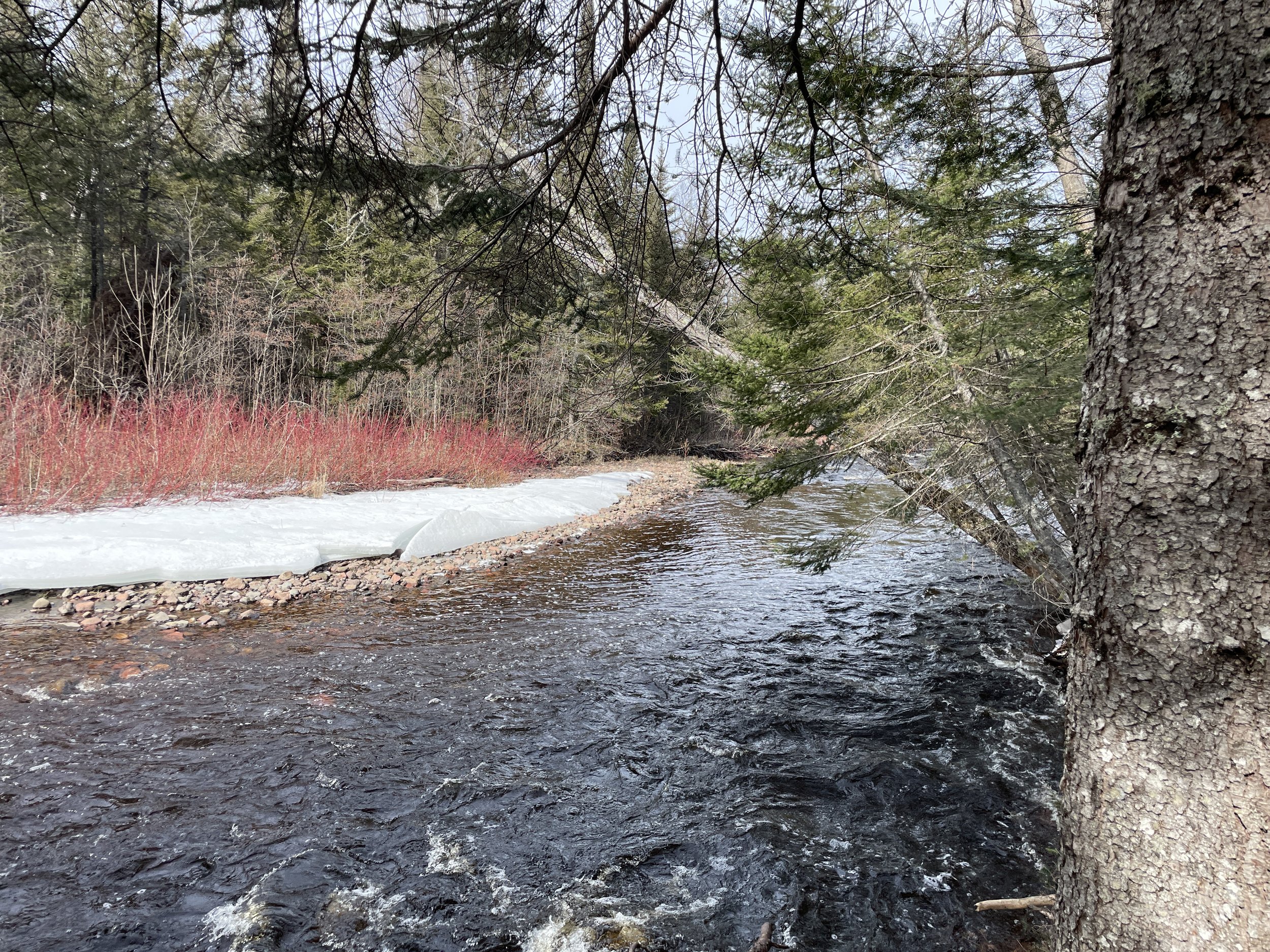
West-side of Temperance River on the Upper Falls Trail - April 2024
If you enjoy my blog, please consider signing up below for email notifications of my latest posts. I will not share your email.
Temperance River Gorge Trail - July 2005
Unique Waterfall Hikes
Out of all of Minnesota’s State Parks, Temperance River might be the coolest one. In just one moderately easy hike that is less than a mile in length, the Temperance River Gorge goes past 5 waterfalls (and a 6th waterfall can be added for under 0.1 mile from the same trailhead). These waterfalls are all viewed from the top of the gorge, as the Temperance River has formed a tight canyon, and the walls are high and vertical. All but the last waterfall occur in potholes, which are circular sections in the rocks formed by swirling water over time. These waterfalls are harder to take pictures of, but they are amazing to watch - there is just so much power in the water as it violently flows downstream. I imagine the slot canyons that I love to hike in the southwest, started out just like this.
In addition to the Temperance River Gorge Trail, there are several other hiking options for those interested. For an extra mile, there is an out-and-back trail along the western-side of Temperance River that goes past a 7th waterfall. There is also a second river in the park, Cross River, which has two smaller waterfalls. (Outside of Temperance River State Park, as the Cross River tumbles into Lake Superior, there is a huge waterfall visible just off of MN-61.) Carlton Peak, Tofte Overlook, and Britton Peak offer beautiful fall color views of Lake Superior with minimal elevation gain and fewer crowds compared to nearby Oberg Mountain and Bear and Bean Lake.
I can’t think of another MN State Park where you can see so much, in such short distances, and yet feel removed from society while wandering in the wilderness of our north woods. Temperance River should be high on the list of must-sees for a North Shore vacation.
Fourth waterfall visible along the Temperance River - April 2024
Location and Parking
Temperance River State Park is the fourth MN State Park as you drive north on MN-61 from Duluth (Gooseberry is first, then Split Rock Lighthouse, Tettegouche, and Temperance River). Temperance River is about an hour and a half drive from Duluth (if there’s no traffic), and a 25 minute drive from Tettegouche. Cascade River State Park is another 25 minutes north of Temperance River.
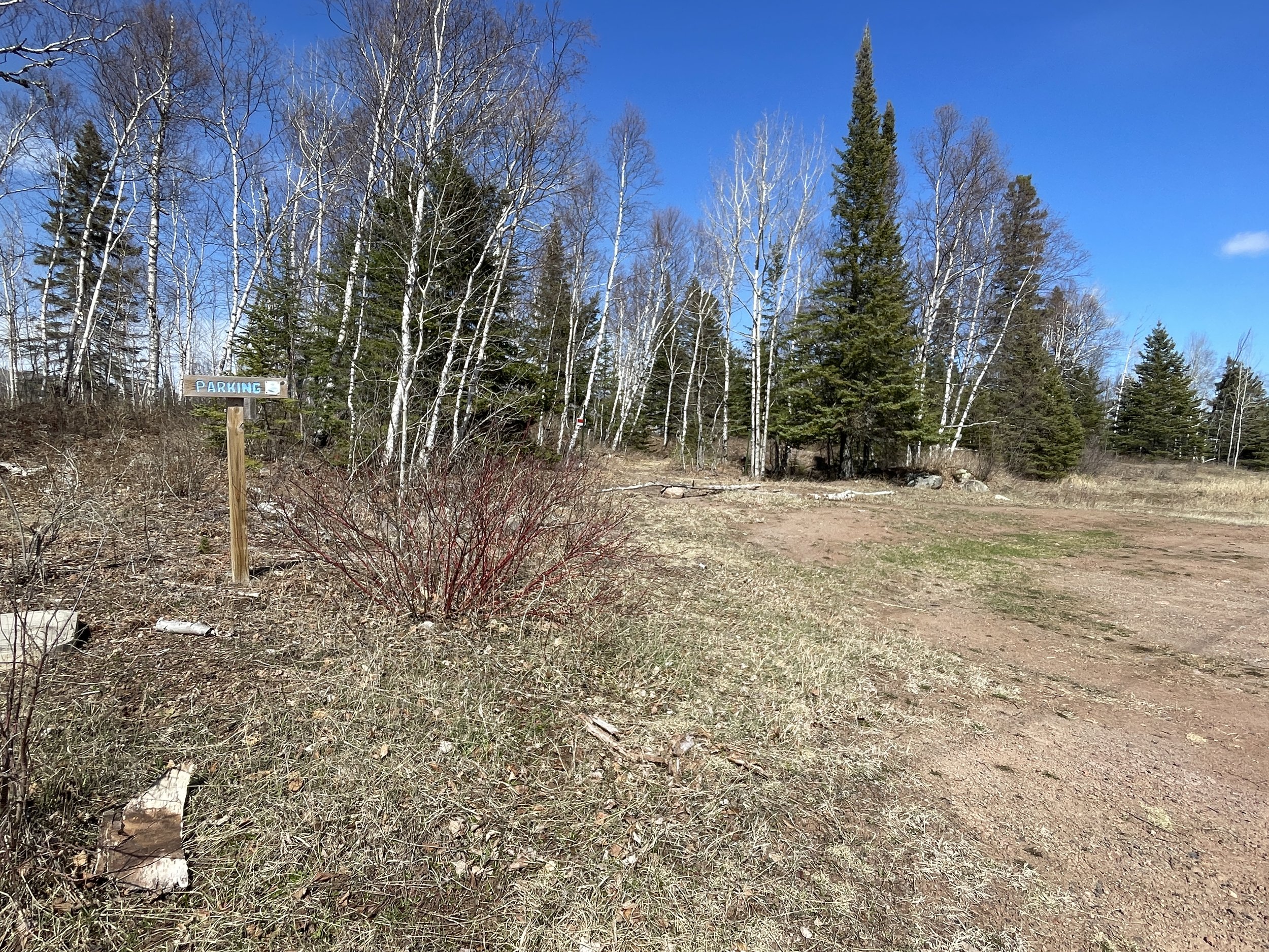
The main parking lot is just off of MN-61, right next to the bridge that crosses Temperance River. There are spots to park along both sides of the highway. This is the trailhead for Temperance River Gorge, Lower Falls, Upper Falls, the Hiking Club Trail, and the longer hiking option to Carlton Peak. This trailhead can also be used to access Cross River, which is also a longer day hike.
Main parking area off of MN-61 leading to the River Gorge, Hiking Club, Carlton Peak, Upper Falls, and Cross River along the Superior Hiking Trail
There is a second parking lot by the ranger station, next to the campground. There are bathrooms here, but this parking location adds 0.15 miles (in both directions) to walk to the main trailhead by the bridge.
For a closer trailhead to Carlton Peak, Tofte Overlook, and Britton Peak, park at the Britton Peak Superior Hiking Trail trailhead (off of Sawbill Trail Road). For a closer option to hike along the Cross River, park at the Cross River trailhead on the Superior Hiking Trail (off of Skou Road). Both of these trailheads are outside of Temperance River State Park, but the trails return within park boundaries. Parking along the Superior Hiking Trail does not require a parking pass or permit and is free.
Mouth of Temperance River - Jan 2024
As seen in my pictures, there isn’t a beach at the mouth of the Temperance River. I’ve read that has to do with why the river was named “Temperance” - because there isn’t a sand “bar.” I have no idea if that’s true, but the story makes me laugh at least.
According to the State Park Map, if you want to access Lake Superior, there are short trails in the campground near sites 14 and 25. Park by the Ranger Station. I haven’t explored these short trails yet, but for my favorite spots along the Lake Superior shoreline are Park Point in Duluth, Agate Beach in Tettegouche, Pebble Beach in Split Rock, Crystal Bay in Tettegouche, and the Lakeshore Trail in Cascade River.
This post stands on its own, but it is a part of a larger network of posts I’ve written regarding things to do along Minnesota’s North Shore. This is a link to my full North Shore Guide for anyone interested. It’s an external link so you won’t lose your spot. I will also re-post this link at the end.
Lodging Options
Temperance River State Park does have a small campground with showers. I haven’t had a chance yet to stay in this campground. I have camped at Cascade River, Tettegouche, and Split Rock, and have enjoyed them all. If a hotel would be better, Temperance River is very close to Schroeder, but this is a pretty small town. Other options north of Temperance are Lutsen and Grand Marais. And south of Temperance is Tofte, Two Harbors, and Duluth.
When our kids were young, we would stay at the Edgewater in Duluth over the long MLK holiday weekend. We would use the waterpark to bribe our boys for winter hiking in the day, and then we’d swim in the evening since it gets dark early. The hotel isn’t the nicest, but the waterpark is fantastic.
Hiking at Temperance River State Park
Before listing my hiking recommendations, I do need to talk about the waterfalls not having names, and not being marked on the main state park map. I have no idea why this is - but it results in an inadequate picture of how cool this state park is. Maybe that’s intentional as the parking lots are pretty small? In the maps below, I have pinned locations of the falls. I don’t feel I have authority to make up names for the actual waterfalls though, so if I am not aware of the name, I will simply list a number for each waterfall in the order it will be encountered along the trail.
My recommendation for Temperance River would be to start with the short loop hike around the lowest falls, on the lake-side of MN-61, and then hike upstream along the Temperance River Gorge. If there’s extra time, add the Upper Falls Trail along the west-side of Temperance River. For a longer hike, drive down to Cross River (south on MN-61). I would skip the Hiking Club loop. For the best views of fall colors, hike up to Britton Peak, Carlton Peak, and Tofte Overlook. The shortest option to these peaks is from the Britton Peak Superior Hike Trail trailhead.
Trailhead for the Temperance River Gorge - parking off of MN-61 is just to the right of us in this picture. And yep - sometimes there’s snow on the ground and we think it’s warm in MN. That’s hard to explain if you don’t live here…
Below is a map that I will use throughout the rest of the post. I use colors for the trails to help me explain where in the park to find different things. These colors will not mean anything to you while you are in the park, however. There are also hyperlinks below in the captions. If you click on a trail name, it will bring you to pictures and a trail description within this post. There will be a link back to this map at the end of each trail.
Lower Falls (maroon) - 0.1 mile loop hike to view a waterfall below MN-61. Trail crosses a pedestrian bridge near the mouth of Temperance River to make a loop.
Temperance River Gorge Trail (dark green) - 0.75 mile out-and-back hike along the rim of the Temperance River Gorge. The trail goes past 5 waterfalls, but many are rather difficult to photograph due to the angle from the rim trail. This is one of the best hikes in Minnesota.
Hiking Club Trail (purple) - The Hiking Club Trail adds a 1.45 mile loop to the Gorge Trail. The rapids of Temperance River can be heard from above, but there aren’t many spots where the river is clearly visible. I would hike a short distance upstream and instead save the steps and hike Upper Falls.
Upper Falls (yellow) - Out-and-back trail on the west-side of Temperance River adds 1.5 miles to the Gorge Trail, provides a better view of the last cascading waterfall compared to the River Gorge Trail, and adds one more waterfall that isn’t visible from the east-side.
Carlton Peak/Tofte Overlook (brown) - The main trail to Carlton Peak adds 5.85 miles out-and-back to the Gorge Trail (for a total 6.6 mile hike). The shorter option is a 3.7 mile out-and-back hike from the Britton Peak Superior Hiking Trail trailhead (red).
Britton Peak (lime green) - This trail is outside of Temperance River State Park. Parking is at the Britton Peak Trailhead on the Superior Hiking Trail. Out-and-back, the trail to Britton Peak is just 0.3 miles, and is the easiest hike to see fall colors along the North Shore. This shares a trailhead with Carlton Peak and Tofte Overlook, for anyone wanting a longer hike.
Cross River (blue and orange or pink) - From the main Temperance River parking lot (beginning with the Gorge Trail) (pink plus blue) this is a 9-mile out-and-back hike. From the Cross River Superior Hiking Trail parking area (orange plus blue) this is a 6 mile out-and-back hike.
Lower Falls - Temperance River
Distance / Elevation Gain - This is a very short 0.1-mile loop-hike to see a waterfall at the mouth of Temperance River where it enters Lake Superior. This trail has an elevation gain of 30ft, all with wooden steps. This trail is marked in dark maroon on the map (it almost looks brown).
The closest parking lot is along MN-61, right next to the bridge over Temperance River. This is the main trailhead in the park. Note that there are no bathrooms here. To find bathrooms, head north on MN-61 to the campground, where there is a place to park next to the Ranger Station. I would recommend driving back to avoid the 0.15-mile walk to the trailhead at the bridge (both ways).
The Lower Falls is on the lake-side of MN-61. There isn’t a formal trailhead sign, but there are obvious steps to head down right next to the MN-61 bridge.
Steps down to Lower Falls and the mouth of Temperance River
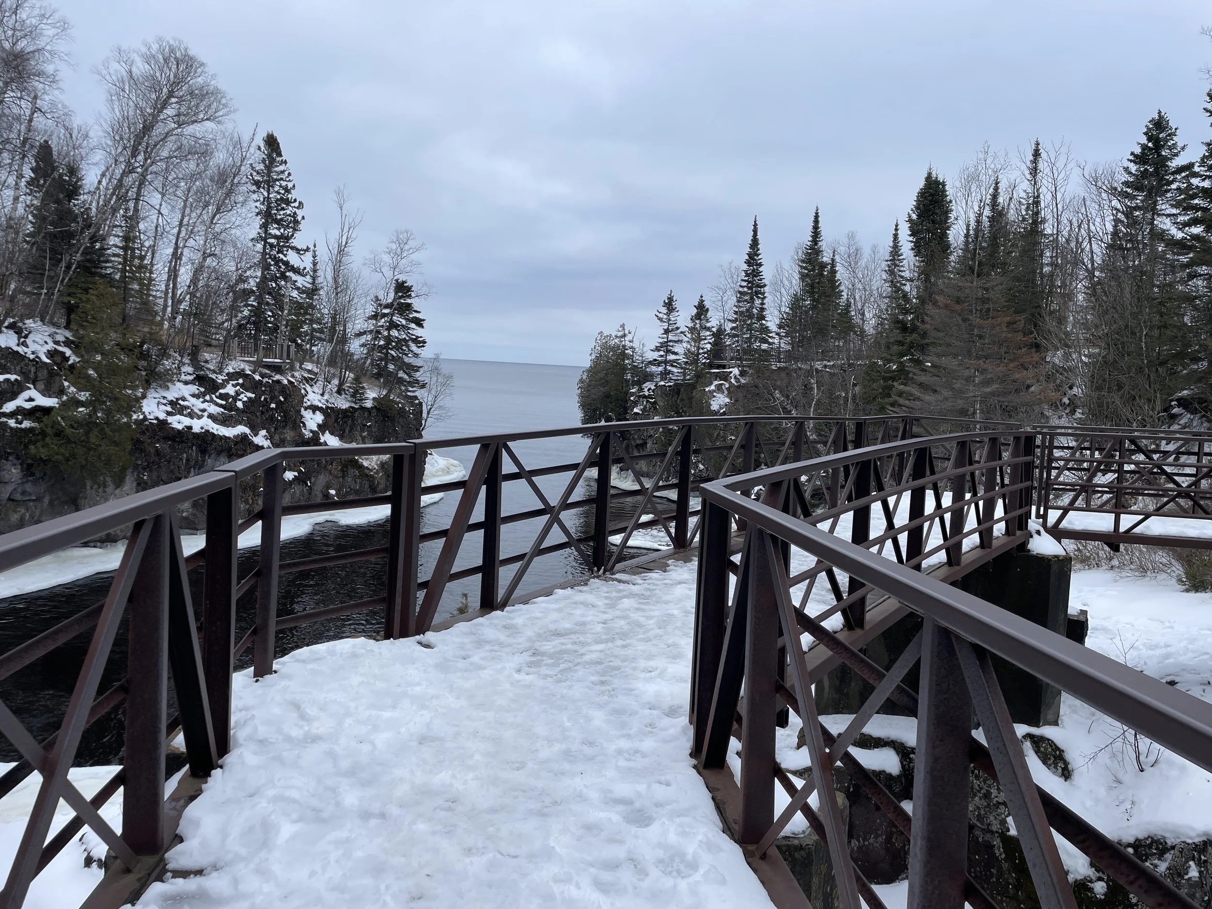
Unlike Gooseberry, Split Rock Lighthouse, and Tettegouche, there is no beach at the mouth of Temperance River. The only view of the river’s end is from this pedestrian bridge.
Pedestrian bridge enabling a loop hike
Temperance River cuts out a beautiful gorge, and it continues to flow with full force, right into Lake Superior.
End of Temperance River as it flows out into Lake Superior - April 2024
Same view as above in the winter - Jan 2024
Lower Falls is visible from the pedestrian bridge, looking back towards MN-61. Note that I’m not sure if “Lower Falls” is its actual name. I don’t think it formally has a name.
The last waterfall as Temperance River tumbles into Lake Superior - April 2024
Zoomed in view of the same waterfall
Same view as above in the winter - Jan 2024
From MN-61, looking downstream at the pedestrian bridge
Same view as above in the winter.
Temperance River Gorge Trail
Distance / Elevation Gain - Hiking out-and-back from the parking area (same location as Lower Falls) to the end of the waterfalls (marked by trail marker ‘C’) is 0.75 miles with a gradual elevation gain of 100ft. This is the trail marked in dark green on the map. There are five waterfalls along this short trail. They are marked with red pins on this map.
Trailhead is marked by the Hiking Club sign.
The Temperance River Gorge Trail is one of the best hikes in all of the MN State Parks. This is a short (0.75 mile) trail with an elevation gain of 100ft. Most of the elevation gain comes with steep stone steps. For hikes in the winter, YakTrax and hiking poles are a must because of these steps. One other thing to note is that this trail follows along the top of a very steep and deep gorge. Most of the views are unguarded. My boys were great hand-holders when they were little, so I was never nervous hiking here with them.
This trail starts on the north side of MN-61 (non-lakeside). The trail starts paved, and is clearly labeled with the Hiking Club sign. Both the MN State Park map of Temperance River, as well as my GAIA app map show a trail leading from MN-61 along the west-side of Temperance River. As far as I can tell, this is old. The trail is marked off closed with fences. I think the park is letting this section of trail return to the wilderness. Later, to get to Upper Falls on the west-side there is a hiking bridge that goes over Temperance River. So for all hikes (except to the Lower Falls loop) head north along the east-side of the river, along the paved trail.
Heading left takes goes to Temperance River. The formal trail stays to the right. Hidden Falls is best viewed from the area marked by the fence.
In a few steps, the trail is at Temperance River. The left fork goes directly out to the water.
There are some bigger rocks to sit on and enjoy the sound of the rushing water. If the water is low enough to walk through, this might be a fun place to play, but don’t enter if the water is deeper than that. This river moves extremely fast, and remember there is another waterfall (Lower Falls) downstream, before Temperance reaches Lake Superior.
Temperance River
Temperance River State Park will always hold a special place in my heart as this is the spot my husband and I stopped and ate the top of our wedding cake on our first anniversary.
Our special picnic spot
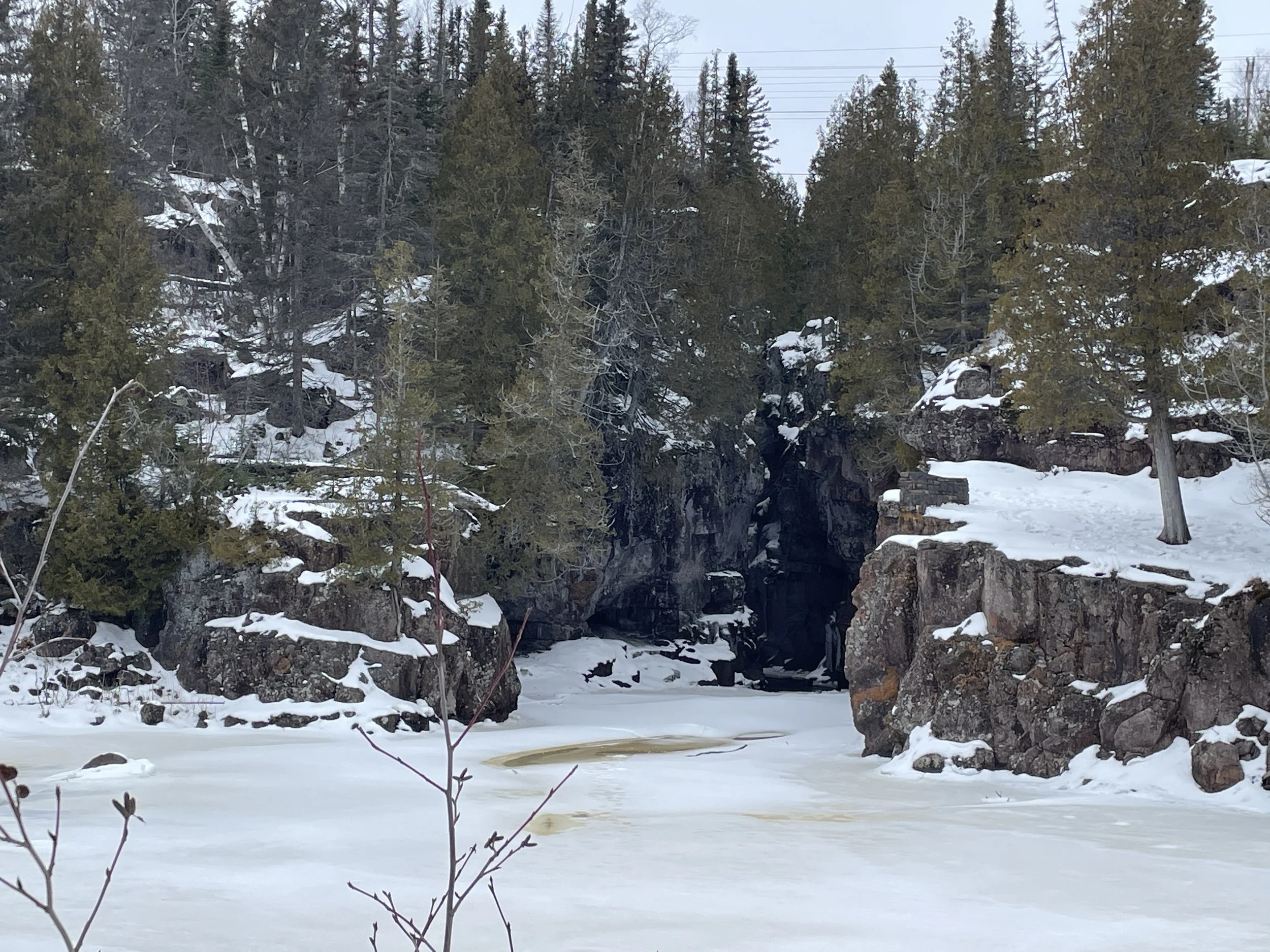
Heading back to the main trail from the river, Hidden Falls is best viewed from that observation area that was marked by the fence a few pictures above. Look upstream. There is a canyon that the river flows through. Look closely, and Hidden Falls is there. It’s impossible to get a great picture of Hidden Falls, as it’s hidden… But the trail will eventually go right next to it, and it can be kind of seen from above. Hidden Falls is the 2nd waterfall (Lower Falls being the 1st).
First glimpse of Hidden Falls in the back of the canyon wall - It’s hard to see in this picture, but this is the canyon to look into. Jan 2024
This is a more zoomed in picture, and Hidden Falls is better seen. Because this is zoomed in, it’s closer in the picture than can be seen with unaided eyes.
An even closer shot - this was taken in the summer with lower river levels.
Same view of Hidden Falls as the picture above in winter - Feb 2017
A few steps further and this is a great spot to turn around and look downstream.
Temperance River flowing towards Lower Falls - April 2024
Same view as above in Jan 2024. Winter is such a stunning time to hike near water.
From here, the trail goes up these steps and follows along the rim of the gorge for the rest of the trail. These are the steps I mentioned above regarding winter hiking. Going up, no problem. Going down - they are going to be a problem. I like YakTrax, my husband prefers snowshoes. And we both use hiking poles. Better to be cautious on this hike than tumbling and breaking a bone, or worse, falling into the gorge.
Steps leading from Temperance River up to Hidden Falls and the rest of the Temperance River Gorge Trail
Same view as above with slippery ice and snow. This is an awesome park to hike in during winter months, just be prepared.
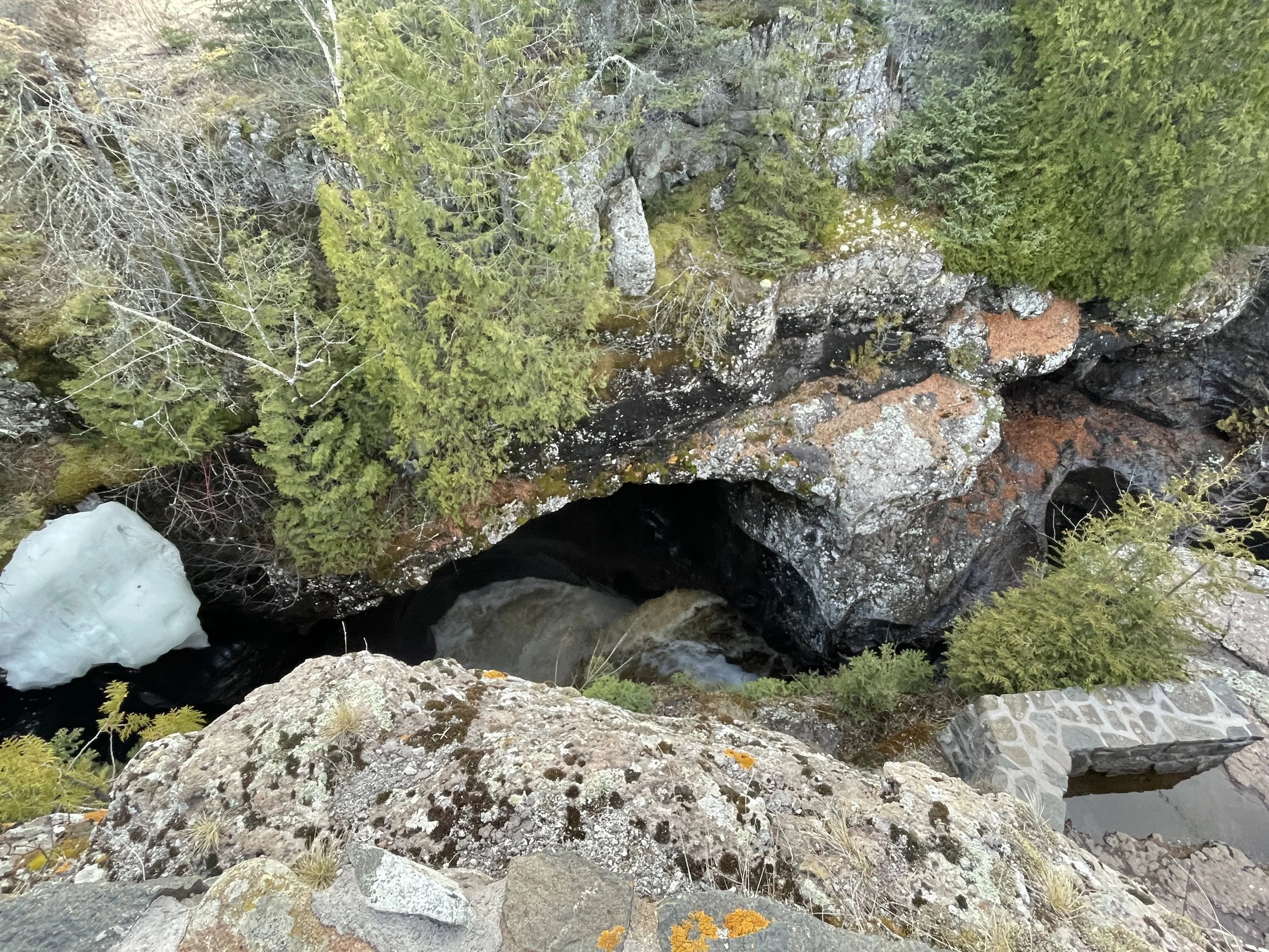
At the top of the steps, towards the left, there is a small wall. Peer over this wall to get a view of Hidden Falls. This trail has several unique ways to experience a waterfall. Hidden Falls is better heard and felt (from it's mist) than simply seeing it.
Looking down into Hidden Falls. The foam at the bottom of the waterfall is visible.
Hidden Falls - Peering a little further over the wall, a portion of the waterfall is visible, along with the rainbow made from the mist.
Same view in the winter - I love all of the places the water just hangs in place, defying gravity.
As I mentioned, the rest of this hike stays along the gorge’s rim. Just past Hidden Falls, there is an impressive view of the rocks as they drop down to the river.
Temperance River Gorge
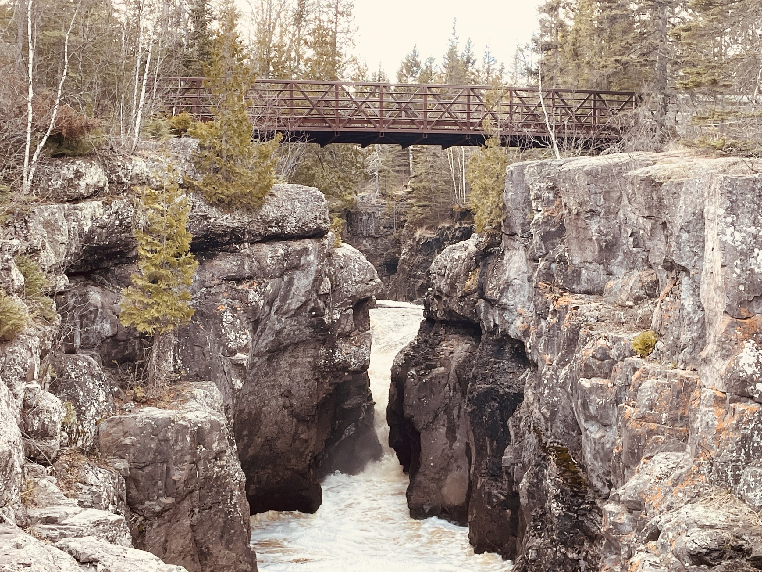
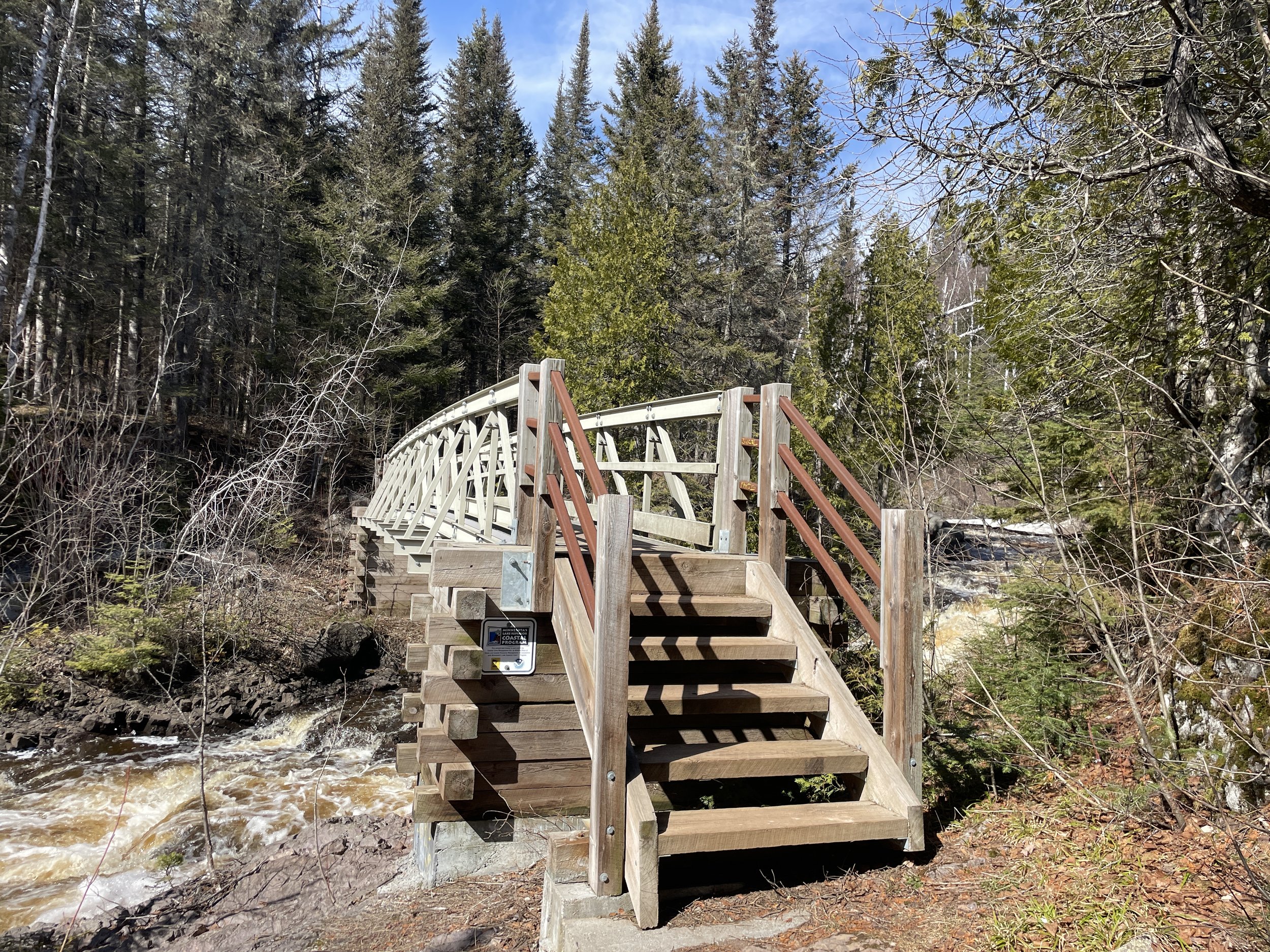
The third waterfall is visible a short distance upstream from Hidden Falls. This is the iconic hiking bridge going over Temperance River, with a waterfall flowing under it. I don’t know if this waterfall has a name.
There is not a loop-back option along the other side of the river, unfortunately, even though it looks like there is on the State Park map. (Downstream on the west-side, there is a fence blocking what may have once been a return trail). This bridge is for the Superior Hiking Trail. There is a trail on the west-side that continues upstream. The view of the sixth waterfall is better on the west-side. And Upper Falls (seventh waterfall) is only visible on the west-side. Stay on the east-side to see the fourth and fifth waterfalls.
Third waterfall along Temperance River with the Superior Hiking Trail bridge crossing over the falls - April 2024
Same view in August 2015
Yep, when you don’t have kids, you have free time - LOL. Had to add in a picture of my husband from our anniversary trip.
Same view - Feb 2017
Looking downstream at the same pedestrian bridge from the east-side of the river.
The Temperance River Gorge Trail continues on the east-side, upstream of the bridge. A short distance further is the fourth waterfall.
Fourth waterfall along Temperance River - April 2024
Same waterfall - August 2015
Same picture as above in the winter - Jan 2024. The water on the top is frozen, but I could hear the water under it still gushing over the rocks, and at the bottom, I could see the water moving from underneath.
In a short bit, there is a bridge to nowhere. Walk across it, for the best view of the fifth waterfall.
Bridge out to a rock to see the next waterfall
Fifth waterfall along Temperance River - April 2024
Same view in the winter - Jan 2024
The last waterfall visible on the Temperance River Gorge Trail is the sixth waterfall. This is a big waterfall, but only a portion of it is visible along the east-side of the river.
This waterfall has several steps in it. This is the first. - April 2024
Same view as above in the summer - Aug 2015
Below is the second step of this sixth waterfall. This was visible in the background of the previous pictures. There is a spur trail to walk down closer to the river.
A fun spot to fish and explore, but not a safe spot to swim - Aug 2015
Same view - Feb 2017
The third step in the waterfall
Closer picture of the top part of the waterfall - April 2024
Same viewpoint as above, but angled to see more of Temperance River upstream of the sixth waterfall
There is a nice bench to stop for a bit above the waterfalls.
The waterfalls are over at this point in the trail. The river widens out so it is much more shallow. In the summer months, this is a great spot to get feet wet. Just past the bench, there is a split in the trail for the Hiking Club loop. It’s marked with a “C”. My recommendation would be to stop here and skip the Hiking Loop Trail. For a longer hike, head back to the pedestrian bridge, cross it, and walk upstream along the west-side of the river for a better view of the sixth waterfall, and to see Upper falls.
The next sections in this post are about the Hiking Club Loop and Carlton / Britton Peaks as these trailheads start where the Temperance River Gorge Trail ends at the “C” trail marker. Click here to skip to the Upper Waterfall Trail.
End of Temperance River Gorge Hike - beginning of Hiking Club Loop
Temperance River Hiking Club Loop
Distance / Elevation Gain - Continuing upstream along the east-side of the river and walk the Hiking Club Loop (trail marked in purple). This loop adds 1.45 miles and 150ft in elevation to the Temperance River Gorge Trail (for a total of 2.25 miles).
Cousins - One of my favorite hiking pictures
I like the beginning of the Hiking Loop Trail, as it continues upstream along Temperance River. There are no more waterfalls visible, but the trail continues to have spurs that lead to the river’s shoreline. The river remains wide, and in the dryer summer months, these are shallow calm sections of the water to splash in and skip rocks.
This is what Temperance River looks like above the falls. Tons of rocks to lift and look under for crayfish. Lots of smaller rocks to try skipping across. Plenty of water to splash in on a hot day. August 2017
Cousins skipping rocks in the river
This is a great picture for why not to walk across a frozen river - See how thin the ice is at the top? And how big of a space there is between the top and the next par that is frozen? And under that is quickly flowing very very cold water. I do love the ice formations along moving water though - the ice sculptures are creative and intricate and unique.
Eventually the trail curves and heads up the below steps. The trail will continue to hug the river gorge along the left, but from this point, the views of the river are pretty much covered up by tree growth. The sound of the river is still present, however. This is the point in the trail that there are simply other trails I like better. My recommendation would be to hike up the river for a bit, but then turn around and head over to Upper Falls for a longer hike.
Steps going up along the river’s curve
An interesting fact that I learned while hiking at nearby Sugarloaf Cove - Birch Trees are not native here along the North Shore. They moved in following the logging industry and a fire. Several of these trees on the North Shore are approaching their lifespan of 80-90 years. Expect the birch to slowly die out and hopefully be replaced by native pines.
I think of the yellow Birch Tree leaves as being iconic to the North Shore in fall, but nope, not native to this spot in MN.
Pine trees slowly taking back the forest
Upper Falls (west-side of Temperance River)
Distance / Elevation Gain - The Upper Falls Trail adds 1.25-miles out-and-back and an elevation gain of 100ft to the Temperance River Trail (for a total of 2.0 miles / 200ft elevation gain). This trail is marked in yellow and starts by crossing the pedestrian bridge to the west-side of Temperance River and heading upstream.
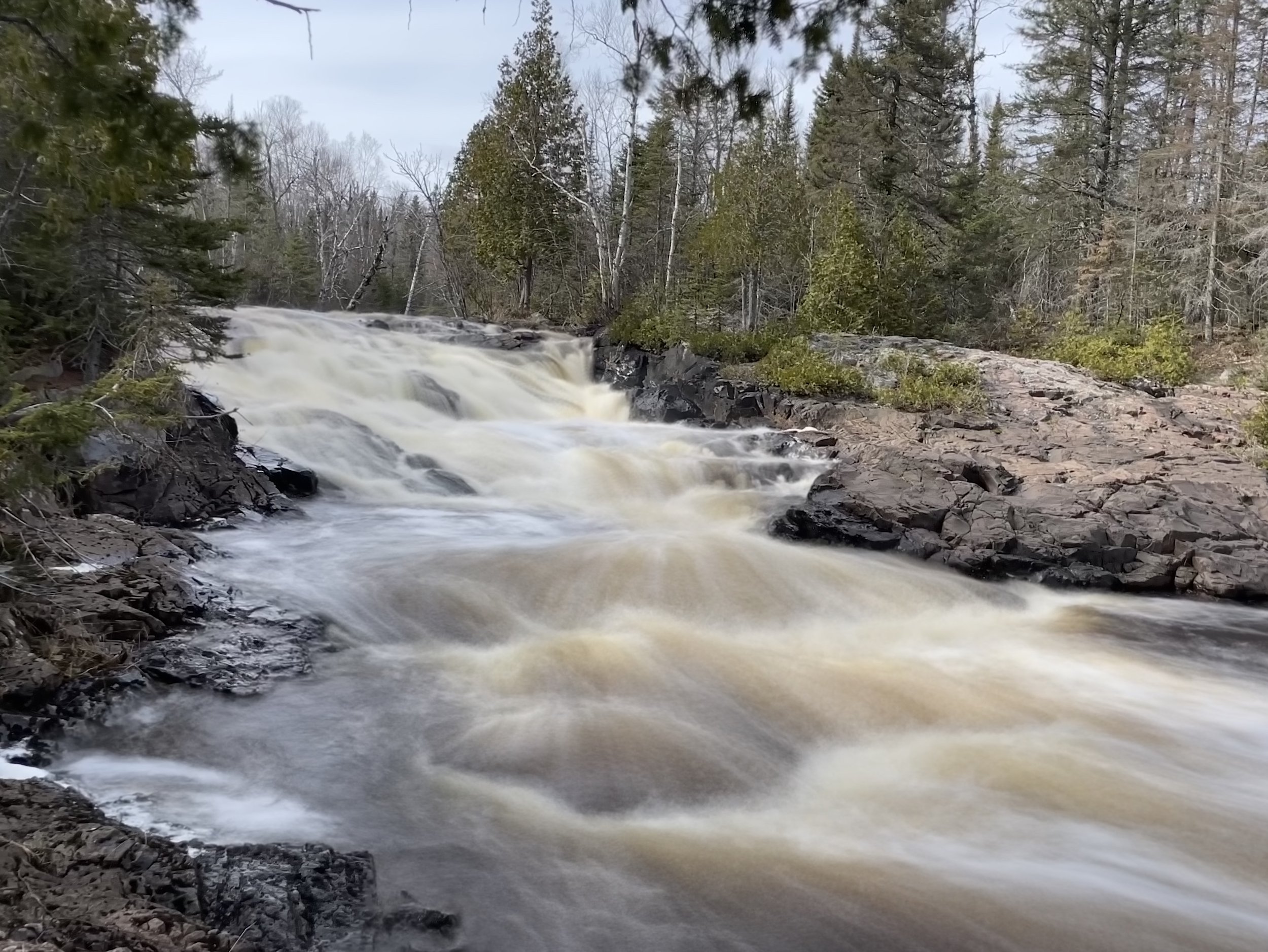
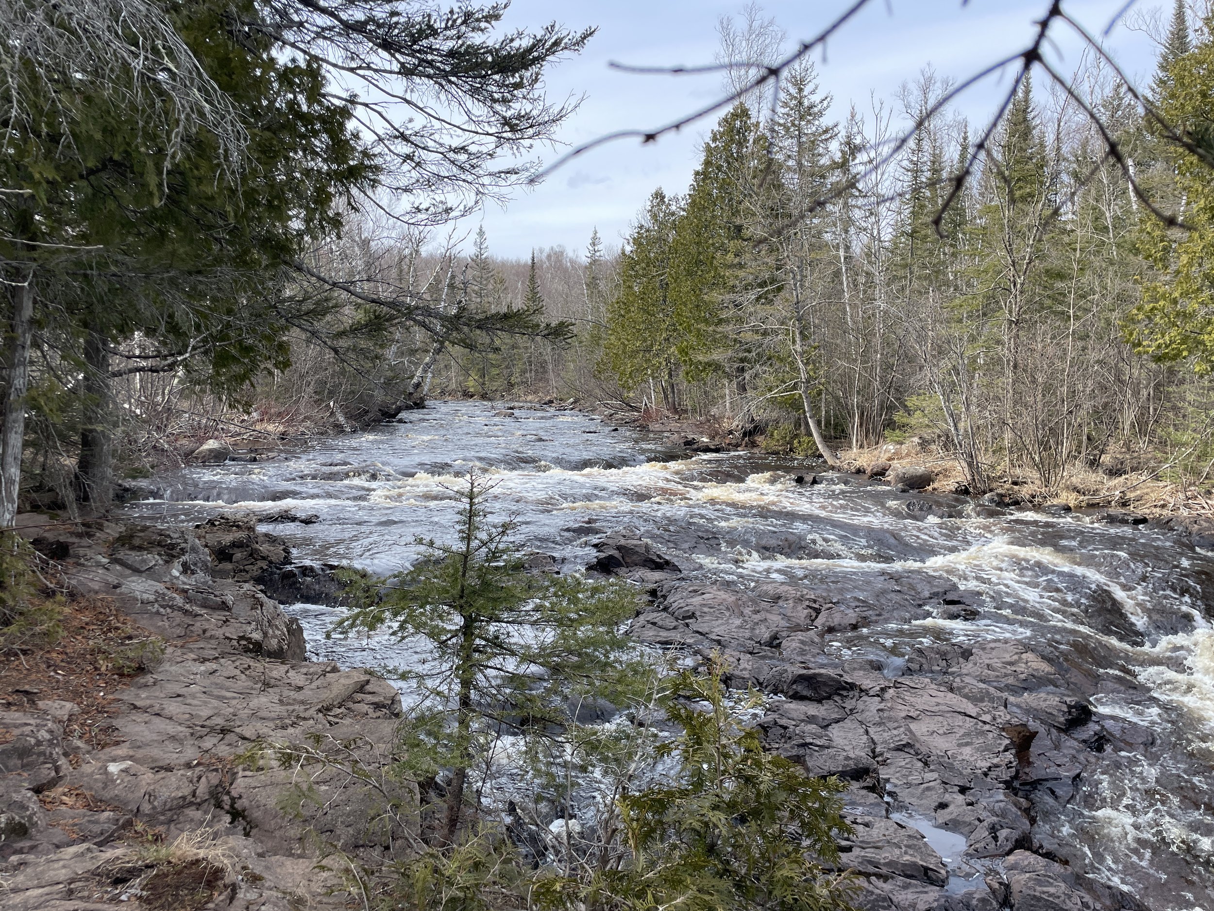
On the west-side of Temperance River, there isn’t a great view of the fourth or fifth waterfall, but it’s just a short hike to the sixth waterfall. This one is visible from a side angle along the Temperance River Gorge Trail, but on the Upper Falls Trail, the view is head-on. This is a much more impressive waterfall when viewed on the west-side.
Sixth waterfall viewed from the west-side of the river - April 2024
Same waterfall as above with a different angle (hard to pick just one favorite picture) - April 2024
I had previously hiked the Hiking Club Loop Trail on the east side of the river and hadn’t seen or heard the seventh waterfall (Upper Falls). I was pretty sure the MN State Park Map (which shows a waterfall symbol for Upper Falls) was incorrect. But I had some extra time before the sun set on my last trip to Temperance, so I decided to hike along the Upper Falls Trail on the west-side. And I’m so glad I did! That sixth waterfall was amazing! The river was beautiful, and I did find Upper Falls. The map is correct, although it’s quite a bit smaller than the other falls in the park.
Temperance River along the west-side on the Upper Falls Trail
The Upper Falls Trail stays fairly close to the Temperance River, with several views along the way and the constant sound of rapids - an immediate de-stressor for me.
Another view of the Temperance River roaring with snow melt
Upper Falls is a step waterfall with a few sections, and it’s pretty much where the state park shows this waterfall to be. This waterfall is smaller, but was still impressive with the amount of water flowing through the river.
Bottom-section of Upper Falls
The bottom section is definitely the main waterfall, but looking just upstream, there is a really short step above, and a bit further upstream one more step.
Between the steps of Upper Falls
Top-section of Upper Falls
One closer picture of the top part of Upper Falls, and a relatively calm Temperance River Upstream.
For a super short, cool hike, the Temperance River Gorge Trail, in my opinion, is the best one along the North Shore. But it’s really short. To spend some more time in the park, I would suggest adding on the Upper Falls Trail.
Note that I will review Cross River further below. There is no easy way to get to Cross River - this is for those looking for a longer day hike. One option is to continue past Upper Falls (I have this trail marked in pink). The advantage to this trail (pink plus blue) is that 2 miles of total 9 are already included with Temperance River Gorge and Upper Falls (so this trail only adds 7 miles of hiking). The disadvantage is that the other option (orange plus blue) is only 6 miles total. I opted for the other route, mainly due to it being closer to Cross River, but the trail marked in orange never actually gets close to Cross River, so this was a bit of a disappointment.
Carlton Peak and Tofte Overlook
Map to Carlton Peak and Tofte Overlook from main Temperance Park trailhead
Distance / Elevation Gain - From the main trailhead along MN-61 (including the Temperance River Gorge Trail) the main trail to Carlton Peak (dark green to purple to brown) is 6.6 miles with an elevation gain of 950 ft.
I noticed a shorter hiking option on my GAIA map, so I’ll admit that I have not hiked to Carlton Peak from the main Temperance River Trailhead. I drove instead to the Britton Peak Superior Hiking Trail Trailhead, which is just 3.7 miles out-and-back trail with an elevation gain of 525ft. This is the trail marked in red.
Map of Britton Peak, Carlton Peak, and Tofte Overlook from the Britton Peak Superior Hiking Trail trailhead
There are so many great hikes along the North Shore, that it is legitimate to take the shorter option sometimes to see more in a day. There’s an alternate idea that a longer hike reduces more stress, and I very much think this is true. On this particular day in October 2024, I chose the shorter option to Carlton and Tofte Peaks but then hiked an 11+ mile trail out in Cascade State Park, getting the best out of all hiking options on a beautiful fall day. That’s the best part of the North Shore - there are so many great hiking options.
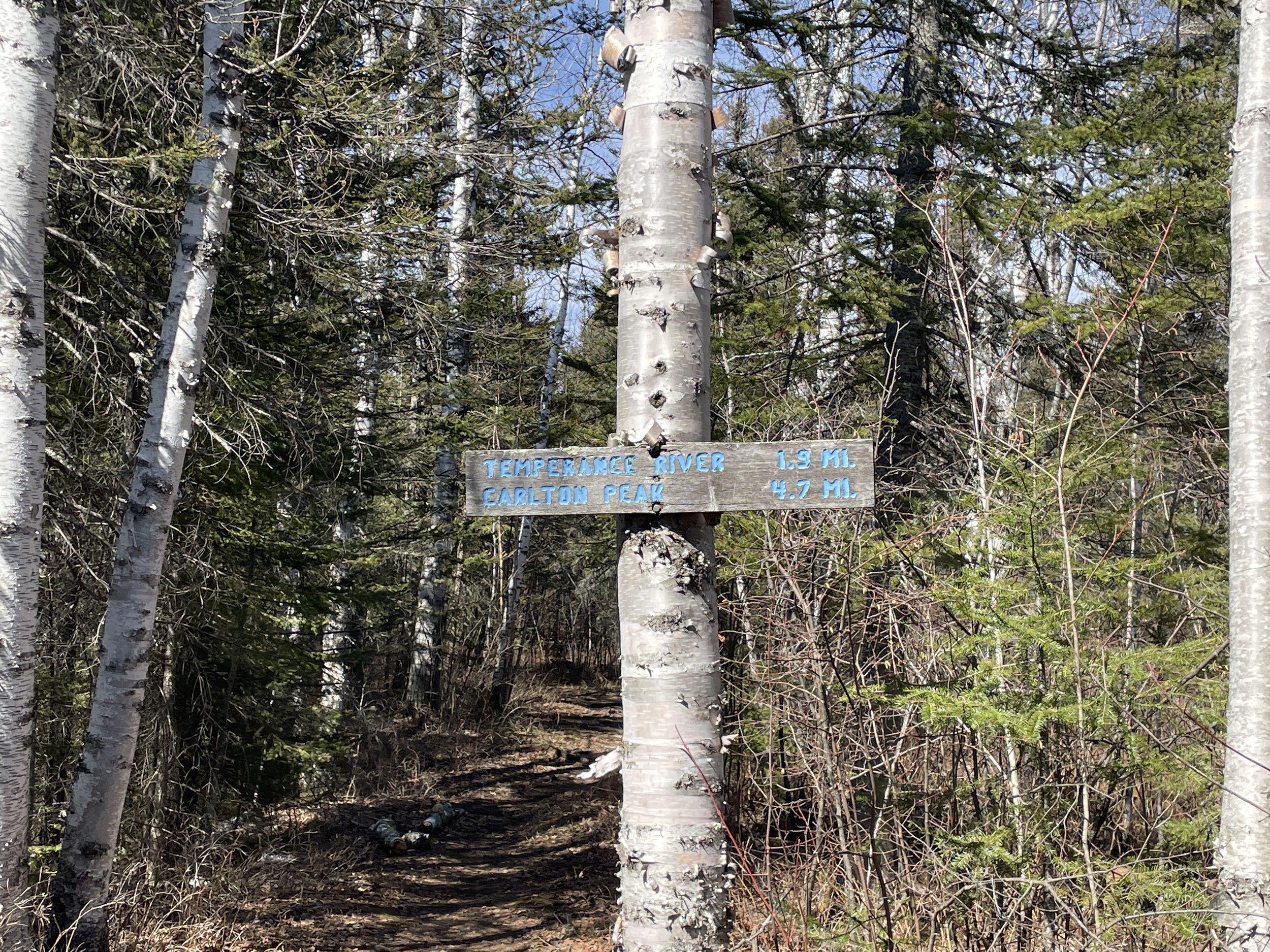
Trailhead sign to Carlton and Tofte Peak from the Britton Peak Superior Hiking Trail trailhead
The Britton Peak Superior Hiking Trail trailhead was the perfect option for me on a peak color weekend of October 2024. I arrived at about 9am, and there were just two other cars. Compared to Oberg Mountain and Bear and Bean Lake Loop whose trailheads are insanely busy, I thought this was a hidden gem, with comparable views.
The Britton Peak trailhead has two trailheads - the Superior Hiking Trail cuts directly through this parking lot. One side of the trail goes to Britton Peak, and the other goes to Carlton Peak and Tofte Overlook. Both trails are well marked.
The Trail to Carlton Peak crosses the Sawbill Road Trail. This is the sign clearly marking the trail after it crosses the road.
After a short distance (maybe a third of a mile?) the trail to Carlton Peak and Tofte Overlook crosses the Sawbill Trail road. The Superior Hiking Trail is marked clearly on both sides of the road.
Superior Hiking Trail to Carlton Peak and Tofte Overlook
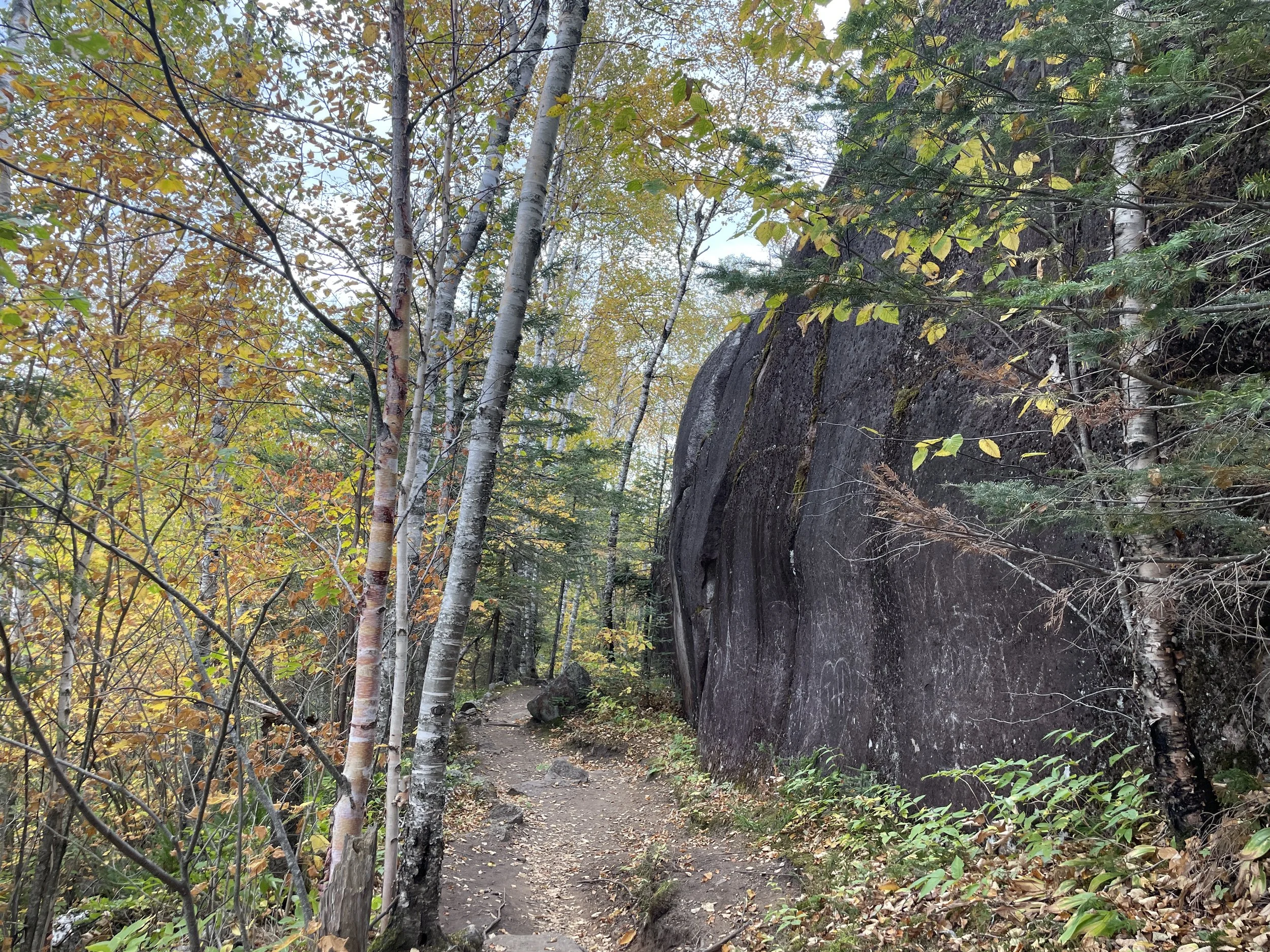
I absolutely love the Superior Hiking Trail and the people that take care of the land. The slightly muddy sections have walkways and bridges of all different kinds to prevent trail damage and future erosion. The mountain peaks were beautiful this weekend, but so were the trees that simply lined both sides of the trail.
The first weekend of October is typically close to fall peak colors along the North Shore of Lake Superior in Minnesota.
The most common colors in the fall along Lake Superior in Minnesota are the green of pine trees and the yellow of birch. But there are a small number of maples and oaks that add oranges, reds, and deep browns.
An unusual hillside lit up in red color
Overall I would rate this section of trail to Tofte Overlook and Carlton Peak as easy to moderate. The majority of the trail was flat, with some gentle elevation gain until the very end. For Lake Superior Trail hiking, which is notorious for its ups and downs, the up sections were pretty gentle.
Hiking up to the split for Carlton and Tofte Peaks
I chose to hike up to Carlton Peak first. No real reason, and after hiking both, I would recommend going to both peaks, but I don’t think the order matters.
After the trail split, the way to Carlton Peak is marked with boulders
Carlton Peak is along the Superior Trail, so there is a split to be aware of. The trail is going to go downhill back to Temperance River State Park. The trail up to the summit of Carlton Peak is a spur trail. Look for the clearly marked sign to the summit.
Summit Trailhead to Carlton Peak - This is a spur trail of the Superior Hiking Trail
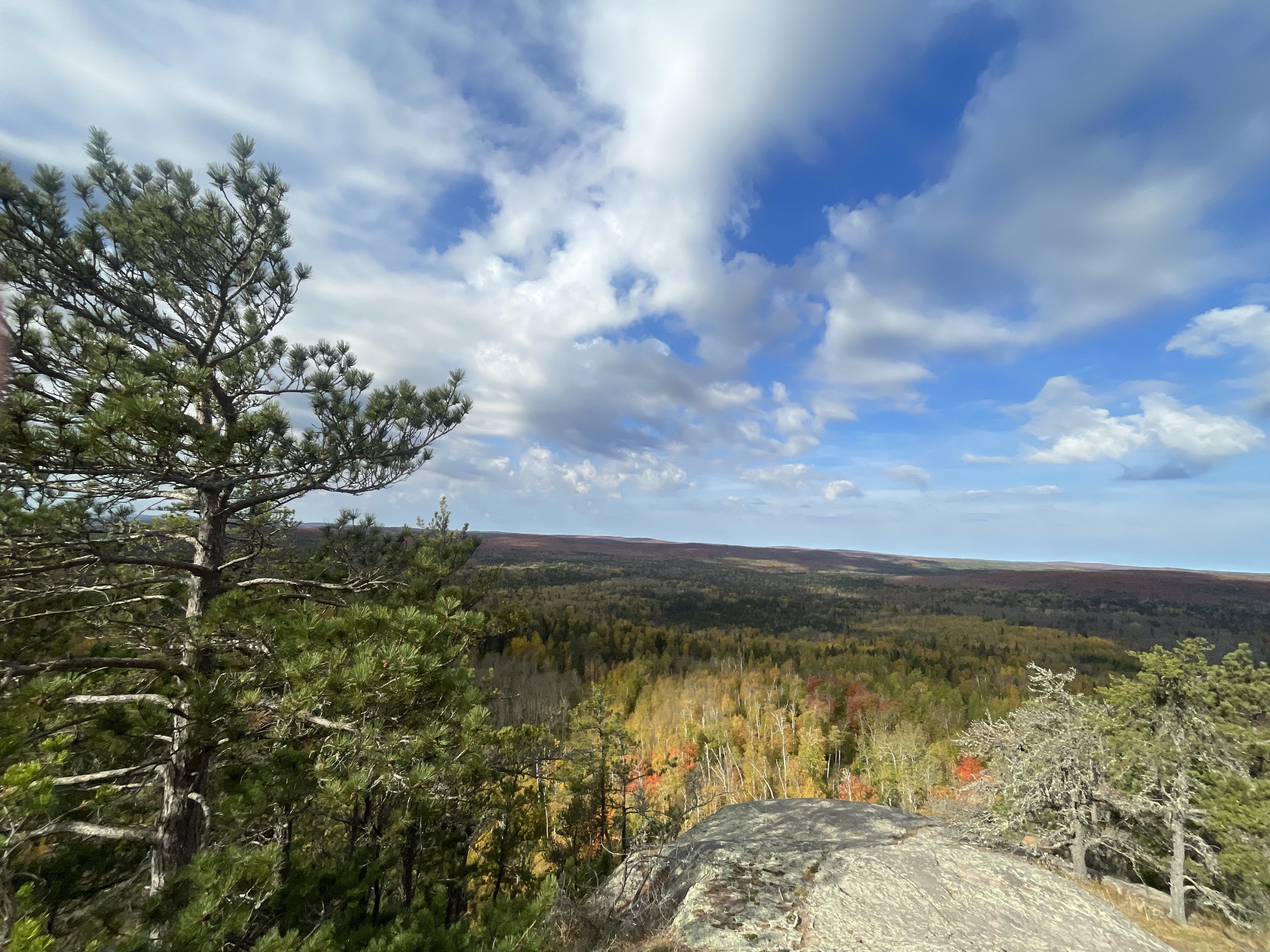
At the top of Carlton Peak is a huge boulder. There are views of all sides along this large boulder to explore. When I got here, I was alone. Prior to leaving, I passed 3 other hikers. This was as pretty of a hike as Oberg Mountain which is crawling with people. For just a tidge further in miles, these are pretty comparable hikes. I would pick Carlton Peak and Tofte Overlook on a fall weekend and avoid the crowds!
Carlton Peak - Superior Hiking Trail in Temperance River State Park
Carlton Peak - Superior Hiking Trail in Temperance River State Park
Carlton Peak - Superior Hiking Trail in Temperance River State Park
Carlton Peak - Superior Hiking Trail in Temperance River State Park
Carlton Peak - Superior Hiking Trail in Temperance River State Park
On my way back to the trailhead, I stopped at Tofte Overlook. This was just as petty of a peak as Carlton Peak, however, it was smaller.
Superior Hiking Trail split to Tofte Overlook
This is a short spur, and the elevation gain was minimal. For anyone already out here on the trail to Carlton Peak, this is an easy add to see Tofte Overlook.
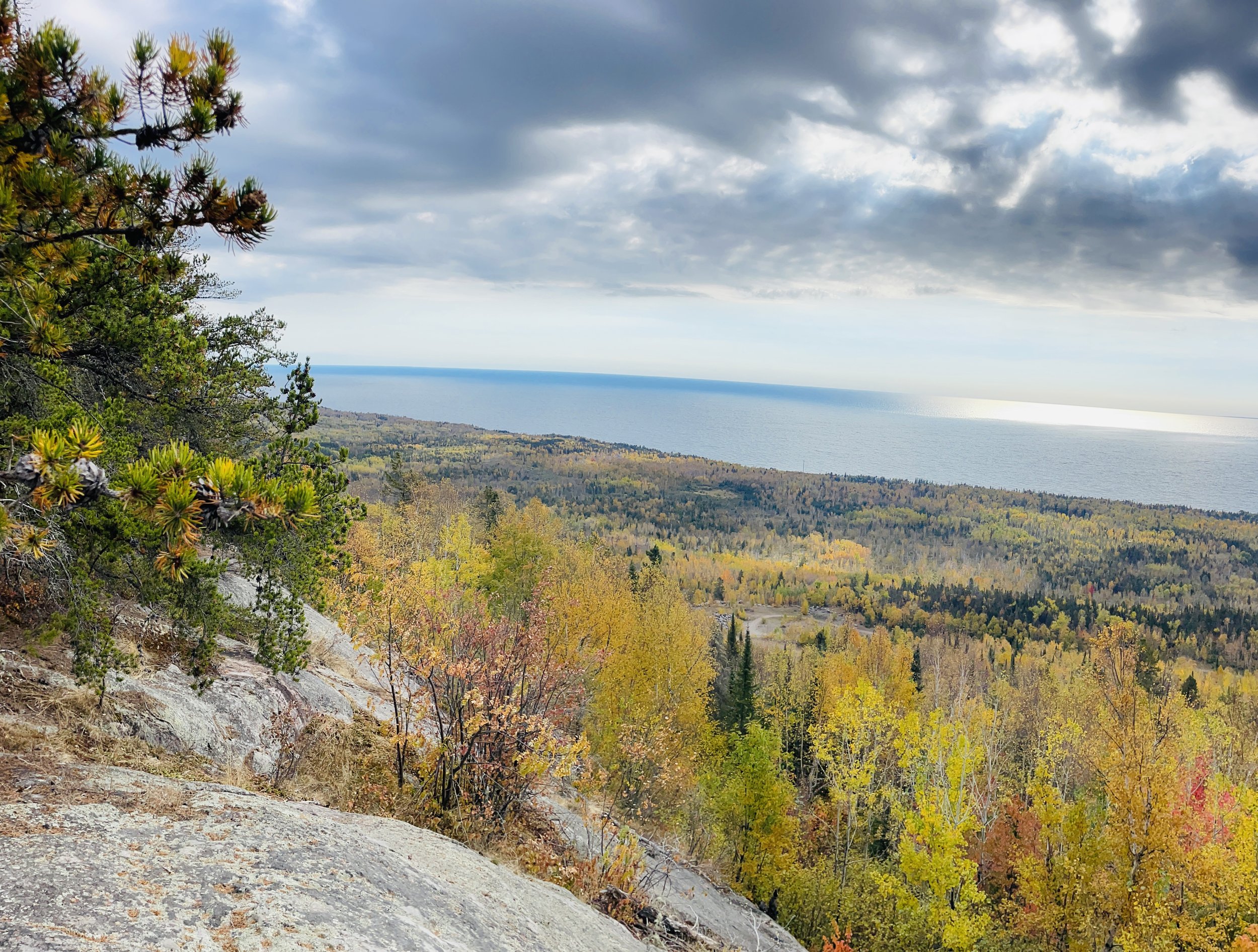
View of Lake Superior from Tofte Overlook - Carlton Peak is the boulder visible on the right side of the picture.
Tofte Overlook
Britton Peak
Distance / Elevation Gain - Britton Peak - 0.30 miles / 145ft
Britton Peak is a short hike from the same trailhead that can be used for Carlton Peak and Tofte Overlook. The trail to Britton Peak takes off from a different side of the parking lot, so anyone that is hiking to both Britton Peak and Carlton Peak will end up back at the parking lot in-between peaks. Both trailheads are clearly marked and right next to the parking lot.
Superior Hiking Trail trailhead to Britton Peak
Britton Peak is the shortest and easiest hike up to a mountain peak to see fall colors along the MN North Shore that I have found so far.
The trail is on 0.15 miles up to the peak, and it starts off with just a gradual slope.
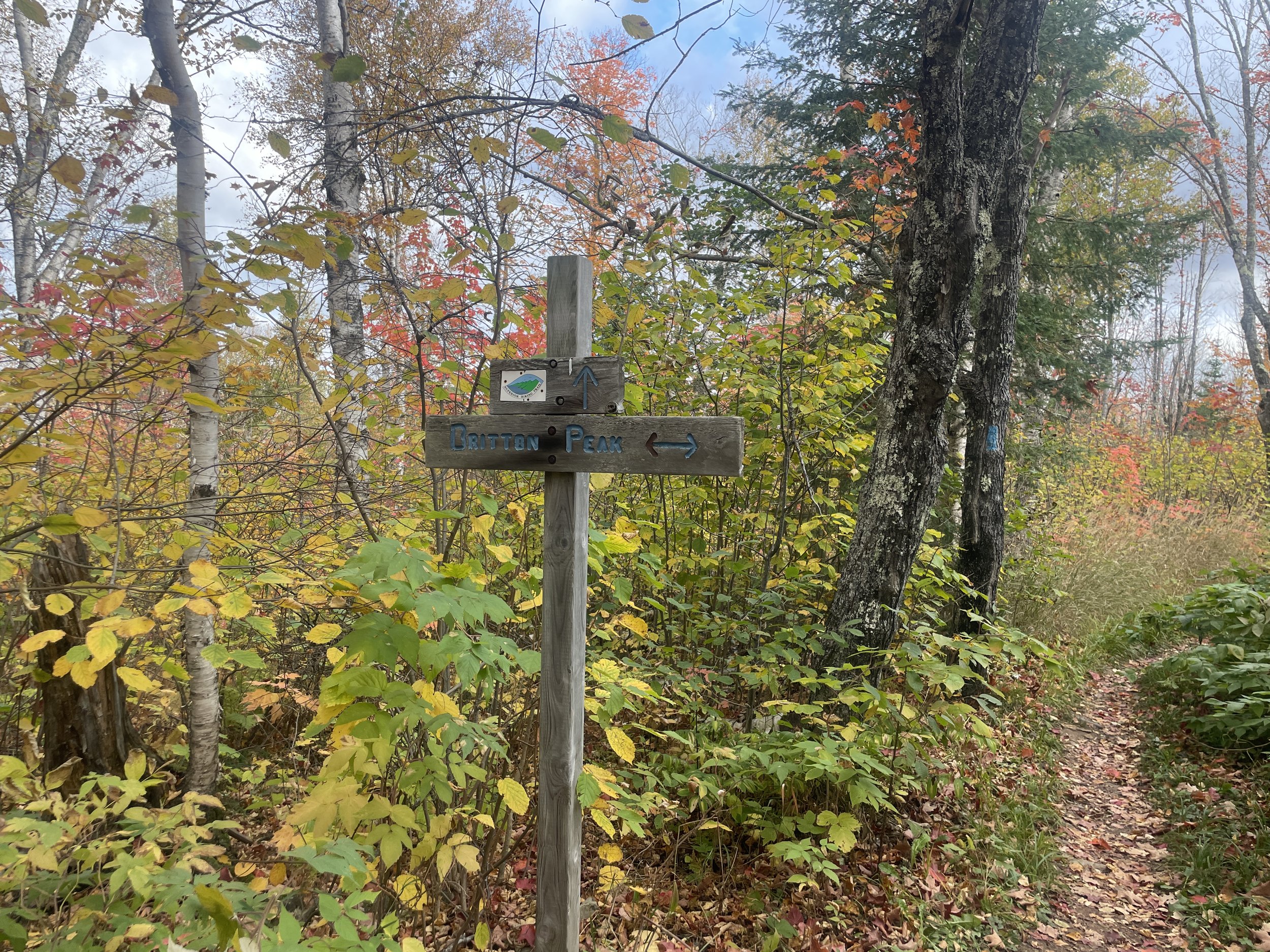
The trail to Britton Peak is a spur off of the main Superior Hiking Trail, so look for the split sign.
Sign marking the summit to Britton Peak
The summit to Britton Peak is a really quick sort kick-your-butt trail as far as North Shore hiking trail goes. With hiking poles if needed, I think this trail is doable for anyone.
Short relatively steep section to the summit of Britton Peak
Second section of the summit to Britton Peak
I was the only one at the top of Britton Peak, and I only passed one set of hikers on my way back to the car. For the easiest fall color hike that I know of on the North Shore, I’d say Britton Peak remains a secret.
View of Lake Superior from Britton Peak
View from Britton Peak
Cross River
Distance / Elevation Gain - From Temperance River State Park Trail head (starting with River Gorge) - out-and-back is 9.0 miles / 1,050ft in elevation gain (dark green to yellow to pink to blue)
From Cross River Falls along MN-61 - out-and-back is 6.6 miles / 825ft in elevation gain (orange to blue) or cut off 0.6 miles and 200ft in elevation and park at Superior Hiking Trail. Parking areas are marked with black stars. Not knowing any better, I hiked up from Cross River Falls rather than the SHT trailhead.
Cross River Falls, viewed from the MN-61 bridge
An embarrassing admission - I’m not sure how many times I’ve driven past Cross River Falls along MN-61 and never noticed it, until my my trip in April 2024. And as I drove past it, I realized I needed to look up what river that was.
I spend a decent amount of my free time staring at maps. And I’d noticed that there was a waterfall symbol in the western part of Temperance River State Park, along the Superior Hiking Trail and Cross River, near a backpacking site. I’ve had my eye on this symbol for awhile, as I couldn’t find any pictures or trail reviews online of this waterfall. What’s humous to me is that I missed the waterfall symbol at the bottom of the map, along MN-61. Regardless, I noticed the falls while driving, and I’m really glad I stopped on my way south. This is a huge waterfall, and no hiking is required. There is a parking lot just north of the falls. This is where I parked to hike up to Cross River, but there isn’t a need to park here. See the waterfall, and then get back in the car, and turn on on Skou Road. There is a small trailhead parking lot for the Superior Hiking Trail. Parking here takes off 0.6 miles and 200ft in elevation gain.
I parked at the Cross River Wayside and walked up Skou Road. There is a Superior Hiking Trail Parking Lot at the top of this hill. My recommendation would be to see the waterfall, then drive up this steep road and park at the closer trailhead.
This is a small parking area, but I’ve found zero blogs so far about Cross River. This is not a popular trailhead. Park here and enjoy an incredibly quiet hike along a beautiful section of the Superior Hiking Trail
Now that my boys are older and can hike 10+ miles relatively easily, when I plan trips, I balance the ideas of seeing lots of different things, and picking some trails we can hike long distances on. It’s those longer distance trails that take away societal stress for me. Worrying about water is healthy. Water actually matters in survival. Worrying about what other people think, or did I do this right, or could I have done this better, adds a huge amount of stress in life. My biggest recommendation to the average person that may simply have stumbled across this blog is - take that long hike. Worry about the things that matter and stop worrying about the things that don’t. That’s the secret reason myself and so many others out there have fallen in love with nature; that’s the reason we hike.
For those out on the North Shore looking for a quiet day of hiking - Cross River will be a perfect hike. I spent almost 3 hours on this trail on a Saturday in late April, and I never saw another person on this trail. This is a North Shore secret.
Beginning section of the Superior Hiking Trail - hiking towards Cross River. This was shared with a snowmobile trail for the first bit.
The snowmobile trail section was really short. Quickly the trail turns into an Aspen Tree forest.
There is a trail shelter in the section that I’ve marked in orange. Practically, I wonder how much these shelters matter. It’s far between these shelters in a storm, and I’d already be wet - I wonder what this would offer. But I haven’t ever been hiking in a thunderstorm, so maybe it does matter? Regardless, its good to know where the shelters are, I suppose.
Shelter is located along the orange trail on the Superior Hiking Trail
Hiking on the trail marked orange to blue, instead of pink to blue, saves a mile of hiking and several hundreds of feet in elevation gain, but I actually picked this way because the trail looked closer to the Cross River. That ended up not being important. The trail is above the Cross River in the orange section of the trail, but it was so far away that waterfalls could be heard, but not seen very well. The blue section of the trail follows the Cross River very closely, so I still really enjoyed this hike, but I don’t really have any true accolades for going this way verses taking the pink trail other than the mileage and elevation save.
Trail intersection - where the orange and pink trails intersect
Sometimes it just takes a bit of walk to get to the awesome section of the trail, and that’s the way it was with Cross River. That extra distance keeps the crowds away, so that’s fine with me. Just after the above intersection, the trail quickly descends down to the Cross River and crosses it over this bridge. This is where I fell in love this trail.
Bridge crossing Cross River. After this bridge, the trail (marked in blue) stays close to the Cross River.
View of the Cross River upstream, as viewed from the bridge
The MN State Park map only marks two waterfalls along Cross River, but I think there is a third one, shortly after the bridge. I heard it, and walked just a few steps off trail to be able to see it.
Unmarked waterfall along Cross River, just upstream from the bridge. Not visible from main trail.
Zoomed in view of the above waterfall
So much of this section of the Superior Hiking Trail is right next to Cross River. It was beautiful, and peaceful, and quiet. It’s amazing to me how healing a walk in the forest can be without seeing another person for hours.
Cross River as viewed from the trail
Below are several pictures of Cross River from the trail.
Cross River - April 2024
Lots of rapids along Cross River
The backpacking sites along the Superior Hiking Trail are marked with signs similar to this one, and there will be a short spur trail to the site.
Trail to Cross River backpacking site
A backpacking site along the Superior Hiking Trail includes a fire pit (and often a way to sit around the fire), a spot for a tent, and a second spur trail to an open pit toilet (meaning there are no walls around the toilet but they aren’t needed due to the privacy of the trail.
Showing what a backpacking site along the Superior Hiking Trail looks like. This it eh Cross River site.
In addition to the beautiful backpacking sites, another reason I love the Superior Hiking Trail are the unique solutions to water crossings. Each bridge is designed slightly differently for the specific situation.
Creek crossing along the Superior Hiking Trail
Picture of how close the trail is to Cross River. The majority of the trail looks like this.
Another picture of the Cross River Trail
As I hiked in April, the dogwood was in beautiful blooms.
This is the waterfall marked on the Temperance River State Park Map. It is a smaller waterfall, but was still impressive with the snow melt in April. This view is from directly on the main trail.
Cross River Waterfall near backpacking campsite
Same view of the water - I like the long exposures to capture the flow of the water
Looking downstream across the waterfall
The backpacking campsite for the falls is just upstream a few steps from the falls
View of Cross River upstream of the Falls. This i where I stopped and turned back.
Other Outdoor Things to Do within an Hour Drive
Below are hyperlinks to other posts I’ve written about things to do that are located within an hour’s drive from Temperance River State Park
Caribou Falls State Wayside
(south) An easy hike to large but quiet waterfall..
George Crosby Manitou State Park
(southwest) This is a rustic, quiet, and less travelled MN State Park with one of the more impressive waterfalls in Minnesota.
Tettegouche State Park
(south) This is my favorite MN State Park. There are four waterfall hikes within the park, amazing views of Lake Superior along the cliffs above the water, secret beaches with sea caves, and more inland there are some incredible views from above of smaller lakes (especially gorgeous in the fall colors).
Bear and Bean Lake Loop
(south) Part of both the Superior Hiking Trail and Tettegouche State Park, the Bear and Bean Lake Loop is one of the most popular trails along the North Shore. The views are amazing, and the trail is fun to hike. Be warned though this is a 7-mile loop trail with an elevation gain of 900ft.
Black Beach
(south) This is a free beach on Lake Superior’s shoreline, lined with black rocks. There is an island that can be explored by foot. There are also tables right on the beach, making this my top recommendation for a picnic location.
Split Rock Lighthouse State Park
(south) Pebble Beach is my favorite place to stop and play along the North Shore, and I think the best place in Minnesota to skip rocks. Little Two Harbors is the best short trail to see the lighthouse up close. Split Rock River is the best long trail with small waterfalls and views of Lake Superior. Day Hill is a shorter trail with views of Lake Superior.
Iona’s Beach
(south) This is a free beach on the Lake Superior shoreline, full of beautiful pink rocks.
Gooseberry Falls State Park
(south) Hike to three amazing waterfalls in 1.3 miles. Additional hikes included within the link.
Two Harbors, MN
(south) Not a hiking recommendation, but Betty’s Pies really is a fantastic place to stop for pie!
Sugarloaf Cove
(north) A privately owned section of Lake Superior with an interesting bay protected by rock formations. This park has a small fee and includes its own visitor center.
Sawbill Canoe Outfitter
(northwest) The closest entry to the Boundary Waters Canoe Area from MN-61 is Sawbill Lake. There is a canoe outfitter on the lake where canoes and other gear can be rented. There is a 4.5-mile three-lake trek for a single day exploration, and multiple options for multi-day canoe trips.
Temperance River State Park
(north) This is the most unique State Park along MN-61 where seven waterfalls can be seen in a hike less than 2 miles. Several of these waterfalls occur in dramatic pothole formations. The official MN State Park map undersells this state park, as does the size of the parking lot off of MN-61.
Oberg Mountain
(north) This is overlook hike is part of the Superior Hiking Trail, and therefore parking is free. This is a busier trail, especially in the fall.
Lutsen Ski Resort
(north) Lutsen is the best ski resort in Minnesota. During the summer months, the gondola continues to run. There are hiking trails and a half-mile Alpine Slide.
Cascade River State Park
(north) This park has multiple waterfalls that cascade, making it difficult to provide an actual waterfall count. Similar to Temperance, most of the waterfalls are within a hike less than a mile long. This is also the only MN State Park with a true hike along the Lake Superior Shoreline.
Eagle Mountain
(north) The highest point in Minnesota can be accessed from the BWCA along a 6.5 mile out-and-back trail. This is an easy trail until the last 1/3 of the trail ascends 500ft dramatically. A permit is required, but it’s free, and the paperwork is available at the trailhead.
Grand Marias, MN
(north) My favorite pizza along MN-61 is at Swen & Ole’s Pizza in Grand Marias.
Lake Walk - Superior Hiking Trail
(north) The only section of the Superior Hiking Trail that is along Lake Superior’s shoreline is the Lake Walk, a 1.5 mile stretch of sand / loose gravel, just south of Judge Magney State Park. Note that this is an awesome beach, but a hard place to hike long distances due to the soft ground.
Judge C.R. Magney State Park
(north) This park has two large waterfalls - Upper Falls and Devil’s Kettle.
Link to Full North Shore Guide from NatureImpactsUs.com
For more ideas of things to do up and down MN-61 along Lake Superior, visit my North Shore Guide.
Other Hiking Ideas
If you are looking for more hiking suggestions, please check out my below map which has additional posts linked to each pin.
