

Bridal Veil Falls along the Columbia River Gorge
If you enjoy my posts, please consider signing up below to receive email notifications of my latest blogs. I will not share your email.

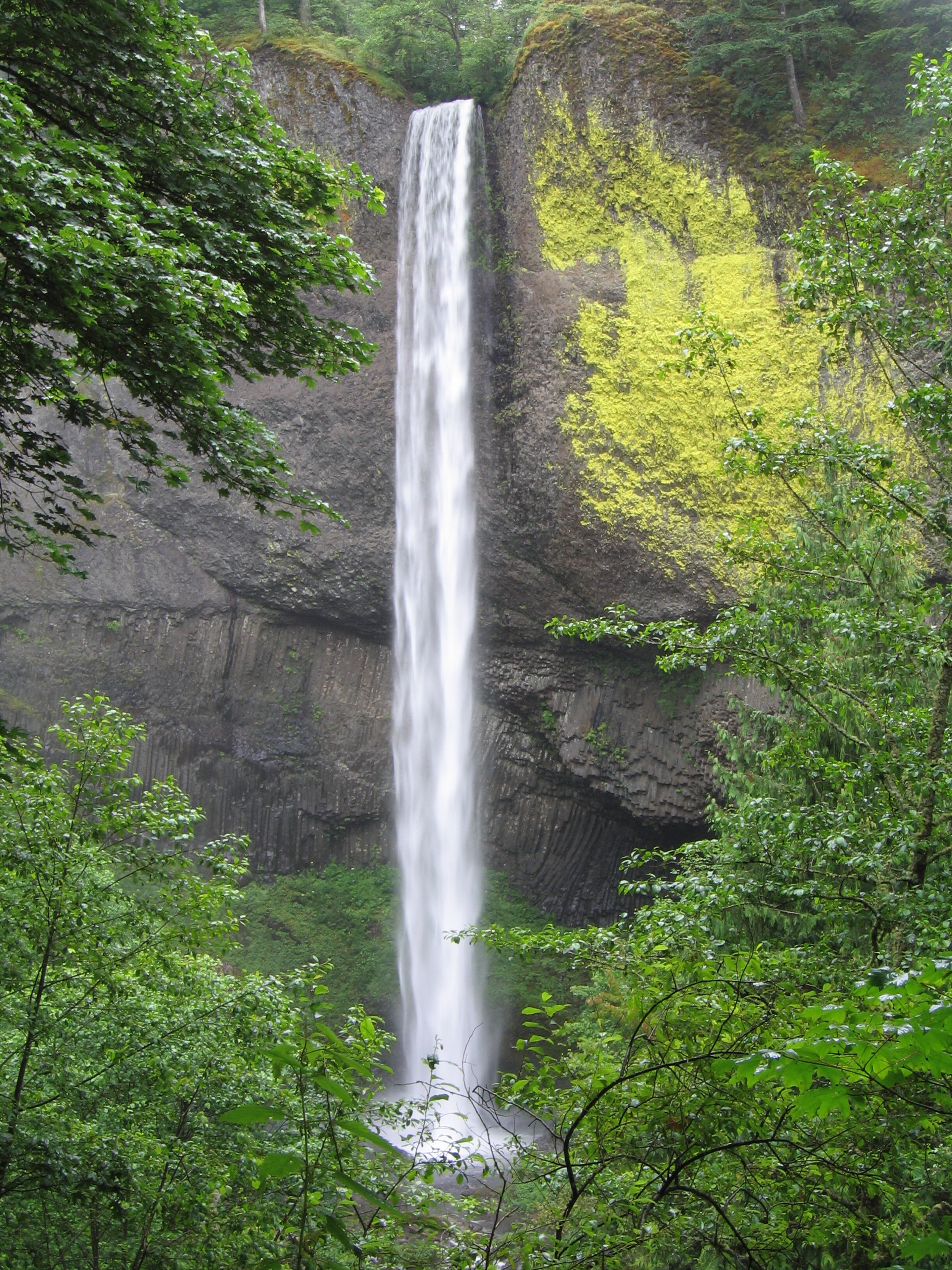
Maltnomah Falls - Columbia River Gorge
Waterfall Corridor Along the Historic Columbia River Highway
There are a lot of amazing things about the Historic Columbia River Highway. First, and the most obvious, is the high number of stunning waterfalls all within less than 9 miles of one another. Included in the list of waterfalls you will find is Multnomah Falls, which at 620ft is the second highest waterfall in the United States. The second thing to note about this famous stretch of highway is its convenient location. It’s less than an hour drive from Portland, which makes this a fantastic day or half-day adventure. Lastly, these the trails allow for flexibility based off of your own abilities and available time. Several waterfalls are simply viewpoints or easy hikes less than 0.5 miles out-and-back. But if you are looking for longer and harder hikes, the trails keep going to lesser visited waterfalls.
We enjoyed a half day of hiking here in August 2022 when we stayed with friends in Vancouver, WA. Trails are the perfect way to catch up when you haven’t seen someone in a long time, as you can talk and walk at the same time while you explore together and enjoy the gorgeous scenery.

Wahkeena Falls - Columbia River Gorge
Directions to the Waterfall Corridor
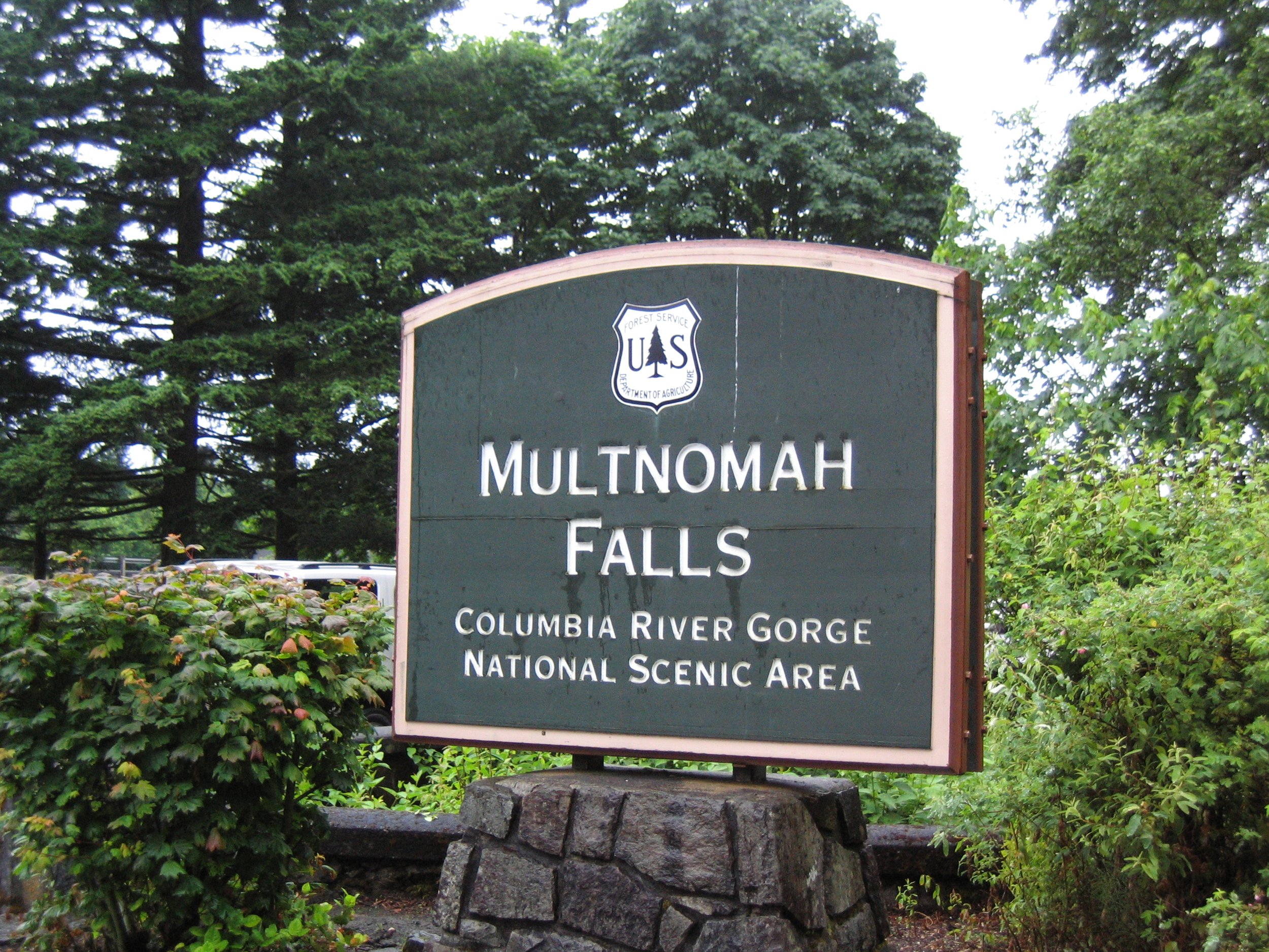
There are three exits of note from I-84, and all are less than an hour outside of Portland, OR. If Multnomah Falls is the only waterfall you are interested in (or you only plan to hike from the Multnomah Falls Trailhead - you can see other waterfalls, you just need to do so by foot), you can take exit 31. This exit will only get you to a parking lot specific to Multnomah Falls, and you won’t be able to access the remainder of the Historic Columbia River Highway unless you return to I-84. The parking lot at exit 31 is bigger though than the Multnomah parking lots available off of the Highway.
If you are looking for more than just one hike, then take either exit 22 or 35. We started at Horsetail Falls at exit 35 and worked our way west. This post follows our journey from east to west.
Planning Your Trip
Check the Recreation.gov website before you travel to find current requirements for parking permits, as the requirements have already changed since we travelled in 2022. We needed a permit to enter the Historic Columbia River Highway, as of right now in Nov 2023, you just need a permit for parking at Multnomah Falls from exit 31. This could change again, so it’s best to check ahead of time. Overall the permit system is helpful as it limits the number of people you encounter on the trails, but it’s important to know the requirements while you are planning for your trip.
As I mentioned above, there are tons of hiking options, both for non-hikers and avid hikers. I’ve included as much information as I’ve been able to find on the trails we didn’t have time to visit, so you can pick what works best for you.

Latourell Falls - Columbia River Gorge
Trails and Viewpoints along the Waterfall Corridor
The below map gives a high-level view of where the trailheads and viewpoints are located. I’ll use the same numbering systems throughout the rest of this post. There are hyperlinks in the captions - if you click on the names, it will bring you to pictures and trail descriptions. There will also be a link back to this map.
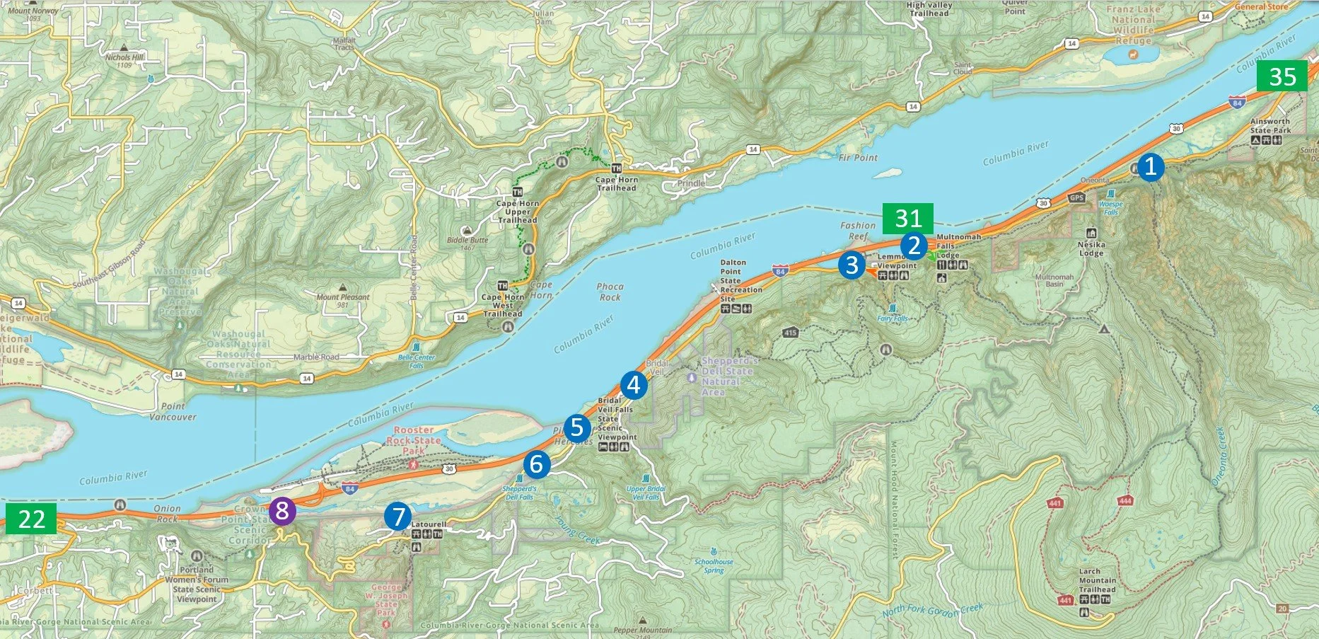
Trailheads: 1 - Horsetail (Horsetail and Ponytail Falls), 2 - Multnomah (Multnomah Falls, Dutchman Falls, Wiesendanger Falls, Ecola Falls, and there is a loop to Wahkeena and Fairy Falls), 3 - Wahkeena (Wahkeena and Fairy Falls), 4 - Angel’s Rest (Lower and Upper Coopey Falls), 5 - Bridal Veil Falls, 6 - Shepperd’s Dell Falls,
Viewpoint: 8 - Crown Point
1 - Horsetail and Ponytail Falls

Horsetail Falls

Map of Hiking Trail from Horsetail Falls to Ponytail Falls
Distance / Elevation Gain - Horsetail Falls is a viewpoint at the parking lot. The trail to Ponytail Falls is a 0.8 mile out-and-back with an elevation gain of 300ft.
Trailhead Location - If you take exit 35 from I-84, the Horsetail Falls trailhead is going to be the first parking lot on your right, about 1.5 miles down the Historic Columbia River Highway from the exit.
Trail Information - To see Horsetail Falls, you simply need to walk across the road. There’s a path to get down right next to the water directly in front of the waterfall. The boys spent some time skipping rocks and exploring along the water’s edge. If you choose to continue to Ponytail Falls, follow trail #438 for 0.4 miles (shown in blue on the map above). We saved our steps for other hikes later in the day and just enjoyed Horsetail Falls while at this trailhead.
You’ll also notice on the map that the there is also the Oneota Falls. This area was unfortunately significantly damaged in the 2017 Eagle Creek Fire. As of 2023, there is still no re-open date.

Skipping Rocks at Horsetail Falls

Exploring around Horsetail Falls - the boys found a skink!
2 - Multnomah Falls

Multnomah Falls

Map of Hiking Loop between Multnomah Falls and Wahkeena Falls
Distance / Elevation Gain - There are lots of hiking options at this trailhead. You can see Multnomah Falls as simply a viewpoint from the parking lot.
Hiking up to the bridge is 0.2 miles (one-way), with a 400ft elevation gain.
Hiking to the top of Multnomah Falls is 1.3 miles (one-way) with an elevation gain of 800ft.
To reach Dutchman Falls, from the top of Multnomah Falls, hike another 0.3 miles (one-way) and add an elevation gain of 255ft.
Wiesendanger Falls is 0.25 miles (one-way) past Dutchman Falls, with an additional 100ft elevation gain.
If you continue to Ecola Falls, add another 0.1 mile (one-way) and another 135ft.
If you plan to hike to Fairy Falls, make this hike a loop with Wahkeena Falls. The entire loop hike includlng both Multnomah and Wahkeena Falls is 5.25 miles with a total gain of 1,640ft. The entire loop is shown in light orange on the map above.
For reference, we chose to hike up and back to the top of Multnomah Falls (trail in green), which took us about 90 minutes. Then we drove to Wahkeena Falls and hiked 0.5 miles (trail in red). (See trail #3 below for Wahkeena Falls).
Trailhead Location - If you are on the Historic Columbia River Highway, the parking lot for Multnomah Falls is 2.5 miles from Horsetail Falls. If you come directly from I-84, you can take exit 31 which takes you to a different parking lot. If you take exit 31, you won’t be able to access the Historic Columbia River Highway or any of the other waterfalls, unless you intend to hike to them.
There is a Visitor Center in front of Multnomah Falls, as well as stands that sell ice cream and coffee. Inside the Multnomah Falls Lodge, there is also a restaurant.

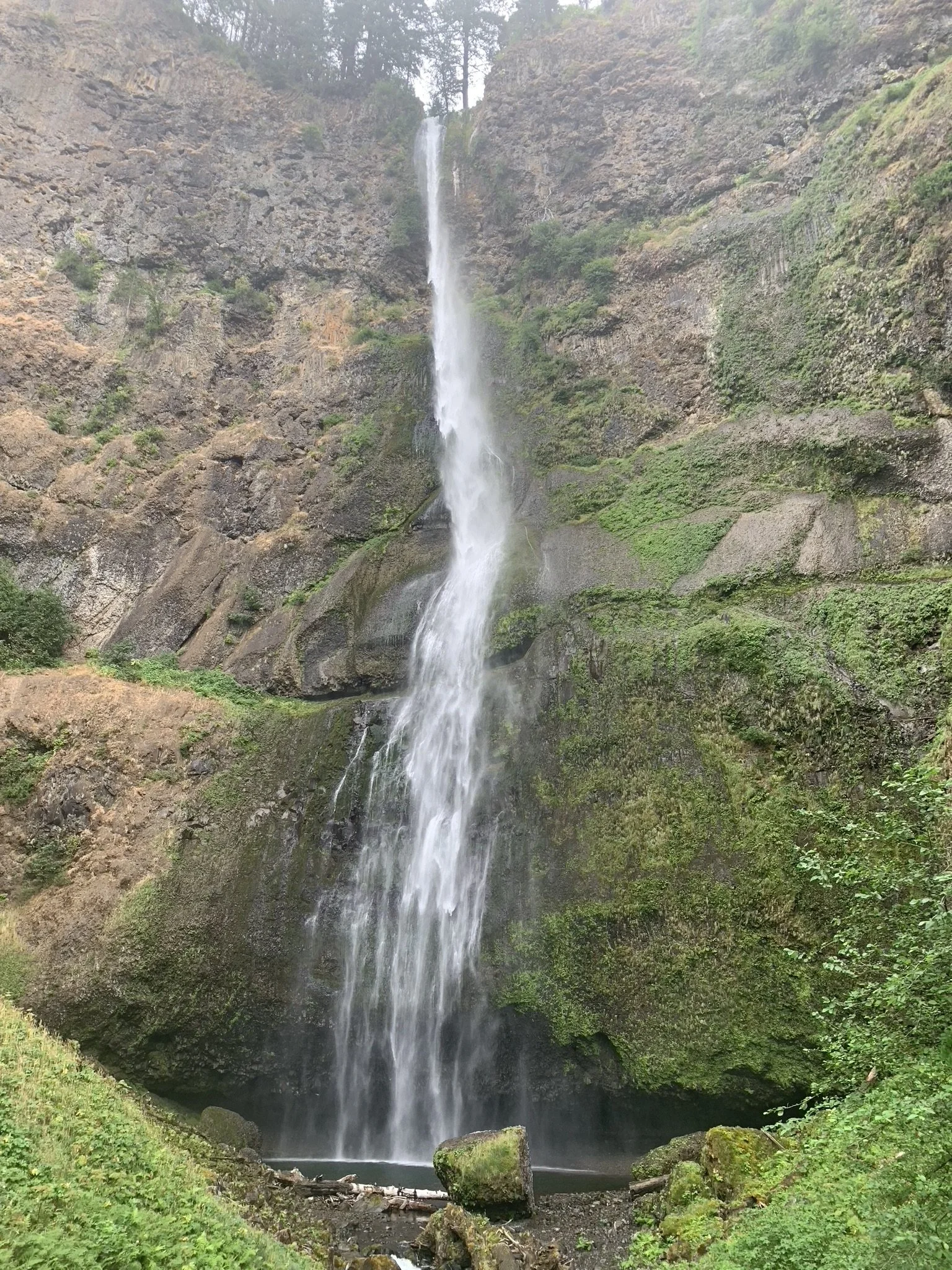
View of Multnomah Falls from below

Multnomah Falls Bridge
There are lots of ways to view Multnomah Falls. Without any hiking at all, you’ll get the best pictures from the bottom, where you can include the bridge in your photos. That being said, to best experience a waterfall, you need to invest at least a little bit of time. So I’d recommend hiking to the bridge. This is a 0.4 mile out-and-back hike with a 400ft elevation gain.
View of Multnomah Falls from the Bridge

View looking down from the Multnomah Falls Bridge
We kept going all the way to the top of Multnomah Falls. The trail has several switchbacks, but includes multiple views of Multnomah Falls on one side of the switchbacks and the Columbia River on the other. We enjoyed the hike, and I would only rate it a moderately difficult hike.
To the top of the falls and back to the parking lot is a 2.6 mile hike with an elevation gain of 800ft.

One of several views of Multnomah Falls from the hiking trail to the top of the falls

Playing along the trail to the top of Multnomah Falls

View of the Columbia River along the trail to the top of Multnomah Falls
You can follow a trail all the way to the very top of Multnomah Falls, and the view looking down isn’t for those afraid of heights. At 620ft, Multnomah Falls is the second tallest waterfall in the United States.

View from the Top of Multnomah Falls
There is a very small drop just prior to the top of Multnomah Falls. You can’t see this from the parking lot below.
A small waterfall just above the top of Multnomah Falls
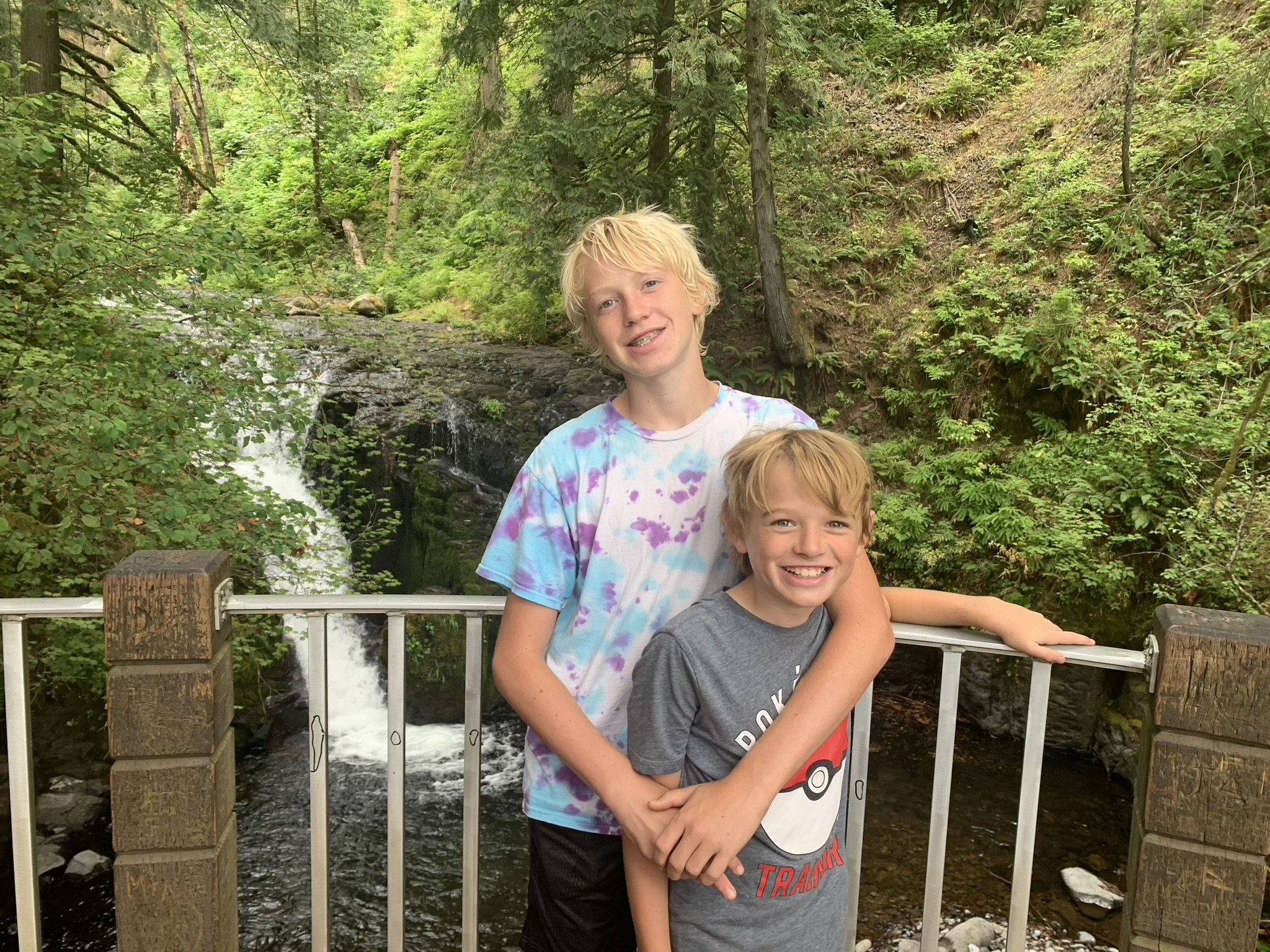
We stopped to play in the Multnomah Creek above the falls for a bit before heading back down to our car.

Playing in the water before hiking back down
Honestly, I didn’t realize there were three more waterfalls so close to us when we stopped at this creek. Had I known, we may have continued to Dutchman Falls, Wiesendanger Falls, and Ecola Falls before heading back. Dutchman Falls is 0.3 miles (one-way) from the top of Multnomah Falls with a climb of 255ft. Dutchman Falls is a three-tiered waterfall dropping a total of 33 feet.
Wiesendanger Falls is 0.25 miles from the top of Dutchman Falls and drops another 50 feet. Ecola Falls is 0.1 miles past Wiesendanger Falls, and drops another 59 feet.
Hiking all the way to Ecola Falls and back to the parking lot is a 3.9 mile hike, with a total elevation gain of almost 1,300ft.
It’s still shorter to head back to your car and hike the out-and-back 0.5 mile walk to Wahkeena Falls (see trail #3 below), however, you will miss Fairy Falls, which is a “fan” waterfall dropping 20 feet.
If you want to see Fairy Falls, then simply hike the entire loop between Multnomah and Wahekkna Falls (which is a total of 5.25 miles with a gain of 1,640ft.
3 - Wahkeena Falls

Wahkeena Falls

The trail to Wahkeena Falls is the red trail (visible under the orange loop trail)
Distance / Elevation Gain - Wahkeena Falls is a 0.5 mile out-and-back hike with an elevation gain of 230ft.
If you choose to hike to Fairy Falls (which is past Wahkeena Falls), the total hike is 2.2 miles out-and-back from the parking lot, with an elevation gain of 500ft.
Trailhead Location - Following the Historic Columbia River Highway, the parking lot for Wahkeena Falls is 0.8 miles west of the Multnomah Falls parking lot.

Trail to Wahkeena Falls
The trail to Wahkeena Falls takes you past the flowing waters of Wahkeena Creek.

Wahkeena Creek
I loved the moss-covered parts of the trail to Wahkeena Falls, which included this retaining wall. Although this is just a short 0.25 mile hike up to Wahkeanna Falls, I really enjoyed this trail.

Moss-covered trail to Wahkeena Falls

Wahkeena Falls
If you follow the trail past Wahkeenha Falls another 0.85 miles, you will find Fairy Falls.
4 - Angel’s Rest (Coopey Falls)

Coopey Falls Map
Distance / Elevation Gain - The trail to Coopey Falls is 1.1 miles out-and-back with an elevation gain of 350ft.
Trailhead Location - The trail to Coopey Falls is accessible from the parking lot of the Franciscan Sisters of the Eucharist Center, which is privately owned, but you can ask for permission to hike along the trail. I’ve learned of this waterfall after we visited in 2022, and therefore have not ventured out here yet.
Coopey Falls drops 150ft in a horsetail waterfall form.
5 - Bridal Veil Falls

Bridal Veil Falls

Map of Bridal Veil Falls - Columbia River Gorge
Distance / Elevation Gain - Bridal Veil Falls is a 0.6 mile out-and-back hike with an elevation gain of 200ft.
Trailhead Location - Following the Historic Columbia River Highway, the parking lot for Bridal Veil Falls is 3 miles west of the Wahkeena Falls parking lot, or just 1.4 miles past the Angel’s Rest trailhead.
Trail Information - Out of all of the waterfalls we have hiked so far along the Columbia River, Bridal Veil is my favorite. First, it’s a pretty dramatic waterfall at 118ft. But it’s far enough beyond Multnomah Falls that this parking lot is plenty big, and you might just might get lucky and have the whole trail to yourself, like we did.

Bridal Veil Creek along the trail
What I remember most about this trail is just the quietness. It was pretty, the boys had plenty of space to run and play, and there was this awesome rock to sit on and gaze out at the waterfall. And this rock is where I dropped my phone into the creek… We were in the middle of a 17-day hiking trip, and I use GAIA to record all of our treks. I thought for a moment I had lost everything, since I use these records to create blog posts of where we’ve been. No worries - my phone turned on just fine after I scrambled down to the water to find it, and GAIA keeps a record of your treks that can be accessed from your account on any device connected to the internet (which is nice to realize if you use that app).

Bridal Veil Falls

Perfect rock for a picture
6 - Shepperd’s Dell Falls

Shepperd’s Dell Falls Map
Distance / Elevation Gain - The trail to Shepperd’s Dell Falls is a short 0.1 miles out-and-back trek with a handful of steps.
Trailhead Location - The trail to Shepperd’s Dell Falls is 1 mile west of Bridal Veil Falls. We missed this waterfall while we were driving down the Historic Columbia River Highway and I’ve learned about it since we visited, so keep your eyes out for a small turnout for parking.
Shepperd’s Dell Falls drops a total of 220ft.
7 - Latourell Falls
Latourell Falls

Latourell Falls Map
Distance / Elevation Gain - The trail to Latourell Falls is 0.2 miles out-and-back with negligble elevation gain. There is a two-mile loop option if you are looking for a longer hike that includes a second waterfall - Upper Latourell Falls.
Trailhead Location - The trailhead to Latourell Falls is 2.2 miles west of Bridal Veil Falls along the Historic Columbia River Highway.

Latourell Falls Trailhead
It’s a quick walk to Latourell Falls, which dramatically drops 224ft right over a rock. The best part of this waterfall s that you can walk behind it. The trail continues for a two mile loop if you haven’t used all of your steps yet with the other waterfall hikes. For us, this was where our hiking ended for the day so we had enough time to go play in the Columbia River. The whole Pacific Northwest is a gorgeous part of the country, and we can’t wait to have an opportunity to go back.

Latourell Falls

Climbing behind Latourell Falls
8 - Crown Point
Before you exit back to I-84, make sure to stop at Crown Point for some pictures of the Columbia River. Crown Point is 5 miles west from Latourell Falls.

Crown Point - Columbia River Gorge

Columbia River view from Crown Point
Other Hiking Options
If you are looking for more hiking suggestions, please check out the below map that has additional posts linked to each pin.