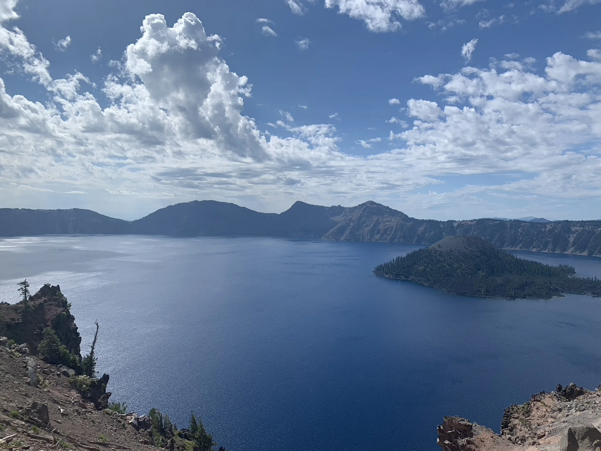
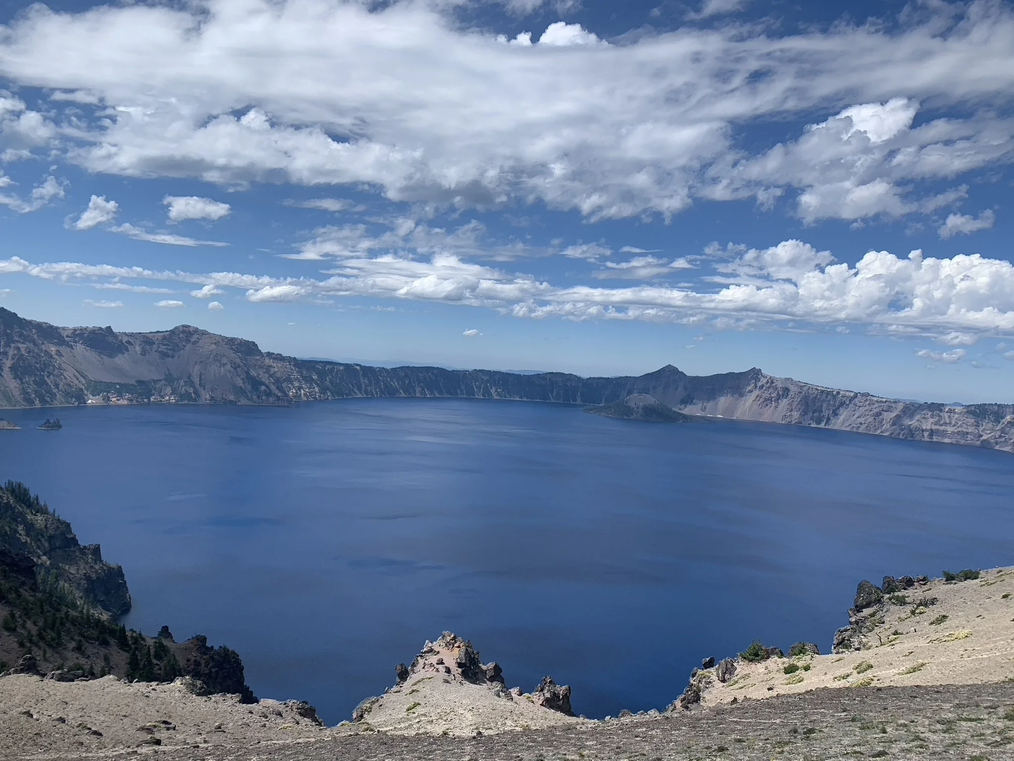
View of Crater Lake from Watchman Overlook
If you enjoy my posts, please consider signing up below to receive email notifications of my latest blogs. I will not share your email.
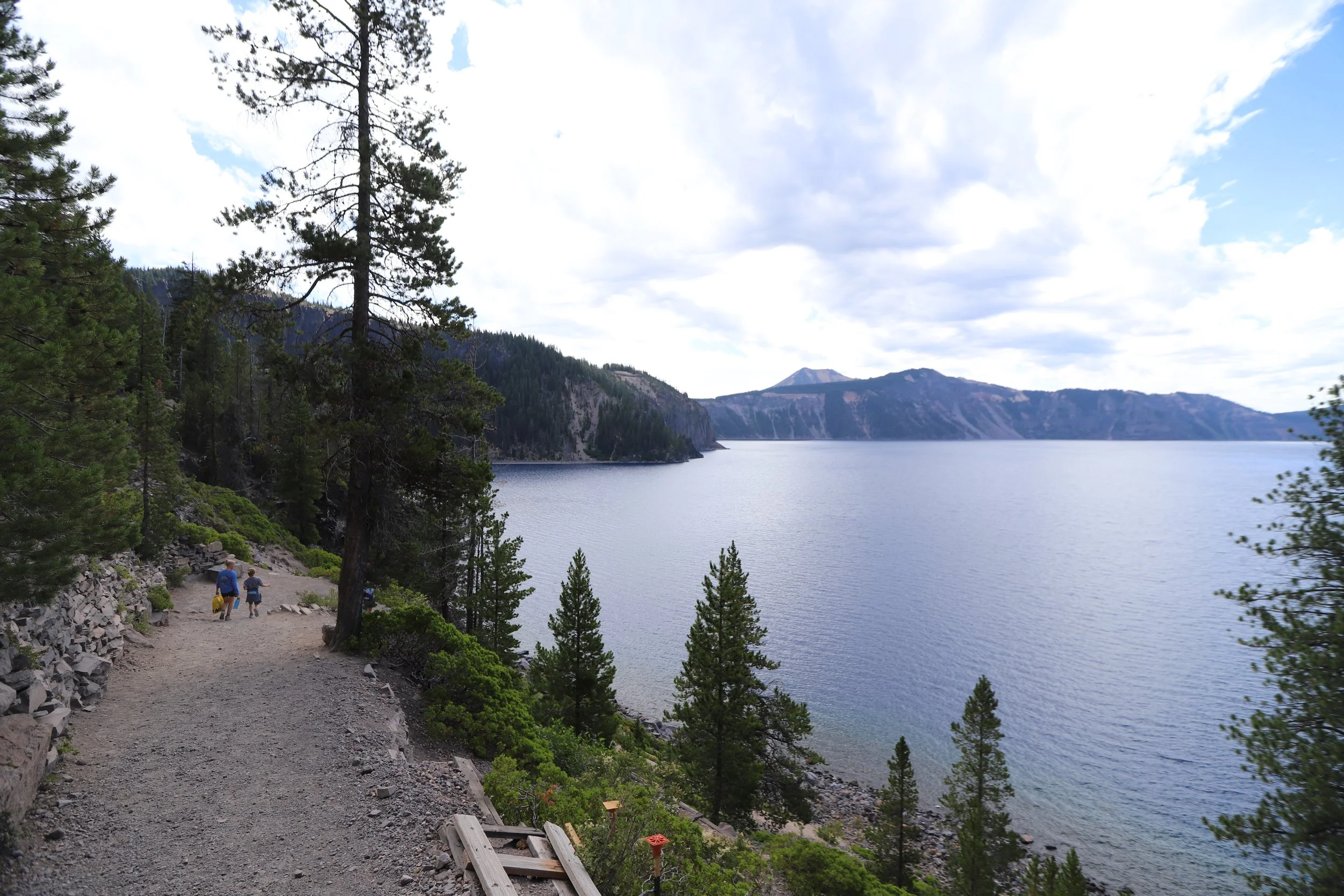
Crater Lake from the Cleetwood Cove Trail
Crater Lake National Park
We found ourselves at Crater Lake National Park in August 2022 as part of a 17-day road trip from Minnesota to the three National Parks in Washington. If you look at a map though, you’ll notice that Crater Lake (which sits in southern Oregon) is not on the way to these destinations, and was actually a 5-6 hour detour. However, as my husband and I were staring at maps while planning the trip (ok, this isn’t quite true… I’m the one that stares at maps and then I make persuasive arguments, which in this case Chris agreed to), we decided we would be close enough (comparatively anyway as we were driving all the way from MN) to add an extra day to our trip - because when else will we have an opportunity to explore Crater Lake?
Crater Lake was a fantastic park to explore, and we were so glad that we made the extra effort to get there. We hiked, went swimming and cliff jumping, continued to learn more about volcanoes (as we’d just traveled from Yellowstone and Craters of the Moon, this truly was a trip formed by hot lava), and enjoyed the beauty of quite a lake.
Crater Lake was formed from Mt. Mazama (a 12,000ft tall volcano) that collapsed on itself during a huge eruption about 7,700 years ago. When you look down into Crater Lake, you are looking into a caldera that has been filled water from snow and rain over thousands of years, which now boasts of being the deepest lake in our country, reaching down 4,000ft. The term caldera means a depression formed by a volcano that has collapsed. Mt. Mazama was a part of the Cascade Range, a chain of volcanos across the northwest part of the United States.
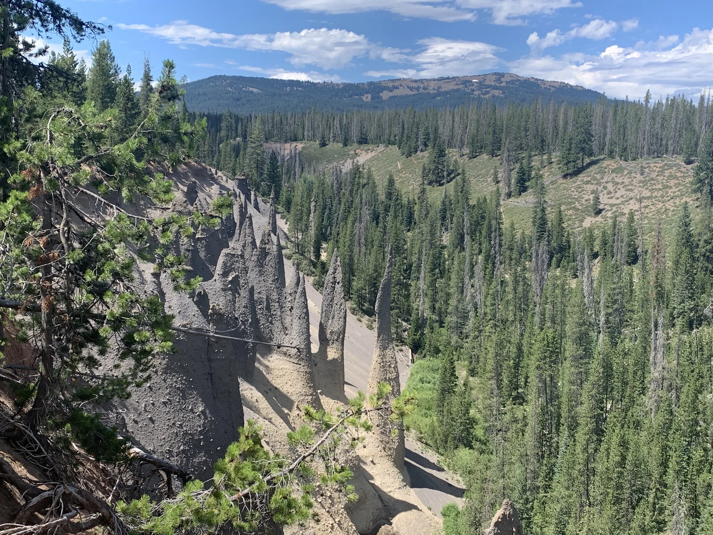
Hardened fumeroles (vents that trapped gasses escaped from) visible along the Pinnacles Trail at Crater Lake
Planning Your Trip
We spent one day at Crater Lake. To help you figure out how much time you might need, we started our journey at Merriam Point at 10:30am, and we left the park from Watchman Overlook at 5:30pm. I felt like we were able to enjoy the whole park. If we had a second day (or if we find ourselves here again), I would take the boat ride to Wizard Island, and hike the trails to Plaikni Falls and Mount Scott. I’ve included information about these trails below, even though we haven’t visited them yet.
There are two entrances to the park in the summer months. If you are traveling in the winter, check out the Crater Lake National Park website so you understand which roads / trails are closed due to snow. The North Entrance is convenient if you are traveling from Bend, or Portland. The West Entrance (which is really southwest) is more convenient if you are coming from Sacramento. If you arriving by one entrance and leaving by another, consider that you will either miss one side of the lake or you may need to add a few minutes to re-drive a portion of the loop again.
The road surrounding Crater Lake goes in both directions. We chose to drive clockwise as most of the parking for viewpoints were on the lakeside, so we could both turn right to get into the parking lot as well as turn right as we left the parking lot (helpful in the event there is lots of traffic).
Bring a swimsuit and towel with you if you hike the Cleetwood Cove Trail. You might as well get in the water, even if it’s crazy cold, just to say you did it. If wading is more your thing, bring sandals that can get wet as the bottom is pretty rocky in the spots you can wade into.
The trails we hiked were pretty wide without too many obstacles. If you don’t have hiking boots, tennis shoes are fine for this park.
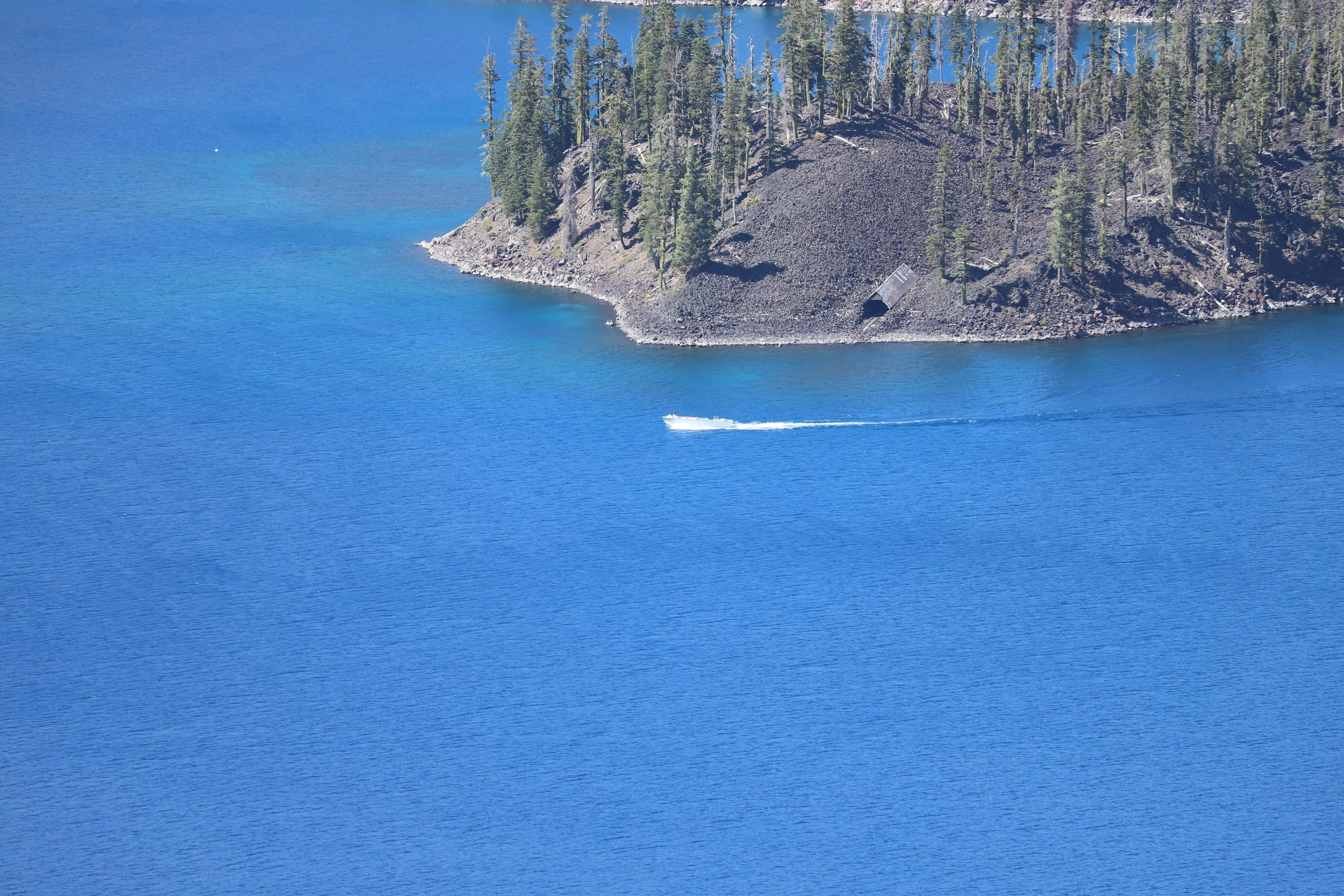
If you want to ride the boat from the end of the Cleetwood Cove Trail to Wizard Island, you can find the link to make reservations on the Crater Lake National Park website. You should look to book these reservations months in advance.
Crater Lake Boat Tour to Wizard Island
Cities and Lodging Options
As typical when visiting a National Park, sometimes the hardest part of planning a trip is simply figuring out where to spend the night. Within the park, there are both camping and cabins at Mazama Campground, and there’s a hotel - Crater Lake Lodge, in Rim Village.
Outside of the park, in small towns you can find lodging at Chiloquin (south) and Diamond Lake (north). We drove in from Bend, OR, which took us about two hours to get to Crater Lake.
Larger nearby cities with airports include Portland, OR (4 hours) and Sacremento, CA (6 hours).
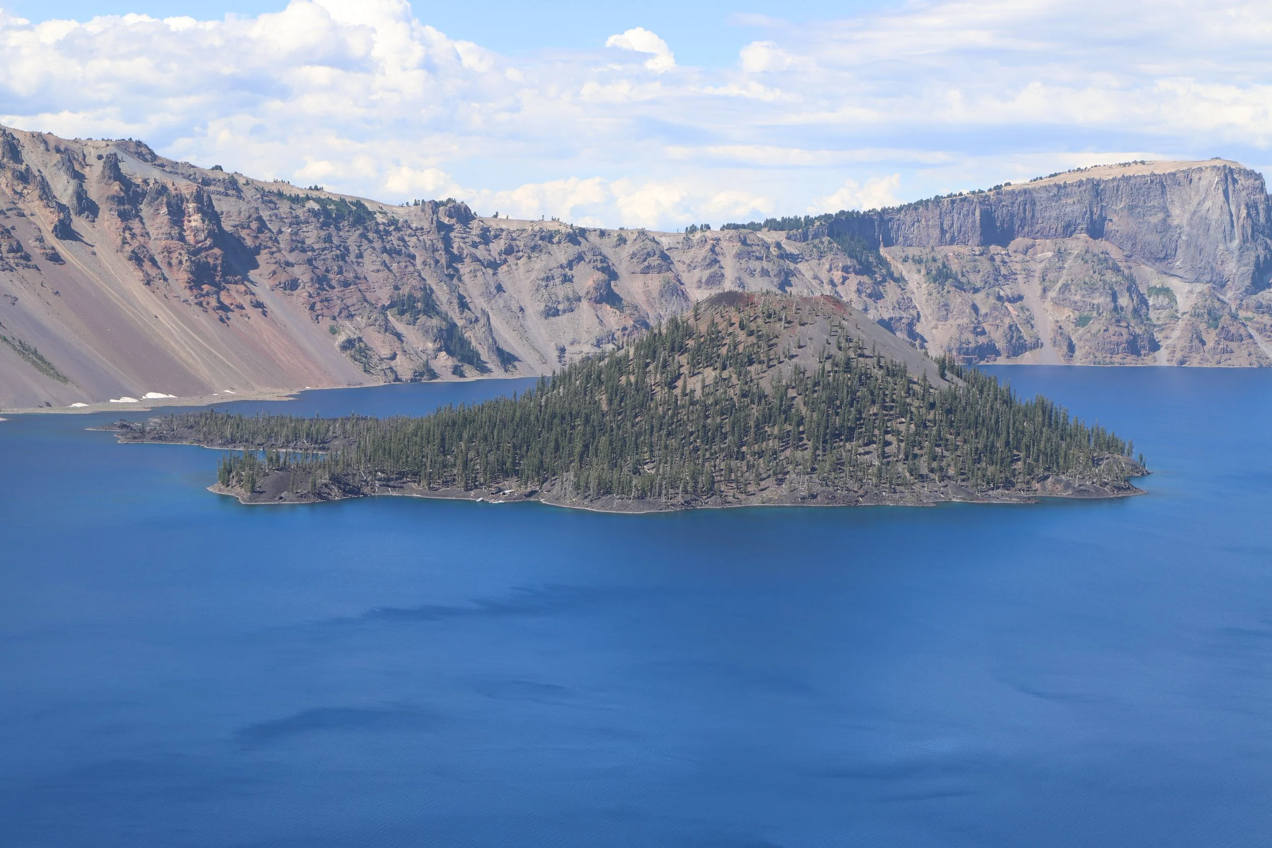
View of Wizard Island from the Rim Trail
Hiking and Viewpoints at Crater Lake
The below map gives a high-level view of where the trailheads, viewpoints, and visitor centers are located. I’ll use the same number system throughout the rest of this post. There are hyperlinks in the captions - if you click on the names, it will bring you to pictures and trail descriptions. There will also be a link back to this map.
Entrances (red): A - North, B - West
Visitor Centers (red): C - Rim Village, D - Steel Visitor Center
Lodging (green): F - Mazama Campground and Cabins, G - Crater Lake Lodge
Viewpoints (purple): 1 - Merriam Point, 3 - Palisade Point, 5 - Cloudcap Overlook, 6 - Pumice Castle, 7 - Phantom Ship Overlook, 10 - Vidae Falls
Trails (blue): 2 - Cleetwood Cove Trail (Boat Launch - E), 4 - Mount Scott, 8 - Pinnacles, 9 - Plaikni Falls, 11 - Rim Trail, 12 - Watchman Overlook
1 - Merriam Point (viewpoint)
View of Crater Lake from Merriam Point
If you enter from the North, your first view of Crater Lake is at Merriam Point. I didn’t think this was the prettiest spot, but since it’s your first opportunity to see Crater Lake of course you need to stop.
2 & E - Cleetwood Cove Trail (and boat tour access)
Bottom of Cleetwood Cove Traiil
Map of the Cleetwood Cove Trail down to Crater Lake to swim or access the boat launch
Distance - 2.2 miles out-and-back
Elevation Gain - 900ft
Trailhead Location - The trailhead starts at a large parking lot that includes pit toilets near the North Entrance. The trail crosses the road and then heads down several switchbacks to Crater Lake.
Trail Information - If you are taking the boat ride to Wizard Island, want to swim in the deepest lake in the United States (and seventh deepest in the world), or simply want to dip your feet in the water, the only place to access the water within Crater Lake is by hiking down and back up the Cleetwood Cove Trail.
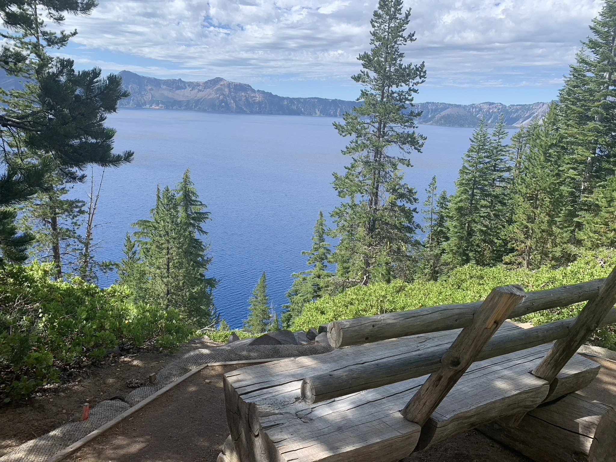
This is a moderate hike. If you give yourself plenty of time you will do fine. There are several switchbacks, but the trail isn’t too steep, and you will find benches to sit on overlooking the lake if you need a break on your way back up.
There are pit toilets down at the bottom of the trail that are big enough you can also use them to change out of wet swimsuits if needed.
We spent about 2.5 hours between hiking along this trail and swimming.
Spots to sit and rest (on your way back up the trail
If you only have time for one hike in Crater Lake, you might as well hike Cleetwood Cove so you can touch the incredibly cold water that forms Crater Lake. My 10 year-old could do it - so can you!
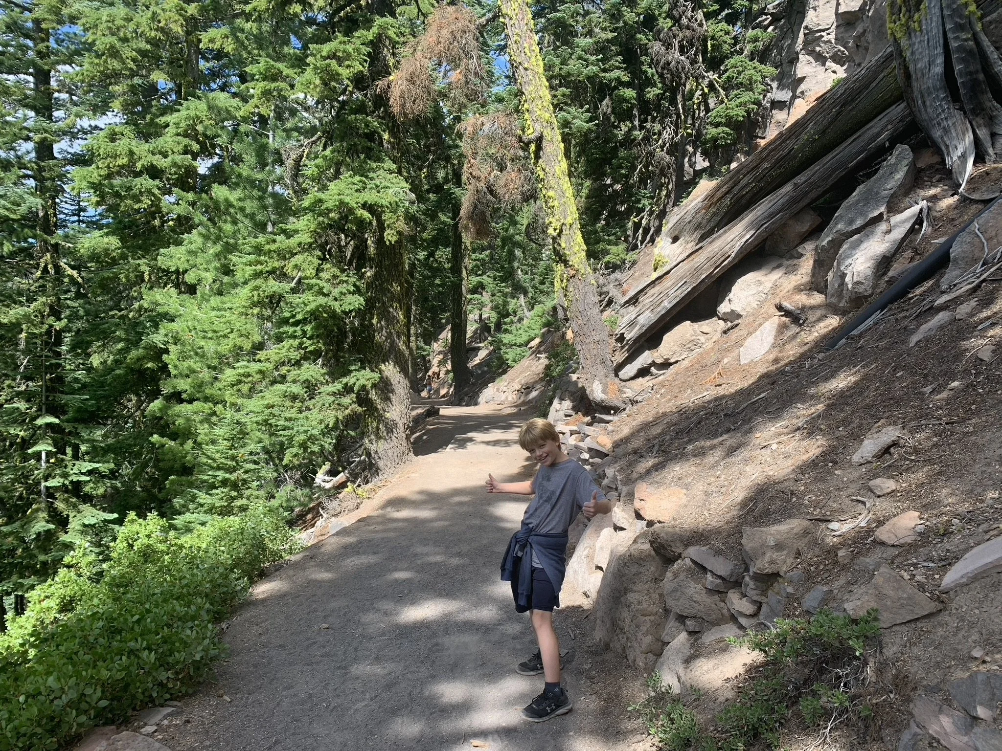
Lots of switchbacks but an easy trail to navigate over
Walking down Cleetwood Cove Trail
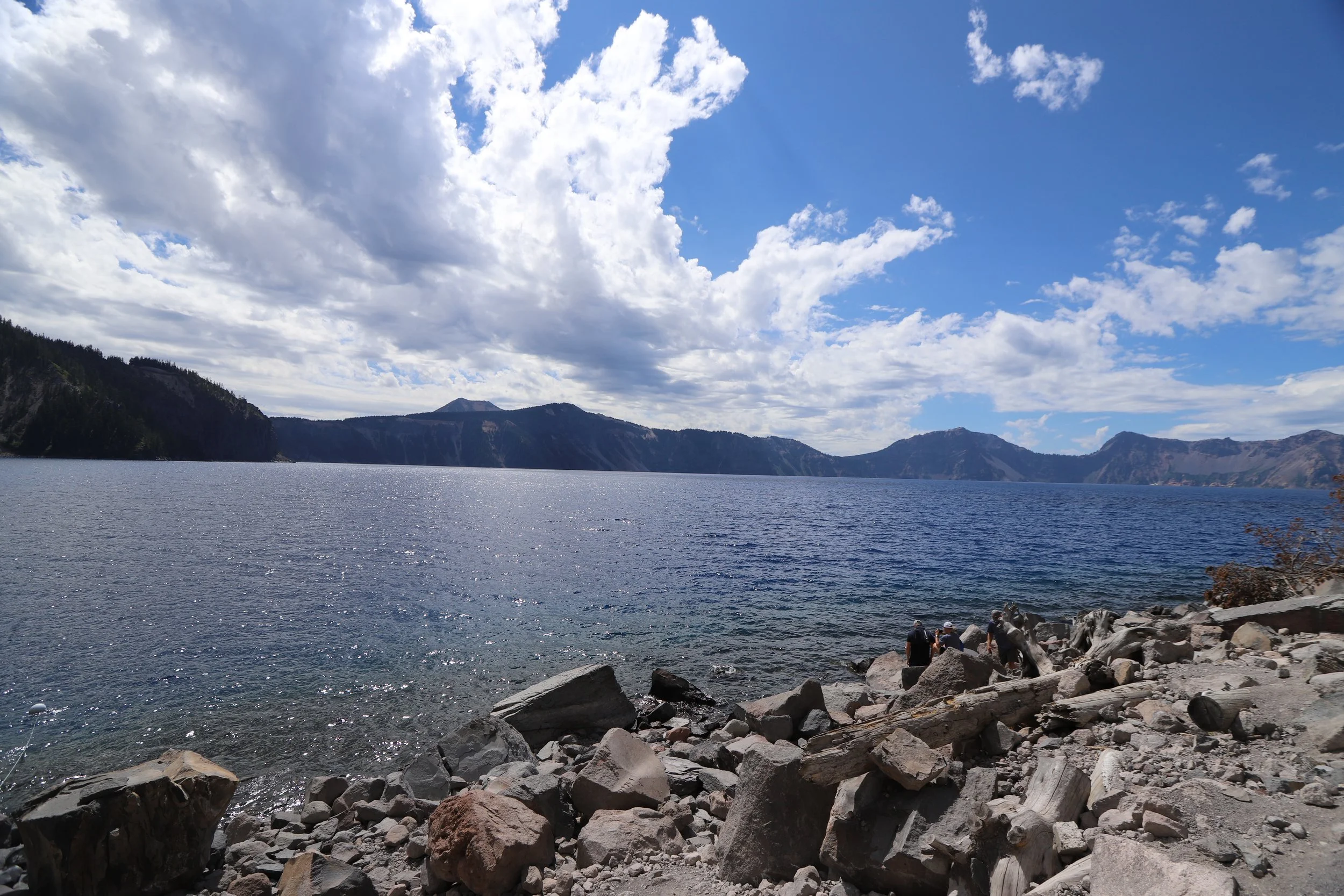
At the bottom of the trail, you won’t find any sandy beaches. It pretty much looks like this if you want a spot to slowly wade into Crater Lake. If that’s what you are looking to do, then bring water sandals with you to protect your feet.
Along the edge of Crater Lake
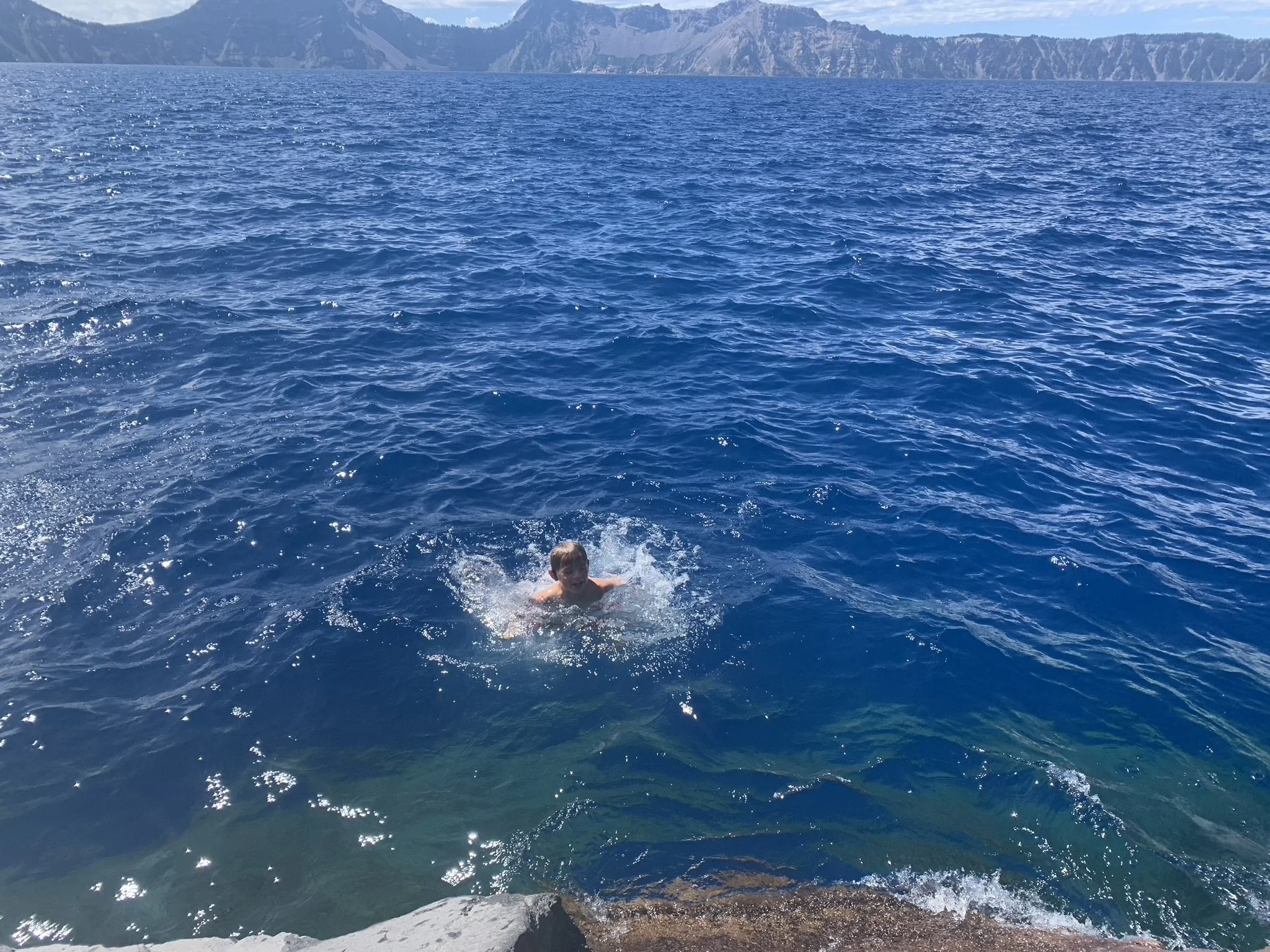
Wading in extremely cold water is challenging to want to do, but no worries, you have two other options. The first is to simply go all in and jump off a cliff. This was one of the highlights of our whole 17-day trip for my 13 year-old.
You walked all the way down here - there’s no way you should stay dry despite how cold it is. Whether or not you choose to jump off the cliff though… that’s a personal choice.
If cliff jumping isn’t your thing, no worries. Keep climbing over the boulders a bit further and you’ll find several rocks that you can either jump from or use to ease yourself into the water. The lake drops off extremely fast in this section. If you get off the rock, you’ll find yourself swimming in Crater Lake.
You drove here, walked all the way down here… Do you really want to go home and say you didn’t get wet?
There are plenty of really small rocks to jump from or use to slide into the lake if cliff jumping isn’t your thing
3 - Palisade Point (viewpoint)
View of Crater Lake from Palisade Point
There are lots of viewpoints along the road that surrounds Crater Lake. Most of these viewpoints we simply got out of the car, took a picture, and then just kept going. Our stops were usually no longer than 10 minutes.
4 - Mount Scott
Distance - 4.3 miles out-and-back
Elevation Gain - 1,300ft
Trailhead Location - Trailhead parking is off of the main road between Cloudcap and Pumice Castle pull outs.
Trail Information - We did not have time to hike up this trail, but if I ever return, this is on my short list of other things to do. Mount Scott is the highest point within Crater Lake National Park. Although the views of Crater Lake are from further away, the trail also includes views of the surrounding mountains.
5 - Cloudcap Overlook (viewpoint)
View of Crater Lake from Cloudcap Overlook
Another quick place to take a picture.
6 - Pumice Castle (viewpoint)
Pumice Castle refers to the orange rock shapes on mid-right section of this picture
The pull out for Pumice Castle isn’t as well marked as the other viewpoints. If you are looking for it, the pull out is about 1.1 miles past Cloudcap (on the east side of Crater Lake). This stop isn’t for a view of Crater Lake, but instead it’s to see the above bring orange pumice rocks - probably the brightest rock colors exposed by erosion within the caldera so far.
7 - Phantom Ship Overlook (viewpoint)
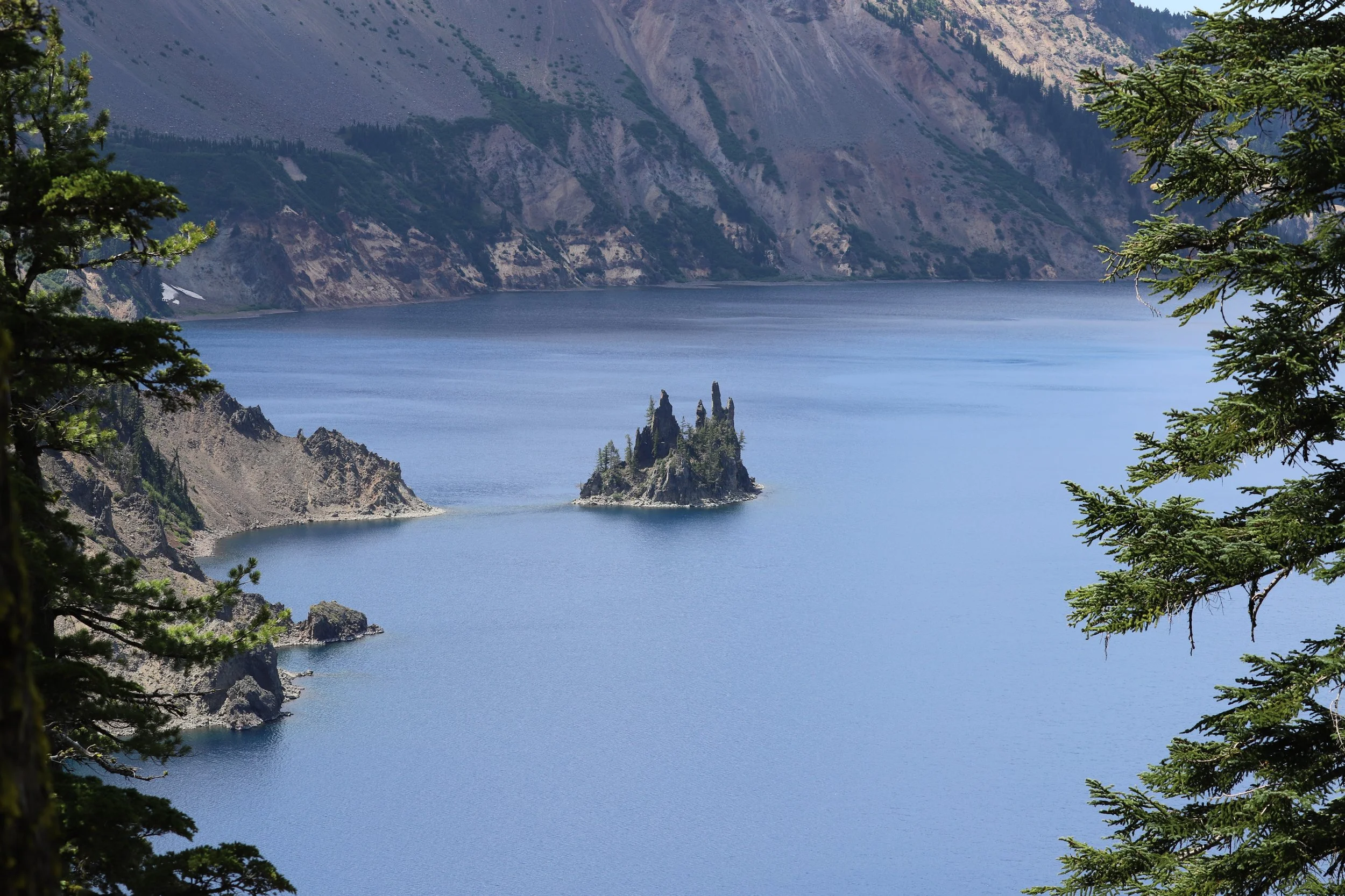
Phantom Ship refers to an island within Crater Lake
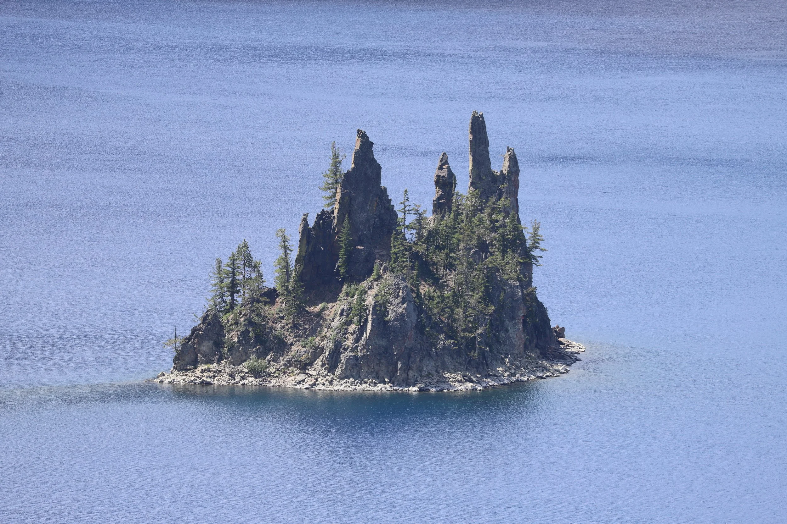
Phantom Ship Overlook was my favorite viewpoint at Crater Lake. This island was so well named. The longer I stared at it, the more I could imagine it as an actual ghost ship, sailing across the lake. According to the National Park information, this island is the oldest rock within the caldera at 400,000 years old.
Close up of Phantom Ship
8 - Pinnacles
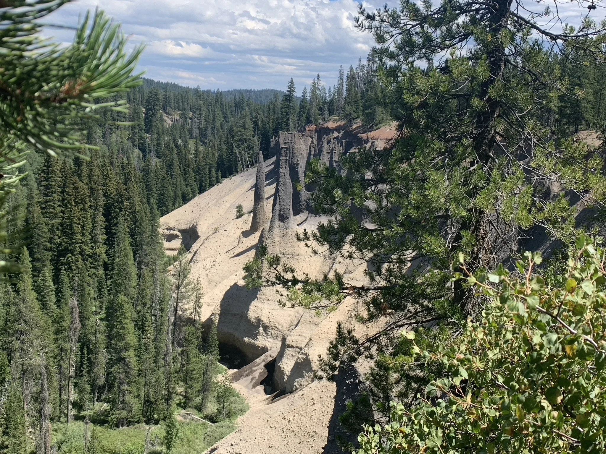
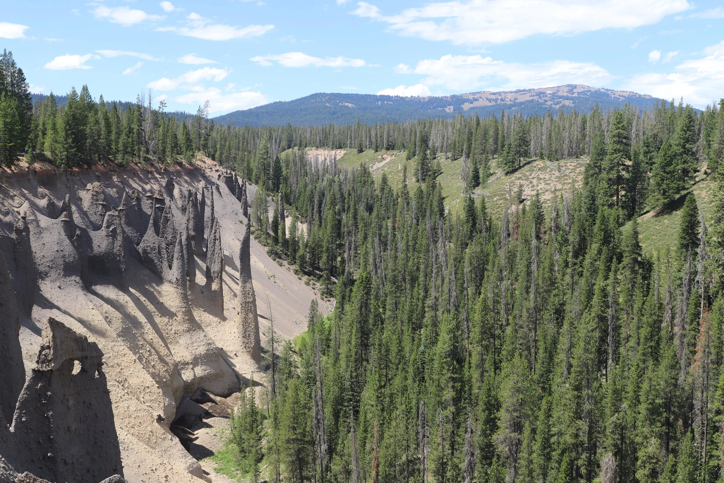
Pinnacles (old fumerole vents that let out trapped steam)
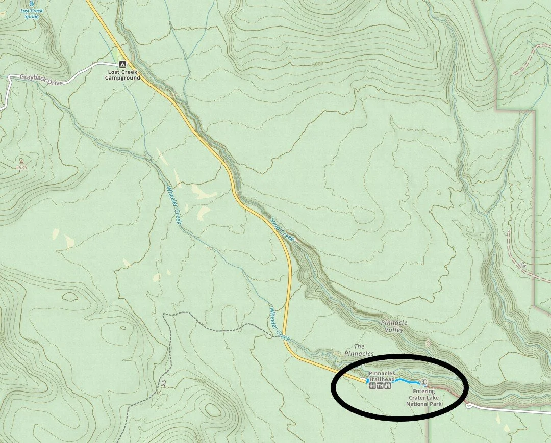
Trailhead location and map of Pinnacles Trail
Distance - 1 mile out-and-back
Elevation Gain - 80ft
Trailhead Location - This trailhead is a bit off the main road by about 10 minutes. You will drive towards Lost Creek Campground, and then just keep going. The road ends in a parking lot for the Pinnacles trailhead.
Trail Information - This is a pretty easy trail to walk along, and the pinnacles are so weird (and they are everywhere) that it’s worth the short drive. This hike took us 30 minutes.
This must be what Yellowstone looks like under the surface, if it were to all erode in front of us
You’re planning a trip to Crater Lake, and most likely you’re only spending one day and trying to some how cram everything you want to do in an extremely short period of time (I get it - I do the same thing and that’s why I write these posts - to help you do it all). Just to get back and forth from Pinnacles is a 20 minute investment in driving, and you are driving away from Crater Lake which feels weird since you came to this park to see Crater Lake, right? Pinnacles is very likely a trail that is going to get cut from your itinerary - as must be true for most people as there weren’t any other cars at the trailhead. That said, although there are no views of Crater Lake along this trail, Pinnacles probably had the biggest impact on me of anywhere we visited within the park.
We were in Yellowstone National Park just two days prior, where we saw the geysers and mud pots and fumeroles letting out water, steam, and gas (all of it smelling “delicious"). The day in-between we visited Craters of the Moon and learned about volcanos and different types of lava and realized that the hot spot that is currently under Yellowstone used to be under Craters of the Moon. And then here we find ourselves at Crater Lake, staring at these incredibly strange spires wondering what they could possibly be, and it turns out these are tunnels that used to be geysers spewing steam up into the air. This is literally what Yellowstone likely looks like under the surface if you could see how the tunnels reach further down into Earth’s surface. Strange and humbling to stare at the underside of the Earth’s belly (kind of anyway) to really see the powerful forces at play that built our planet.
More pinnacles - they were everywhere along this trail.
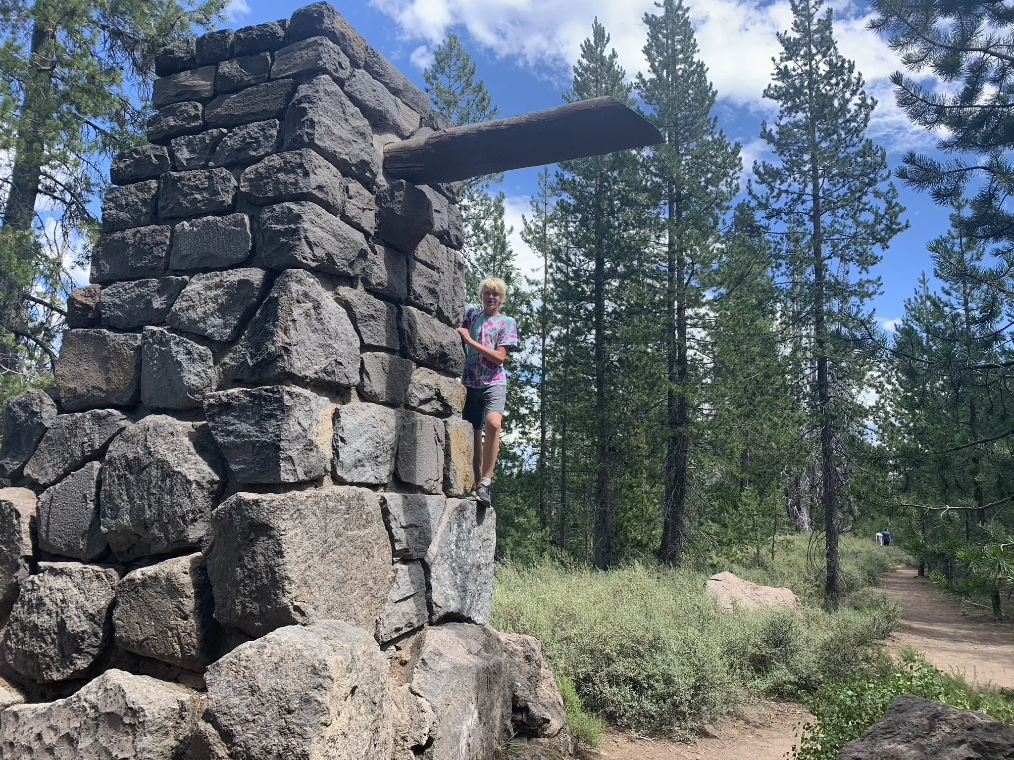
The trail keeps going, but the below marker indicates the boundary of Crater Lake National Park, so this is where we decided to turn around.
Boundary of Crater Lake National Park along the Pinnacle Trail
9 - Plaikni Falls
Distance - 2.0 miles out-and-back
Elevation Gain - 130ft
Trailhead Location - The trailhead to Plaikni Falls is just off Pinnacles Road. You could stop on your back from Pinnacles Trail.
Trail Information - Plaikni Falls is the other trail on this blogpost that we did not have a chance to visit, but if we return I will update this with pictures. The trail is considered easy and wheelchair accessible. The trail wanders through the forest with wildflowers and a 20ft waterfall at the end.
10 - Vidae Falls (viewpoint with short walk)
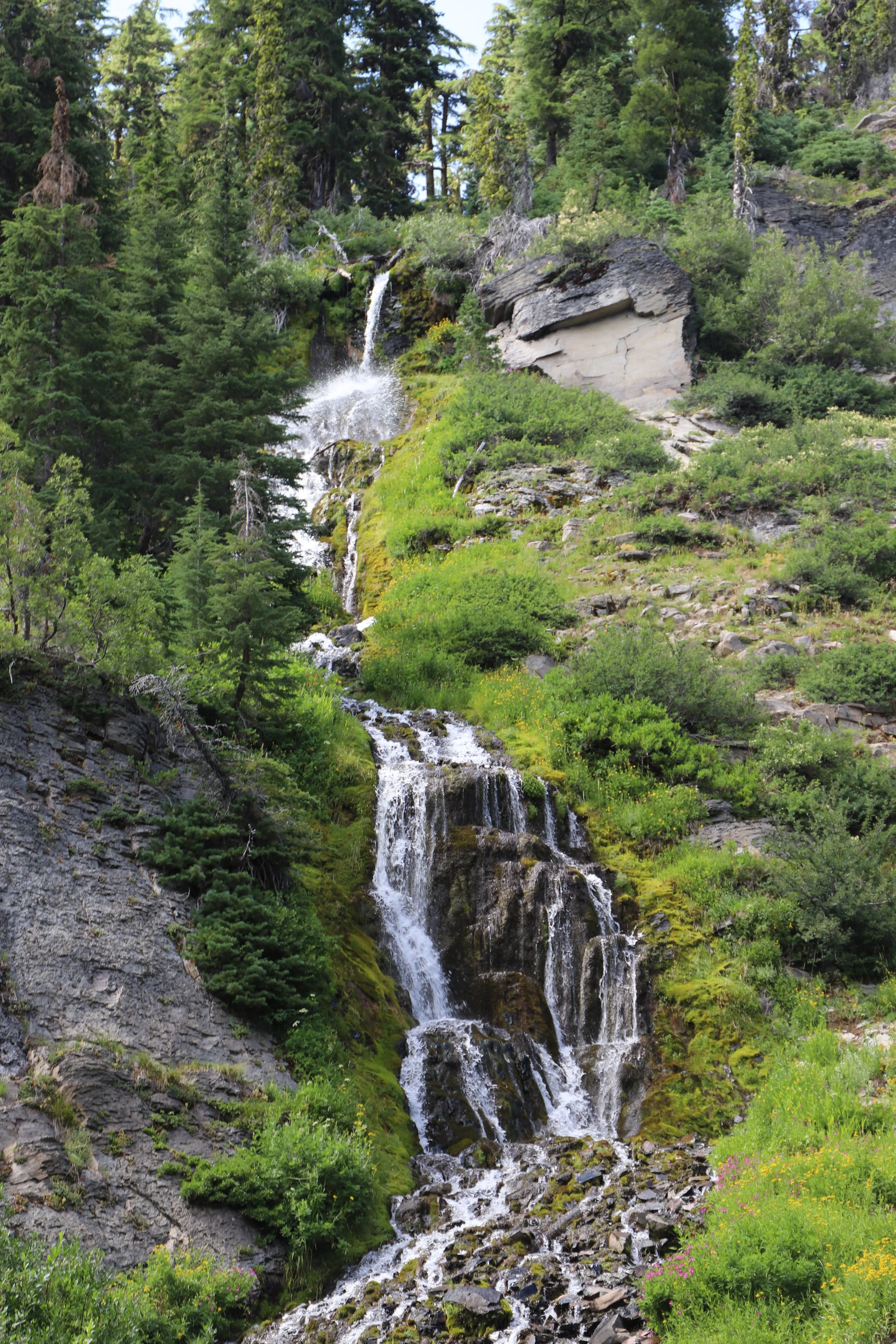
Vidae Falls at Crater Lake
Vidae Falls is a very accessible 100ft waterfall just steps from the road. To see Vidae Falls, there will be a pull out along the road on the south side of Crater Lake. You just need to cross the road and walk a short ways for the best view. This was one of the busier pull outs that we encountered at the park.
11 - Rim Trail
View of Crater Lake and Wizard Island from the Rim Trail
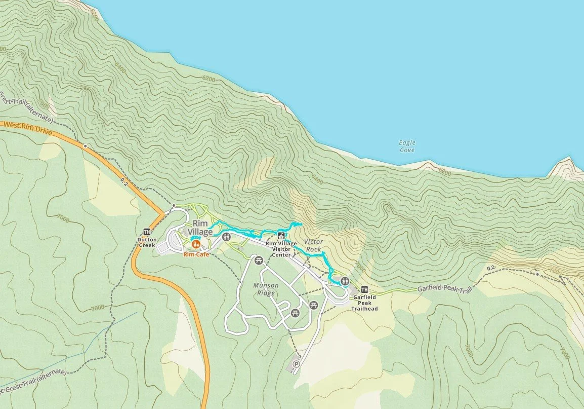
Map of Rim Village and the Rim Trail at Crater Lake
Distance - 1 mile out-and-back
Elevation Gain - N/A
Trailhead Location - There are multiple parking lots within the Rim Village. There is a Visitor Center,
Gift Store, Crater Lake Lodge, and places to eat all within the village. You will find the Rim Trail at the Visitor Center.
Trail Information - We spent a little more than an hour here, between the Gift Store, Visitor Center, and Rim Trail (which includes multiple interpretive signs). If you are looking for information about Mt. Mazama, the formation of Crater Lake and its geological history, the Visitor Center and Rim Trail are your best places to stop. (Note that the Steel Visitor Center wasn’t open when we visited in Aug 2022, so I’m not sure what different information is available at that location).
View of Crater Lake from the Rim Trail
12 - Watchman Overlook
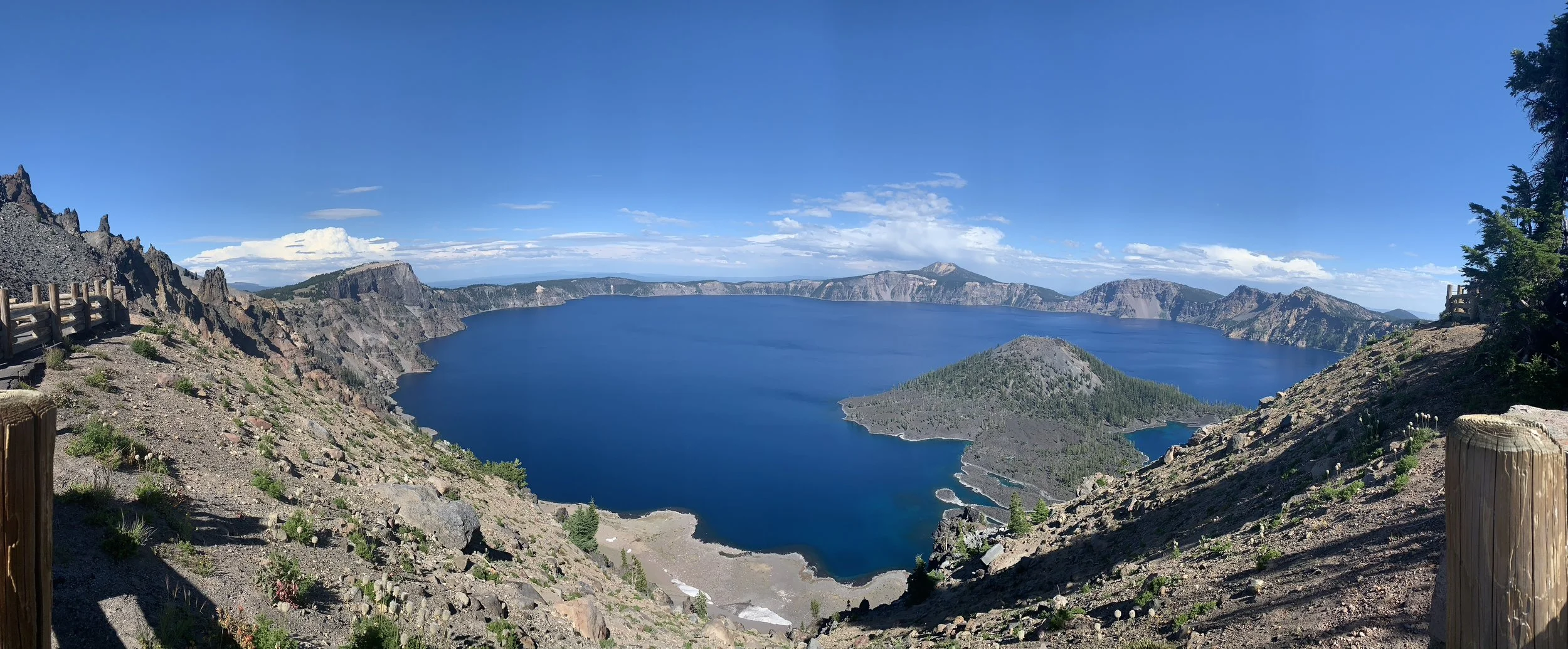
View of Crater Lake from Watchman Overlook - Best view of Crater Lake
Map of Watchman Overlook Trail
Distance - 1.8 miles out-and-back
Elevation Gain - 400ft
Trailhead Location - The trailhead is at a parking lot on the west side of the park, just across from Wizard Island. The view of Crater Lake is pretty good from just the parking lot, but will be phenomenal from up above at the lookout tower.
Trail Information - I thought the view from the lookout tower on top of the Watchman Overlook was the best in the entire park. There are some steep switchbacks on the way up, which may be tiring if it’s at the end of your day (as it was for us), but it will be worth every step of effort. It took us about 70 minutes to hike up and back down from the tower.
View of Crater Lake from the Watchman Overlook parking lot
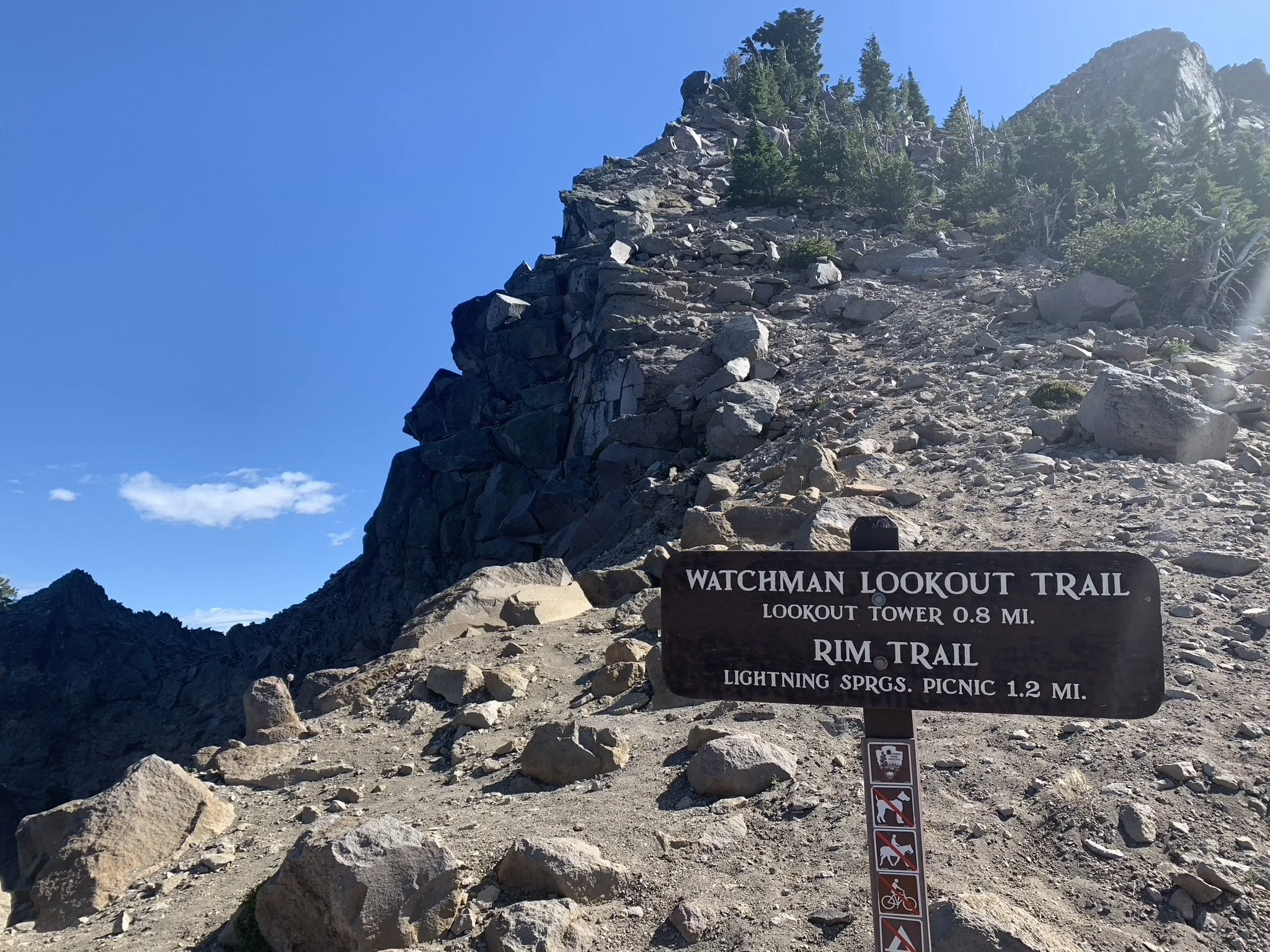
Here’s the trailhead sign, and yep, you are going to walk up to the top. Just keep walking, just keep walking. It’s not actually that bad, and I would say this is really just a moderately difficult hike.
Trailhead to the fire lookout tower
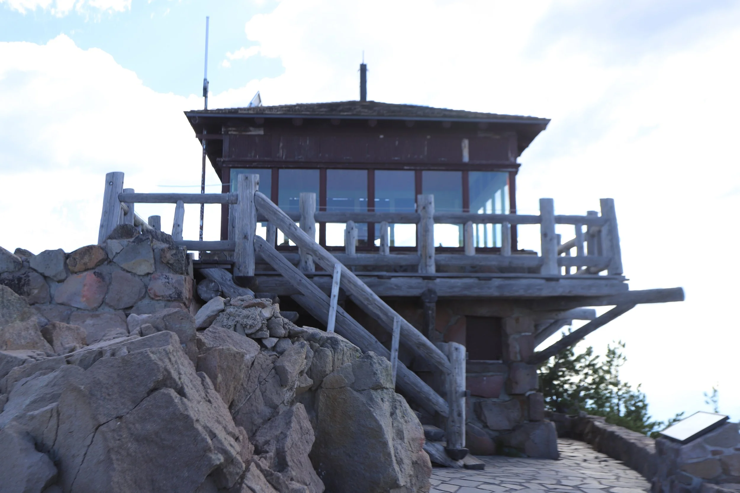
Most of the trail is on the backside of the hill, so you won’t be looking at the lake. The view of the surrounding mountains is nice as well. I don’t often take pictures while hiking up, and I must have simply forgot on the way down to snap a couple due to this being the very end of our day. But this really is a pretty hike. Below is what the lookout tower looks like at the top.
Watchman Overlook Fire Tower
Just below the tower, there is a stone patio with more space and a sitting wall for one last family picture.
View from Watchman Overlook Tower
Other Hiking Ideas
If you are looking for more hiking suggestions, please check out my below map which has additional posts linked to each pin.


