
Mount Rushmore National Memorial
If you enjoy my blog, please consider signing up below for email notifications of my latest posts. I will not share your email.

Logistics for Exploring Mount Rushmore
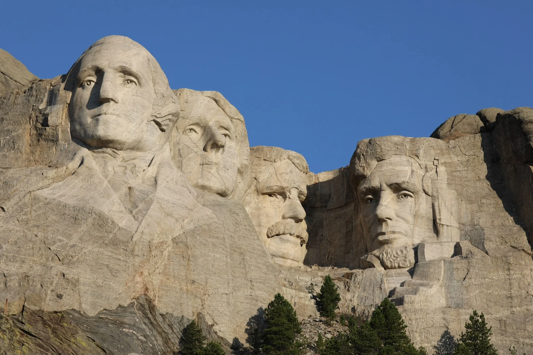
Mount Rushmore is likely South Dakota’s most iconic landmark. This monument, located within the Black Hills, features 60 foot faces of George Washington, Thomas Jefferson, Theodore Roosevelt, and Abraham Lincoln carved into the mountain historically known as Six Grandfathers.
There are a small number of places where the monument is visible outside of the park, as I’ll note below, but the best way to see Mount Rushmore is from within the park itself. Mount Rushmore is a National Memorial. Technically, it’s free to visit, but for anyone arriving by car, which I would assume would be most people, there is a small fee to park.
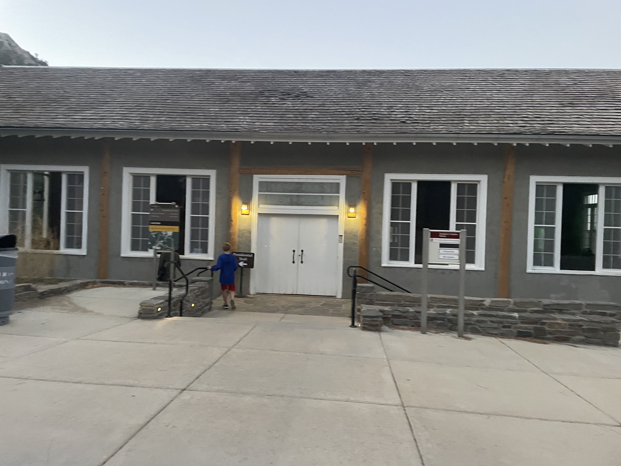
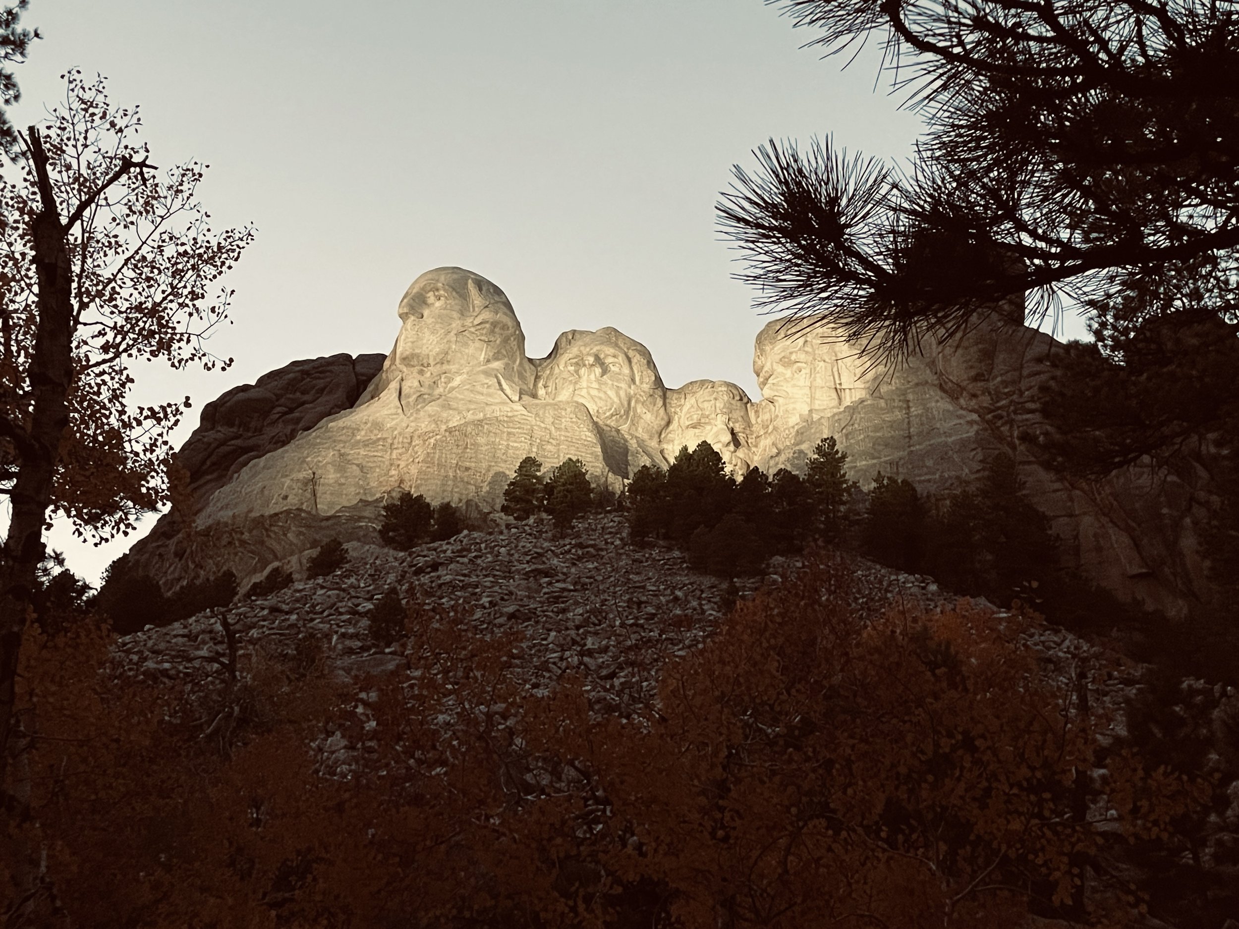
The park is open all year round, and of course, the summer months are the busiest. My favorite time of day to visit is just before dusk, when the monument is still lit up in natural light. Due to its proximity, Mount Rushmore pairs well with a visit to Custer State Park (drive the Wildlife Loop Road, hike at Sylvan Lake, and enjoy views from Needles Highway on the way to Mount Rushmore). After walking down the Avenue of Flags, take a few pictures in the remaining daylight. Walk along the short Presidential Trail. Then head into the Lincoln Borglum Visitor Center and catch the video. Enjoy the Ranger-led lighting ceremony at dusk, and then take a few pictures of the monument lit up in the dark.
A few things to note with my recommendations, which are based on visiting in the summer months. Needles Highway is closed due to snow in the winter, and the lighting ceremony only occurs in the summer. The monument is lit up at night in non-summer months, but there is not an official ceremony. I’ve been to Mount Rushmore several times, therefore the pictures of the monument are from multiple times of day and in multiple seasons. The brighter pictures of Mount Rushmore are taken during the morning hours. The monument won’t look quite the same closer to dusk. Lastly, if you’ve seen National Treasure 2, Mount Rushmore is further away from Sylvan Lake than Disney portrays. It takes a little more than a half hour to drive between locations.
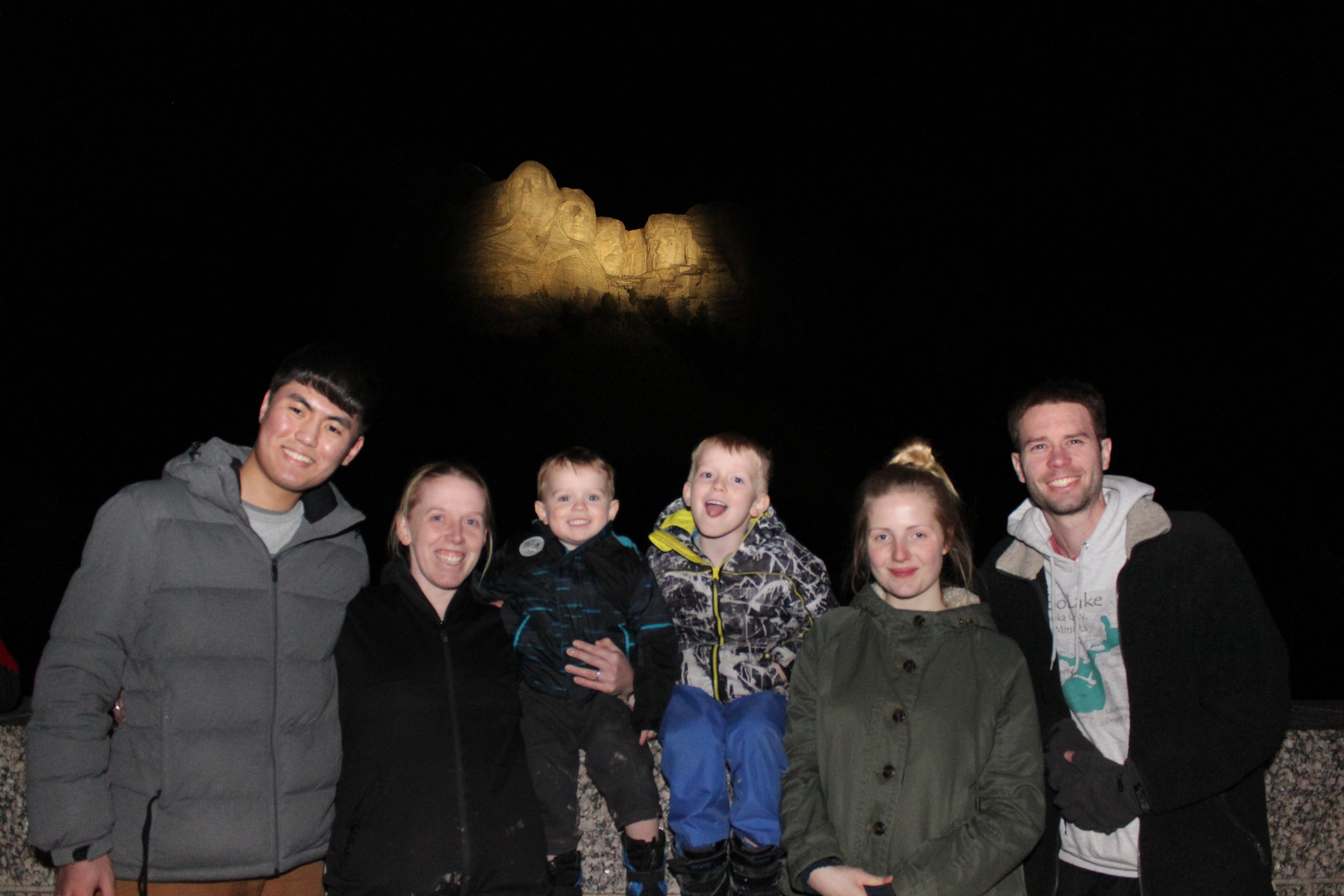
Spring Break 2015 - Still our craziest road trip - Minnesota to the Grand Canyon. We stopped at Mount Rushmore along the way to show it to our two exchange students.
Locations of Mount Rushmore Viewpoints
There are hyperlinks below in the captions. Click on the name, and the screen will move to that section of the post, which will include additional information and pictures. There will be a link at the end of each section back to this map.

Mount Rushmore Viewpoints - Historic Viewing Terrace (red star), George Washington profile (orange star), Iron Mountain Road Tunnels (brown stars), Backside of Mount Rushmore from Elk Peak (purple star)
Historic Viewing Terrace
There are a handful of different places to see Mount Rushmore from, but the main location is simply from the Memorial itself. After parking the car, walk past the Information Center. Mount Rushmore will be directly in front, and there is a nice terrace to take pictures from past the Avenue of Flags. For anyone wanting to sit for a bit, there is also an amphitheater overlooking the monument.
Mount Rushmore viewed from the Grand View Terrace
The Presidential Trail
Just on the side of the terrace, there is access to the Presidential Trail loop. This is an easy, short 0.6 mile walk, and the monument is visible at several angles. There are 442 steps along the way, however, so the trail is not wheelchair or stroller friendly.
This trail is as close as the public can get to the monument. Although there is a 70ft tunnel behind the faces, known as the Hall of Records, it is not accessible to the public, and there are no trails leading up to it.

View of George Washington from the Presidential Trail
SD-244 George Washington Profile
Outside of the main park, there are three other places to view Mount Rushmore from. The first is just 0.7 miles down SD-244. After leaving the park, turn right. There is a small pullout area for pictures. This view will be just the profile of George Washington. This view is also visible directly from the road, so stopping is not required to see it.
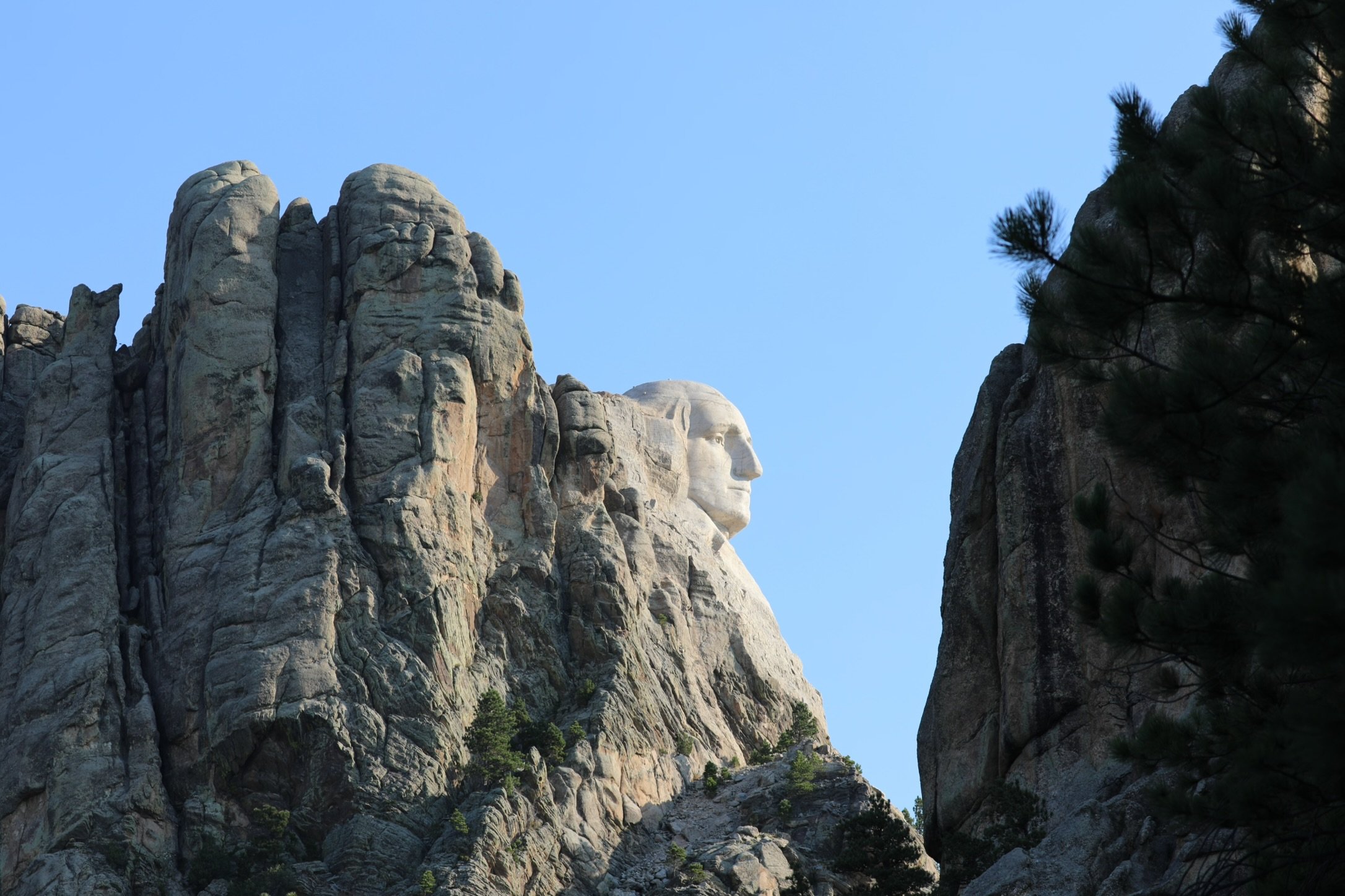
George Washington’s profile from SD-244.
Views from Iron Mountain Road Tunnels (US-16A)
The other two places to view Mount Rushmore from are along the Iron Mountain Road (US-16A), which is one of the main roads into the park when driving from Custer State Park. These views occur at the Scovel Johnson and Doane Robinson tunnels. The views of Mount Rushmore are cool as the monument is framed by the tunnel walls. There are no places to stop the car though, and there is likely oncoming traffic, making these difficult places to take pictures from.
Backside of Mount Rushmore (Six Grandfathers Mountain)
One more unique view of Mount Rushmore is from Black Elk Peak. The monument itself isn’t visible, but Six Grandfathers, the mountain that Mount Rushmore is carved into, can be seen. It’s the larger mountain in the left middle of the picture. Most people won’t know that Mount Rushmore is on the other side when they are viewing the landscape from Black Elk Peak.
Here is a link to Black Elk Peak trail information.

Six Grandfathers can be easily viewed from Black Elk Peak - Mount Rushmore is carved on the other side of this mountain.
Return to Mount Rushmore Viewing Map
Things to Do at Mount Rushmore
I would recommend about 2-3 hours for a thorough visit of Mount Rushmore. This should include enough time to watch the video at the Visitor Center, hike the Presidential Trail, and enjoy the evening lighting ceremony (if visiting in the summer months).
There are hyperlinks below in the captions. Click on the name, and the screen will move to that section of the post, which will include additional information and pictures. There will be a link at the end of each section back to this map.
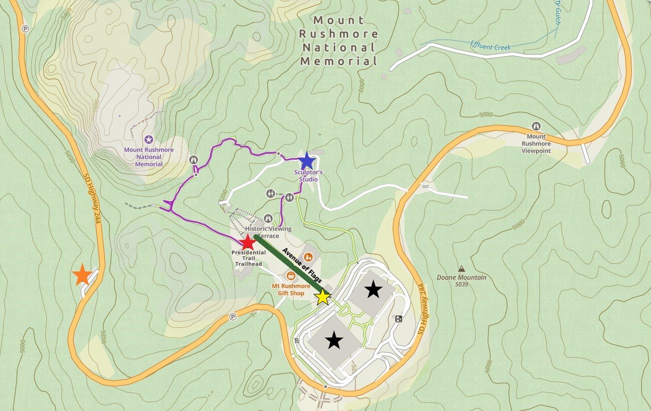
Parking (black stars), Information Center (yellow star), Avenue of Flags (green), Visitor Center (red star), Presidential Trail (purple), Sculptor’s Studio (blue star), George Washington Profile (orange star)
Information Center
There is an Information Center just past the parking lot. There are Park Rangers to answer questions and handout maps and Junior Ranger Books to anyone interested. There is also an audio tour available. The gift store is a short walk past the Information Center, and there is a café that serves food and ice cream.

Mount Rushmore from the Historic Viewing Terrace
Avenue of Flags
On the way to the main viewing area is the Avenue of Flags. All 50 state flags fly in alphabetical order.

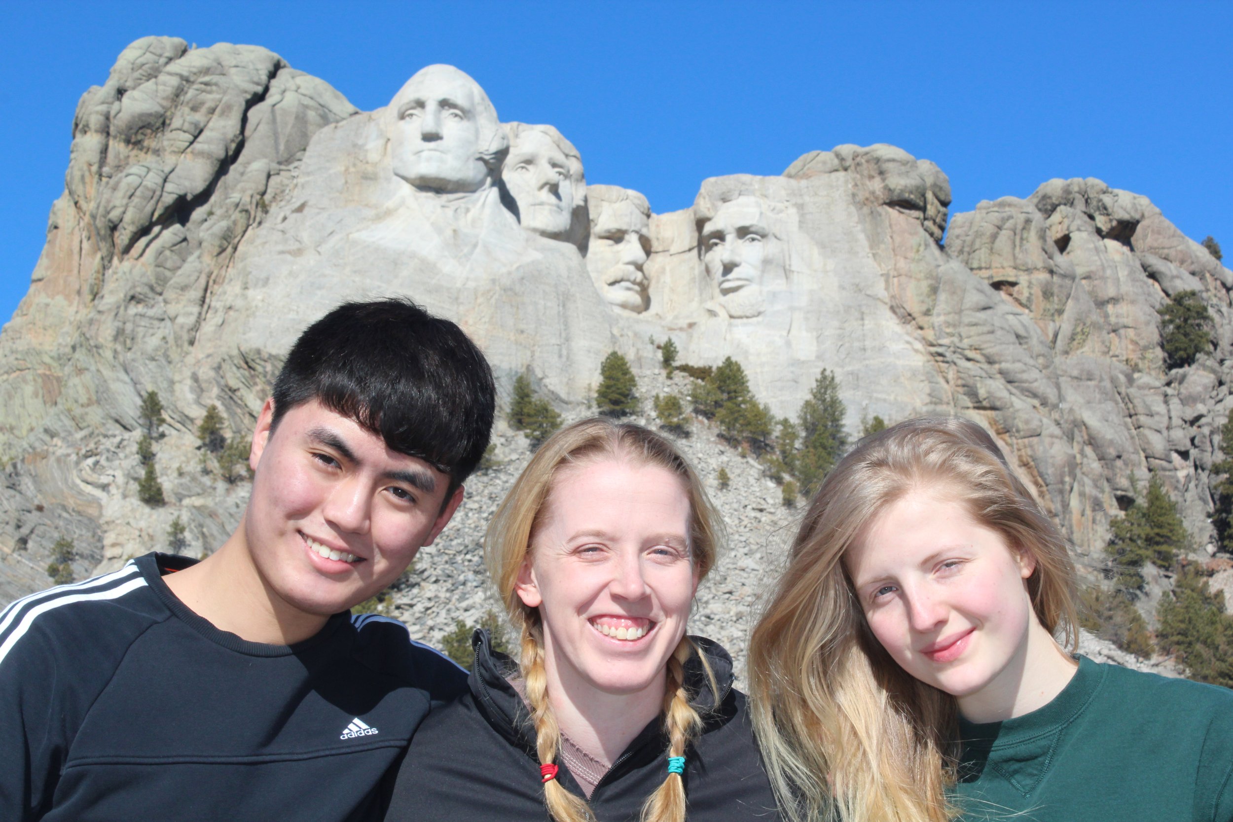
Acting out the statues behind us and trying not to laugh
Lincoln Borglum Visitor Center
The visitor center includes information about the monument, why it was designed, how it was made, and problems that occurred along the way. There is a short film “Mount Rushmore, the Shrine” which plays every 20 minutes. This movie provides a nice summary of the information found within the visitor center.
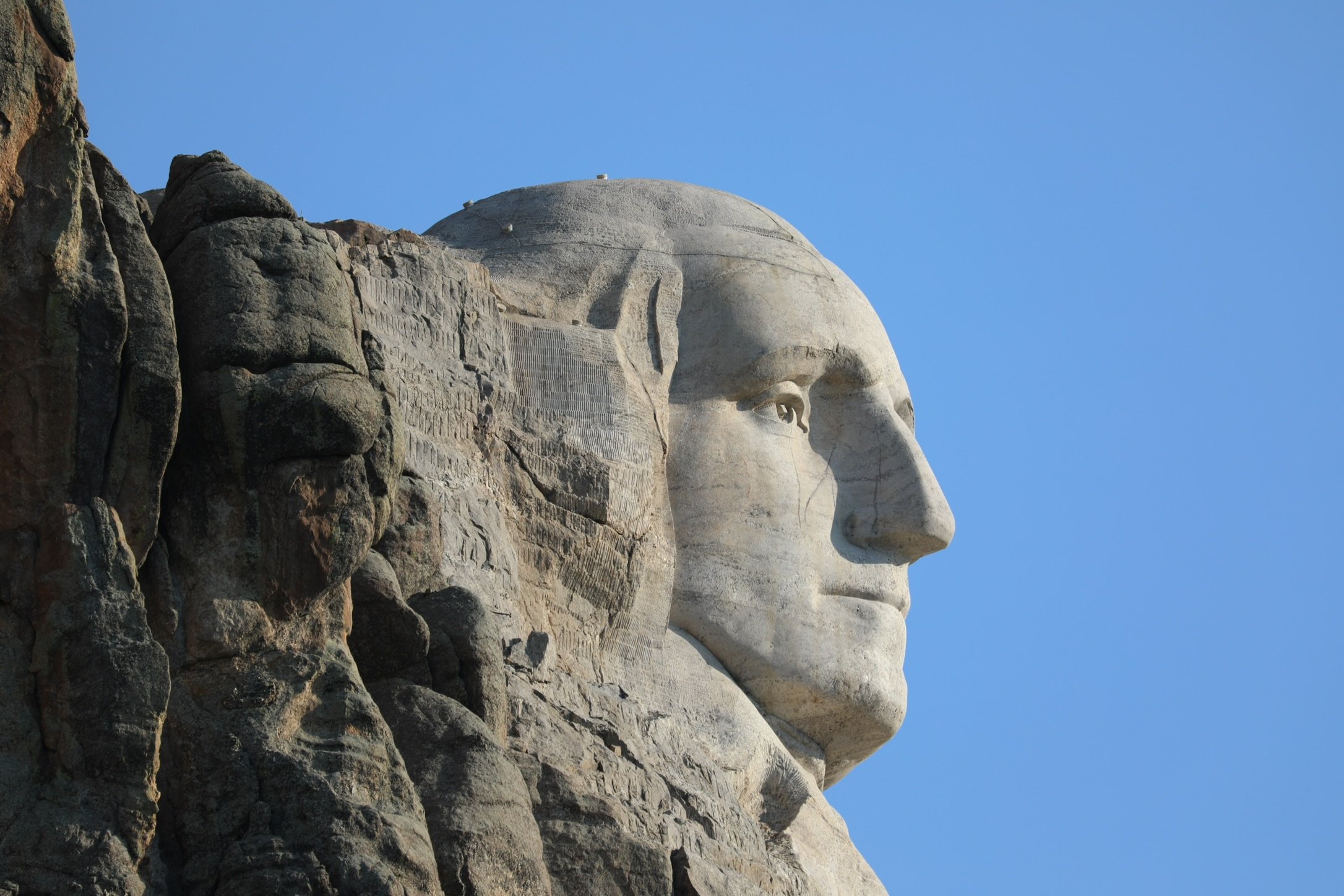
Sensors are visible on George Washington which monitor the monument for potential movement. Although this monument was built in an area that is free of earthquakes, these sensors provide additional safeguards. If there were movement of the rocks, rangers would be able to respond quickly to prevent potential damage to the monument.
Sculptor’s Studio
In addition to the information center and the visitor center, there is a third building, the Sculptor’s Studio, which is open in the summer months. The Sculptor’s Studio includes a plaster model of the original design - not just faces in a mountain, but sculptors of the presidents down to their midriffs, which is why George Washington has the top part of a jacket included. The monument was finished in its current state due to lack of funding, the United States joining WWII, the death of Borglum (designer of Mount Rushmore), and the rock below the faces not being strong enough for additional carving.
The Sculptor’s Studio can be found along the Presidential Trail, east of the visitor center.
Sculptor’s Studio - Mount Rushmore

Intended design of Mount Rushmore
Presidential Trail
It’s not possible to hike up to the monument. The closest viewing options are from the Presidential Trail. This is an easy 0.6 mile loop along paved surfaces, boardwalks, and stone patios. There are 422 steps however, so this trail is not wheelchair or stroller accessible.

View of Mount Rushmore from the Presidential Trail

Steps along the Presidential Trail at Mount Rushmore
The Presidential Trail offers multiple views of Mount Rushmore

Looking up the statues’ noses - this is as close as you can get to the monument
Lighting Ceremony
In the summer months (late May through September), there is a 45 minute lighting ceremony at sunset. The ceremony includes a Ranger talk and video. The visitors will then sing the National Anthem. At the end there is a flag folding demonstration. The Rangers will ask the crowd for all active military personnel and veterans to come down to the stage to participate in the flag folding. We had a family reunion out in the Black Hills in June, and I was able to watch my dad participate in this ceremony. This was an incredibly touching moment for me and my family.

Lighting ceremony - Mount Rushmore

Avenue of Flags after the lighting ceremony - Mount Rushmore

The monument is open until 11:00pm spring through summer, and until 9:00pm the remaining months.
Other Nearby Things To Do
On a trip out to the Black Hills, here are other things to do nearby:
Hike at Sylvan Lake
Explore Waterfalls along Spearfish Canyon
Tour Jewel Cave National Monument
Tour Wind Cave National Park
Hike Around Devils Tower National Monument
Visit Badlands National Park
Visit Minute Missile National Historic Site
Swim at Hippie Hole
More from NatureImpactsUs.com
To see additional hikes I’ve written about around the country, click on a pin below, and then click on the hyperlink. Use two fingers to zoom in and move around within the map.