Updated June 2024
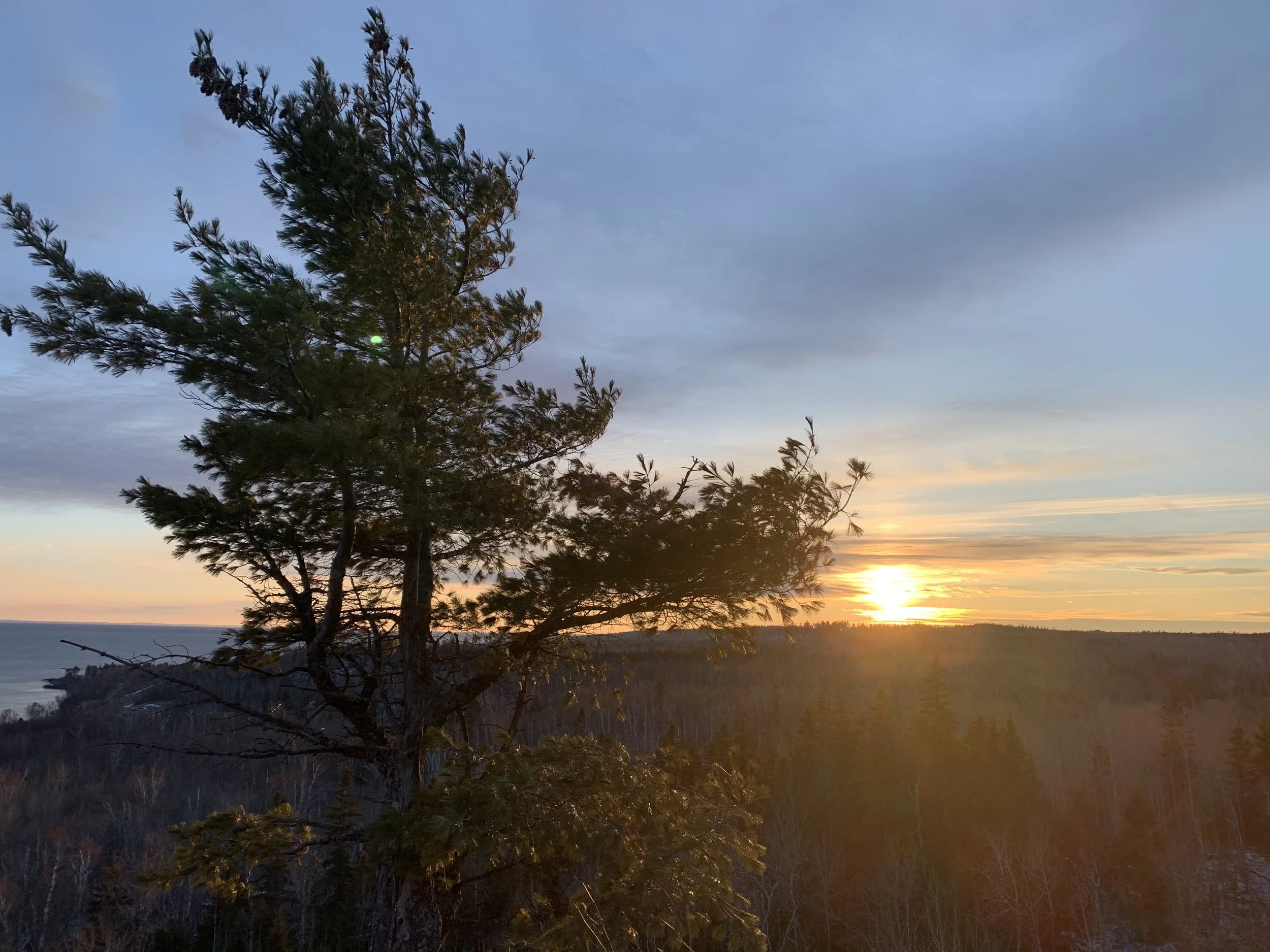
Sunset on the Split Rock River Loop Trail - Split Rock Lighthouse State Park
If you enjoy my posts, please consider signing up below to get email notifications of my latest blogs. I will not share your email.

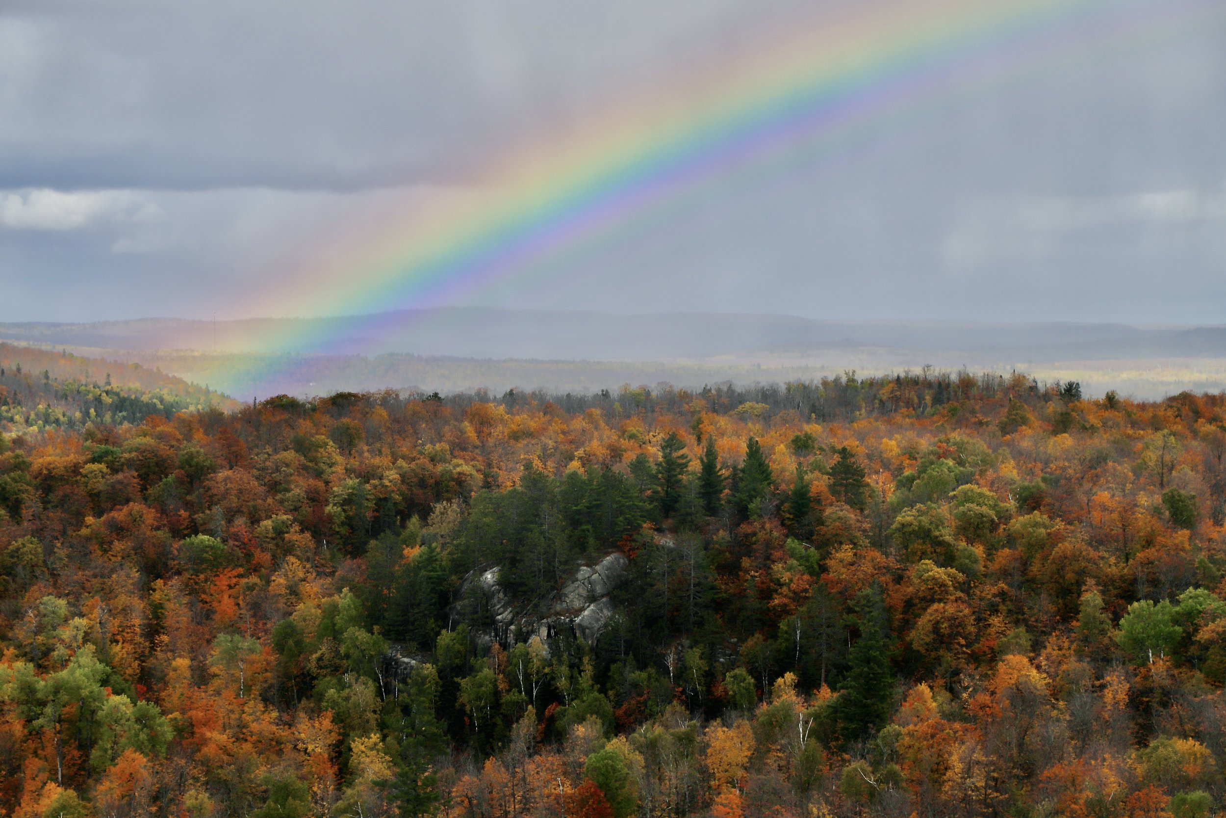
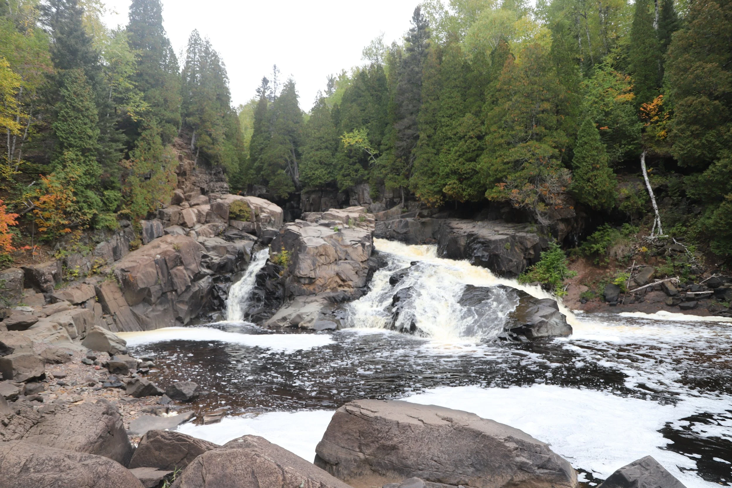
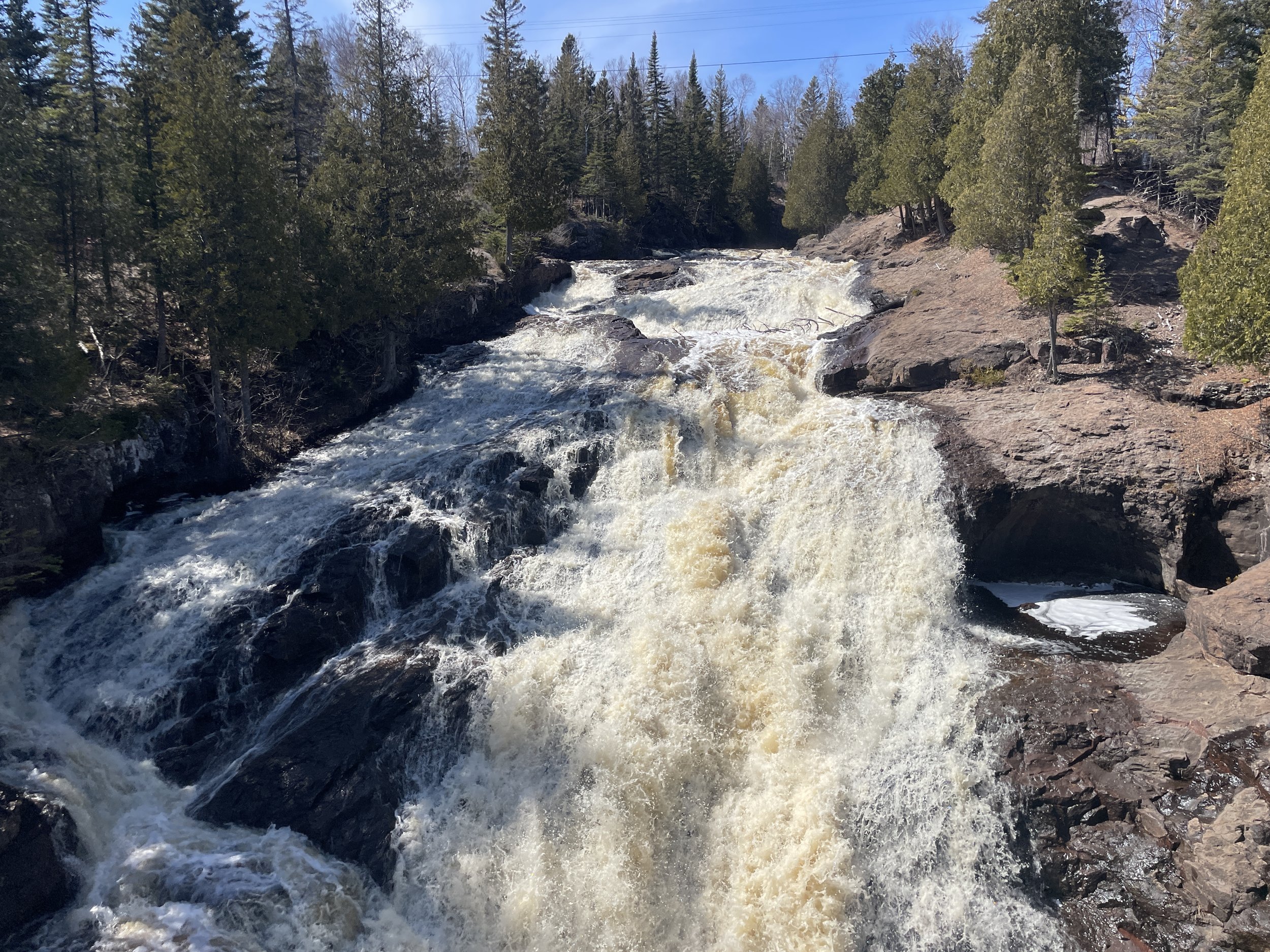
Cascade River State Park
Planning a Perfect Minnesota North Shore Vacation
“Perfect” probably isn’t the right word for any vacation, anywhere. There’s going to be days that are too hot, too cold, too windy, rainy, there may be bugs, disagreements between family members… Maybe the hike is too long, too rocky, or too steep. Maybe there are too many people to get a perfect picture of the waterfall. The drive between destinations might take up too much time. Time and money are limited resources, and so of course we all really do want that perfect vacation, and “perfect” is different for everybody. The goal of this guide is to provide lots of options - for those looking for short hikes, long hikes, secret hikes, amazing waterfalls, time at the beach, picnics, beautiful viewpoints, ideas to keep kids busy, romantic places to simply sit still, etc.. I also know from experience that quick pivots may be needed in the middle of a trip, and having an easy go-to list is really helpful to make up a quick Plan B. Sometimes having the agility to move to Plan B is what makes a vacation the best vacation, despite something unexpected happening.

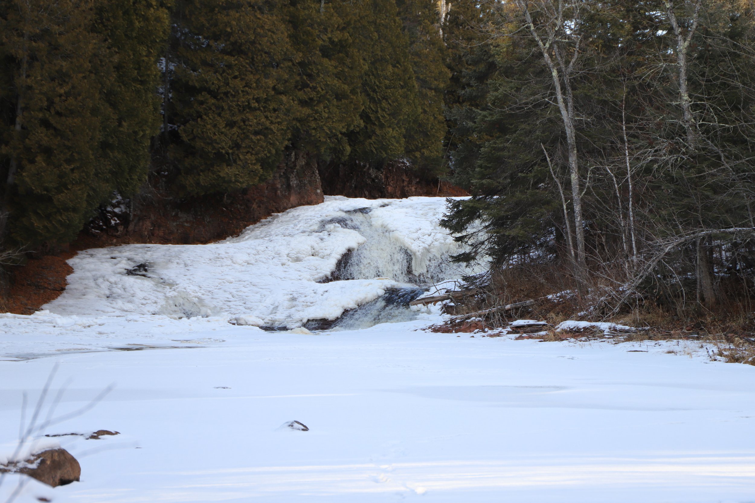
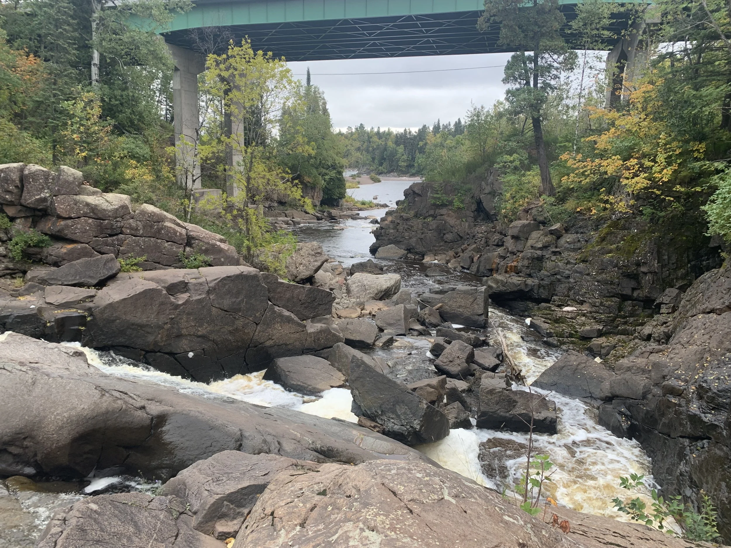
Temperance River State Park - Upper Falls Trail
Necessary Minnesota Terminology
Some quick, quirky Minnesotan lingo is going to be needed for any out-of-staters. There are 11,842 lakes in our state, and when asked what we are doing over the weekend, we all say, “I’m going to the lake.” The actual lake we are going to is never named; it doesn’t really matter in the conversation. It more describes what we are going to do - sleep in, have coffee on the dock, fish, take the kids inner tubing… A trip to Lake Superior is very different though, even though it also is a lake. Visiting Lake Superior means hiking to waterfalls, walking along a shoreline that might be too cold to get in, and typically we don’t take our small boats out onto Lake Superior. So instead of saying that we are going to the lake, we will say that we are going to the North Shore. Why the North Shore when Minnesota borders the southwest part of Lake Superior? I’m not actually sure, other than most of us drive north to get to Lake Superior…?
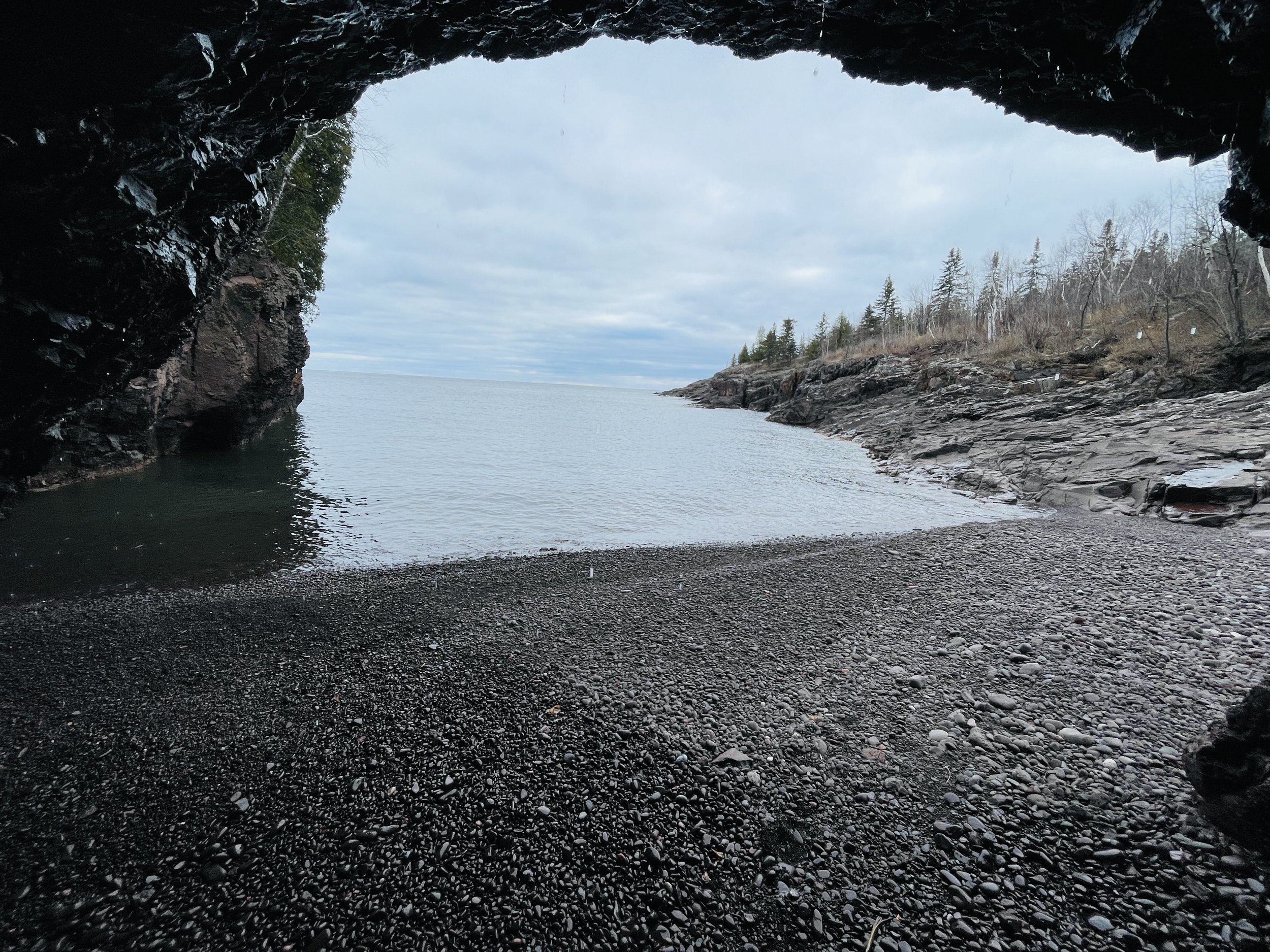
Tettegouche State Park - Mt. Trudee
Minnesota State Highway 61 (MN-61)
The North Shore is long. MN-61 stretches 150 miles between Duluth and the Canadian border, and that drive takes at least 2 hours and 40 minutes, each way. Traffic, potential road construction in the summer months, and the stoplights in Two Harbors can easily add more drive time, so some pre-trip planning is logistically important as no one wants to spend their whole vacation in the car.
Tettegouche State Park - Crystal Bay Point Trail
Lake Superior Swimming?
The North Shore is one of my favorite places to visit in our country, but I don’t swim in this lake - Lake Superior is cold. Really cold. This lake has a max depth of 1,323ft. That’s a lot of water, so it takes a lot of energy from the sun to heat it. As our winters are quite cold, it keeps this lake cold. Shallower parts may get up to 65 deg F, but most spots won’t even reach 55 deg F. I’ve been brave enough to wade in up to my knees several times, but never further. The best options to get wet are near the river mouths that empty into Lake Superior. Gooseberry River (in Gooseberry State Park) and Baptism River (in Tettegouche State Park) are my favorite places to play in the water. Another recommendation would be to bring water sandals. Most of the beaches and river bottoms are rocky.

Superior Hiking Trail - Oberg Mountain
Parking Pass for Minnesota State Parks
One last bit of pre-trip planning information is regarding the MN State Park Passes, as it costs money to park at most MN State Parks. As of 2024, a day pass is $7, and is good for all MN State Parks that are visited on that day. An annual pass is $35. This annual pass is required to be stuck onto the car’s windshield, so this wouldn’t be an option for a rental car. There are no additional fees inside of the MN State Parks.
North Shore Lodging Options
There are several types of lodging to choose from, as well as different places along the North Shore to pick from.
Camping
The MN State Parks have fantastic campgrounds! The biggest problem is trying to actually book a campsite as they are very popular. If campsites are full, try for a non-weekend option, or keep looking at parks located further north.
Gooseberry State Park Campground
This park is busy because it’s the closest to Duluth. There are tent and electric site options.
Split Rock Lighthouse State Park (Cart-in and Drive-in Campgrounds)
There are two campgrounds - one is a tent cart-in only and the other has drive in with electric. I absolutely love the cart-in only campground. The sites are extremely secluded, several having lake views, and there are showers in the main bathroom. I haven’t stayed in the drive-in campground.

Throwback picture from 1995ish - camping in the cart-in campground at Split Rock Lighthouse with my parents and best friend
Tettegouche State Park (Cart-in and Drive-in Campgrounds)
Tettegouche also has two campgrounds - one tent cart-in only and the other is drive-in. The tent cart-in campground is much more primitive than at Split Rock Lighthouse. There are only pit toilets available, although there are showers that can be used for free at the drive-in campground.

Tettegouche Drive-In Campground

Tettegouche Cart-In Campground
Temperance River State Park
The main Temperance River State Park campground is drive-in, but there are a handful of cart-in sites. I haven’t stayed in this campground yet.
Cascade River State Park
Cascade River has drive-in sites, and this campground is my second favorite (after the Split Rock Lighthouse cart-in campground). I love it because it feels quieter due to it simply being further north. Additionally, Cascade River has a lakeshore trail near the campground. I have several memories of both my boys learning to walk along these rocks.

Camping with Young Children
Several times I’ve heard the question about what age is the right time to start taking kids camping. We first took our son when he was 9 months. I still remember so much of that trip, and that weekend was so much fun. For anyone looking for tips camping with young children, check out my camping with children post.
Water Park Hotel
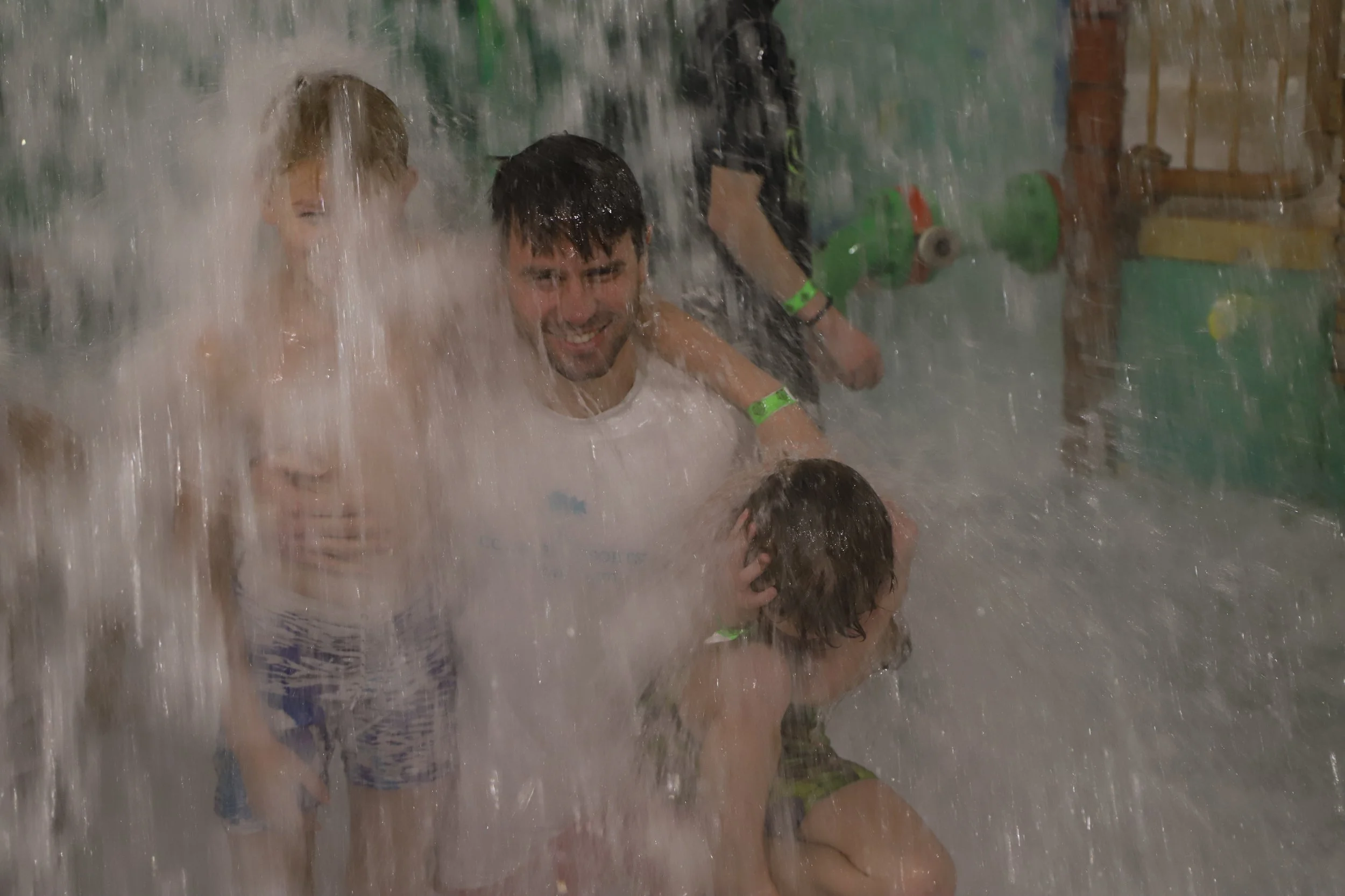
The Edgewater Hotel in Duluth is the one hotel along MN-61 that has a waterpark. We’ve stayed here several times over long weekends in the winter. Being honest, the hotel itself isn’t great. The doorframes may be slightly crooked, the rooms are old, and breakfast isn’t free. But the waterpark is a ton of fun, and it works amazing well as bribery for kids to go winter hiking during the day. There are a couple of different buildings, so do pay attention when booking. Some rooms have exterior-only access, meaning that to get to the waterpark requires a walk outside. Not a big deal during the summer, but a huge bummer in the extremely cold winters.
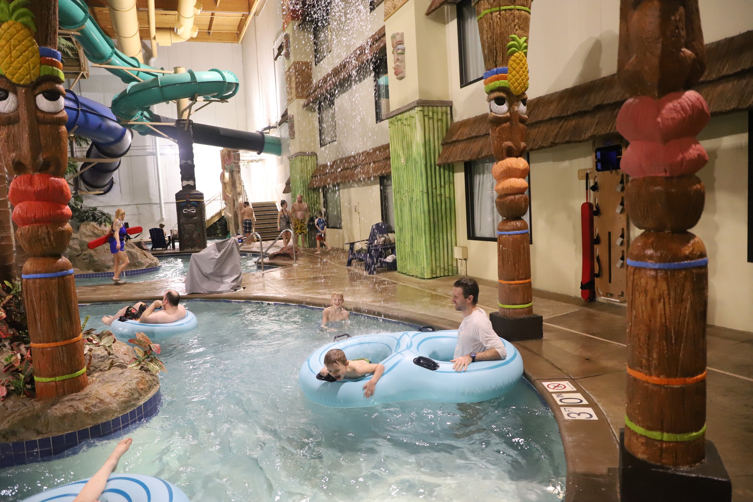
My boys playing in the Lazy River at the Edgewater Resort
Hotels
Personally, I think Tofte is my favorite small town to stay in if I’m not camping, as it’s approximately mid-way up MN-61. There’s a large AmericInn that’s a relatively newer hotel, and I’ve stayed there several times. Grand Marais has several small hotels as well, but is 2 hours north of Duluth, which can lead to long drives to the majority of the more southern parks.. Duluth has the largest amount of hotels, but keep in mind that this is at the very southern end of MN-61, and it takes at least 45 minutes to just get to Gooseberry, which is the southern-most of the MN State Parks. Staying in Duluth could add a lot of driving on a longer trip.
Cabins
Looking on Orbitz, there are several smaller cabin options along the North Shore as well. Often there is a group of cabins together that have a main office to check-in at. I’ve stayed in one near Lutsen, although it was several years ago, and I can’t remember the name. That was a fun option for us as we had 4 adults and it was cheaper than getting two hotel rooms.
Something Fancier
I have two recommendations for those wanting a nicer place to stay. The first is Bluefin Bay, just outside of Tofte. This resort includes larger spaces with kitchens. We’ve had a couple of family reunions at Bluefin Bay, and this has worked fantastically well for such occasions. It’s also my parent’s favorite place to stay along the North Shore. When booking a room at Bluefin Bay, pick a lakeview room on the lower level, as it will include a private access to the shoreline.
My second recommendation for a fancy option is Eagle Ridge Resort at Lutsen Mountain. This resort is a bit cheaper during the summer months when the ski resort is not in operation, and some of the rooms include jetted tubs.

Eagle Ridge Resort is in the Lutsen Mountain Ski Resort, literally on the one of the ski hills

Eagle Ridge Resort at Lutsen Mountain
Things to Do Along the North Shore
Below is a map of the North Shore, highlighting some places to consider visiting. Purple dots indicate waterfalls. Dark blue dots are places to access Lake Superior. Green dots are overlooks and typically involve more strenuous hikes. Yellow dots indicate other beautiful destinations to hike to beyond the waterfalls, lake shore, and overlooks. Orange dots are non-hiking places of interest. Light blue dots indicate places to canoe (day or multi-day trip options).
There are hyperlinks in the captions to jump to that section of the post, and then there is a Return to Map link that comes back here. Note that this is a high-level overview of the North Shore and that within each section, there will be a link to a more detailed post that I’ve written on each destination. Those links will open a new browser window so readers don’t loose their location within this post.
Trail conditions can change quickly and dramatically due to weather along the North Shore. Check the main park websites for current conditions before heading there.

1) Jay Cooke State Park - Beautiful hiking options along the St. Louis River
2) Duluth, MN - Park Point is a quiet, sandy beach. The Aerial Lift Bridge is fun to visit. And there are day-cruises and train rides, as well as several museums.
3) Two Harbors, MN - Betty’s Pies
4) Gooseberry Falls State Park - There are short hikes to three large waterfalls and a longer hike to a fourth smaller waterfall. Agate Beach forms as Gooseberry River enters Lake Superior.
5) Iona’s Beach - Free beach full of pink rocks
6) Split Rock Lighthouse State Park - Pebble Beach is one of my favorite places to stop along the North Shore as it has a beautiful view of the lighthouse and a beach full of perfect skipping rocks. There are several hiking options, including an overlook and smaller waterfalls. Tours of the lighthouse are offered through the MN Historical Society.
7) Beaver Bay Falls - This is a short walk to a large waterfall but there isn’t a real place to view the waterfall from. This is also a free place to stop.
8) Black Beach - This is another free place to stop and enjoy a quiet beach of small black rocks. There is a nearby island that can be explored by foot.
9) Tettegouche State Park - This park has a bit of everything - Four waterfalls, multiple overlooks, cliff drops into Lake Superior, a secret beach with huge sea caves, and an inland lake large enough to kayak. Bear and Bean Lake is one of the most popular trails along the North Shore.
10) Ely, MN - This is the most popular entry point into the Boundary Waters Canoe Area. There is also a large (and mostly secret) waterfall, the International Wolf Center, and two State Parks - Bear Head Lake State Park and Soudan Mine State Park, which includes underground tours in working mine cars.
11) George Crosby Manitou State Park - This whole state park is a secret, and it has a stunning waterfall. This is a very rustic park with minimal infrastructure.
12) Caribou Falls - Easy hike to an off-the-beaten-trail waterfall
13) Sugarloaf Cove - Interesting shoreline hike. There is a small fee required to park. A nature center is open in the summer months.
14) Cross River - This large waterfall is visible from the MN-61 bridge. Free parking is next to the bridge. There is also a quiet section of the Superior Hiking Trail with a couple of smaller waterfalls upstream for those looking for a longer hike.
15) Temperance River State Park - This park has seven waterfalls, and six of them can be viewed on a short hike, less than one mile. There is also a hiking option to an overlook.
16) Tofte, MN - For those looking for hotels, Tofte is great destination as it’s midway up MN-61. Note that this is a small town and hotels do fill up quickly. A nicer lodging location for larger families is Bluefin Bay.
17) Sawbill Canoe Outfitter - This is the closest entry point into the Boundary Waters Canoe Area from MN-61. Canoes and supplies can be rented here for a day or multi-day trip.
18) Oberg Mountain - This is an amazing, but very busy, overlook trail along the Superior Hiking Trail with no cost to park.
19) Lutsen, MN - This town includes the Lutsen Mountain Ski Resort. For anyone looking for a fancy lodging option, Eagle Ridge Resort is located in Lutsen.
20) Cascade River State Park - This park has multiple waterfalls that cascade, making it difficult to provide an actual waterfall count. Similar to Temperance, most of the waterfalls are within a hike less than a mile long. This is also the only MN State Park with a true hike along the Lake Superior Shoreline. Cascade also has an overlook hike.
21) Grand Marias, MN - This is the quintessential North Shore town - Grand Marias is the best place to shop souvenirs along the North Shore. Swen and Ole’s Pizza gets a shout out as well - I absolutely love their pizza!
22) Eagle Mountain - Hike to the tallest point in Minnesota
23) Superior Hiking Trail - Lake Walk - The only section of the Superior Hiking Trail along the Lake Superior shoreline.
24) Judge C.R. Magney State Park - This park has two large waterfalls.
25) Grand Portage National Monument - When visited in the summer months, this National Monument includes an interactive fort that depicts the life of British fur traders from the 1780s. Outside of the fort is an exhibit on the Ojibwe Native Americans, which is open year-round.
26) Grand Portage State Park - This park borders Canada and includes the tallest waterfall in Minnesota. The hike to this waterfall is handicap accessible. There are also two smaller waterfalls along a more rugged, (and slightly swampy) trail.
Superior Hiking Trail (SHT)
There are several times in this post that I refer to the Superior Hiking Trail. For those that haven’t heard of this trail before, here is a quick background to avoid confusion throughout this post. The SHT begins south of Duluth in Jay Cooke State Park and follows Lake Superior north for 310 miles to the US/Canadian border. Although the trail is called the Superior Hiking Trail, it only actually goes to the shoreline of Lake Superior once (in a spot called “Lake Walk” just south of Judge Magney State Park) – see below for more details. The SHT follows rivers, passes several beautiful waterfalls, and winds between birch, aspen, pine, fir, and cedar forests. There are several overlooks of lakes from the trail, including Lake Superior. The trail is well marked with blue signs, and there are several trailheads, each with its own free parking area. The trail is free to use. Permits are not required to camp at any of the backpacking sites, but all campers must stay in designated campsites, even those just using a hammock hanger.
There is a Superior Shuttle service that stops at designated trailheads on weekends for anyone that only wants to hike one way. I’m not sure how this service works exactly though, as we’ve just hiked portions as out-and-backs. There is also a trail guide that I would recommend buying for anyone planning a multi-day hike. It details each section of the trail, including where to park, the mileage and elevation changes between trailheads, and the locations of campsites and water sources.
1) Jay Cooke State Park

Swinging Bridge over St. Louis River at Jay Cooke State Park
Where is Jay Cooke State Park?
Most people will travel to the North Shore from the south, along I-35. Jay Cooke State Park is about 12 miles south of where I-35 ends and MN-61 begins. The park is just off of Hwy 210, about 5 miles from the interstate. There is one parking area at the River Inn Visitor Center which is used to access the majority of trails in the park. The Visitor Center has bathrooms and a small gift store.
A day pass or annual MN State Park Pass is needed to visit here. Both can be purchased at the Visitor Center.

Close-up view of Jay Cooke State Park’s best hike (follow yellow to blue and add an out-and-back along green for a longer hike). See my full post, linked below, for additional hikes.
Best Things to do at Jay Cooke State Park
Although there are no waterfalls at this park, there is a beautiful hike along the rapids of the St. Louis River that is less than a mile. Refer to the above map for colors that I reference. From the Visitor Center Parking Lot, walk towards the Swinging Bridge and then veer to the river downstream of the bridge (marked in yellow). This is the best spot to get a picture of the bridge and river. Then head back towards the parking lot and cross the bridge (marked in blue). There is a small loop hike that will get close to the rapids on the south side of the river.
For a longer hike, add an out-and-back along the River Trail (marked in green). One way along the River Trail is 0.4 miles.

Rapids of St. Louis River viewed from the Swinging Bridge
More Information on Jay Cooke State Park
For more information, including additional hikes, more pictures, and detailed hiking maps, refer to my post on Jay Cooke State Park.
2) Duluth, MN

Bentleyville is the largest outdoor Christmas light display in Minnesota, and it’s free!
Where is Duluth?
There is a small airport in Duluth, but the main airport in Minnesota is in Minneapolis / St. Paul. Duluth is pretty much a straight drive north from the Twin Cities up I-35. The drive takes a little less than two-and-a-half hours. Duluth sits on the very southern corner of Lake Superior. Superior, Wisconsin is just on the other side of the harbor.
Best Things to Do in Duluth
I have several favorite things to do in Duluth.
Canal Park
First of course is Canal Park, with the Aerial Lift Bridge, Grandma’s, and a lighthouse. There is a free ship museum right next to the bridge, which is a great activity while waiting for ships to pass through that might be running behind schedule. In the summer, there is a food truck that serves Grandmas’s with a minimal line. The food will obviously be given as “to-go”, so go enjoy a picnic at nearby Park Point Beach. For more information, see my post on Canal Park. Note that parking will require a fee, but there are several options in Canal Park along the streets as well as a few parking lots.

Aerial Lift Bridge in Duluth
Park Point Beach
The only sandy beach I am aware of in Minnesota along the Lake Superior shoreline is Park Point. This is just a short drive over the Aerial Lift Bridge. This beach is free and there are bathrooms and place to change. The sand stretches quite a ways in both directions. For more information, see my post on Park Point.

Park Point Beach in Duluth, MN
For any parents of train-lovers, Thomas comes to Duluth every summer at the beginning of August. A ticket includes a ride on the train, and the whole day is quite fun.

A Day Out with Thomas
Another cool option to see Duluth is on the Vista Fleet, which gives tours of the harbor, heads under the bridge and explores the southern section of Lake Superior.
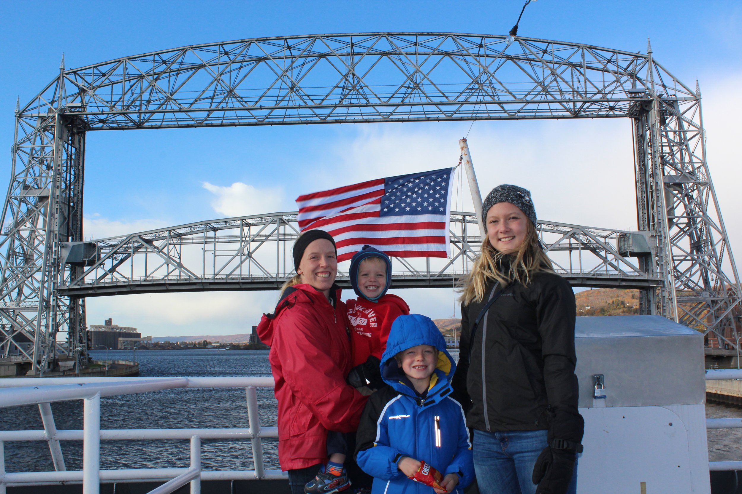
Vista Fleet Cruise
On rainy days, we’ve also enjoyed the Great Lakes Aquarium and the Lake Superior Railroad Museum.
For anyone interested in checking Duluth out in the winter (and I would highly recommend it for the opportunity to see one, or several, frozen waterfalls), head up between Thanksgiving and New Years and enjoy Bentleyville. This is the largest outdoor Christmas light display in the state of Minnesota.
One more shout out to the Edgewater Hotel - For parents, consider a weekend of winter hiking during the day, the waterpark in the afternoon, and Bentleyville at nighttime. Or, skip Bentleyville and use one of the winter 3-day weekends in Duluth at the Edgewater, and enjoy some longer hikes through the snow during the days. We’ve had a lot of fun during the winter in Duluth, even when it’s quite cold.
Edgewater Water Park in Duluth
3) Two Harbors, MN
MN-61: Mile Markers 25-28
Approx time from Duluth (Canal Park): 37 minutes
Where is Two Harbors?
Two Harbors is the first small town along MN-61, north of Duluth.
Best Thing to do in Two Harbors
I don’t have any favorite hiking recommendations or places to check out in Two Harbors, but I would enthusiastically recommend stopping at Betty’s Pies (located between mile markers 28 and 29, just after passing through Two Harbors). Don’t be intimidated by how many people are in the parking lot. For those that just want to get pie, there are options to buy a slice or a pie to go - in fact that’s what most people do. There is an outdoor line for to-go pie, and it’s just like a restaurant where after ordering they give out a vibrating disk to hold which buzzes when the pie is ready. The line moves very quickly, and the pie is fantastic! Try a unique flavor like Bumbleberry, Butterscotch, or French Blueberry Cream - they are all amazing! And the Five Layer Chocolate Cream Pie is incredible… Sigh, now I’m thinking about pie and trying to figure out when I have time to drive back up there…
4) Gooseberry State Park
MN-61: Mile Marker 39
Approx time from Duluth (Canal Park): 47 minutes

Gooseberry Middle and Lower Falls in early December as the falls are just starting to freeze
Where is Gooseberry State Park?
Driving north from Duluth, Gooseberry is the first State Park along MN-61. The trailheads, visitor center, and campground are all accessed from Co Hwy 1, which intersects with MN-61 just before mile marker 39. The turn is clearly labeled with a brown sign for the State Park.
There is primarily one parking lot, which is next to a large Visitor Center. All trailheads are accessed from this main parking lot. There is a second parking lot next to Agate Beach for anyone wishing to drive to the beach rather than hike there along the River View Trail.
A day pass or annual MN State Park Pass is needed to visit here. Both can be purchased at the Visitor Center, which also includes bathrooms.

Agate Beach - and I think the most romantic spot to sit along the lakeshore (of all of the state parks and public beaches)
Best Things to do at Gooseberry State Park

Map of hiking trails at Gooseberry State Park
Waterfall Loop Hike
At a minimum, stop and hike to Middle and Lower Falls. Out and back to both falls is 0.75 miles. This trail will be busy, and it will be difficult to get a picture of the falls without people in them, but this is a huge step waterfall (when viewed from the bottom to see both), and I think it’s one of the most impressive waterfalls along MN-61. The hike is so short there isn’t a reason to miss it. For just a half mile more, instead of doing an out-and-back, hike the whole waterfall loop (marked in yellow) and add in the Upper Falls.
My best tip to deal with the people issue on this hike is to arrive close to sunset at the end of the day. Everyone else stops here first on their way north from Duluth.

Middle Falls

Gooseberry Upper Falls
For more information, this is my post on the Waterfall Loop Hike at Gooseberry (including more pictures, a more thorough trail review, and detailed maps).
Fifth Falls
Fifth Falls adds 2 miles to the Waterfall Loop hike, and the trail is accessible near Upper Falls (marked in red above). This is a nice quiet hike along the river. This waterfall is not near as impressive though as Upper, Middle, or Lower Falls. Click on my link for more information on Fifth Falls.

Gooseberry’s Fifth Falls
River View Trail
The River View Trail adds 1.5 miles to the Waterfall Loop hike (marked in blue). There is one unique view of the waterfalls at a distance, otherwise there isn’t much that can’t simply be seen by driving to Agate Beach and parking there. But for someone wanting to hike a little further, this is a great trail. Click on my link for more information on the River View Trail.

Agate Beach
More Information on Gooseberry State Park
For more information on this park, including additional hikes, more pictures, and detailed hiking maps, refer to my post on Gooseberry State Park.
5) Iona’s Beach
MN-61: Mile Marker 42
Approx time from Duluth (Canal Park): 50 minutes

Iona’s Beach
Where is Iona’s Beach?
Iona’s Beach is located just off of MN-61 along an unnamed road. The turn-off is marked with a brown sign. Iona’s Beach is not connected with a state park, and currently the parking area is free. Accessing the beach does require a bit of a walk (approx 0.75 miles) to and from the parking lot. The walk is flat and easy, however. There is no visitor center, and I do not recall any nearby bathrooms.

This is the map between the parking lot (marked with a black star) and Iona’s beach. The beach stretches slightly past the shaded lines.
Best Thing to do at Iona’s Beach
I’m not quite brave enough to swim in the frigid waters of Lake Superior, but I love walking along the beach, and Iona’s beach is so unique with it’s small pink rocks (whereas most of the lakeshore is black or dark grey rock). The rocks are between the size of pebbles and sand dollars so the shoreline is easy to walk over. I would recommend bringing water sandals for anyone that prefers walking in the water. This beach stretches close to a mile for anyone looking for a quiet stroll. For more information (including more pictures), see my post on Iona’s Beach.

Iona’s Beach
Split Rock Lighthouse State Park
MN-61: Mile Markers 43 & 46
Approx time from Duluth (Canal Park): 56 minutes

Split Rock Lighthouse viewed from Pebble Beach
Where is Split Rock Lighthouse State Park?
Driving north from Duluth, Split Rock Lighthouse is the second State Park along MN-61. There are three parking areas. The Split Rock River Loop parking lot is on the west-side of MN-61 near mile marker 43. This is a relatively small parking lot, but this trail is not very popular despite the fact that it’s my personal favorite long-hike in the park. The other two parking areas are accessible from the same turn off of MN-61 (near mile marker 46), which is marked clearly with a brown sign for Split Rock Lighthouse State Park. On this road there is a split. Turning south will go towards the state park, which includes Pebble Beach, Day Hill, the Corundum Trail, and Campground. Going north after the exiting MN-61 goes to the lighthouse, which is run by the MN Historical Society.
There is a ranger station available to purchase day or annual MN State Park Passes from and to check-in for camping reservations. Bathrooms are available next to the Pebble Beach parking lot. There is also a Visitor Center run through the MN Historical Society, next to the lighthouse.

Hiking Map of Split Rock Lighthouse State Park - Parking lots are marked with black stars. Pebble Beach is marked with a purple star.
Best Things to do at Split Rock Lighthouse State Park
My top recommendation for Split Rock Lighthouse would be to enjoy some time playing Pebble Beach. For a shorter hike, walk up to the Lighthouse along the Little Two Harbors Trail. For a longer hike, enjoy the Split Rock River Trail. The best overlook in the park is Day Hill.
Pebble Beach
My favorite spot at Split Rock Lighthouse is Pebble Beach (marked with the purple star above). It’s just a short walk from the parking lot to the beach. The walkable section of the beach extends about 1/3 mile. The rocks are thin, perfectly smooth, and the perfect size for both little and adult-sized hands. I’d argue this beach is the best place to skip rocks in the entire state of Minnesota. Here is my review of Pebble Beach

Playing at Pebble Beach
Little Two Harbors Trail
The Little Two Harbors Trail is a 2.5 mile loop hike from the State Park parking lot up to the lighthouse, with an elevation gain of 120ft. This trail is marked in green above. There are wooden steps on one side of the trail and a paved bike trail on the other. I think it’s easier on my knees to go up along the steps, so that’s my favorite direction to hike the loop. This trail goes past some historical sites along the way. For more information, here is my review of Little Two Harbors Trail.

Split Rock Lighthouse
Split Rock River Trail
My favorite long hike at Split Rock Lighthouse State Park is the Split Rock River Trail, which is a 5 mile loop hike with an elevation change of 425ft. This trail is marked in blue above. The trailhead is outside of the main park, south down MN-61 at mile marker 43. This hike has a couple of small waterfalls, includes the rock that is “split” from which the park is named, and there are some pretty viewpoints from higher sections in the park. For more information, here is my review of Split Rock River Trail.
Split Rock River Trail
Day Hill Trail
My last hiking recommendation at Split Rock Lighthouse State Park is the Day Hill Trail. This trail is marked in red above (note that Day Hill is part of the larger Corundum Trail and both are marked in red). The Day Hill Trail takes off from the campground. Only campers can park in the campground lot, so just stay parked in the same lot that was used for Pebble Beach. Day Hill is a 2.0 mile out-and-back trail to a lookout with a pretty view at the top of Lake Superior. There is an elevation gain of 300ft along this trail. For more information, here is my Day Hill Trail review.

View from Day Hill
Split Rock Lighthouse Tours
There are paid tours available inside Split Rock Lighthouse. This is run by the MN Historical Site. Here is a link to the Split Rock Lighthouse website for more tour information.
More Information on Split Rock Lighthouse State Park
For more information on this park, including additional hikes, more pictures, and detailed hiking maps, refer to my post on Split Rock Lighthouse State Park.
7) Beaver Bay Falls
MN-61: Mile Marker 51
Approx time from Duluth (Canal Park): 60 minutes

Beaver Bay Falls - upstream of the MN-61 bridge
Where is Beaver Bay?
Beaver Bay is the second town along MN-61, after Two Harbors.
Best Thing to do in Beaver Bay?
Beaver Bay is even smaller than Two Harbors, so don’t expect any restaurants, not even fast food. There is a gas station though. The best thing to do in Beaver Bay is to explore Beaver Bay Falls, although there aren’t any great viewing locations for the waterfall. Park at the Beaver Bay Wayside (which is free and includes a bathroom). Walk on the small foot trail towards the river. The bigger falls are upstream just a bit, and there are some smaller rapids back under the highway. There isn’t much of a trail to either section of the river though. It’s more of a choose your own adventure directly over the boulders.
Beaver Bay Falls looking downstream, under the MN-61 bridge
8) Black Beach
MN-61: Mile Marker 55
Approx time from Duluth (Canal Park): 66 minutes

Black Beach
Where is Black Beach?
Black Beach is in Silver Bay, just after the Taconite plant. Turn right onto Mensing Drive, and then take a second right onto W Lakeview Dr. At the T-intersection, make one more right onto E Lakeview Dr. The turn-off from MN-61 is marked with a brown sign. Black Beach is not connected with a state park and currently the parking lot is also free. It is a short, flat, and easy walk to get from the parking area to the beach. I don’t think there are bathrooms, but there are a few picnic tables along the beach.
Below is a map with parking and the trail marked.

This is the map between the parking lot (marked with a black star) and Black Beach.
Best Thing to Do at Black Beach
There is an island down the shore a short ways that looks and feels like it should be explored, so expect to walk at least a mile to exploit your curiosity. The best part of this beach is that even though it’s amazing, it’s relatively unknown. There are also a couple of tables right on the beach, making this my favorite spot along the North Shore for a picnic. For more information, including more pictures, see my post on Black Beach.

Black Beach
9) Tettegouche State Park
MN-61: Mile Markers 57-60
Approx time from Duluth (Canal Park): 1 hour and 10 minutes

Tettegouche High Falls
Where is Tettegouche State Park?
Tettegouche is a large MN State Park and as a result, there are multiple trailhead parking lots. The main entrance, which includes a large visitor center, is just off of MN-61 between mile markers 58 and 59. The turn-off is marked with brown signs for the state park, and the road immediately goes past the Visitor Center with a place to park. This is the best parking lot for High Falls and Two Step Falls (currently as the swinging bridge has now completely washed away), Shovel Point, the Cascades, and access to the mouth of the Baptism River. I will mention locations of other trailheads below.
The Visitor Center includes a large gift store, bathrooms, and park passes (annual and day) can be purchased here as well. Note that there are several other trailheads that I will refer to below, and none of them have bathrooms, except the visitor center and campgrounds.

Tettegouche State Park Hiking Map - Colors noted below
Best Things to do at Tettegouche State Park
I truly love several of the MN State Parks, but if I had to say just one was my favorite, it would be Tettegouche. There are enough hikes in Tettegouche alone for several days, but I’m sure most people planning a vacation to the North Shore want to see more than just one park. My obvious recommendation would be to plan more than one trip here, but I’ll also do my best at quickly highlighting my favorites. Feel free to check out my full post on Tettegouche for additional recommendations, detailed maps, and more pictures.
Palisade Head
Best View of Lake Superior (don’t bring small children)

View from Palisade Head
The turn-off for Palisade Head is just after miler marker 57 (south of the main park entrance). There is a small parking lot at the bottom. From here to the cliffs and back is a 1.25 mile trek (with an elevation gain of 300ft). This trails is marked in green. The easier option is to just drive to the top and park right next to the viewpoint. The potential problem is that there could be a long wait at the top, and you’ll be stuck because there is no way to turn around. We waited 30 minutes one weekend in October. The view is worth it, but maybe one of these options sounds better than other. I’ve walked up the road as well. Not the most exciting along the road, but at the top, I enjoyed exploring a bit more on the rocks on the way back.
Note that these are extremely high cliffs and there is only one spot with a wall. I would not bring young children here. Here is more information on Palisade Head.

One of my favorite family pictures at Palisade Head (with two of our former exchange students)
Shovel Point
Best Cliff Hike along the North Shore
(this one is fine for younger kids that are good hand holders)
Shovel Point is an easy 1.2 mile out-and-back hike from the Visitor Center, and the trail is pretty flat. I think this is one of the prettiest hikes along the Lake Superior shoreline. This trail is marked in dark blue on the map above. Here is more information on Shovel Point.

View from Shovel Point - Crystal Bay Beach (with the sea caves) is just to the left, in the spot of the rocks that can’t quite be seen
High Falls (and Two Step Falls)
Best Waterfall in the Park - One of the Best Waterfalls in the State
With Swinging Bridge currently down, the only option to get to High Falls is a 3 mile out-and-back hike with an elevation gain of 500ft from the Visitor Center. There is also a small parking lot a few steps closer for anyone interested. Just get back on the road and stop at the next pullout (towards the cart-in campground). Two Step Falls will be visible with just a short spur hike on the way. This trail is marked in yellow. Here is more information on High Falls.
Tettegouche High Falls - Yes, winter hiking is a thing. Yes, it’s wicked awesome! Yes, kids can hike in the snow. And no, I’m not going to be able to explain hiking in the snow with shorts to someone who doesn’t live in Minnesota…
The Cascades
Best Secret Waterfall
Some parts of Tettegouche can get busy at times, but there are other parts of the park that are just as beautiful but not popular. The Cascades is one of these secrets. This hike starts in the same parking lot as High falls, near the Visitor Center, but the trailhead is on the other side of the river. Walk just a few steps along the road across the driving bridge. Parking at the cart-in campground is the same distance away. The Cascades is a 1.8 mile out-and-back hike with an elevation gain of 100ft. It might feel like the trail ends before the waterfall is visible, even though it can be heard. Walk out on the rocks/boulders to get around the river bend. It’s safe to walk here, but if accessibility is a concern, this wouldn’t be the hike I would recommend even though the rest of it is easy. This trail is marked in pink. Here is more information on the Cascades.
The Cascades at Tettegouche
Baptism River - Best Place to Catch a Crayfish
For anyone wanting to get wet and cool off, heading to the mouth of the Baptism River is a great option. Bring water shoes and walk right into the water. Flip over some rocks in the shallow section and look for crayfish. This is the most obvious place to get in the water in the park, but neither the beach nor the river are very big. On a hot day, expect it to be busy. Park in the same lot as for the Cascades and High Falls. The trail is marked in purple. Here is more information on the Baptism River.

I wouldn’t get in the Baptism River when it looks like this… But I don’t bring my camera with when I play in the river, so this is the best picture I have of the Baptism River mouth, looking upstream.
Mt Trudee
Best Viewpoint in the Park
The shortest out-and-back hiking option to Mt. Trudee is 6.25 miles with an elevation gain of 870ft. This is a safe hike for younger kids, but it’s a hard hike. They might have more fun playing in the Baptism River and at the Crystal Bay Sea Caves Beach.
Drive all the way into the main campground and keep going to the Superior Hiking Trailhead. This trail starts orange on my map and then goes to gray. There are some amazing views of Lake Superior and the surrounding valley. The viewpoint at the end is over Mic Mac Lake. This is going to be another quiet section of the park. Here is more information on Mt. Trudee.
View of Mic Mac Lake from Mt. Trudee
Crystal Bay Sea Caves Beach
One of the Best Beaches along the North Shore
Crystal Bay might be the best unknown part of Tettegouche. This trail is short (0.35 miles out-and-back) but steep (115ft) and is marked in dark green on the map above. The trailhead is not marked off of MN-61, and the pullout is just after the MN-1 intersection. Part of the beach is sandy, part of it is small gravel-sized rock. On a hot day, maybe I’d walk a short ways out into the lake? The sea caves are very visible from the beach, but require a kayak to explore. Here is more information on Crystal Bay.

Tettegouche’s Crystal Bay Beach and Sea Caves
Illgen Falls
Shortest Waterfall Hike in the Park
Illgen Falls is a smaller waterfall, but it’s really easy to get to and the view of it is nice. The out-and-back hike is an easy 0.25 mile hike. The trail is hard to see on the above map because it’s so short. It’s marked in light purple and is right next to a viewpoint symbol towards the top of the map. The trailhead is unmarked off of MN-1, about 1.7 miles from the MN-61 intersection. Here is more information on Illgen Falls.
Tettegouche’s Illgen Falls
Mt Baldy
Second Best Viewpoint in the Park
I liked the view from Mt. Trudee better, but Mt. Baldy is a close second and is a much easier hike with just a 3 mile out-and-back distance, and the elevation gain is only 500ft. I think younger kids could easily enjoy this hike. This hike is marked with black and then brown on the map above. The trailhead is in the back of the park. Take MN-61 to MN-1. Then turn left on Lax Lake and drive for about 3 miles. A kiosk marks this trailhead. The parking lot is small, but this is another really quiet part of the park. Here is more information on Mt. Baldy. Lake Superior won’t be visible along this hike.

View from Tettegouche’s Mt Baldy
Bear and Bean Lake Loop
One of the Best Hikes along the North Shore (but extremely busy)
The Bear and Bean Lake Loop is part of the Superior Hiking Trail within the park boundaries of Tettogouche. There is a large parking lot off of National Forest Hwy 11. Expect that lot to be full. Additional parking is allowed along the roadside. This an amazing and extremely fun hike. It’s hard. The trail is 7 miles with an elevation gain of 900ft, but the trail surface constantly switches between grass, and hard dirt, to rock, to wooden walkways, and back and forth, constantly changing. The elevation gain doesn’t feel significant because the trail goes up and down so frequently. The only reason this isn’t my favorite hike along the North Shore is purely because it’s insanely busy. Maybe on a Monday-Thursday it wouldn’t be too bad? Or try checking it out in the later afternoon rather than morning to have smaller crowds. The trail is marked in maroon on the map above. Here is more information on the Bear and Bean Lake Loop.

View of Bear and Bean Lakes along the Superior Hiking Trail (inside of Tettegouche State Park)
More Information on Tettegouche State Park
For more information on this park, including additional hikes, more pictures, and detailed hiking maps o each trail, refer to my post on Tettegouche State Park.
10) Ely, MN
MN-61: There are two options to get to Ely. From Duluth, turn at mile marker 26 in Two Harbors. From Silver Bay or further north, turn at mile marker 60.
Approx time from either Duluth (Canal Park) or Silver Bay: 1 hour 20 minutes

Kawishiwi Falls - Ely, MN
Where is Ely, MN?
Ely is not exactly on the North Shore, but it’s a 4 hour drive from Minneapolis/St. Paul and only 80 minutes from either Duluth or Silver Bay, so driving to Ely may make more sense coming from the North Shore. Ely is next to the Canadian border, and is the primary gateway to the Boundary Waters Canoe Area.

Map of things to do near Ely, MN: Lake Vermilion-Soudan Underground Mine State Park (green), Bear Head Lake State Park (Orange), Ely (red), International Wolf Center (yellow), Kawishiwi Falls (blue), Moose Lake (purple)
Best Things to Do in Ely, MN
Of course the best thing to do in Ely is canoe. Trips take off from Moose Lake, where there are several outfitters. I’ve only canoed up at Moose Lake once so far, so I don’t feel like an expert in this area. I’ve included it on the map for perspective of its location with other things to do. I would encourage anyone interested in a multi-day canoe trip to google Moose Lake Outfitter options, in Ely and take the advice of those that have canoed here more frequently than me.
There are also plenty of non-canoeing options.
Lake Vermilion-Soudan Underground Mine State Park
Lake Vermilion-Soudan Undergound Mine State Park is just what it sounds like - an underground mine. Purchasing a tour ticket involves traveling (by elevator and then mine car) to the last section of the area that was mined, prior to it closing in 1962. This tour descends to 2,341ft into the earth, to the 27th level of the mine. It’s an educational tour, and both interesting and informative. Here is more information on the Soudan Mine.

Familty trip to the Soudan Mine
Bear Head Lake State Park
The best thing to do at Bear Head Lake State Park is to canoe, kayak, or paddleboard. All are available for rent at the Visitor Center. The best hike is the Norberg Lake Loop, an easy 3 mile hike. Here is more information on Bear Head Lake State Park.

Norberg Lake - Bear Head Lake State Park
Kawishiwi Falls
Kawishiwi Falls is my favorite hike near Ely. This is a 1.4 mile out-and-back hike with an elevation gain of 150ft. This is an easy hike to an incredible waterfall that doesn’t get much publicity for how large it is. Here is more information on the hike to Kawishiwi Falls.

Kawishiwi Falls near Ely, MN
11) George Crosby Manitou State Park
MN-61: Mile Marker 59
Approx time from Duluth (Canal Park): 1 hour and 25 minutes
George Crosby Manitou State Park - Cascades Waterfall
Where is George Crosby Manitou State Park?
I have commented that some particular waterfalls and beaches are “secret” on this post. George Crosby Manitou gets the award though for “secret” state park along the North Shore. We’ve talked with Park Rangers, trying to understand this park better, and to the best of our knowledge, the family that donated this land wanted it to remain undeveloped, and it is.
The other hikes and waterfalls I’ve labeled “secret” are pretty accessible to most people, if they simply know where to look. George Crosby Manitou is so rustic, it simply isn’t going to be for everyone, so know that going in. There is no visitor center, no campground (other than backpacking sites), no flush toilets (just pit toilets). There’s a parking lot and a trail and that’s it.
Getting to George Crosby Manitou State Park is going to be a bit of an offbeat adventure. Turn off of MN-61 after mile marker 59, onto MN-1 (this is still within Tettegouche State Park). After 6.2 miles, turn right on Cramer Road. Drive 7.6 miles to enter George Crosby Manitou State Park. Eventually there will be a brown state park sign, but it’s after turning onto a dirt road. It will not feel like driving to a state park.
There is a kiosk stand to get a map and pay for parking (for those that don’t have a pass yet). The kiosk will take cash or a credit card number for parking. In the summer months, the road will continue further to a closer parking lot (about 0.25 miles). In the winter, this part of the road will be closed (so plan ahead for walking an extra 0.5 miles).

George Crosby Manitou State Park Hiking Map
Best Thing to do in George Crosby Manitou State Park
The best thing to do in George Crosby Manitou State Park is to hike to Cascades Falls (yes, another waterfall called Cascades. And further north there is a whole park named Cascades and none of the waterfalls are individually named. Don’t get me started on the creativity of my state in naming waterfalls…) The shortest option is a 2 mile out-and-back trek along Middle Trail. I really like the slightly longer 2.6 mile loop hike from Humpback Trail to Middle Trail, although this loop hike has a much greater elevation gain of 400ft versus just 75ft, and there is one place where it’s hard to see the trail on the Humpback Trail.
Another favorite family picture on the North Shore - Cascades at George Crosby Manitou Falls
More Information on George Crosby Manitou State Pakr
For more information on this hike and others, including more pictures, detailed trail maps, and trail reviews, refer to my post on George Crosby Manitou.
12) Caribou Falls
MN-61: Between Mile Markers 70 and 71
Approx time from Duluth (Canal Park): 1 hour and 16 minutes

Caribou Falls
Where is Caribou Falls?
Caribou Falls is a State Wayside, which just means that it’s a smaller size than a State Park. There is a large parking lot directly off of MN-61 between mile markers 70 and 71. Because it’s a state wayside, the sign is blue rather than brown. It doesn’t say Caribou or Falls, I think it’s just labeled “Wayside.”

Map of Caribou Falls (green)
Best Thing to Do at Caribou Falls?
The best thing to do here, of course, is hike to the falls. I was here in the fall on a weekend. There were people, maybe 10 total? An easy hike (less than a mile out-and-back and less then 100ft in elevation gain) to a beautiful waterfall with not many people? That’s a rare occurrence on MN-61. Maybe not quite “secret” status, due to the large parking lot, but close. Take a hike here - it’s worth the stop. The trail is marked in green on the map.
Caribou River
More Information on Caribou Falls State Wayside
For more information on this hike, including more pictures, refer to my post on Caribou Falls.
13) Sugarloaf Cove
MN-61: Mile Marker 73
Approx time from Duluth (Canal Park): 1 hour and 20 minutes

Sugarloaf Cove
Where is Sugarloaf Cove?
Sugarloaf Cove is located directly off of MN-61, near mile marker 73. This beach is not associated with a State Park and does require an additional fee to park. When I visited in 2023, it was $5. Bring exact change as it goes inside a cash box.

Map of Sugarloaf Cove
Best Things to do at Sugarloaf Cove
To get to the beach and back requires an easy 1.1 mile hike. There is also a longer loop hike option. Along the way there is a Visitor Center that is open in the summer months. To get in the water, due to the large rocks, bring water shoes. This is an extremely rocky beach, and not someplace to lay down on a beach towel. The peninsula can also be explored, but stay on the rocks to protect the plants.

Exploring the rocks along Sugarloaf’s peninsula
More Information on Sugarloaf Cove
For more information on this hike, including more pictures, refer to my post on Sugarloaf Cove.
14) Cross River
MN-61: Mile Marker 79
Approx time from Duluth (Canal Park): 1 hour and 25 minutes
Cross River Falls
Where is Cross River?
MN-61 has a bridge over Cross River near mile marker 79. There is a large parking lot just north of the bridge to view the falls from. To enjoy a long hike along the Cross River after viewing the falls, drive to the Superior Hiking Trailhead parking lot (turn left off of MN-61 onto Skou Road, just after the falls parking lot). This saves about 0.6 miles of walking. Both the falls lot and the Superior Hiking Trailhead are free to park.
There are no bathrooms at this trailhead. For anyone hiking along the Superior Hiking Trail, there are open pit toilets within the campgrounds. “Open” means no walls, but the trails to get to them are pretty secluded. Also, bring your own toilet paper roll.

The Cross River Trails are marked in orange and then blue. The rest of this map is Temperance River State Park. Keep reading below for those trails.
Best Things to do at Cross River
Cross River Falls is a pretty large waterfall that can be viewed without any hiking, and the parking lot is just steps away from the viewing bridge that crosses MN-61. This is worth a quick stop.
For anyone looking for a quiet, longer hike, I really enjoyed the Superior Hiking Trail section that follows Cross River. This is 6.6 mile out-and-back hike (with an elevation gain of 625ft) that goes past two smaller falls on the Cross River. The first 1.4 miles (spur trail from the parking lot to the main SHT, marked in orange) isn’t very exciting. The Cross River is visible, but it’s pretty far away. The trail is high up, and there is no way to get down to the actual river. Once the trail joins up with the Superior Hiking Trail, I loved it! The trail crosses Cross River a couple of times, and the rest of it stays just a few feet from the river banks. This wouldn’t be a top trail to visit for anyone that is on a one-time only trip to the North Shore, but I would very much recommend it to a fellow Minnesotan looking for a quiet day hike.

Smaller waterfalls along the Cross River portion of the Superior Hiking Trail
More Information on Cross River
For more information on this hike, including more pictures, refer to my post on Cross River.
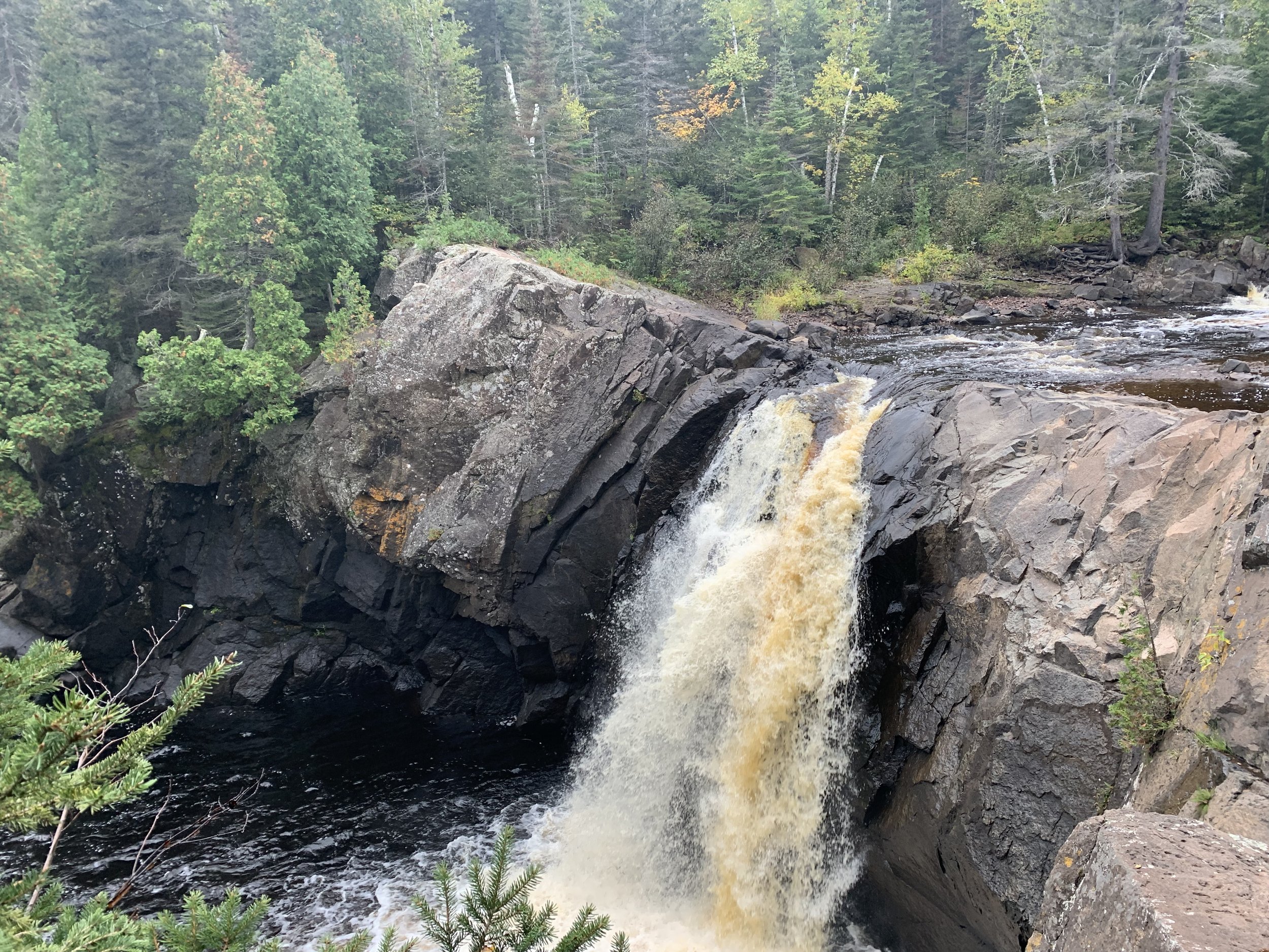
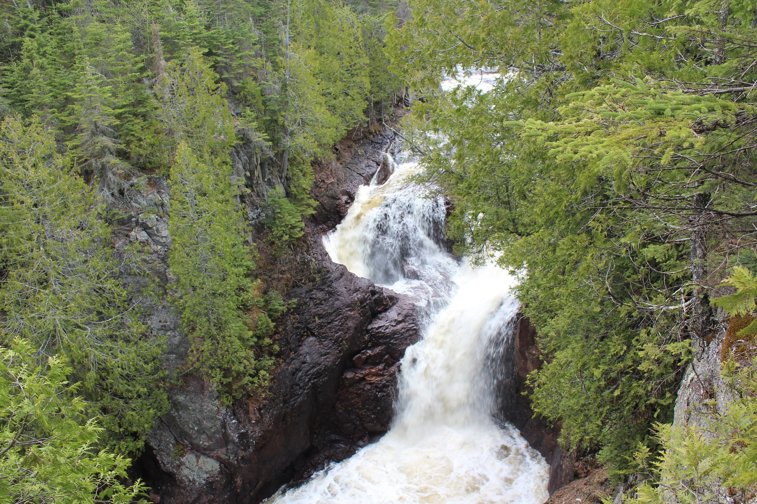
15) Temperance River State Park
MN-61: Between Mile Markers 80 and 81
Approx time from Duluth (Canal Park): 1 hour and 28 minutes

Temperance River State Park - One of five waterfalls along the Temperance River Gorge Trail
Where is Temperance River State Park?
The main trailhead for Temperance river State Park is just off of MN-61 between mile markers 80 and 81. Parking is available in large pullouts on both sides of the highway. There are bathrooms at this park, but there is not a visitor center. To find the bathrooms, go just a short distance north along MN-61 to the campground. They are located next to the ranger station for camper check-in.
This is a fun park to hike in the winter, but the trail is steep and slippery in spots. Bring poles and YakTrax to deal with ice and snow.

Temperance River Waterfall Map - waterfalls are marked with pins
Best Thing to do at Temperance River State Park
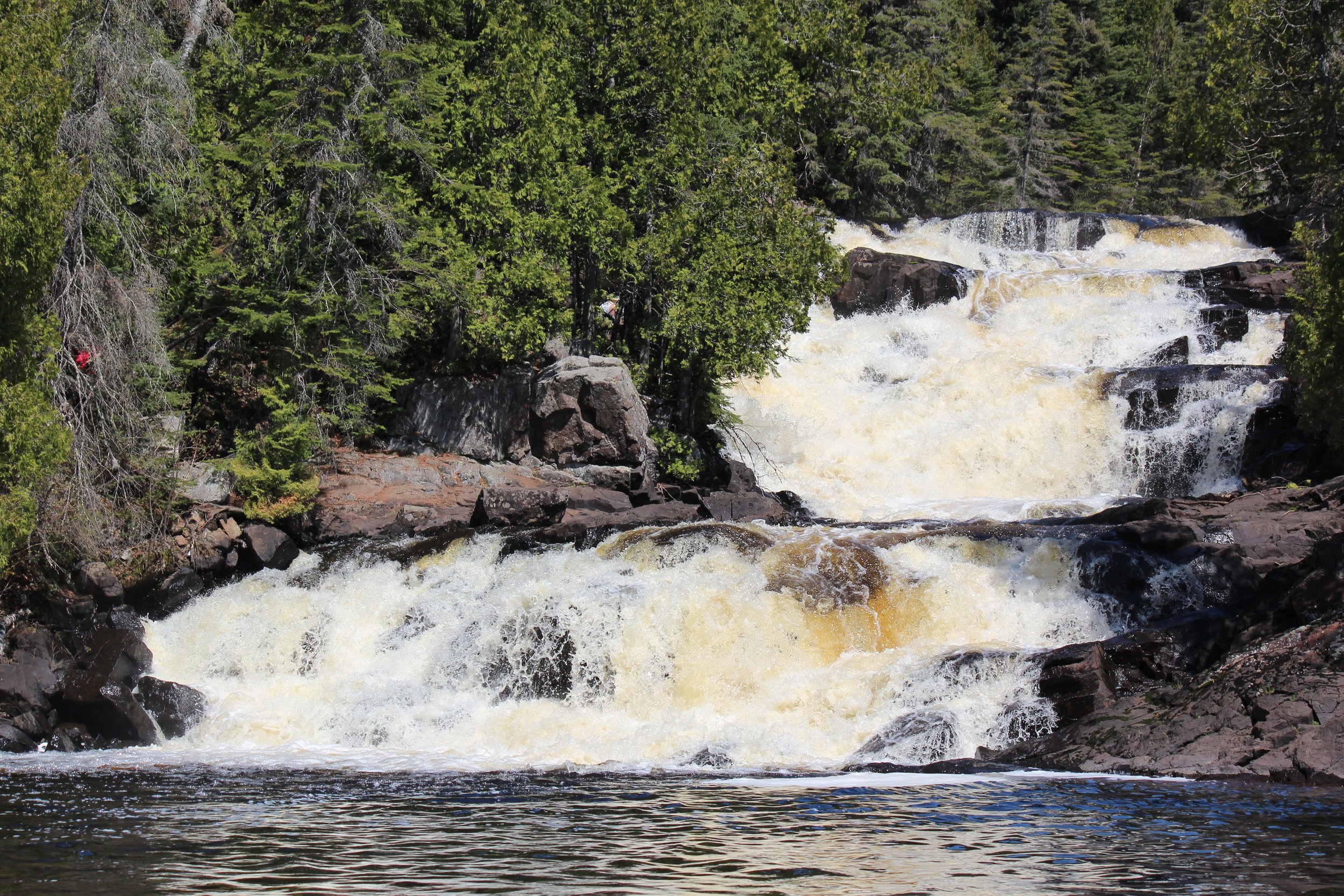
Hiking is the best option at Temperance River State Park. The official MN State Park map for Temperance River underestimates how cool this park is, and several waterfalls are not marked. Above, I’ve pinned the locations of each waterfall along the Temperance River. There are seven waterfalls that can be seen in a total hike of just over 2 miles.
Lower Falls
To get to the first waterfall (marked in brown), cross MN-61 to the lakeside. There are steps down to a bridge. The waterfall can be seen looking back towards MN-61. This is a short 0.1 mile loop hike with an elevation gain of 30ft. Here is more information on the hike to Lower Falls.

Temperance River Lower Falls
Temperance River Gorge Trail
The next 5 waterfalls are all visible along the Temperance River Gorge Hike (the first part of the Hiking Club Trail). This trail is marked in purple, however, I wouldn’t recommend the entire Hiking Club loop. I would enjoy upstream of the last waterfall and then head back down to the hiking bridge. This part of the trail out-and-back is 0.75 miles with an elevation gain of 100ft. Here is more information on the Temperance River Gorge Trail.

Temperance River Hiking Bridge
Upper Falls Trail
Cross the hiking bridge (upstream of Hidden Falls) and then go back upstream on the Upper Falls trail. The last waterfall viewed on the Gorge Trail is at a better angle on the Upper Falls trail. Keep going upstream to see Upper Falls. Upper Falls adds 1.25 miles. Here is more information on the Upper Falls Trail. The total trail distance to all seven waterfalls is just over 2 miles. This is a fantastic park for hikers of all ages.

Temperance River Upper Falls
More Information on Temperance River State Park
For more information on this park, including more pictures, detailed maps, and additional trails, refer to my post on Temperance River State Park.
16) Tofte, MN
MN-61: Mile Markers 81-83
Approx time from Duluth (Canal Park): 1 hour and 30 minutes

View from a Bluefin Bay lakeside room
Where is Tofte, MN?
Tofte is located directly along MN-61, about halfway up the North Shore. For anyone looking for a hotel, who plans to spend multiple nights and visit parks up and down the shoreline, Tofte is the city I would recommend looking for lodging in, primarily to cut down on the amount of driving each day. Tofte is also a big enough town to have a few restaurants to eat at as well.
Best Things to do in Tofte
Tofte is pretty small, so my recommendations are limited to lodging, but it is extremely close to Temperance River State Park, as well as the Lutsen Ski Resort, for those looking for a cheaper option than staying directly at the resort.
There is a relatively newer AmericInn hotel. This is a large hotel and includes an indoor swimming pool and hot tub, and is great for young families. For something fancier, check out Bluefin Bay. This is my parent’s favorite place to stay. It’s on the pricier side, but the rooms include a kitchen, which is a nice option to cut out some of the meal costs of a vacation. Also, there are multi-room options which make traveling with a large group fun. We’ve a had a couple of family reunions up here. If you stay at Bluefin, I would recommend a lakeside view on the lower level as the patios open onto the rocks on Lake Superior’s shoreline.
17) Sawbill Canoe Outfitter
MN-61: Turn off of MN-61 between mile markers 82 and 83 onto Sawill Trail (drive for another 23 miles)
Approx time from Duluth (Canal Park): 2 hours and 3 minutes

Loons are common on Minnesota lakes in the northern half of the state. Fun fact - loons do not sing in their wintering location. As the loon’s song is my favorite part of them, I feel even more blessed to hear these birds at night as I fall asleep in the summer.
Where is Sawbill Lake?
Sawbill Lake is about a 30 minute drive from Tofte. Exit MN-61 between mile markers 82 and 83 onto Sawbill Trail and drive for 23 miles. Sawbill Canoe Outfitters is located right next to the lake, and there is a parking lot to store cars during your canoe trips (single and multi-days).
Best Thing to do at Sawbill Lake
Ely is the most common spot to depart on a canoe trip into the Boundary Waters, but Sawbill Lake is the closest entry point into BWCA from MN-61. Here is the website for Sawbill Canoe Outfitters, if you need to rent any equipment, including a canoe. There are both single day and multi-day options. We’ve rented canoes for a single day and enjoyed a 3-lake, 4.5 mile canoe trip through Sawbill, Alton, and Kelso Lakes. One nice thing aspect of doing a day trip from Sawbill Lake is that there’s no “roughing it” required. Enjoy the remoteness of Minnesota’s treasured lakes, and then spend the night at Bluefin Resort or Eagle Mountain Resort (in Lutsen - keep reading). This truly can be the best of all worlds, for those looking for such an option. For more information, here is my post on canoeing at Sawbill Lake.

My brother, dad, and husband portaging the canoes from the rental to the lakeshore
18) Oberg Mountain
MN-61: Mile Marker 87 (Turn on Onion River Rd and drive 2.1 miles)
Approx time from Duluth (Canal Park): 1 hour and 41 minutes

One of several views of Lake Superior from the Oberg Mountain trail. Fall colors were from the first weekend in October.
Where is Oberg Mountain?
Oberg Mountain is another section of the Superior Hiking Trail. To get to the trailhead, exit MN-61 near mile marker 87 onto Onion River Road. This road eventually turns into a gravel road, but this is a popular trailhead, so expect the road to be in decent condition. There will be an obvious parking area about 2 miles down the road. Look for the sign that explicitly states Oberg Loop Hiking Trail. Parking is free at Superior Hiking Trailheads. I can’t remember if there is a pit toilet available at the trailhead.

Trailhead sign to Oberg Loop
Best Thing to do at Oberg Mountain
My answer for the best thing to do at Oberg Mountain is to hike the Oberg Mountain loop. But before turning onto Onion River Road there is a beautiful parking lot, staircase, and set of bathrooms. I know, that sounds really weird… It’s the Ray Berglund State Wayside. It’s pretty enough to make you want to stop. I have. Walking up the steps leads to a trail that goes along the cliffs and follows the Onion River. The Onion River clearly has some amazing waterfalls. The current trail gets nowhere near the actual river though, and there is no opportunity to fully see the waterfalls. Maybe there is a future plan to create a new trail and a better viewing platform some day, but for now, skip the curious wayside stop and continue onto Onion Road to hike Oberg Mountain.

Clearly there are some impressive waterfalls along the Onion River, but this was the best picture I was able to get in April 2024… I would skip this trail
Oberg Mountain
The Oberg Mountain Loop Trail is 2.5 miles with a a gradual elevation gain of 500ft. As far as amazing overlooks go along the North Shore, this is probably the easiest one, and the views are incredible.

Oberg Mountain Loop Hiking Map
I chose to hike this counterclockwise, so I could see Oberg Lake at the end, but I don’t think there is a real benefit of choosing to hike the loop one direction or the other. The one downside to this trail is that it is likely going to be pretty busy. There are plenty of spots to get great views of though, so I wouldn’t let that be a deterrent. Perhaps consider hiking it Monday - Thursday, or towards sunset rather than during the morning / early afternoon.

View of Oberg Lake from the trail
More Information on Oberg Lake
For more information on Oberg Lake, including more pictures and additional trail details, refer to my post on Oberg Mountain.
19) Lutsen, MN
MN-61: Mile Marker 90
Approx time from Duluth (Canal Park): 1 hour and 40 minutes

Watching the sun set from the Lutsen Resort on our first anniversary. Note that this resort burnt down in Feb 2024, but will be rebuilt.
Where is Lutsen, MN?
Lutsen is a town right on MN-61, similar in size to Tofte, near mile marker 90. There are less hotels but more cabins available for lodging. There are a small number for restaurants at the Lutsen Ski Resort, otherwise there isn’t much for food in Lutsen. Your best option for supper, until the Lutsen Resort is rebuilt, is to drive north about 30 minutes up to Grand Marais.

Lutsen Ski Resort Gondola
Best Thing to do in Lutsen?
The best thing to do in Lutsen, of course, is to ski. This is the best ski resort in the entire state. In the summer, the hill remains open. The gondola continues to operate and there are hiking trails. There is also a half mile Alpine Slide which is quite fun, especially with kids. As I mentioned above, the Eagle Ridge Resort is a nice hotel to stay in with cheaper prices during the summer months.

View of Lake Superior from the Summit Chalet on Moose Mountain
20) Cascade River State Park
MN-61: Between Mile Marker 100
Approx time from Duluth (Canal Park): 1 hour and 50 minutes

Waterfall Trail - Picture taken in April just after snow melt
Where is Cascade River State Park?
Cascade River State Park is located along MN-61 at mile marker 100. The most convenient place to park is at the pullout directly off of MN-61 just south of the bridge that crosses Cascade River. Additional parking is available at the campground, and there is another parking lot near the lake shore, just a short bit past the bridge. Bathrooms are available at the campgrounds and nearby ranger station. There is no visitor center.
Cascade River requires a MN State Park pass, which can be purchased at the Ranger Station for anyone that does not yet have a day or annual pass.

Cascade River State Park hiking map - Waterfalls are marked with pins. Parking is marked by black stars.
Best Things to do in Cascade River State Park
Hiking is the best option at Cascade River. This park has some incredible waterfalls - not because they are the biggest along the North Shore, but because they truly cascade with multiple steps, and there are just so many of them in a short distance.

Cascade River Waterfall Trail
Waterfall Trail
Start with the Waterfall Trail, which takes off directly from the MN-61 parking pullout area. This is an easy 0.5 mile loop trail with an elevation gain of only 125ft. Be sure to hike along both sides of the river and take every spur trail to see each of the waterfalls. For more information, this is my post on Cascades Waterfall Trail.

Cascades Waterfall Trail
Cascade River Trail
For anyone looking for a longer hike in this park, on the west side of the hiking bridge on the Waterfall Trail, keep walking upstream along the Cascade River Trail. There are two more smaller waterfalls about a mile upstream (take the 96 steps to stay by the river). This can be an out-and-back from here, or hike the full loop hike for 7 miles. For more information, here is my post on the Cascade River Trail.

First waterfall along the River Trail, about 0.7 miles upstream of the hiking bridge
Lake Superior Shoreline Trail
Cascade River is the only MN State Park that has a true hiking trail along Lake Superior’s Shoreline. Enjoy up to a 3 mile out-and-back along the rocks and enjoy the relaxing sounds of the waves. For more information, here is my post on the Lake Superior Shoreline Trail at Cascade River.

Lake Superior Shoreline Trail at Cascade River
More Information on Cascade River State Park
For more information on this park, including more pictures, detailed maps, and additional trails, refer to my post on Cascade River State Park.
21) Grand Marias, MN
MN-61: Between Mile Markers 109 - 111
Approx time from Duluth (Canal Park): 2 hours

Walking near the Grand Marias harbor
Where is Grand Marais, MN?
Grand Marais is also directly on MN-61, approximately between mile markers 109-111. This is a larger town, and there are several hotels, although most of them are small. There are also multiple restaurants.
Best Things to do in Grand Marais
Grand Marias is the quintessential North Shore town. I think it’s the best place to look for Lake Superior souvenirs and the harbor is a fun place to explore. My favorite place to eat is Swen and Ole’s Pizza. Their pizza is fantastic, especially after a day of hiking!
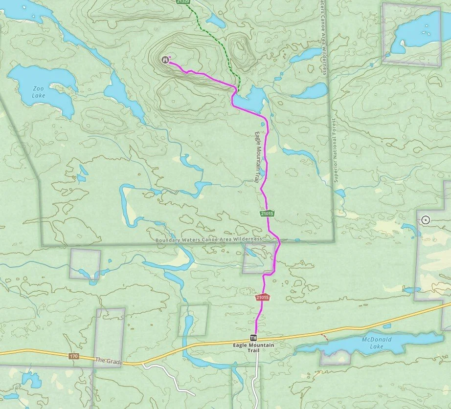
22) Eagle Mountain
MN-61: Turn off MN-61 at Mile Marker 110 (Gunflint Trail) - see directions below
Approx time from Duluth (Canal Park): 2 hours and 15 minutes

The trail to Eagle Mountain goes through the Boundary Waters Canoe Area
Where is Eagle Mountain?
The trailhead for Eagle Mountain is a bit in the middle of nowhere. Searching for “Eagle Mountain trailhead” in GoogleMaps will get you to the right spot, but there is likely no cell service at some point along the route. Writing down directions is going to be important., including to your intended destination after the hike.
After turning off of MN-61 near mile marker 110 onto Gunflint Trail, it’s going to be a 35 minute drive from here. Drive for 4 miles along Gunflint. Turn left at Devil Tracks and drive 5 miles. Turn right at Ball Club Road and drive another 5 miles. Then left on The Grade. The trailhead parking lot will be on your right in 5 miles on Bailey Creek. Parking is free, and there are pit toilets at the trailhead.
Hiking Trail to get to the top of Eagle Mountain - MN’s highest point
Best thing to do at Eagle Mountain
Minnesota’s highest point is the top of Eagle Mountain at 2,301ft. Not to be confused with the Eagle Mountain within the Lutsen Mountain Ski Resort, this Eagle Mountain is further northwest and resides within the Boundary Waters Canoe Area (BWCA) Wilderness.
This is not the typical North Shore hiking trail. There are no waterfalls and no views of Lake Superior. It’s tucked well away from anything else and resides in a wilderness area. This is going to be an extremely quiet trail. I would rank the Eagle Mountain trail as moderate to moderately difficult. It’s an out-and-back 6.5-mile trail that ascends 500ft, all in the last 1/3 of the trail, making this a bit of a kick-your-butt sort of hike.
There is no fee to park, however, because this trail enters the BWCA, it does require a permit. The permit is free, and the paperwork for the permit is available at the trailhead with instructions for how to fill it out. No prep work is needed to hike here, but do realize that this paperwork needs to be filled this out before starting to hike.

View from the top of Eagle Mountain
More Information on Eagle Mountain
For more information, including more pictures and more trail details, refer to my post on Eagle Mountain.
23) Superior Hiking Trail - Lake Walk
MN-61: Mile Marker 121
Approx time from Duluth (Canal Park): 2 hours and 12 minutes

Lake Walk section of the Superior Hiking Trail
Where is the Lake Walk?
The MN-61 turn-off for the Lake Superior Lake Walk along the Superior Hiking Trail is near mile marker 121.

Map of the Lake Walk along the Superior Hiking Trail
Best Thing to do at Lake Superior Lake Walk
The Lake Walk is the only section of the Superior Hiking Trail that is directly on Lake Superior’s shoreline. It stretches 1 mile (one-way). Although this hike is flat, because the beach is made of fine gravel sized rocks, it’s difficult to walk on. I’ve hiked it once with my husband, and being honest, our calves were burning so much after a mile that on the way back, we cheated, and walked on the road (MN-61 shoulder). This is a pretty spot though, along the lakeshore. For anyone brave enough to play in Lake Superior, this would be a great spot as there aren’t large rocks in the water. Similar information can also be found in my post on the Lake Walk.

Superior Hiking Trail Lake Walk
24) Judge C.R. Magney State Park
MN-61: Mile Marker 124
Approx time from Duluth (Canal Park): 2 hours and 16 minutes
Devil’s Kettle - Judge Magney State Park
Where is Judge Magney State Park?
Judge Magney State Park is the second-to-last MN State Park along the North Shore. There is a turn into the park from MN-61, near mile marker 124. This is a small park and due to the distance from Duluth, it’s not very busy. As a result, there is not a visitor center. There is a kiosk to pay for a parking pass for those that don’t have a pass already, if the rangers are not in the campground ranger station. There are pit toilets available in the parking lot.

Judge Magney State Park - Hiking Map to Devil’s Kettle
Best Things to do in Judge Magney State Park
The most popular thing to do in Judge Magney is to hike to the park’s two waterfalls. This is a 2.0 mile out-and-back trail with an elevation gain of 400ft. This trail includes 175 steps as the path nears the waterfalls. These waterfalls are named. The first waterfall is Upper Falls, which doesn’t make a lot of sense to me as it’s downstream from the second falls known as Devil’s Kettle. Devil’s Kettle is a pretty impressive split waterfall where half of the water tumbles out of sight down a deep hole. For more information, here is my post on Devil’s Kettle.

Judge Magney State Park - Upper Falls
I’ve also hiked the Superior Hiking Trail between Kadunce River and Judge Magney (which includes the Lake Walk mentioned above). It’s another nice section of the trail, but beware that this is supposedly one of the hardest sections of the SHT. The trail (one-way) is 9.5 miles and has an elevation gain of 1900ft. For anyone looking for a good trail to train on for a big hike (yes, training for hikes is a thing…), this section is worthy. For more information, here is my post on the Kanduce River SHT Trailhead.

Kadunce River along the Superior Hiking Trail
More Information on Judge Magney State Park
For more information, including more pictures, detailed maps, and more trail reviews, refer to my post on Judge Magney State Park.
25) Grand Portage National Monument
MN-61: Mile Marker 144
Approx time from Duluth (Canal Park): 2 hours and 38 minutes

Entering the Depot Area of Grand Portage National Monument
Where is Grand Portage National Monument?
Turn off of MN-61 near mile marker 144 to find Grand Portage National Monument. There are two primary places to park. The first is at the Heritage Center, which is like a visitor center. The second place to visit is the Depot Area. There is a short 0.1 mile trail that connects the two locations for those that would prefer to walk.

Map of Grand Portage National Monument. The Red Star marks the Heritage Center. The Blue Star marks the Depot Area.
Best Things to do at Grand Portage National Monument
In the summer months, the Depot Area is open and is turned into a piece of interactive history with volunteers dressed up in character from the 1780s during the time of the fur trade between the British and the Objibwe Native Americans. Just outside of the Depot are depictions of how the Objibwe lived.
One of my favorite things to do at any National Park or Monument is to ask a Park Ranger for a Junior Ranger book. (These books can be found at the Heritage Center.) We have fun working through the various activities together as we explore the park. Remember to return to the Heritage Center after finishing the book to get your Junior Ranger badge. No worries if extra time is needed. There is an address on the back of the book to mail it in. They will return the book and send a badge. For more information, this is my post on Grand Portage National Monument.

One of many volunteers bringing history alive inside the Depot Area of Grand Portage National Monument
26) Grand Portage State Park
MN-61: Mile Marker 150
Approx time from Duluth (Canal Park): 2 hours and 44 minutes

Grand Portage State Park High Falls
Where is Grand Portage State Park?
Grand Portage State Park sits at the very top of Minnesota, right on the US/Canada border. Turn off of MN-61 just before the border crossing at mile marker 150. Grand Portage State Park shares the Pigeon River with Canada’s Pigeon River Provincial Park. There isn’t a way to cross the river other than at the MN-61 bridge, using the official border crossing. This is a free park to enter and no MN State Park pass is needed. There is a nice bathroom and a small visitor center next to the large parking lot.

Grand Portage State Park hiking Map - The red star designates parking. The black star shows the US/Canada border crossing.
Best Things to do at Grand Portage State Park
There is a bit of waterfall controversy in Minnesota. The tallest waterfall is either High Falls in Grand Portage State Park (which is the tallest waterfall by height) or High Falls in Tettegouche State Park. The question is if High Falls on the Pigeon River counts, as it is shared by Canada. This doesn’t really matter to a hiker though – High Falls at Grand Portage is amazing! The entire 1.5 mile out-and-back trail is wheel chair accessible (except that two of the three viewing platforms have a small number of steps), and the trail only gains 50ft in elevation. This is a really easy trail so all hikers can experience our state’s most impressive waterfall. For more information, here is my post on Grand Portage’s High Falls.

Grand Portage’s High Falls partially frozen in January
For anyone looking to get off of the paved trail and enjoy more solitude in the orthwoods, keep going to Middle and Upper Falls. This trail adds 3.5 miles to the High Falls trail and 700ft in elevation. This trail is likely going to be wet, muddy, and perhaps a bit swampy in spots. I would recommend not hiking the trail as a loop, but rather do it as an out-and-back to Upper Falls, and turn back after seeing Middle Falls, to avoid as much of the mud as possible. For more information, this is my post on Upper and Middle Falls.

Grand Portage’s Middle Falls
More Information on Grand Portage
For more information, including more pictures, detailed maps, and more trail reviews, refer to my post on Grand Portage (which includes the National Monument and the State Park).
Kakabeka Falls
For anyone that has travelled all the way up to Grand Portage State Park, it might also be helpful to know that the Kakabeka Falls are located just 28 miles across the Canadian border, near Thunder Bay. This waterfall is Ontario’s second tallest waterfall (after Niagra Falls). Make sure to plan ahead and bring required paperwork to get back into the United States.

Kakabeka Falls
More from www.NatureImpactsUs.com
To see more of my posts, click on any pin. There will be a hyperlink to my post on that particular hike.