
Wilke Glen and Cascade Falls in Osceola, Wisconsin
If you enjoy my posts, please consider signing up below to get email notifications of my latest posts. I will not share your email.

A Beautiful Location for an Afternoon Stroll
If you are looking for a place to have a beautiful afternoon or evening stroll, I would suggest heading across the state border into Osceola, Wisconsin to walk the Cascade Falls Trail. At 0.6 miles (out and back), this is an easy walk minus some steps at the beginning and end, which passes a moderate sized waterfall, features enchanting boardwalks, and ends at the St. Croix River. Head back to the trailhead the way you came to continue an easy walk, or if you are up for a challenge, take the Eagle Bluff Trail back. This results in a 0.3 + 0.8 mile loop back to the trailhead. The Eagle Bluff Trail ascends up a short but steep hill (~200ft) along a dirt path.

Beautiful wooden walkways along the Cascade Falls.
Planning Your Trip
Reference the below interactive map for places to hike within 2 hours of Minneapolis and St. Paul, MN. Use two fingers on the map to zoom in and look around. The trailhead to the Wilke Glen and Cascade Falls is included. Check out my other posts to find additional blogs of these hiking locations.
Location and Entrance
To get to the Wilke Glen and Cascade Waterfall, which is along the Cascade Falls Trail, enter “Wilke Glen and Cascade Waterfall” into Googlemaps, or just head into downtown Osceola, Wisconsin. This trail is a city trail, and there is no entrance fee. The easiest place to park is along Depot Road to the west of South Cascade Street.
You will then walk along Cascade street, under the bridge, and follow the trail towards your left, which will bring you back to North Cascade Street. You are going to walk towards Sodie’s Cigar Shop, but you don’t need to enter the building. Go to the left of it, and there will be a series of wooden steps to head down, which takes you to the falls.

Park along Depot Road and walk towards South Cascade Street. Go under the bridge and then follow the trail marked at #1. The trail will bring you back to the road for a moment. Look for a series of wooden steps near Sodie’s Cigar Shop (#2). The steps will take you to the Wilke Glen and Cascade Waterfall. Continue along the trail to the St. Croix River (#3). Head back the way you came for the easy stroll version, or follow the Eagle Bluff Trail for a more adventurous way back. The dots in the map indicate 0.25 mile increments.
Time Needed and Other Things to Know
It took the boys and I about 40 minutes to hike both the Cascade Falls Trail and return via the Eagle Bluff Trail ( ~1.1 mile loop). If you are just walking the Cascade Falls Trail out and back, your hike will only be 0.6 miles, and I would think you could do this in 30 minutes, unless you plan to spend extra time at the falls or the river.
Another useful piece of information is that there is a Dairy Queen right at the intersection of Depot Road and Cascade Street, just across Cascade Street from where you parked. I’m not above bribery as a mom to be able to get out and hike, and usually offering a blizzard (which I also love) is the best loved reward by my kiddos. This Dairy Queen is conveniently located!

This map is present at the top of the steps on the deck near Sodie’s Cigar Shop
Hiking the Wilkes Glen and Cascade Falls
Just past the bridge along Cascade Street, you will turn left and follow the trail before briefly returning to Cascade Street. The view of the Osceola Creek is pretty from the trail.

Osceola Creek
It’s a little confusing when the trail spits you back out onto Cascade Street before you’ve found the waterfall. Don’t fret here, just keep looking towards your left. The next building you come to is Sodie’s Cigar Shop. You don’t need to go into the store, just walk up towards it. There is a deck, and on the deck, a map indicates the below trail. Walk towards the map to a series of wooden steps to find your way to Wilke Glen and Cascade Waterfall.

Stairs down to the waterfall from Sodies Cigar Shop

Keeping your distance while enjoying the falls in the era of Covid-19. I laughed at this sign and had to take a picture. It was not busy at all along this trail as we only saw one other family.
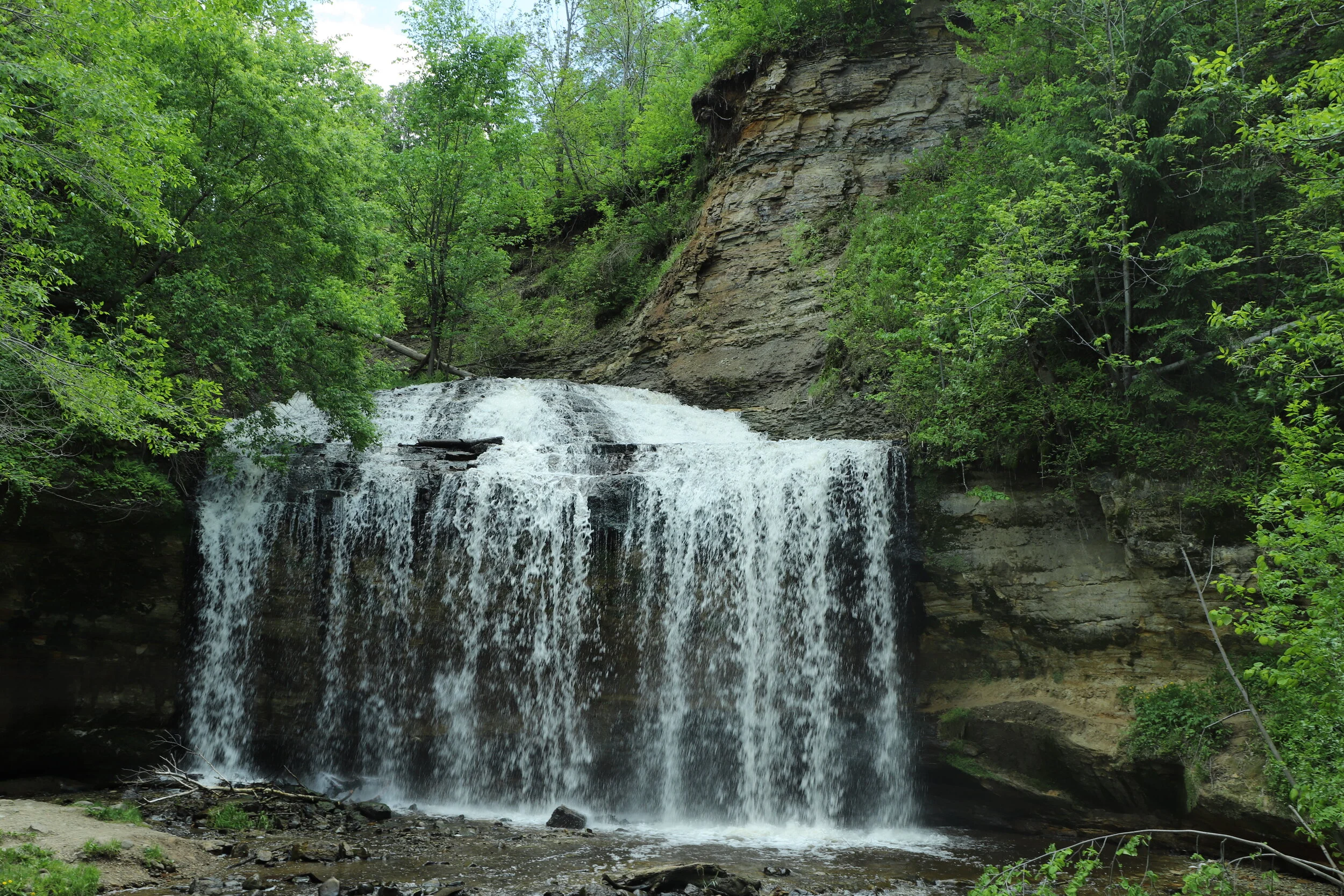
Just a little bit after the steps, you will find yourself at the falls. There is a little beach-ish area, and you can walk right up to and behind the waterfall.
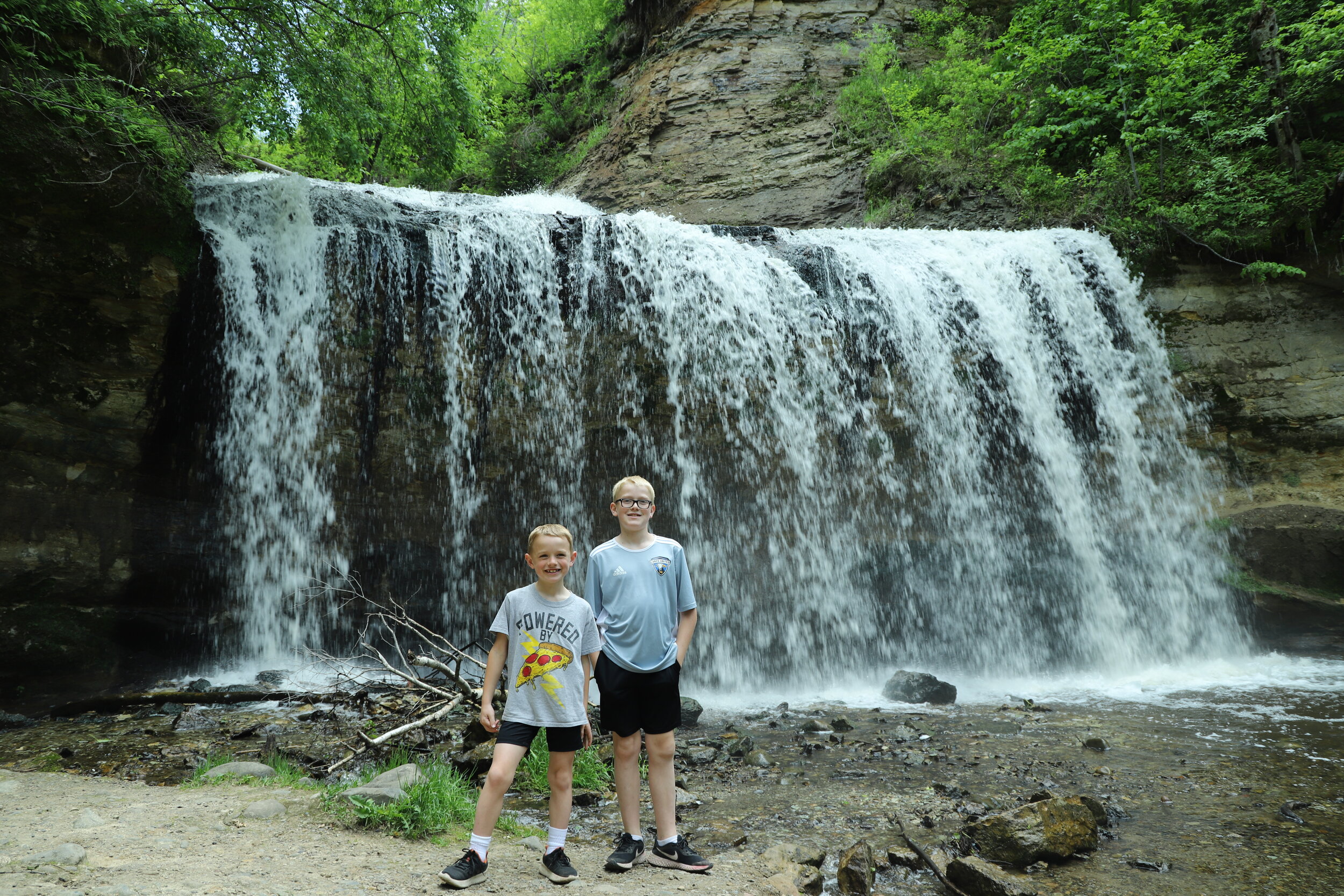
Wilke Glen and Cascade Waterfall
You could head back and get ice cream after the falls, but I would recommend walking a little further to the St. Croix River. The trail is really well kept with cute board walks along the Osceola Creek.

To keep following Cascade Falls Trail to the St. Croix River, head over the bridge in front of the waterfall.
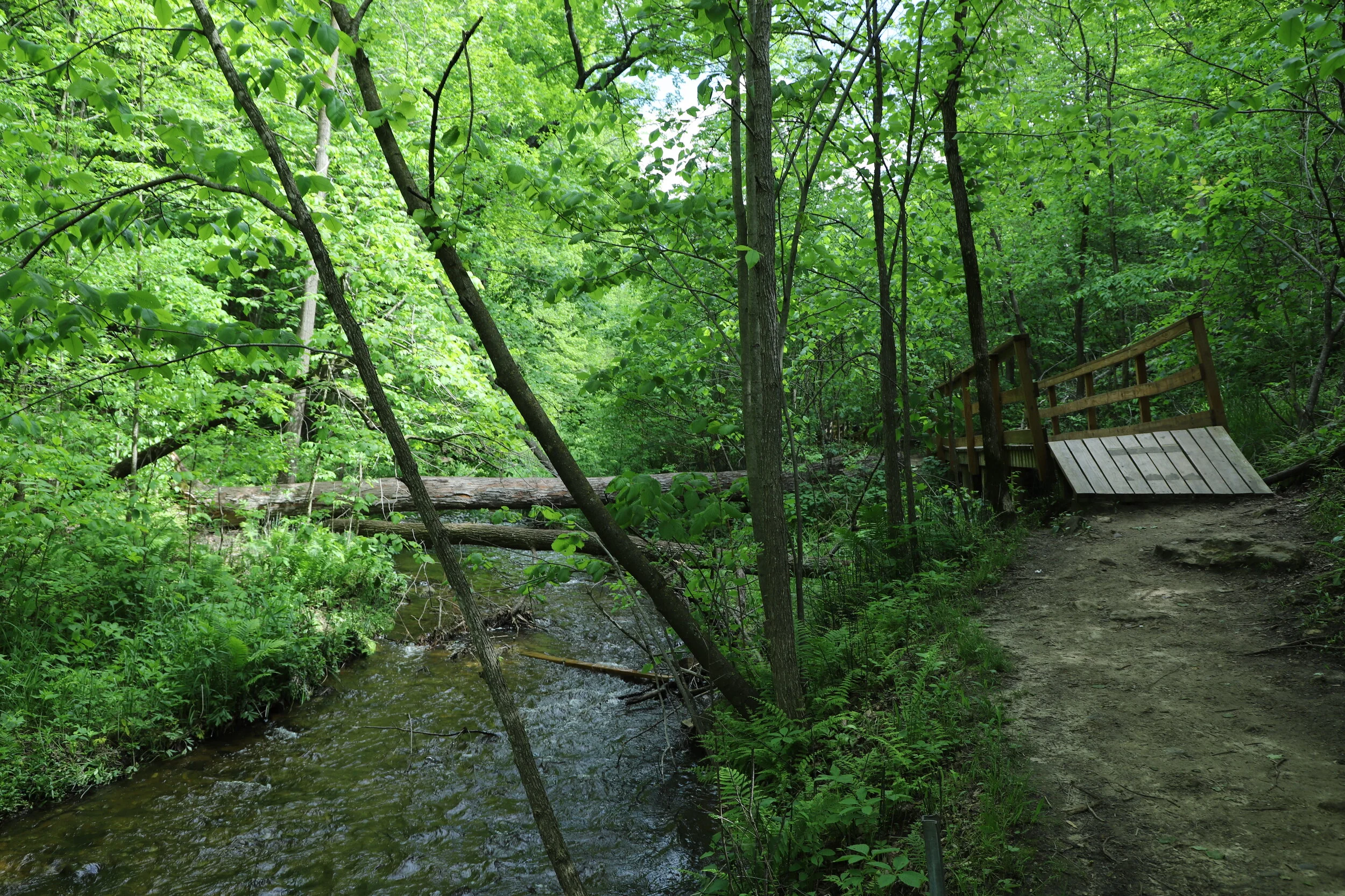
Cascade Falls Trail along the Osceola Creek
There are several bridges and board walks along the way to the St. Croix River. I was impressed by this trail the whole way to the river. For just a city park trail, it was very well maintained.

St. Croix River at the end of the Cascade Falls Trail
The Cascade Falls Trail ends at the St. Croix River. The easiest way back is to return the way you came, but I prefer loop hikes and a bit more adventure. Walk a short distance along the river and then Eagle Bluff Trail loops back to the trail head. This trail starts off with a pretty steep section, but it’s very short, and then you are on top of the hill, and the rest of the way back is easy.
Other Nearby Attractions
If you want to keep hiking, William O’Brien State Park is 11 minutes to the south and Interstate State Park is 12 minutes to the north (both Minnesota State Parks that require admission or an annual park pass to enter).
More from www.NatureImpactsUs.com
There are posts linked to each pin below.