
St. Croix River along the Riverside Trail
If you enjoy my blogs, please consider signing up below to get email notifications of my latest posts. I will not share your email.

Step into Nature
William O’Brien State Park is a great place to feel like you’ve gotten out of the city with only a short commute of 45 minutes from either Minneapolis or St. Paul. This park has a lot of diversity in habitat in just a few short miles, and if you are looking to hike hills, this is the place to go.

William O’Brien State Park
Planning Your Trip
See the below interactive map for additional places to hike in Minnesota and nearby neighboring states. Use two fingers on the map to zoom in and look around. Links to blogposts for each pin are included.
Location and Entrance
William O’Brien State Park sits along the St. Croix River. You will enter the park from MN-95 (otherwise known as St. Croix Trail), and there are two main parking lots (see above pin locations).
Googlemaps assumes you plan to park at the Visitor Center. However, if you want to hike the Riverside Trail there is a closer parking lot to that trail. Enter the state park, but do not follow signs to the visitor center. Instead, take the side road that goes back under MN-95. You will see a general parking area near Lake Alice. There is also a nice picnic area with a covered pavilion at this second parking lot. A one-mile trail connects the two parking lots - If you’ve got kids though, I would move the car if you plan to spend time at both sides of the park and save your steps for better sections of the park.

One other parking lot comment - if you are parking at the Visitor Center, the trailheads aren’t very well marked. If you plan to go to the railroad track tunnel, start by walking towards the visitor center. The trail will be on the right-side of the building. If you want to go to the beaver dam, you can either walk towards the visitor center and turn left into the meadow, or start off on the trail that leads directly into the meadow. The distances are about the same to the dam.

Railroad Tunnel on the Wetland Trail
Time Needed and Other Things to Know
William O’Brien is a Minnesota State Park, so you will either need a day pass or an annual MN State Park parking permit. It doesn’t take too many days of visiting MN State Parks to equal an annual pass. Consider splurging and buy the annual - there are so many great MN State Parks. The passes go off of a rolling 12 months, and you’ll likely feel like you got your money’s worth.
Pay attention to your footwear. Unless you are just sticking to the Riverside Trail which is a harder trail surface, bring older shoes that can get a little muddy.
This is a big park with a lot of trails to choose from. My favorite is the Riverside Trail.
Hikes at William O’Brien State Park

The William O’Brien State Park map lists mileage of various trails, but the trail naming was confusing to me the first time I visited. To get to different parts of the park, you need to go from part of one loop to parts of other loops. I’ve added some color coding to the map to help better describe this park. The parking lots are circled in red.
Riverside Trail
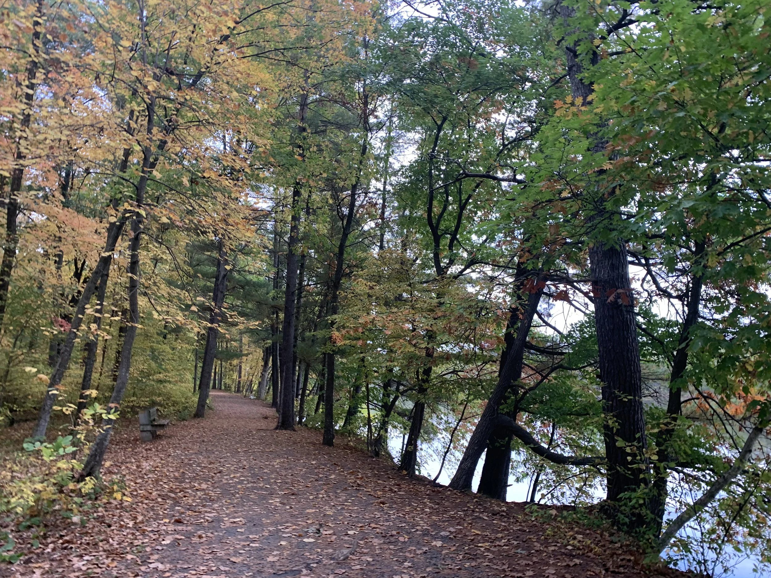
Usually my favorite trail in a park is the one that runs to some far-off destination that less people know of, but at William O’Brien, it’s the opposite. I love the Riverside Trail even though it’s a flat, hard-surface, well-trod path. This is the blue 1.6 mile loop on the map.

Riverside Trail
The Riverside Trail follows along the St. Croix River for the first half of loop. There are a few points along the trail where it dips close enough to the river to throw in rocks, or more likely sticks as there are no large rock piles. The points in the trail close to the river are near the Group Campsite.

Riverside Trail along the St. Croix River
Riverside Trail along the St. Croix River

Riverside Trail along the St. Croix River
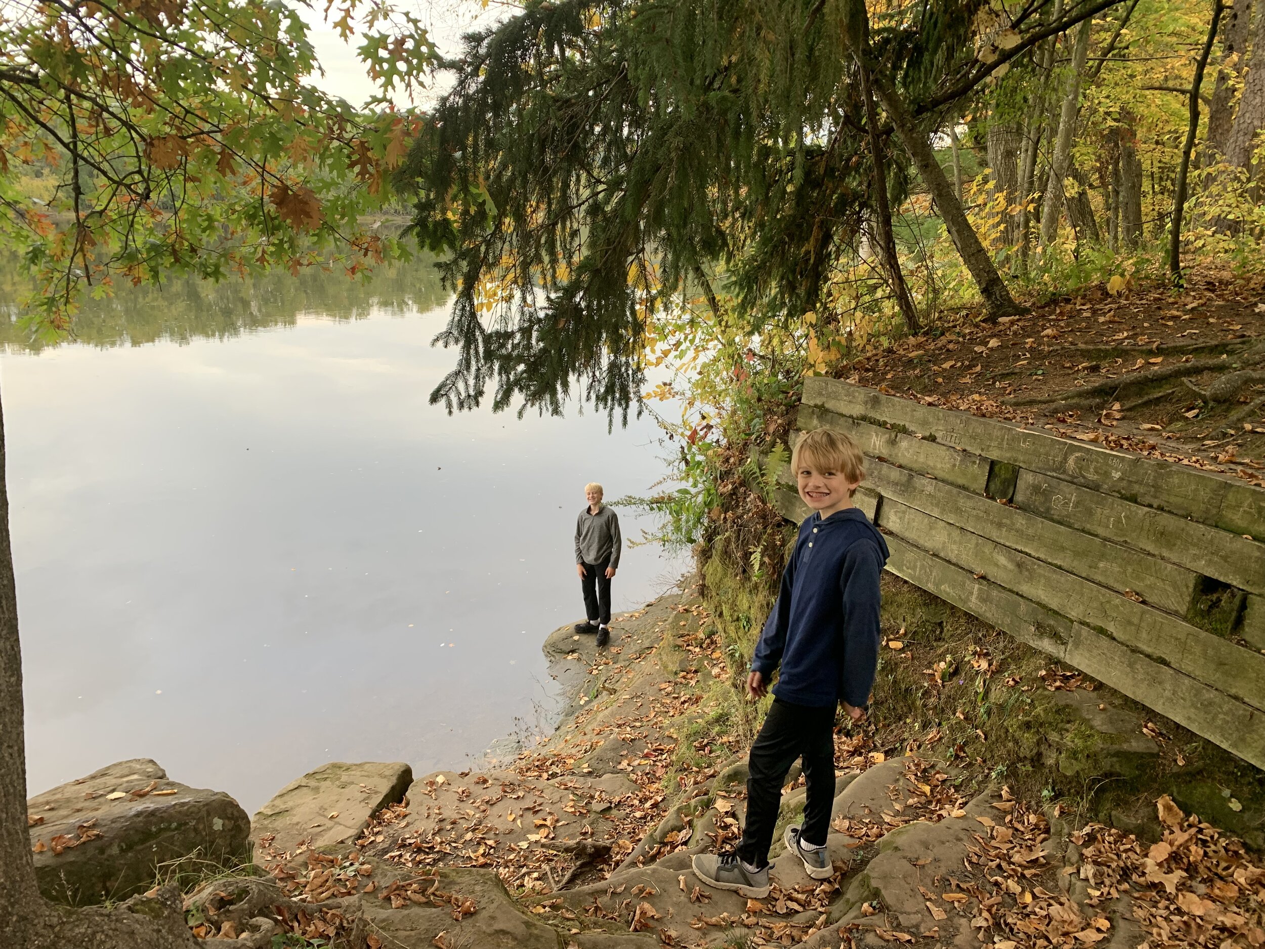
My other favorite part of the Riverside Trail is this tree, shown below. Weird to have a favorite tree at a state park? Maybe not once you’ve seen it too. It’s been a fun place to take pictures over the years. You will find it near the same group camp site mentioned above, and it is just off of the trail.

Riverside Trail

2021 Family Pictures on the Riverside Trail
The trail past the river is not that exciting. In fact, if no one is in the group camp site, you can shorten your hike by cutting across to the road.

Non-river facing portion of Riverside loop trail
At the end of the loop near the parking lot is Lake Alice. I didn’t think that much of it in the summer, it’s just a small lake that is overrun by a lot algae in the summer months, but coming back in the fall, it was quite stunning. Fall is my favorite time to hike in MN.

Lake Alice from the Riverside Trail

Lake Alice near the parking lot at William O’Brien State Park
Connecting Trail

Adding the map here again so you don’t need to scroll up. The connecting trail is orange. Although the map only says 0.5 miles, remember that this is not where the parking lot is along the Riverside Trail. You need to add another 0.5 miles to get to your car. This connecting trail follows along the road. There’s nothing special to see, so I would recommend just moving your car to get to the other part of the park.
Beaver Lodge
My second favorite hike in William O’Brien is to the Beaver Dam. There is a specific trail called Beaver Lodge Trail, but you don’t actually need to hike it to see the dam. The best place to see the dam is where the yellow and purple trails meet, right next to the trail labeled Beaver Lodge Trail.
My GAIA hiking app disagrees with the MN state park mileage back and forth to the dam. The map (yellow trail) shows it as 1.2 miles, but when I walk it, GAIA says it’s 1.7 miles. Not a big difference to an adult, but that difference may matter for littler legs.

Beaver Dam
This bench is right at that intersection of the yellow and purple trails, so you don’t need to walk the entire Beaver Lodge Trail, if you are looking for a shorter hiking option.

Beaver Dam
Instead of an out-and-back to the dam, there are two other options to make it a loop back, with similar hiking distances.
Wetland Trail

If you are looking for a longer trail, the Wetland trail is good option. On the above map, the Wetland Trail is indicated by the purple trail. The entire loop is 3.5 miles long. If you are just looking for the railroad tunnel, you can shorten the hike to an out-and-back 2.0 mile hike. The tunnel is at the northern intersection of the pink and purple trails.
If you are in this part of the park, remember to wear shoes that can get muddy as like the name of the trail implies, the ground is likely to be wet. To get to this trailhead, walk to the visitor center and go towards the right of the building. As you hike, you will soon seen cabins that can be rented from the park.

William O’Brien cabins
As the trail name implies, you will walk past a lot of wetlands, and again, the ground can be pretty soggy and squishy here.

Wetland Trail
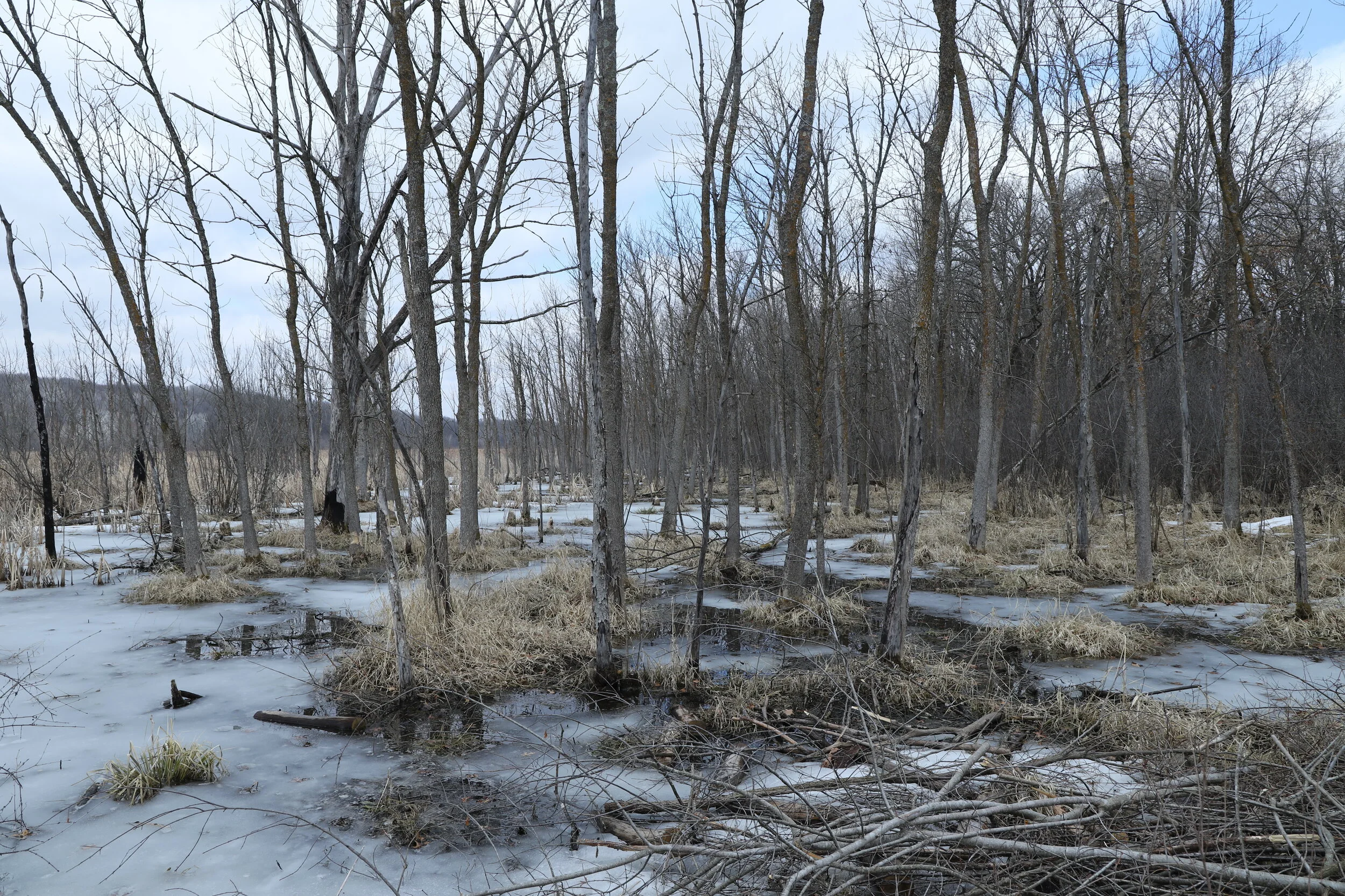
Wetland Trail
Eventually the trail leads to the railroad tunnel - the railroad passes above. This is 1 mile from the parking lot. The fastest way back is to turn around here. If you complete the purple to yellow trails to get back to the parking lot, it is another 2.5 miles from the tunnel.

Railroad tunnel on the Wetland Trail
At the southern intersection of the purple and pink marked trails, the trail crosses over the railroad tracks.

Crossing the tracks on the Wetland Trail

Southern part of the Wetland Trail
The southern part of the Wetland Trail is also wetlands and looks similar to the northern part of the loop. If you go the entire loop however, you will also get to see the beaver dam.

Southern part of the Wetland Trail
Woodland Edge Trail

The Woodland Edge Trail is the pink trail. If you are hiking this loop, expect a 4.5 mile hike. It’s the same trail to the tunnel, and then the habitat completely changes again into a forest. The trail was muddy here when we hiked it, but I assume this was purely from the snow and that during the summer months it would be dry. If you are up for a longer hike, this was a nice walk. Nothing stands out to me though along this part of the trail as something amazingly different than other forests I’ve wondered through however.

Woodland Edge Trail

Woodland Edge Trail

Shelter along the Woodland Edge trail
Prairie Overlook Trail
The Prairie Overlook Trail is the green trail on the map. If you combine this with the Woodland Trail, expect a 6 mile hike. This represents the entire MN Hiking Club Trail for William O’Brien, and it’s one of the longer Hiking Club Trails. If you don’t know what the MN Hiking Club is, there’s a booklet you can buy at the visitor center and you collect park stamps and passwords to earn free nights at MN State Park campgrounds. The passwords are hidden on a sign somewhere along the trail, and the trails are marked as a shaded region on the map.
The Prairie Overlook Trail has a lot of large hills, and it’s quite a few miles into your trek, so expect a good workout on this one. Beautiful though. I really like this part of William O’Brien, and it’s in a less-traveled part of the park.

Hills along the Prairie Overlook Trail

William O’Brien Visitor Center
Other Nearby Attraction
Since you bought that MN park pass for at least the day, I would suggest from here heading over to Interstate MN State Park to view the glacier potholes, which is just 16 miles north along the St. Croix River. The potholes are a fun place to explore, especially if you have kids, and there isn’t much walking required.
Another nearby suggestion is to head to Osceola, WI, to see the Wilke Glen and Cascade Falls. The waterfall is an out-and-back 0.6 mile hike, or you can turn it into a 1.1 mile loop.
I have blogposts for both of these locations. See the googlemap at the beginning of this article for links, or search through the map below.
More from www.NatureImpactsUs.com
There are posts linked to each pin below.