

St. Croix River at Afton State Park
If you enjoy my blog, please consider signing up below to get email notifications of my latest posts. I will not share your email.

Secluded Forest
Despite the close proximity to both Minneapolis and St. Paul (40 and 30 minutes respectively), Afton State Park is tucked away into a protected forest along the St. Croix River, and except for one spot where you can see the chair lifts of neighboring Afton Alps Ski Resort, there are no signs of city development.

Neighboring Afton Alps Ski Resort
This is one of the busier state parks near the Twin Cities metro, however, the park is large, and after you get a mile or so away from the visitor center, the number of people you will cross paths decreases quickly. If you are looking for a park with fewer people though, I would suggest Wild River State Park.
Planning Your Trip
See the below interactive map for additional places to hike in Minnesota and neighboring states. Use two fingers on the map to zoom in and look around. Links to blog posts for each pin are included.
Location and Entrance
There is one entrance into Afton on 70th St and one place to park next to the visitor center, making this an easy park to navigate. This park requires an entry fee unless you have an annual MN State Park Pass. I would recommend getting the annual pass as it is based on a rolling 12-months from when you purchase it, and it doesn’t take too many days of hiking to make up the cost of the pass. You can purchase the annual pass at any of the MN State Parks.

Afton State Park Visitor Center
This post will first focus on hikes within Afton State Park. At the end, I will include one additional nearby hike to Vermillion Falls. It is also marked on the above map.
Time Needed and Other Things to Know
I would recommend planning to spend 2-4 hours at Afton State Park. In four hours, you can cover about half of the park. If you are looking for a spot to picnic, there are some nice tables along the St. Croix River about 0.75 miles from the Visitor Center.

Picnic area along side the St. Croix River at Afton
Hikes at Afton State Park
Afton has a great state park map that is clearly marked with mileage. The trails themselves are pretty well marked as well. It’s a little bit confusing down by the picnic area (along the yellow trail), and hiking in the wintertime, I missed the Trout Brook Loop trail (orange) and instead turned too far to the right and headed back up the hill to the prairie. The trail intersection is more obvious in the spring, summer, and fall when you can see the physical trail.

Note that I’ve added random colors to the map to describe the trails as a lot of them do not have names. This is so I can show you where I’m referring to on the map. These colors are not present on the trails at Afton.
Picnic Trail
If you have young children and are looking to get out of the house without too long of a hike, I would suggest simply walking to the picnic area (follow the yellow trail marked on the map above). Out and back, this trail totals 1.5 miles, and includes water, which is great for skipping rocks or throwing sticks in the stream. And there are picnic tables and benches nearby for the adults to sit on while you watch your kids play. If you want a little bit of variety on your walk back, follow the red trail (on the map above). This does not add any extra mileage.

St. Croix River visible near the visitor center
First thing to note about this trail is that there is one section with steps without an easy way to bypass them. I would skip the stroller and use a front or back carrier for younger kids.

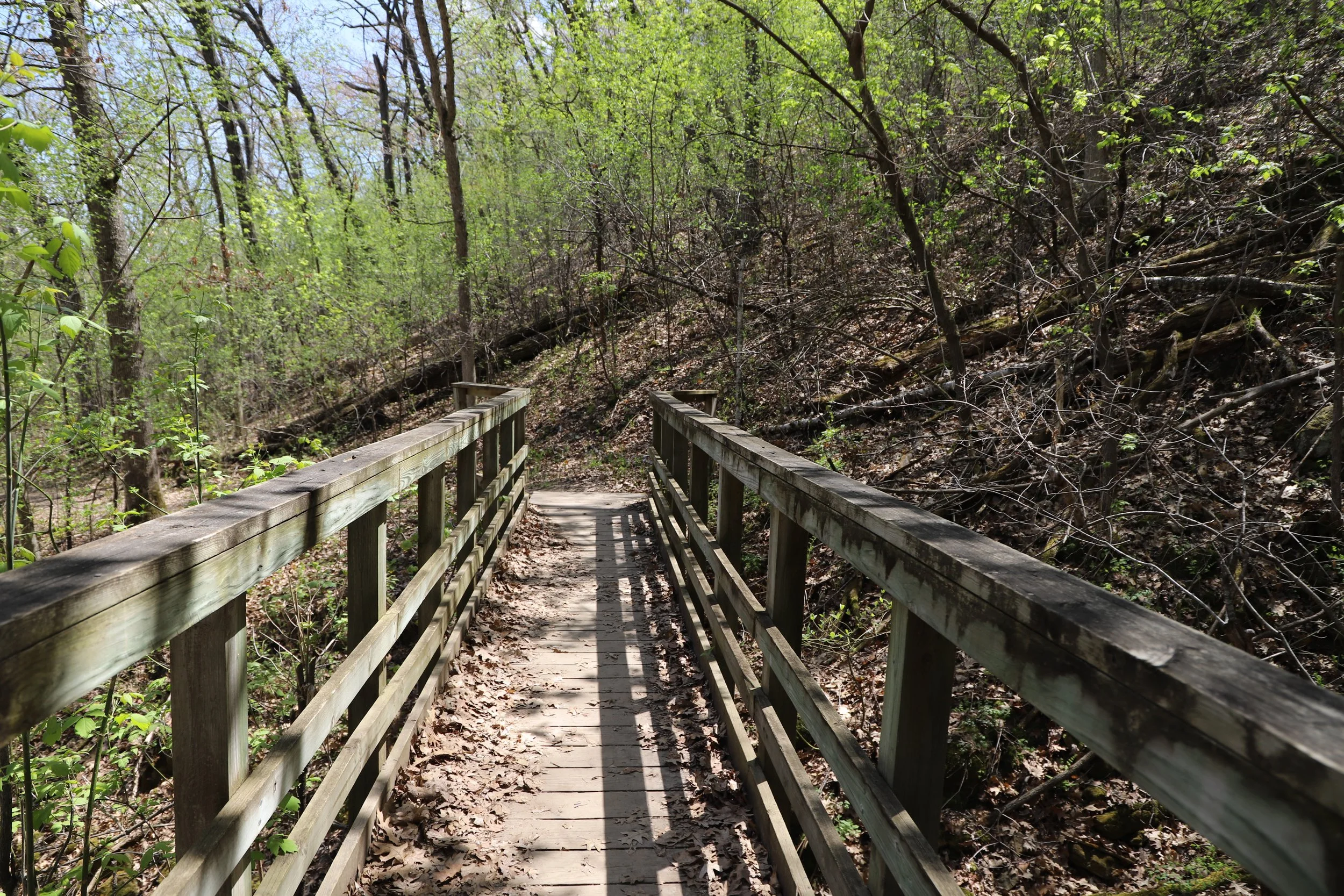
If you are the trail I have marked as yellow, you will cross over the stream on this bridge. If you follow the trail I marked as red, you will be down by the stream.

Bridge near the picnic area at Afton State Park
After the bridge, you can see why this is a fantastic place for kids to play. There is a stream, forest, river, and a beach all right next to one another.


Beach along the St. Croix River at Afton State Park
There is sand to play in as well as rocks to throw, with picnic tables nearby.

Beach along St. Croix River at the picnic area in Afton State Park
If you hike the trail I marked as red, you will see the same bridge as shown above, but from below.

This trail gets right next to the stream. You can see this is a beautiful hike in the winter as well.

If your kiddos still have energy, but perhaps you don’t, before heading back to your car, keep walking to the prairie trail that I have marked in purple. This small loop is about 0.5 miles, and the grassy trail is perfect for running. My other favorite part of prairie trails in the summer is to walk slowly and see if I can find any garden spiders sitting on their beautiful webs.

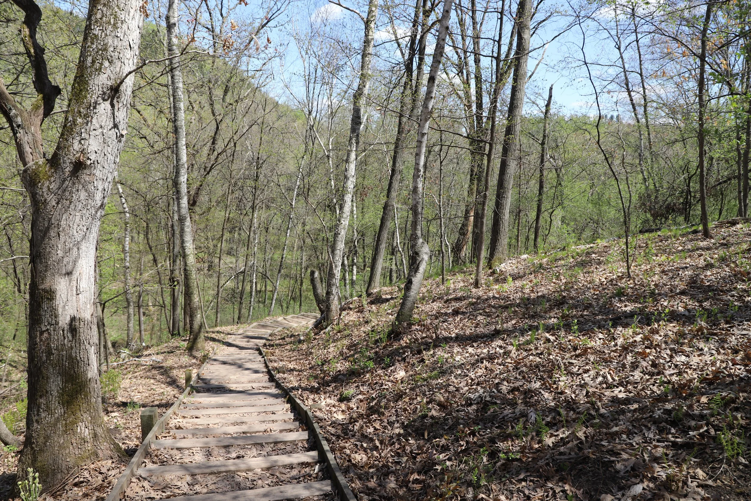
Backpacking Campground Loop
If you are looking to get out of the crowds but still keep your hike on the shorter side, a nice option is the loop I have marked in blue, which will take you away from the river, up into the forest, and past the backpacking campground, which is a pretty spot. The sites are a little less secluded than I have observed in other parks, but the hillside is cool. Of course I was focused on my kids during this hike who were slightly complaining about having to walk up a hill, and didn’t think to take any pictures at the campground. The trail is 3 miles (including the mileage along the yellow and/or red trails) and the elevation is only about 390 ft, but you know, children drama…

Like I said…

Trail near backpacking campground at Afton
Here you can see that this is a longer hill, but not terribly steep.

Trail near the backpacking campground at Afton
Prairie Loop
The next trail I have highlighted in green on the map is the prairie loop, which is the green loop. To get to, from, and around this loop (green, yellow and/or) will take you about 4.5 miles, and there is an elevation gain of around 425 ft. Honestly, this wouldn’t be the trail I would recommend hiking. If you are going up to the backpack campground and want to add a little bit to your hike, then this is a good option, or if you are hiking to the Trout Brook Loop, you could walk this loop as well. But on it’s own, it isn’t my favorite part of Afton.

Shelter along the Prairie Trail
It’s a really big meadow marked with trees on the edge and not a lot of shade along portions of the trail.

Prairie Loop at Afton State Park

Prairie Loop at Afton State Park
On the way to and from the loop, the trail does get closer to the stream, which is more interesting.


Trout Brook Loop
My favorite part of Afton is the Trout Brook Loop (marked in orange in the map above). There is not a quick hike though. This keeps the crowds away, which adds to its appeal, but expect a hike around 7 miles no matter which way to you use to get to the loop and return.

Trout Brook Loop at Afton State Park
There is one big hill on your way to the loop that you will have to walk back up on your return. It will be worth every step.

Trout Brook Loop
There are so many great places to play along this stream. Obstacles to dare yourself to cross over, minnows and tadpoles to observe, sticks to throw in and watch the current take downstream.

Trout Brook Loop
Trout Brook Loop
Trout Brook Loop
Never too old to play the stick game when you cross over the perfect bridge.

Trout Brook Loop

Trout Brook Loop
Hikes Near Afton State Park
Vermillion Falls
13 miles from Afton State Park is Vermillion Falls. To find the trailhead, type “Vermillion Falls Park” into GoogleMaps (also marked on the pins in the map at the top of this post). This is only a 0.3 mile out and back hike, so on its own, Vermillion Falls is likely not worth the outing. But it makes a short tack-on hike when you’ve spent the day at Afton.
Below is the trail map from GAIA. The blue dot simply indicates 0.25 mileage increments.

Park in the main parking lot. There are a few trails here, but it’s easy to keep your orientation. Just walk towards the river.

Vermillion Falls
This is a pretty waterfall and on the larger size for waterfalls near Minneapolis and St. Paul. I also thought the trail was rather charming. Being honest though, there is a factory smell that dilutes the typical magic of a waterfall.

Trail to Vermillion Falls
The trail has gnarly tree roots and large rocks that form the steps. I liked the trail and the nearby stream. It’s just the smell that was a bit off.

Trail to Vermillion Falls
The trail also goes past some small caves.

Trail to Vermillion Falls
Other Posts from NatureImpactsUs.com
Posts are linked to each pin below.