

Great River Bluffs MN State Park - Viewpoint from King’s Bluff Overlook
If you enjoy my blog, please consider signing up below to get email notifications of my latest posts. I will not share your email.

North Overlook Viewpoint at Great River Bluffs State Park
Amazing Views of the Mississippi River
If you are looking for a quiet hike with amazing views in Minnesota, consider a trip to Great River Bluffs State Park, especially during September and October as the leaves turn color. The trails in this park are pretty flat, wide, and mostly free of tree roots or other trip hazards. I enjoyed a quiet stroll of a little over 6 miles in this park one weekday afternoon in October. I saw two other sets of hikers along King’s Bluff Overlook, and never encountered another person anywhere else in the park. The parking lots are pretty small, so I’m guessing despite how pretty this park is, it probably doesn’t get that much traffic. Something to consider when picking where to hike, as the North Shore and Twin Cities State Parks can get pretty busy.
The best thing about Great River Bluffs is how easy it is to navigate to the best viewpoints. There are multiple places to park, so you don’t need to hike in-between viewpoints, although there are nice connecting trails if you wish to walk. I hiked between King’s Bluff and the North / South Overlooks, and then drove to the other viewpoints. Sometimes it’s nice to just walk, enjoy the empty space and breath deeply. But if you’re short on time, the option to drive between trailheads allows you to experience the whole park quickly if you choose.
One note, although this is the Great “River” Bluffs State Park, the trails stay high in the bluffs. You see the river from above in many places, but there are no trails that take you down to the water.

Hiking along the East Overlook
Planning Your Trip
Great River Bluffs State Park is a little over 2 hours drive from Minneapolis. If you are looking to make a weekend out of the trip, Winona is the closest city (just 20 minutes away). Rochester is another good option (just under an hour away). Great River State Park also includes both drive in and cart in campsites for those that like to camp. If you plan to spend more than one day in southeastern MN, other great places to hike include Whitewater, Carley, and Forestville. (Scroll to the end for links to my posts on these MN State Parks)
I would suggest planning 2-4 hours at this park. On the shorter side if you intend to drive to the different trailheads, and obviously on the longer side if you prefer to hike. This is a MN State Park, so there is a daily fee to enter the park if you do not have the annual MN State Park Pass.

Hills along the North Overlook
See the below interactive map for additional places to hike in MN and WI. Use two fingers on the map to zoom in. Links to blog posts for each pin are included.
Location and Parking Lots
Great River Bluffs State Park is located in southeastern Minnesota, on the border of Wisconsin. From I-90, exit onto County Hwy 12, going east. Turn right onto Kipp Drive. There is a welcome center where you can pay your state park fee, and then keep going on Kipp Drive. This is the only road that runs through the park.
There are four different parking lots throughout the park - King’s Bluff Overlook, North / South Overlooks (which also has picnic tables and a latrine), drive in campground (use to access Orchard Overlook and East Overlook trails - there is also a bathroom in the campground), and the cart-in campground (use to access Kearns Valley Overlook).

Kearns Valley Overlook
Hiking at Great River Bluffs State Park
I would recommend that you start with King’s Bluff Overlook, then drive to the picnic area and hike to the North and South Overlooks. If you have additional time, drive to the campground parking lot and hike to the East Overlook. Orchard Overlook and Kearns Valley were nice hikes as well, but the views are of the hills and not the river.
I’ll use the colors I’ve added in the below map to describe the trails and provide pictures so you can plan your best trip.

Great River Bluffs Map - Note that I’ve added in colors for the purpose of describing the trails, mileage, elevation gain, and views. These colors do not mean anything when you are actually hiking at the park.
King’s Bluff Overlook
2.5 miles round trip, Elevation Gain - 200ft (Trail is marked in green on the above map)
The trailhead to King’s Bluff Overlook is marked clearly with a small parking lot, and it will be the first turn off from the main road after the welcome center.

King’s Bluff Overlook Trailhead
The trail starts off covered in White Pine needles. I love MN hiking trails covered in these needles. It reminds me of trails along the north shore, and the smells take me back to hikes that I went on with my family when I was younger.

King’s Bluff Overlook Trail
As I mentioned before, the trails stay high up in the bluffs, which provide views on both sides. The view of the river will be at the end of this trail, but along the way, there are some beautiful valleys.

King’s Bluff Overlook Trail
At the end of the trail, you will have a gorgeous overlook view of the river from above.

First view of the Mississippi River from King’s Bluff Overlook

Mississippi River from King’s Bluff Overview
North and South Overlooks
0.4 miles round trip, Elevation Gain - < 100 ft (trail is marked in yellow on the above map)
At the trailhead for the North and South Overlooks, there is a parking lot, scattered picnic tables, and an outhouse. The trailhead is well-marked. You will go out towards one overlook, come back, and head to the other one.
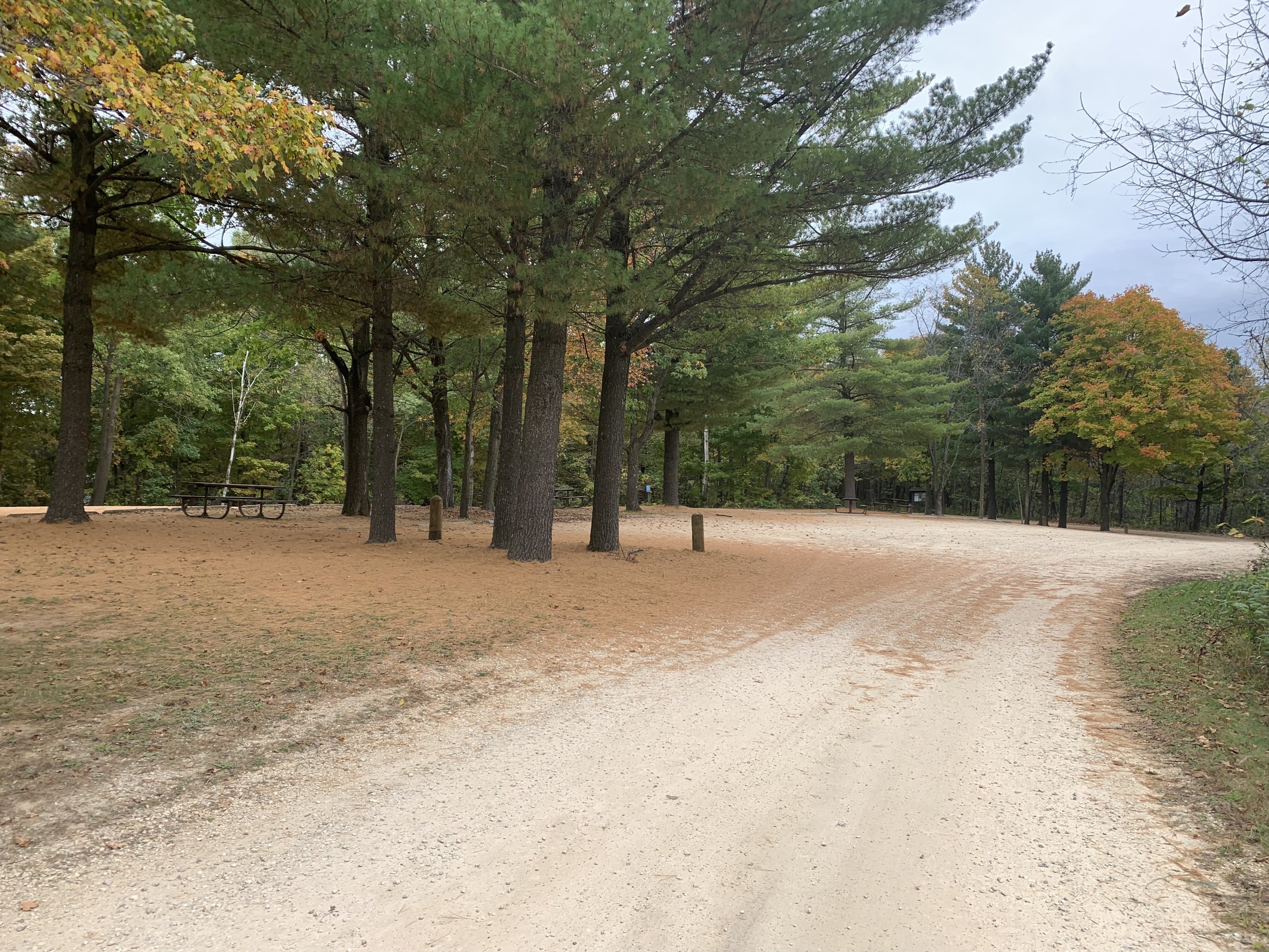
Parking lot and picnic area of North and South Overlooks
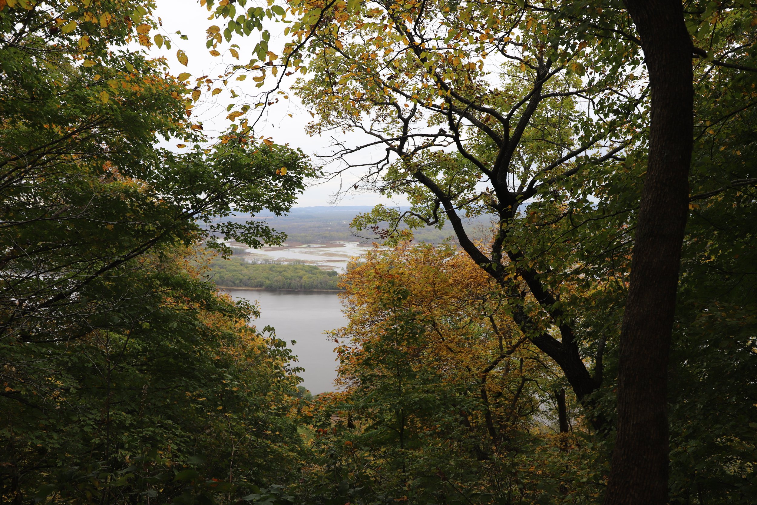
These are short hikes through the woods. In just 0.1 miles you will arrive at the North Overlook. The viewpoints here feel closer to the river than from King’s Bluff Overlook.

North Overlook Viewpoint
There are a few different viewpoints of the river.
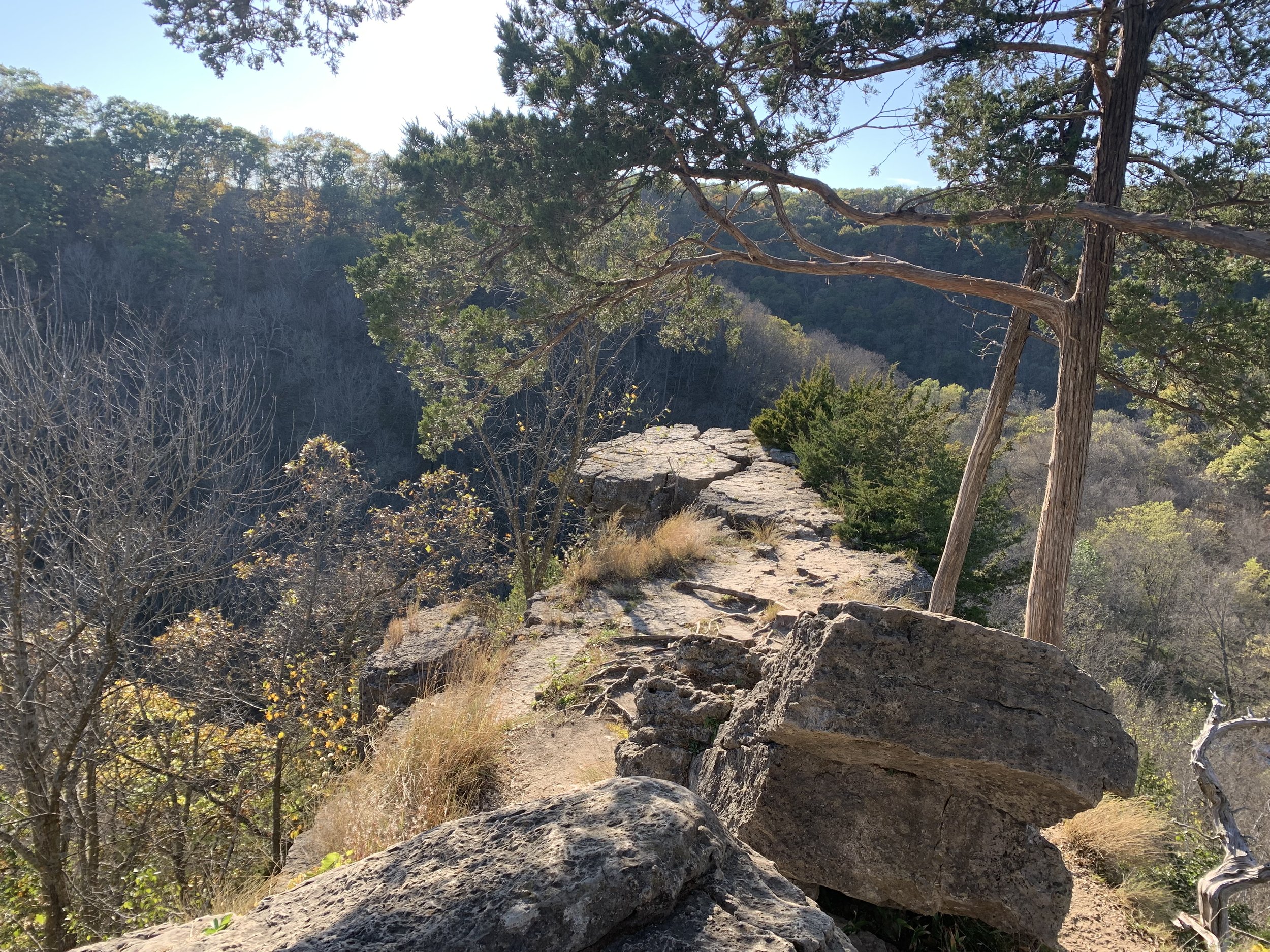
After this view, turn around and head back on the same trail you just came on. You’ll go just about the whole way back to the parking lot, but this time take the trail to the South Overlook. The South Overlook and East Overlook were my favorite views in the park.

South Overlook Viewpoint
At the South Overlook was something labeled as a “Selfie Station.” I laughed when I saw this, but overall it’s a clever idea. There’s a spot where you can place your phone. Since I was hiking by myself, I figured, why not?

Selfie Station at Great River Bluffs South Overlook

Selfie at the South Overlook
Trails Connecting King’s Bluff and North/South Overlooks
This is the trail I have marked in red on the above map. If you choose to hike instead of drive between King’s Bluff and the North and South Overlooks, it adds about 1.5 miles of hiking. There are a few times there are multiple trails to chose from. It seemed like everything joined back up together though.
The views of both the prairie and the forest were very pretty with the fall colors. There are no additional views though of the Mississippi River.

Trails connecting King’s Bluff and the North/South Overlooks

Trails connecting King’s Bluff and the North/South Overlooks
East Overlook
0.6 miles round trip, Elevation Gain - 150ft (Trail is marked in pink in the above map)
To get to this trailhead, park in the main parking lot of the drive in campground. Similar to the other trails, the view of the river is mainly at the end. The trail to get there is short, and the view is worth it.

Great River Bluff’s East Overlook
Orchard Overlook
1 mile round trip, Elevation Gain - 80ft (trail is marked in blue on the above map)
Unless you are camping and have a closer place to park, you will keep your car in the same parking lot as for the East Overlook and take a short connecting trail to the Orchard Overlook trailhead. There are no views of the river, but with the colors of fall, the view was still pretty incredible.

Great River Bluffs Orchard Overlook
Kearns Valley Overlook
0.6 miles round trip, Elevation Gain - 70ft (trail is marked in purple on the above map)
To get to the Kearns Valley Overlook trailhead, head to the parking lot for the cart-in campground. I didn’t feel like this trailhead was marked near as well as the others, and I originally headed off in the wrong direction. You need to go past some of the cart-in sites to get to the viewpoint.

Great River Bluffs Kearns Valley Overlook
Other Things to Do Nearby
Whitewater State Park
(40 minute drive) A busier park from a people traffic standpoint, but my favorite MN State Park in the southeastern part of MN. A link to my blog post is included.
Whitewater State Park - Inspiration Point
Beaver Creek Valley State Park
(40 minute drive) Behind Whitewater, Beaver Creek Valley is my second favorite State Park in southeastern Minnesota. This is an extremely quiet park tucked into the very corner of the state. A link to my blog post is included.

Beaver Creek Valley - Beaver Creek trail
Carley State Park
(45 minute drive) Another very quiet and less developed park. This park seems like a well-kept secret from those that live in nearby Rochester. A link to my blog post is included.

Carley State Park - Whitewater River
Forestville / Mystery Cave
(65 minute drive) You will find interesting sink holes and a neat historic preserved town in Forestville State Park. Nearby Mystery Cave includes a nice tour that you can purchase tickets (excluding the winter months).

Forestville State Park - Big Spring Trail

Mystery Cave
Niagara Cave
(70 minute drive) This is a privately owned cave that runs tours. The coolest part of the cave is a very large waterfall. I thought Mystery Cave was more interesting overall, but the waterfall is quite impressive. Hard to take a picture though that matches the actual beauty of it.

Niagara Cave
More from www.NatureImpactsUs.com
There are posts linked to each pin below.