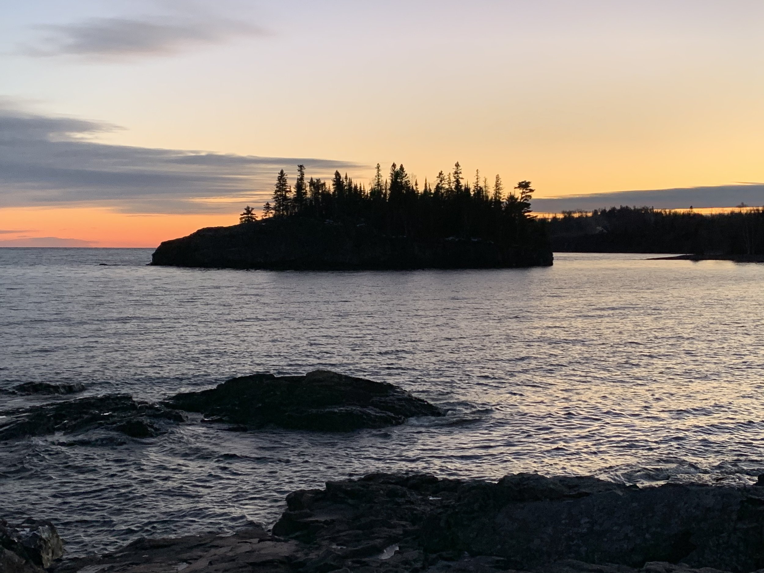
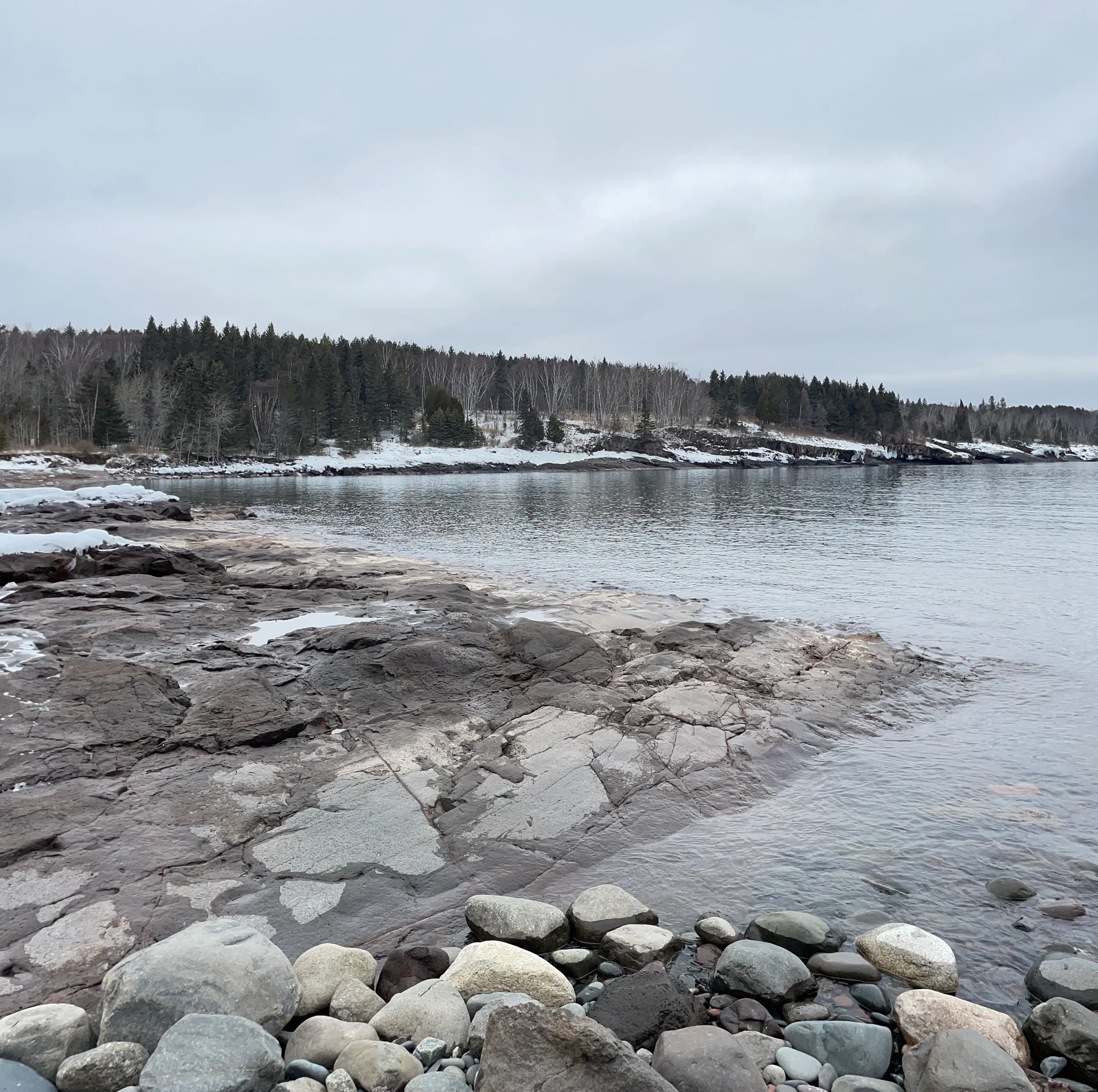
View of Ellingsen Island at Split Rock Lighthouse State Park’s Pebble Beach
If you enjoy my posts, please consider signing up below to get email notifications of my latest blogs. I will not share your email.
Black Beach
Visiting the North Shore Beaches
Let me start with some Minnesota terminology for out-of-staters. When asked what a Minnesotan is doing on a summer weekend, a common answer is “going to the lake.” There are 11,842 lakes in MN. The name of which lake we are going to typically never comes up in the conversation. Everyone may be heading to “the” lake, but we will all end up in different locations. This isn’t weird to us.
If someone says they are going to the “North Shore,” this is in specific reference to the shore of one lake that hasn’t been formally named in the conversation - Lake Superior. Looking at a map, “North Shore” really doesn’t quite make sense, as the Lake Superior shoreline in Minnesota is the southwest portion of the lake. But that’s what we call it. Got it? Going to a lake? Any lake in the state other than Lake Superior. Going to the North Shore? I’m going to the southwestern shoreline of Lake Superior in MN. Ok, that’s how to speak Minnesotan.
The Lake Superior shoreline “North Shore” starts in Duluth and continues up to Grand Portage. MN-61 is the highway that travels along the North Shore up to Canada. Some sections on the highway are close enough to see Lake Superior, but the best way to experience this lake is to stop, get out of the car, and at least dip toes in it. Lake Superior has a max depth of 1,332ft. That’s a lot of water, so the temperature doesn’t fluctuate too much. It can get cold enough in the winter to freeze, but in the summer months, most parts of the lake won’t even reach 55 deg F. Shallower bays may get up to 65 deg F. I’ve been brave enough to get in up to my knees several times, but that’s as far as I’ve ever waded in. To get wet, the warmest option is to enter the lake next to a river that feeds into it, and then walk up the river. My favorites are Gooseberry River (at Gooseberry State Park) and Baptism River (at Tettegouche State Park).
One last overall comment before getting into specifics - the beaches are not soft sand (except Park Point in Duluth), and I can only think of two others (Crystal Bay Sea Cave Beach and the Lake Walk on the Superior Hiking Trail) that have fine enough gravel to lay down on top of a towel comfortably. The rest of the beaches referenced are rocky. Having water sandals isn’t a must, but I would highly recommend them.
Iona’s Beach
Planning Your Trip and Lodging Options
MN-61 stretches 148 miles between Duluth and Grand Portage State Park, and that drive will take at least 2 hours and 40 minutes (one-way). Some traffic, potential road construction, and stoplights in Two Harbors can easily add to that time. Essentially, this matters for two reasons. One, a lot of time can easily be spent in the car driving between lodging too far north or south compared to the places of interest that are visited in the day. Two, that distance does limit what can feasibly be done on the same trip, unless that trip is multiple days.
All of the MN State Parks have campgrounds except Grand Portage. These sites fill up fast in the summer months. If the Gooseberry, Split Rock, and Tettegouche campgrounds are full, check the parks that are further north. Cascade River has a very nice campground with plenty to do nearby. If a hotel is better, Duluth is always an option, but it’s a 45 minute drive to even get to Gooseberry, the first State Park. Tofte is a nice option, about midway up. It’s a small town but there are a few hotels and restaurants. Grand Marias is the best city to stay in on the northern side of MN-61.
This post stands on its own, but it is a part of a larger network of posts I’ve written regarding things to do along Minnesota’s North Shore. This is a link to my full North Shore Guide for anyone interested. It’s an external link so you won’t lose your spot. I will also re-post this link at the end.
Now on to the fun stuff - Reference the below map for places to easily access Lake Superior’s shoreline. In the captions, I have hyperlinks to the specific section within this page, and there will be a link back to this map after each section.
1 - Canal Park - There is a sidewalk path between the lift bridge and a lighthouse in Duluth. Boulders are near the water to play on. Big ships entering the harbor relatively frequently. A fee is required for parking.
2 - Park Point, Duluth - This is a long sandy beach on the southern shore of Lake Superior across the Aerial Lift Bridge. Parking is free, and there are bathrooms and places to change in the summer months.
3 - Agate Beach - Mouth of Gooseberry River. This is a great river to walk up for a ways with water warmer than Lake Superior. Parking is next to beach, and is included with the MN State Park pass.
4 - Iona’s Beach - Beach full of pink rocks about the size of sand dollars. Parking is free.
5 - Pebble Beach - This beach is full of thin, black rocks the perfect size for throwing, and I would argue that it’s the best place in MN to skip rocks. Enjoy the beach and a beautiful view of the Split Rock Lighthouse. Parking is next to the beach and is included with the MN State Park pass.
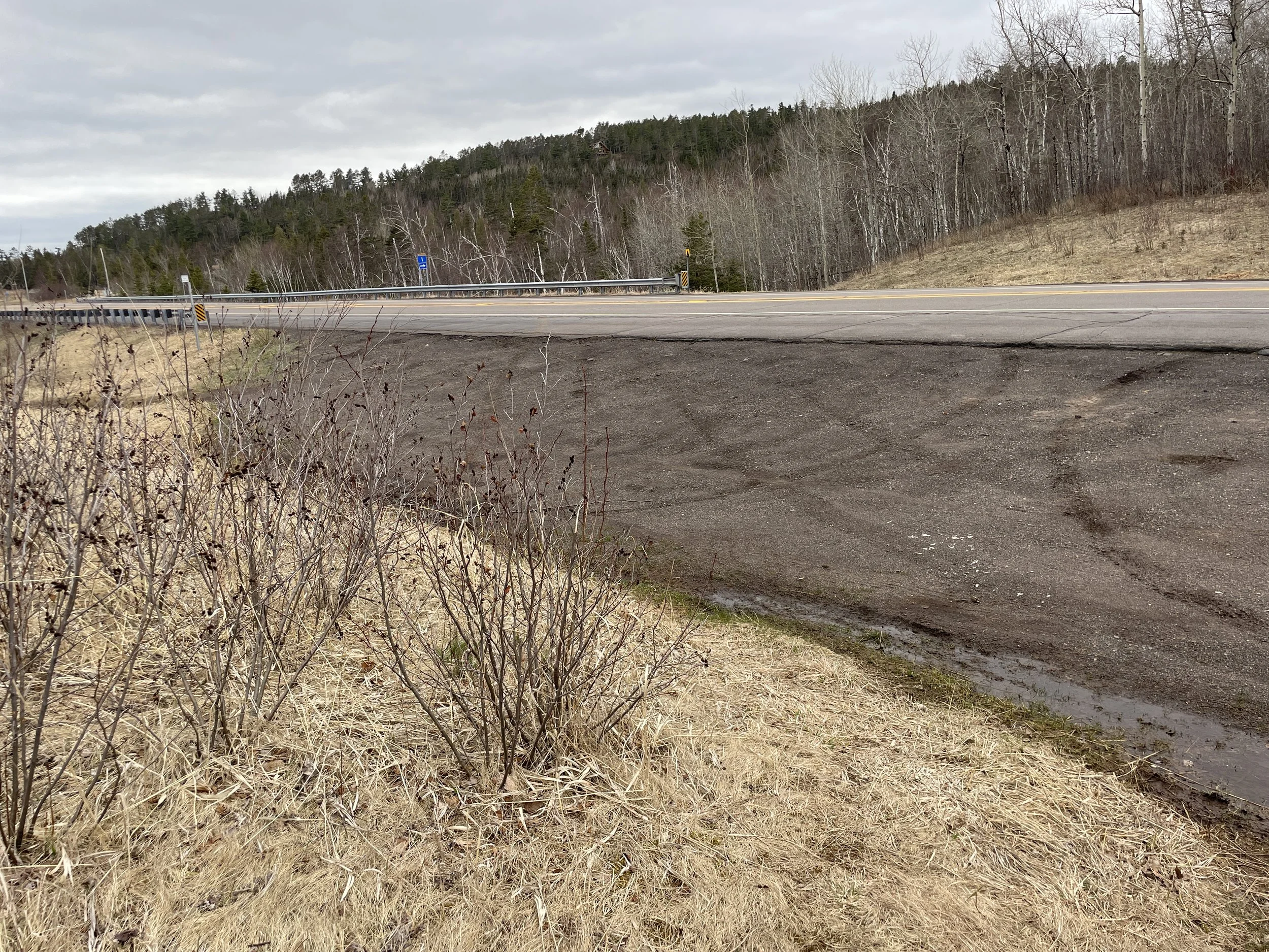
6 - Black Beach - An interesting beach of black rock about the size of gravel. The rocks stretch to an island that can be wandered to without getting wet. The beach is right next to a free parking area, but the area begs to be explored, so expect to walk at least a mile or more while here.
7 - Baptism River Beach - Walking down to this beach and back requires a 1/3 mile hike and a few stairs. This beach is very small, but I’ve included it on this list because the Baptism River is incredibly fun to walk up. Bring water sandals and a small water net if you have one. There are crayfish that hide under the rocks. Parking is included in the MN State Park pass.
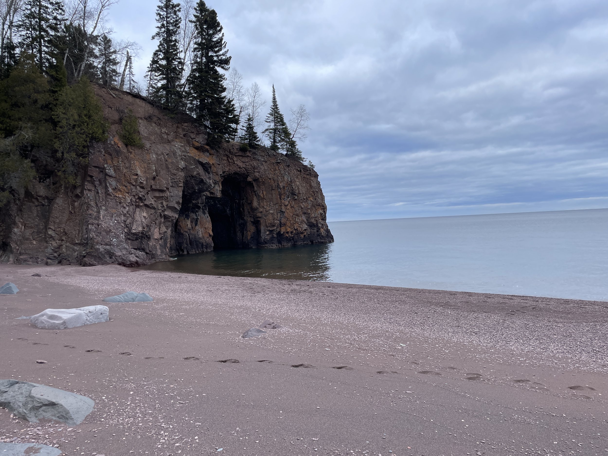
8 - Crystal Bay Sea Caves Beach - Note that this beach can’t be found using GoogleMaps. Parking is free at a small gravel pull-out after MN-1 along MN-61. A short but steep walk down a rocky area leads to a large protected beach. There is a stretch of sand which ends before the shoreline which has rocks a little larger than gravel. Two large sea caves are visible, but cannot be accessed without a boat.
9 - Sugarloaf Cove - This spot requires a mile loop hike and $5 cash collected in a box at the beginning of the hike. There is also a nature center that is open in the summer months. There is a peninsula to explore in the cove.
10 - Cascade River Lakeshore Trail - Other than a short distance along Pebble Beach in Split Rock, this Lakeshore Trail in Cascade is the only trail in the MN State Parks that is along Lake Superior. This isn’t a beach, rather it’s large rock that can be walked and hopped over for 1.5 miles (one-way). These rocks have holes in them that collect water from larger waves, which are fun to splash in. Parking is included in the MN State Park pass.
11 - Superior Hiking Trail Lake Walk - This is the only part of the Superior Hiking Trail that is actually along the lakeshore. This beach extends 1 mile (one-way) and is made of gravel along the shoreline. A note - hiking long distances in soft gravel is hard. Walk along the MN-61 shoulder that you can walk back along if it gets to be too much. Parking is free.
1 - Canal Park, Duluth
Expect about a 0.75 mile walk between parking, the Aerial Lift Bridge, out to the lighthouse, and back (the path is marked in blue). There are several options to park, marked with black stars at approximate locations. The red star marks the Aerial Lift Bridge.
Canal Park is a fun place to visit. There are several souvenir shops and restaurants. Frequent traveler tip - skip the restaurant wait, grab food at the Grandma’s Food Truck (same food as in the restaurant, just fewer options), and enjoy eating along the water’s edge.
The Aerial Lift Bridge marks the beginning of the Duluth Harbor. This bridge goes up for all boats that are tall enough to require it to be raised. My boys loved watching the ships come in and out, and the bridge go up and down. There is a schedule online, that can be used to plan ahead to get a better chance of seeing one of the bigger ships pass through. There is a free museum right next to the bridge (Maritime Visitor Center). This is a great place to take kids if a ship is running behind schedule. One note of caution for kids that are sensitive to loud noises - the ships sound their horn before going under the bridge, and the bridge gives a horn back telling them to proceed. This is loud if you are right next to the water.
Aerial Lift Bridge in Duluth, MN, in the up position as a ship approaches
There is also a sidewalk path that leads out to a lighthouse. And there are some boulders that kids can climb around near the water, if they need to burn off some energy before getting back in the car.
Lighthouse in the background can be walked to from the Aerial Lift Bridge
Vista Fleet - Sightseeing Cruise Ship
Vista Fleet offers boat rides in the Duluth harbor and out to Lake Superior. This is a fun way to see all of the activity happening in the harbor. Sitting was hard for my youngest, though. We walked around a lot on this boat to stay busy.
In October, the Irvin, which is docked in the Duluth harbor, is turned into a haunted ship. This is on my bucket list, but I’ve been waiting for my youngest to get just a bit older. Hopefully in the next year or two we can try this out.
Between Thanksgiving and New Years, Bentleyville is also in Canal Park, and it’s the largest Christmas light display in the state of MN. It’s free, and there’s also free popcorn and hot chocolate. We’ve done this several years and loved it.
One of several Bentleyville light displays
Entryway into the one of the light tunnels at Bentleyville
2 - Park Point, Duluth
2 - Park Point. (1 - Canal Park and the Aerial Lift bridge marked with the red star are shown for reference)
The one sandy beach on Lake Superior in Minnesota that I know of is Park Point, which is in Duluth, on the southern shoreline. To get there, cross over the Aerial Lift Bridge, and continue down Lake Ave about 3 miles. There are several large parking lots, and there is no cost to park.
Sandy beach at Park Point looking from the Beach House out to the southern Lake Superior Shoreline
Between the parking lot and the beach is a public beach house, where there are bathrooms and places to change. This building is only open in the summer months.
A public beach house is available at Park Point in the summer months with bathrooms and places to change
Park Point feels as close to an ocean beach as it can get in Minnesota, except that this is fresh water. Lake Superior is so big, the northern shoreline is not visible, and the wind and changes in air pressure result in decent-sized waves. A reminder though, this water is much colder than the beaches in Florida and California.
It feels like a really cold ocean. The only difference is this water is fresh. Expect some level of waves.
From the beach house, the public beach extends west almost a half mile. Duluth is visible (just barely) when looking east. Eventually this beach runs into privately owned property.
Looking west towards Duluth.
The beach extends towards Wisconsin about a mile and a half. This is nice place to wander along the sand due to the length of beach.
Looking west towards Wisconsin.
3 - Agate Beach, Gooseberry State Park
Agate Beach has a parking lot (marked with a black star). Exploring the entire beach area and upstream slightly along the Gooseberry River is approximately 0.25 miles with no change in elevation (red trail)
I’m not sure there’s a spot to really “swim” in Lake Superior that is warm enough, but Agate Beach in Gooseberry State Park is a great place to cool off and get wet. If Lake Superior is too cold, walk into Gooseberry River (which feeds into Lake Superior) and head upstream. It’s probably not deep enough to swim in, but will be perfect to splash and play around in.
Agate Beach itself is pretty cool. There are several boulders to climb around, and I’m assuming agates? Although I don’t know what the outside of an agate looks like, so I haven’t found one yet.
There are picnic tables a short distance from the beach parking lot. Just walk towards Gooseberry River and stay near the water. They are just off the main trail by the river. The last feature of Agate Beach, that is worth mentioning, is a bench, that is located right down by the lakeshore. This might be the most romantic spot for a date along the North Shore.
Gooseberry also has some amazing waterfalls (Upper, Middle, and Lower Falls) that are short and relatively easy hikes. For more information on hikes, here is my full post on Gooseberry State Park.
View from Agate Beach in Gooseberry State Park
Agate Beach itself if made of loose gravel. I think water sandals would be helpful for walking out into the lake or river.
Agate Beach at Gooseberry
There is a bench at Agate Beach that overlooks the water along the shore’s edge. I think this might be the best spot for snuggling along the entire lakeshore.
I take a lot of pictures of benches when I’m out hiking, making notes of the best places to hike with my husband when we get older.
The water entering Lake Superior from the Gooseberry River is going to be a lot warmer than Lake Superior itself. Note the ice on the edge is from visiting the park on a day off in December. That won’t be there in the summer :)
A perfectly still day, allowing for a reflection shot at the end of the Gooseberry River. The picnic tables aren’t seen in this picture, but they are just past, on the left.
4 - Iona’s Beach
Walking along Iona’s Beach and back from the parking lot is approximately 0.75 miles with minimal change in elevation.
The black star marks the parking lot.
Most of the rock along the Lake Superior beaches in this post are black, but Iona’s beach is full of pink rocks. These rocks are between the sizes of pebbles and sand dollars, so walking is easy along this beach, which is good as this is a fun place to explore.
Iona’s Beach - Keep walking to see the larger portion of the beach
Iona’s Beach - The pink rock stretches on for quite a ways along the water’s edge
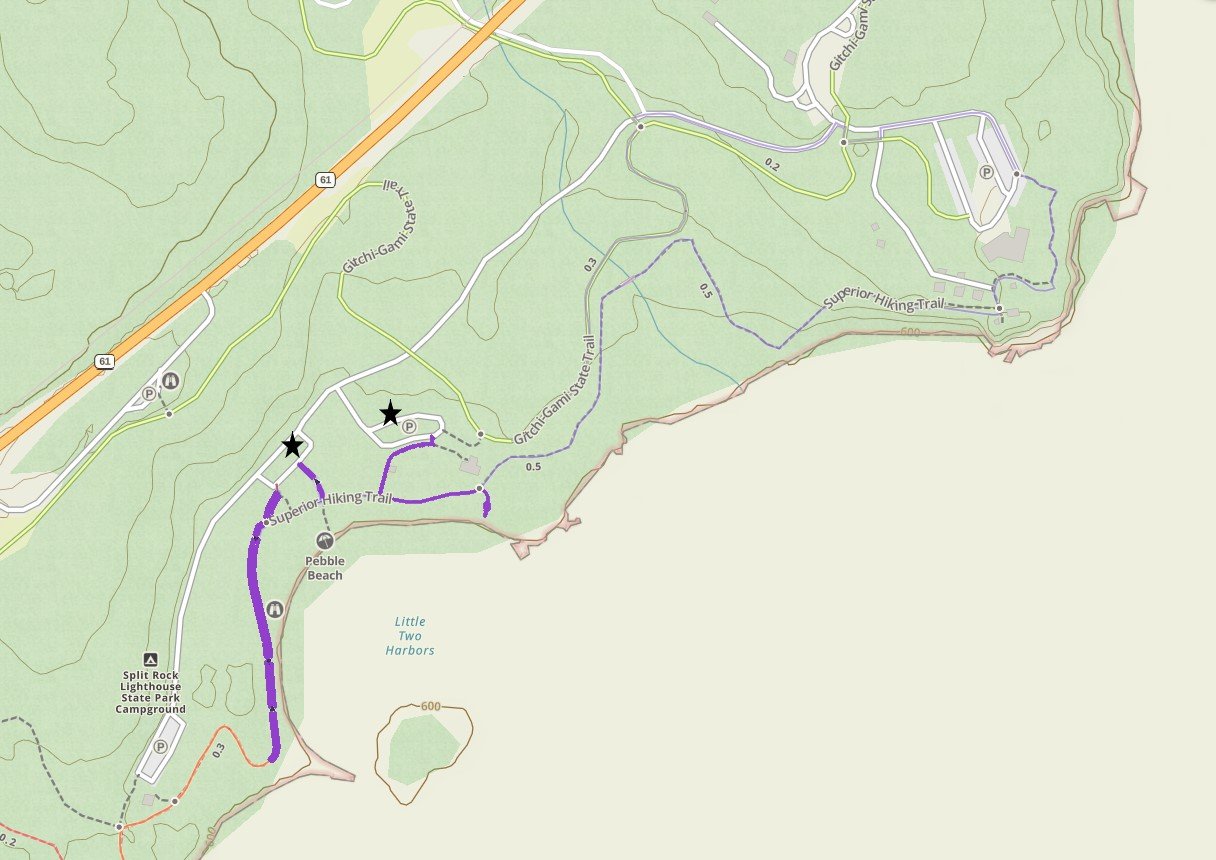
5 - Pebble Beach, Split Rock Lighthouse
Expect to walk about a half mile with no change in elevation along Pebble Beach. There are two parking lots. Both are marked with black stars. There are also bathrooms with flushable toilets at the star on the right.
Pebble Beach is my favorite spot along Lake Superior. When my son turned two, we drove up here and spent most of the day throwing rock after rock into the water. I frequently stop here on my way back to the Twin Cities in the evening. The sun sets behind the lake, but the sky still turns shades of beautiful pinks and oranges, and Ellingsen Island is a great spot for pictures.
For more information on hikes to see and places to explore at this State Park, here is my link: Split Rock Lighthouse.
This is a great beach to just sit and watch the littles play. As they get older, this is a great place to skip rocks.
I don’t think there’s an age that you are too old to skip rocks. I think this is a helpful picture as you can see the rock size, and how many there are, as well as the view of the Split Rock Lighthouse.
Rocks, rocks, and rocks -this beach is so much fun.
One of many family pictures at this spot. Ellingsen Island is to the right of this picture.
Sunset at Pebble Beach - Ellingsen Island is off to the right. Note that the lake faces east, but the colors of the sky still change as the sun sets behind the lake.
Pebble Beach is beautiful to explore in the winter too. The waves splash onto the rocks and plants and freeze, making stunning ice dispalys.
Rocks just past Pebble Beach covered in ice at the beginning of December
6 - Black Beach
Walking out and back to the view of the island is 0.5 miles. Add another half mile to walk out to the island. The parking lot is marked with a black star.
Black Beach seems largely unknown to the crowds of people at the nearby MN State Parks. This beach is currently free to visit, and there are a handful of picnic tables for eating directly on the beach, which isn’t common. This would be a fantastic spot for a picnic. The rocks are big enough that walking along Black Beach is pretty easy. Just past the picnic table, there is a small creek to navigate over, and then the beach extends out to an island accessible without needing to get wet. This is probably the best spot to simply explore along the North Shore.
This is the view from the Black Beach parking area. There are a couple of picnic tables available for use. Just before the trees, there is a small creek that is easy to get over, and there is a hiking path through the trees to the other side.
On the other side of the trees from the prior picture, the island is now in view.
Black Beach extends all the way to the island.
Side view of the island from Black Beach
Black Beach, Lake Superior, MN
A view of the beach while walking back to the parking lot
7 - Baptism River Beach, Tettegouche
Walking down to the mouth of the Baptism River, to the small shoreline and back is about a third of a mile, with an elevation gain of 50ft. This is an easy trail. The steps include a railing. Parking is marked with a black star.
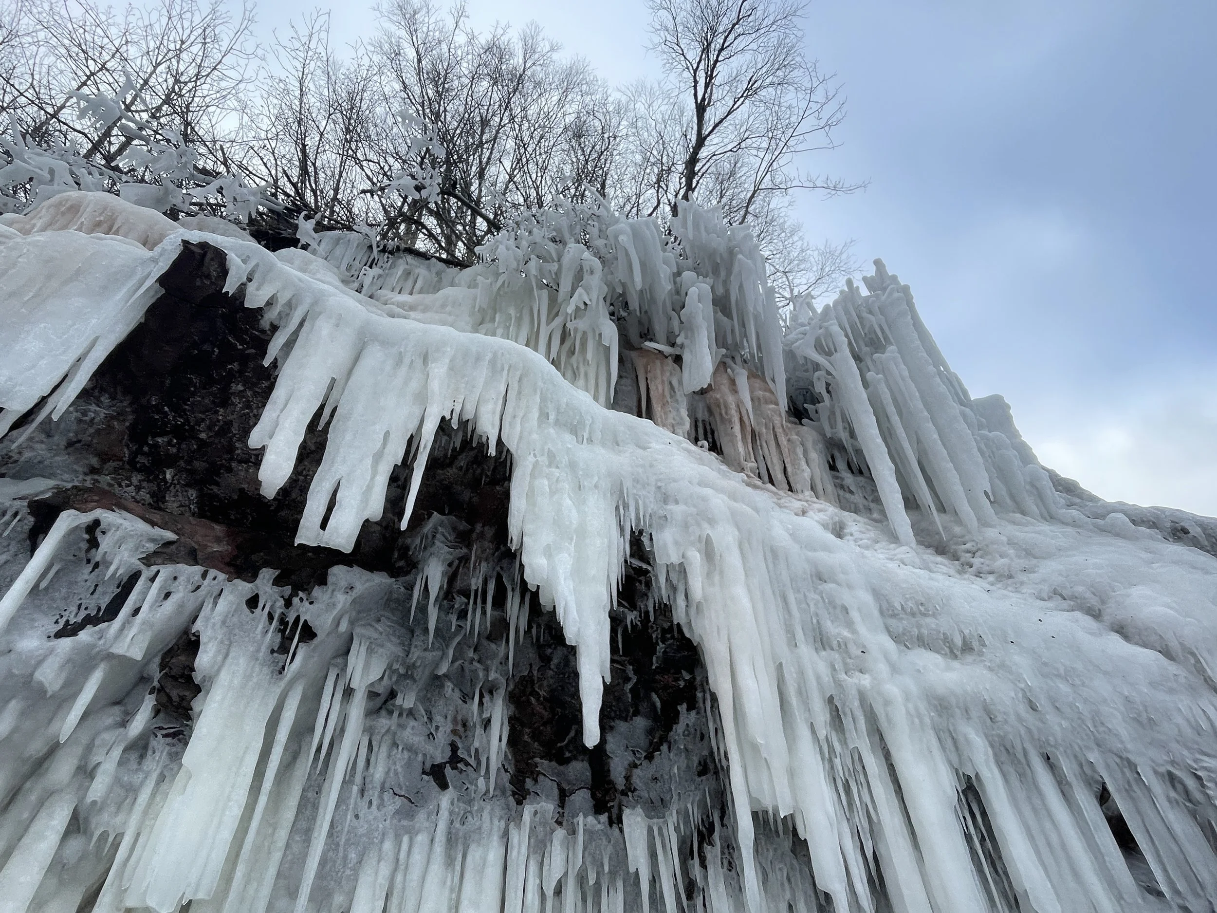
This rocky beach in Tettegouche is extremely small, but I’ve included it in this post for two reasons. One, in the winter, there are amazing ice formations on the cliffs that drop into the water along the beach, and it’s very much worth the short trek to see. Second, in the summer, I love playing in the Baptism River as it enters Lake Superior. Water sandals are going to be needed, as well as a small net to catch crayfish that are hiding under the rocks. Life jackets may also be needed for younger kids.
For other hiking options, this is a link to my full post on Tettegouche State Park.
Walking out to the ice sculptures on a quiet January day. The beach keeps going to the left of the picture.
Some incredible ice formations at the edge of Lake Superior in Tettegouche
Just, wow!
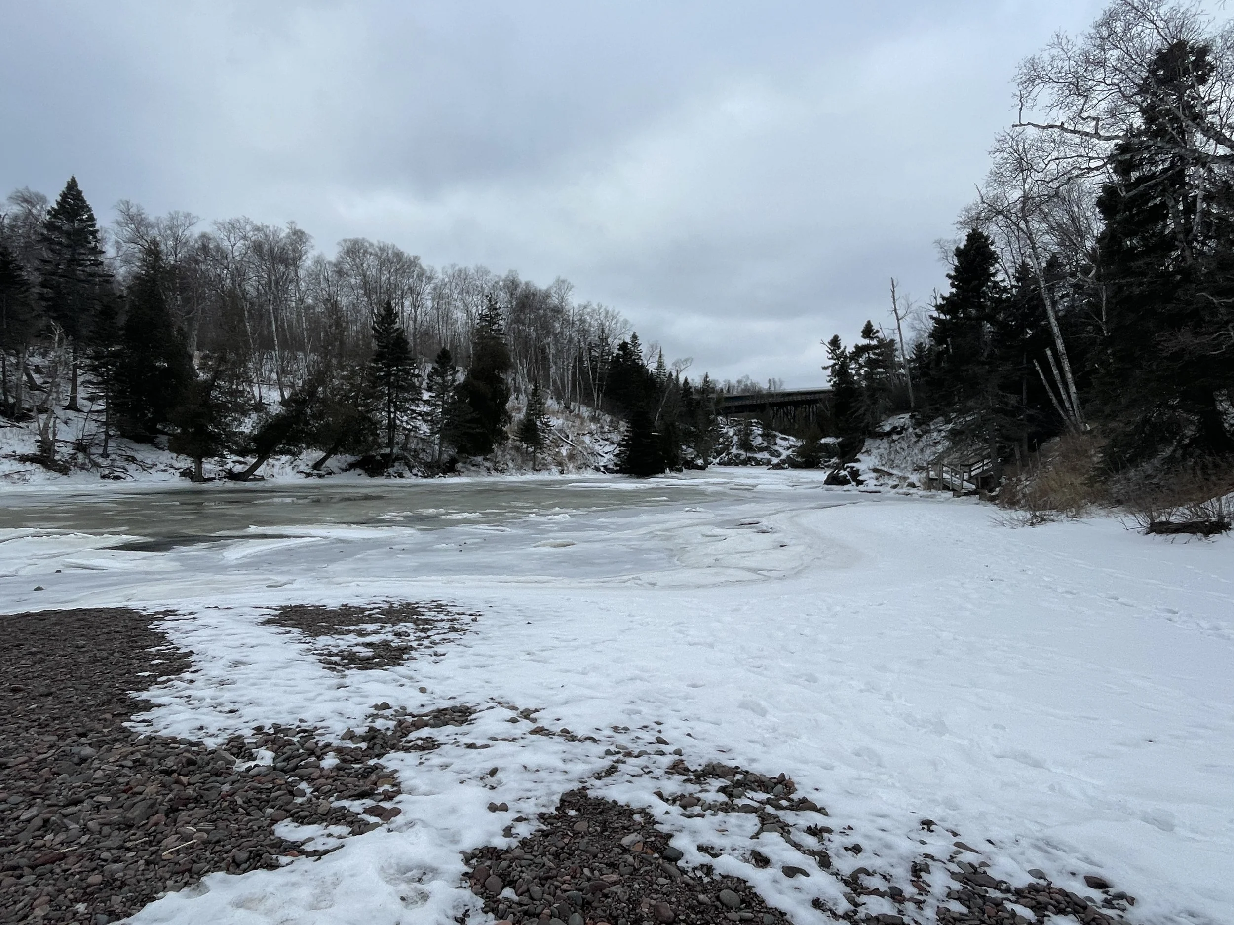
Looking up the Baptism River. I haven’t brought a camera or phone with me as we’ve played in the river in the summer for fear of dropping it. This is my favorite place to swim on the North Shore.
8 - Crystal Bay Sea Caves Beach
The trail down to the Crystal Bay Sea Caves (green) is 0.35 miles out-and-back, and the hill is rocky and steep with an elevation change of 115ft. Parking is marked with a black star. The blue trail shown is Shovel Point.
Crystal Bay Sea Caves
Crystal Bay Beach is labeled on the official Tettegouche State Park Map, but neither the trail nor the trailhead parking are marked, making this amazing beach a bit of a secret. Additionally, this trailhead won’t be found in GoogleMaps.
Unmarked gravel parking area along MN-61, just north of MN-61. The trail is just visible at the southern edge of the parking lot.
From the Tettegouche State Park Visitor Center, turn right to go north on MN-61. MN-1 intersects with MN-61, and just past this intersection, on the lake-side of MN-61, will be a small gravel pullout, big enough for maybe 5 cars.
The trailhead is marked with a State Park sign, although the trail name itself is not listed.
There are two trails at this trailhead, and both reviews on AllTrails as well as other posts I read online mixed the two trails up. The trail down to the beach and sea caves is at the southern edge of the parking lot. Look back towards the Tettegouche Visitor Center. The trail might not be immediately visible, but the yellow State Park sign will be. Just walk south and the trail is extremely obvious. It’s short, rocky, easy to follow and heads directly to the beach.
(For reference, the other trail, Crystal Bay Point Trail heads uphill, and this trail is easier to see when parking. This trail also heads to the water, but by way of large rocks, and there is not a beach. This trail is next to high cliff drops into the lake, and parts of the trail are hard to follow due to overgrowth. The Crystal Bay Sea Caves Beach is visible along this trail. This is a cool trail to hike as well, there just isn’t a beach.) For my trail review on Crystal Bay Point, and other trails at Tettegouche, reference my post on Tettegouche State Park.
The trail down to the beach is rocky, short, steep, and obvious.
A small creek was flowing when I visited in April. I was able to hop the rocks to cross and reach the other side of the beach. I’m assuming this creek is dry most of the year, and was likely the result of recent snow melt. The point far off in the distance in the picture is Shovel Point (which can be hiked to from the Tettegouche Visitor Center).
The only way into the sea caves is with a kayak, but they are visible from the beach.
This beach if phenomenal. It’s quiet, large, and there is quite a bit of sand, although the ground turns to gravel-sized rocks prior to reaching Lake Superior. Additionally, this is the only place I know of along the Minnesota Lake Superior shoreline where sea caves are visible.
9 - Sugarloaf Cove
The trail out to Sugarloaf Point is 1.1 miles out-and-back including the interpretive trail loop through the forest. There is an elevation gain of less than 100ft. Parking is marked with a black star
Sugarloaf Cove is a great place for a short hike that includes a shoreline and some fun rocks to explore along the peninsula. Parking here costs $5 and it needs to be in exact cash, as it’s collected in a box just past the parking lot. There is also also a Visitor Center open in the summer months. To get to the Visitor Center, stay to the right when the trail first splits.
Sugarloaf Cove Visitor Center
From the Visitor Center to the Lake Superior shoreline, it’s an out-and-back trail. There is a rocky beach, with bigger sized stones. The peninsula can be explored from the beach, but stay on the rocks to protect the plants.
The main trail ends here at this beach.
The picture below is from the same spot as the picture above, just facing the other direction. Here the peninsula is visible.
Sugarloaf Point
The ice formed as a result of high waves in the winter is an amazing thing to enjoy on a winter hike
On the other side of the peninsula, there is an additional view of the Lake Superior, and this shoreline extends for quite a ways as well.
Sugarloaf Cove - I haven’t waded out here in the summer yet, but I think it would be a nice protected part of the lake.
10 - Cascade River Lakeshore Trail
The parking lots are highlighted with black stars, and the Lakeshore Trail is highlighted in blue. The trail extends 1.5 miles (one-way) along the shoreline. Turning the hike into a loop and returning along Cascade River allows the option of seeing the park’s waterfalls. The entire loop is 3.5 miles.
The best place to hike along the Lake Superior shoreline in MN is in Cascade River State Park. In fact, out of all of the MN State Parks, this is the only park that has a trail directly along the lake. The trail at Split Rock goes out to the beach, but doesn’t continue along the shore.
There are three parking options. The first is directly off of MN-61. This option requires crossing the highway. Cascade River is pretty far north, and the highway isn’t particularly busy. It should feel pretty safe to cross. There is a pullout road further north that has also has parking and doesn’t require crossing the highway. The third option is further into the park, but this will be a few extra steps out of the way.
The Lakeshore Trail extends 1.5 miles along the shoreline (one way). The trail is over large boulders that are fun to walk (or hop) across. There is also an option to turn the hike into a loop instead of walking back, and see the waterfalls in the park along Cascade River. For other hiking options, here is my full post for Cascade River State Park.
Under the MN-61 bridge that passes over the Cascade River.
There are steps that go down to the lakeshore on both the north and south sides of Cascade River.
Lake Shore Trail is pretty easy to navigate around, and quite fun, but this is not a flat trail.
Lake Shore Trail stretching north
Throwback picture from when I was a teenager hiking with my parents and best friend.
A favorite memory of mine is camping at Cascade River when my oldest son was 9 months old. We spent a lot of that weekend practicing walking along the rocks of the Lakeshore Trail.
Southern-most waterfall along the Cascade River, and it can be viewed along with several other waterfalls in the loop-option hike. i
11 - Superior Hiking Trail - Lake Walk
Lake Walk is 1 mile (one-way) and remains flat. This is the only section of the Superior Hiking Trail that is directly on Lake Superior’s shoreline. This is a rough section to hike as it is fine gravel. There are two parking lots, marked with black stars.
Being honest, the Lakeshore Trail in Cascade River State Park is a better hike along the Lake Superior shoreline than the Superior Hiking Trail Lake Walk. The cool thing about the Lake Walk, though, is that this is the only part of the Superior Hiking Trail that is along the shoreline. This section of the SHT is between Kadunce River and Judge Magney State Park. The uncool thing about the Lake Walk is the beach is made of very fine gravel, kind of like walking in sand. And after a mile, my calves were burning. On our way back, we cheated, and took the road to save our legs.
For that “beachy” Lake Superior experience, I think you could comfortably lay out on a towel on this beach, although I haven’t tried it.
Hiking the SHT early in the morning. We traveled between the Kadunce River trailhead and Judge Magney (and back) while training for a Grand Canyon Rim-to-Rim-to-Rim hike.
Beach along the Superior Hiking Trail Lake Walk
Link to Full North Shore Guide from NatureImpactsUs.com
For more ideas of things to do up and down MN-61 along Lake Superior, visit my North Shore Guide.
More from www.NatureImpactsUs.com
To see additional things I’ve written about hikes around the country, click on a pin, and then click on the hyperlink. Use two fingers to zoom in and move around the map.

