

Near Tunnel Mountain Village 1
My family travelled to Banff and Jasper National Parks in Canada last summer for the first time. These were amazing parks, but I struggled to find information to plan out our trip beforehand, and as I would have to pay international roaming fees, I wasn’t able to use my cell phone while in Canada. While at various visitor centers though, I did eventually get the information that I was looking for, but not really in time for this trip. We spent too much time in the car driving back and forth between trailheads that were not near one another. So, I’ve made this page more as a planning tool than a review of hikes, and I’ve done this as much for you as me, for when we return next time.
Banff – Things to Know Beforehand

View from Tunnel Mountain Drive
Banff is a city as well as a National Park in Canada. The city is in the middle, which is a little different than National Parks in the US which are at the edges. The hikes in Banff are beautiful, but the summits tend to overlook on the city, which was a little disappointing.
When you google “Best Hikes in Banff” you will find several hikes that are not actually in Banff, but are actually in the Icefields off of TransCanada Hwy 1, thus lots of driving back and forth. See the map below. If you are planning a trip to Banff, I would recommend spending 1-2 days hiking in Banff. Then plan a separate day to Lake Louise and Moraine Lake while still spending the night in Banff.. Plan another day for driving the Icefields and stopping at hikes along the way. Do not try to drive all the way back to Banff – it will take too long. Instead spend the night in Jasper.
This post will focus on trails in the area directly near Banff. A follow-up post will include trails in Lake Louise and the Icefields.
Banff Lodging
We camped in Tunnel Mountain Village 1. Nothing fancy about this campground, but the bathrooms were clean. There were bear boxes available in a communal location that you could lock, and they were plenty big enough. Wednesday night were nice and quiet. I was disappointed with how loud the campground was on Friday and Saturday. If there were “quiet hours” they weren’t observed.
What about Thursday night? Well, it rained a lot on our trip. Wednesday night we stayed dry in the tent despite it raining all night. It was still raining on Thursday, so when we left to go hiking, we zipped the tent shut. Which apparently is the wrong thing to do. All of the moisture from us being in the tent condensed on the inside of the tent and dripped all over everything. We came back to wet sleeping bags and blankets and a night that was going to drop below freezing. I don’t often give up, but this was too much. We grabbed our wet things after supper and headed into Banff for the night, finding a room at the Douglas Fir Resort. This hotel had a little waterpark with some great waterslides. Lemonade out of lemons – our boys had a blast, and when we woke up in the morning, everything had dried. We went back to our campsite, laid everything back inside the tent, and this time cracked all of the windows open. Despite another day of rain, everything stayed dry in the tent. So my tip to you if you are camping in the cool damp weather, leave the tent windows slightly open.
Hikes or Near Banff

View from Stoney Squaw Summit
The below map shows the trailheads (pins) for several popular hikes in Banff. Following the map, is a brief summary of these hikes. My favorite area that we visited was Minnewanka Lake. Now that I’ve got this quite a bit more figured out, I’m itching to go back!
Trailhead: Lake Minnewanka Parking Lot

Rock Throwing in Lake Minnewanka
Stewart Canyon
Trail Distance – 0.8km to Cascade River. 3.2km to the river gorge. The trail continues to Alymer Pass.
Elevation Gain – Relatively flat
Other Notes - This trail was beautiful, secluded, and was not busy in early June when we visited

Stewart Canyon
Aylmer Pass
Trail Distance – 11.8km from the parking lot to Aylmer Lookout. 13.5km from the parking lot to Aylmer Pass.
Elevation Gain – 575m
Other Notes – There is a backpacking campground at Aylmer Pass
Trailhead: Upper Bankhead Picnic Area of Lake Minnewanka
C Level Cirque Trail
Trailhead Location - Continue down Lake Minnewanka Scenic Drive from the Lake Minnewanka Parking lot to the Upper Bankhead Picnic Area
Trail Distance - 3.9km from parking lot to C Level Cirqure
Elevation Gain - 455m
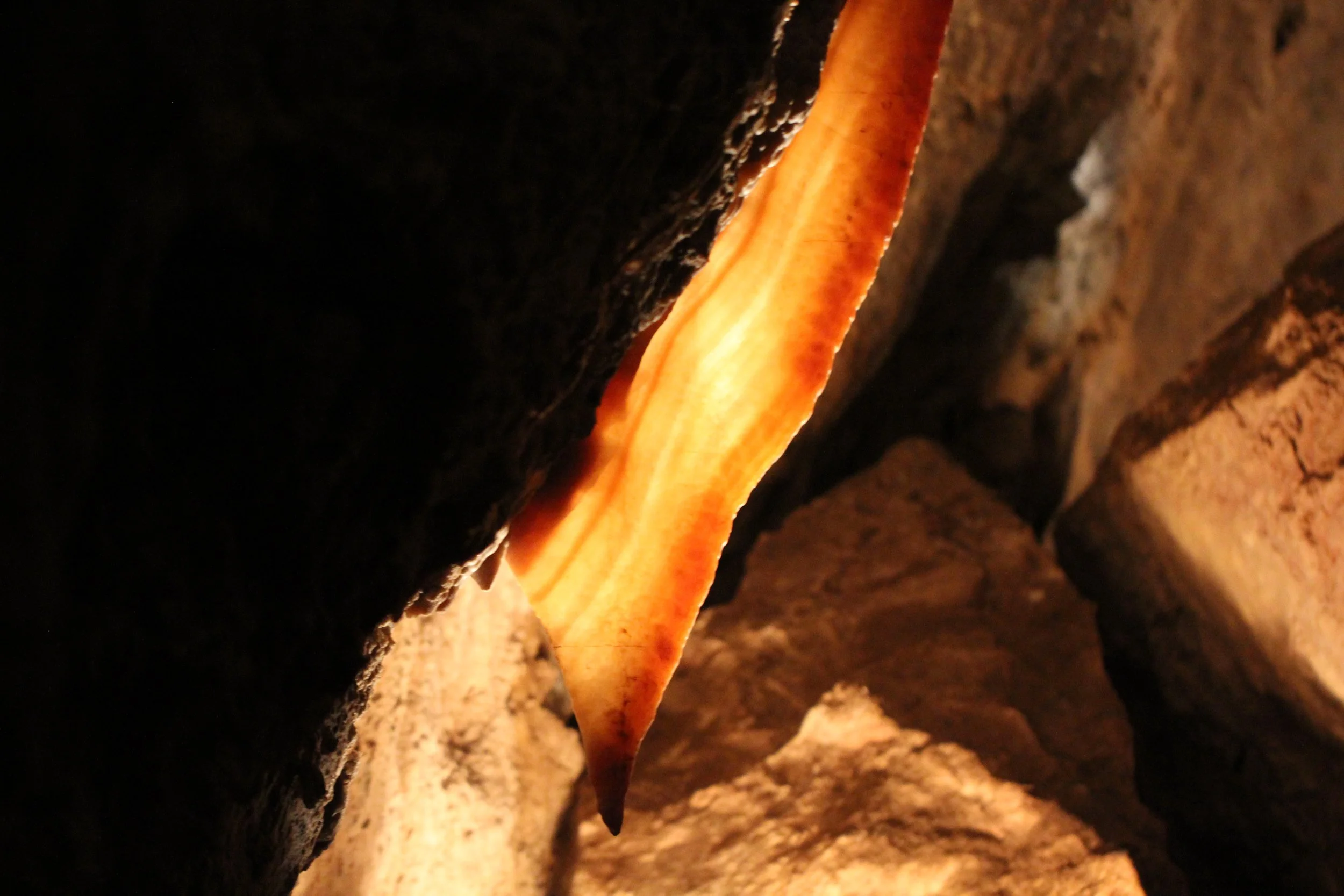
Other Notes: Lake Minnewanka Scenic Drive is closed from November through April. You will need to get to the trailhead by walking during these months. This trail passes two old cola mine buildings.
Trailhead: Johnson Lake Parking Lot
Johnson Lake
Trailhead Location - From Lake Minnewanka Scenic Drive take Johnson Lake Road to the parking lot. The trailhead is downhill from the parking lot. Look for a dam and bridge.
Trail Distance – 3.5km loop
Elevation Gain – N/A
Trailhead: Tunnel Mountain Parking Lot

Tunnel Mountain Drive
If you would like to receive notification of future posts, please sign up below. I will not share your email address information with anyone.
Summit Tunnel Mountain
Trailhead Location – There is a parking lot off of Tunnel Mountain Drive
Trail Distance – 3.6km from the parking lot to Tunnel Mountain
Elevation Gain – 300m
Other Notes – View includes the town below
Trailhead: Surprise Corner Viewpoint
Hoodoos Hiking Trail
Trailhead Location – Parking lot is at the Surprise Corner Viewpoint
Trail Distance - 4.6km from parking lot
Elevation Gain – 60m
Other Notes – This is an interpretive trail
Trailhead: Bow River Avenue
Bow Falls
Trailhead Location- Park in Banff near the Fairmont Banff Springs Hotel. Make your way down to Bow River following the wooden stairs. Stay on the East side of the river.
Trail Distance - 1.2km from hotel to the falls
Elevation Gain - N/A
Trailhead: Cave and Basin National Historic Site
Cave and Basin to Sundance Canyon
Trailhead Location - Park in the parking lot for the Cave and Basin National Historic Site, which is off of Cave Avenue. Follow the paved walkway to the trailhead kiosk.
Trail Distance - 2km loop trail
Elevation Gain - 145m
Other Notes - Marsh and Healy Creek trails branch off from this loop for additiona lhiking opportunities.
Trailhead: Fenland Loop Parking Lot
Fenland Loop
Trailhead Location - There is a parking lot off of Mt Norquay Road
Trail Distance - 2km loop
Elevation Gain - N/A
Trailhead: Mount Norquay Ski Area

Stoney Squaw Summit
Stoney Squaw Summit
Trailhead Location - Park in the Mount Norquay Ski parking lot near the Norquay Lodge. Walk down to the end where you will see a trailhead kiosk. This one was hard for us to find, even after asking for directions.
Trail Distance – 2.1km from trailhead to Stoney Squaw Summit
Elevation Gain – 185m
Other Notes – We struggled to find the trailhead and there were a few places along the hike where we lost the trail and backtracked. There is a way to make a loop of this trail, but we did not brave this as it was starting to get dark.

Stoney Squaw Trail
Cascade Amphitheatre
Trailhead Location – Park at the first parking area in the Mount Norquay Ski Area. Walk towards the ski lodge complex.
Trail Distance – 7.7km from trailhead to Amphitheatre Headwall.
Elevation Gain – 640m
Other Notes – There is a hiker’s guide called “A Climber’s Guide to Cascade Mountain” which can be found at the Banff Visitor Center.
Trailhead: Cory Pass Loop
Edith and Cory Pass
Trailhead Location – Exit the Trans-Canada Hwy 1 at Bow Valley Parkway and go to the right on Cory Pass Loop Trailhead.
Trail Distance – 14km Loop
Elevation Gain – 1,075m
Trailhead: Sunshine Village
Healy Pass
Trailhead Location - Exit Trans-Canada Hwy 1 at Sunshine Road
Trail Distance – 19km with loop
Elevation Gain – 705m
Trailhead: Bourgeau Lake Trail
Bourgeau Lake and Harvey Pass
Trailhead Location – Exit Trans-Canada Hwy 1 at Bourgeau Lake Trail
Trail Distance – 7.5km from parking lot to Bourgeau Lake. 2.5km from Borgeau Lake to Harvey Pass.
Elevation Gain – 1,024m
Trailhead: Johnston Canyon
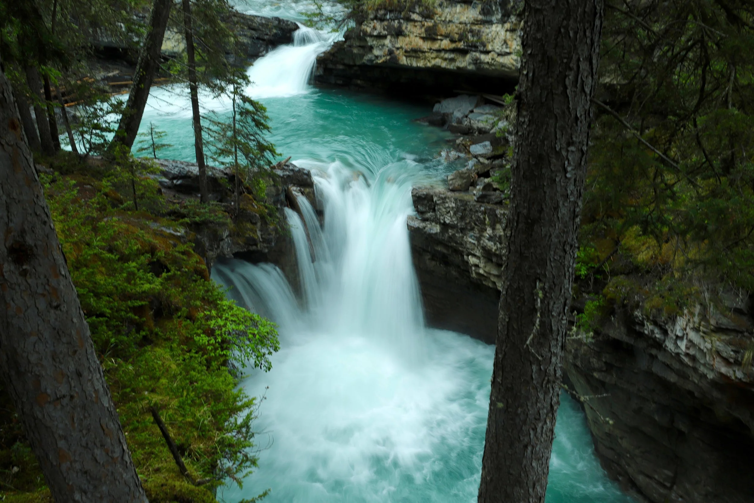
Johnston Canyon Lower Falls
Johnston Canyon Lower Falls, Upper Falls, and Ink Pots
Trailhead Location – Follow Bow Valley Parkway west from the Trans-Canada Highway
Trail Distance – 1.1km from trailhead to Lower Falls. 1.6 km from Lower Falls to Upper Falls. 3.1km from Upper Falls to Ink Pots.
Elevation Gain – 215m
Other Notes – This is a really popular hike and even the overflow parking lot was filled when we were there despite that it was pouring rain. Consider taking the shuttle from Banff.

Johnston Canyon Upper Falls
Trailhead: Rockbound Lake
Rockbound Lake
Trailhead Location – Exit Trans-Canada Hwy 1 at Banff-Windermere Hwy and go to the right towards Castle Mountain. Take a Right on Bow Valley Parkway and another left onto Rockbound Lake Trail.
Trail Distance – 8.5km from parking lot to Rockbound Lake
Elevation Gain – 760m
Other Posts from NatureImpactsUs.com


For a non-hiker, a day at South Dakota’s Custer State Park could include an early morning drive through the wildlife loop. Then drive along Needles Highway, stopping for pictures at each pullout. Enjoy the afternoon at Sylvan Lake - stroll around it and then rent canoes. Head to Mt. Rushmore before the sunsets and enjoy the lighting ceremony.
Hikers may want to start the morning at wandering around the Sunday Gulch Trail, then cool off at the beach in Sylvan Lake. Enjoy an evening drive around the Wildlife Loop. A second morning could be spent driving along Needles Highway, and parking at the Cathedral Spires trailhead. Scramble up to Little Devil’s Tower, and then hike up to Black Elk Peak. Enjoy the evening at Mt. Rushmore.