
Needles Highway
If you enjoy my posts, please consider signing up below to get email notifications of my latest posts. I will not share your email.

The Black Hills rest on the western portion of South Dakota with an abundance of things to do with your children on a family trip. If you live in the Midwest, this is a great destination that is relatively close-by for those daring to do a road trip. If you live elsewhere and are looking for a less-crowded option for an amazing summer vacation, the Black Hills promises to be a memorable trip with a little bit of everything offered from National Parks and Monuments to water parks and zoos.
Badlands National Park

Badlands National Park - Notch Trail
If you are coming into the Black Hills from the east along I-90, I would first recommend taking the scenic route through Badlands National Park on your way into the Black Hills. The drive itself takes about an hour. You can also stop for a hike or two or get out at the visitor center and add another 2-3 hours. Check out my post dedicated to the Badlands for specific recommendations on hikes, activities, and viewpoints.

Wall Drug

Wall Drug T-Rex
Wall Drug is just past the end the of the Badlands Scenic Drive. You might as well stop and see what it’s about as you’ve likely seen signs for Wall Drug the past 200+ miles. It’s a good place to at least stretch your legs. The cafe still offers it’s historical 5 cent coffee and free water. If you visit in the summer months, the backyard will be open which features a T-Rex, Jackalope, mini-Mount Rushmore, and a covered wagon. You’ll also have the opportunity to buy any western-themed souvenir that you can imagine.
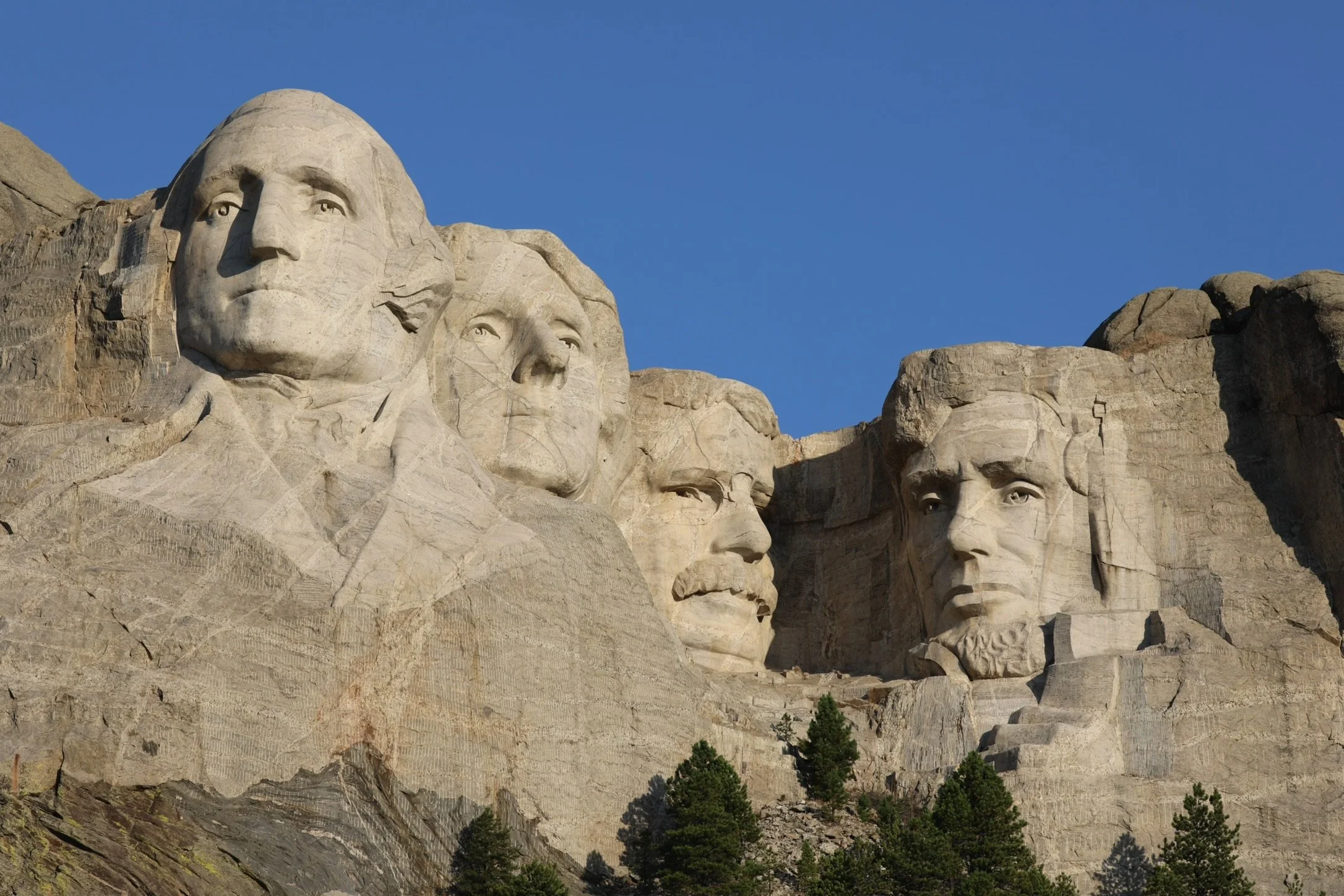
Mount Rushmore National Monument
About an hour and a half past Wall Drug is Mount Rushmore National Monument. If you’ve stopped at the Badlands and Wall Drug, most likely you will hit the Black Hills in the evening. While the visitor center might not be open, Mount Rushmore is a must see attraction at night. From sunset until 11:00pm in the summer months, the monument is lit up at night time. At sunset, there is a 20 minute lighting ceremony which includes a Ranger talk, singing the national anthem, and a flag folding demonstration. They will ask any active military or veterans to participate in the flag folding, which is really powerful if one of your family members has served to see them participate.

Mount Rushmore after the Lighting Ceremony
Things to Do at Mount Rushmore During the Day
Information Center
The Information Center includes general information, park rangers available to answer questions, and a gift store.
Lincoln Borglum Visitor Center
The visitor center includes information about the monument, the sculptor, and the workers who helped build the monument. You can also watch the film “Mount Rushmore, the Shrine” which plays every 20 minutes.
Sculptor’s Studio
You can also explore this third building which has additional information about how the workers built Mount Rushmore. Also included is a smaller model of what Gutzon Borglum had imagined for Mount Rushmore. You’ll notice the monument as it stands today was never finished. The monument was stopped when the faces were complete and the Hall of Records that Borglum imagined would house the Declaration of Independence was never finished.. Learning these secrets make it easy to see why Mount Rushmore was included in the second National Treasure Movie.
Presidential Trail
If you would like to get a little closer to the monument, you can walk along the 0.6 mile Presidential Trail. Note that this trail includes 422 steps and it does not bring right up to the monument.
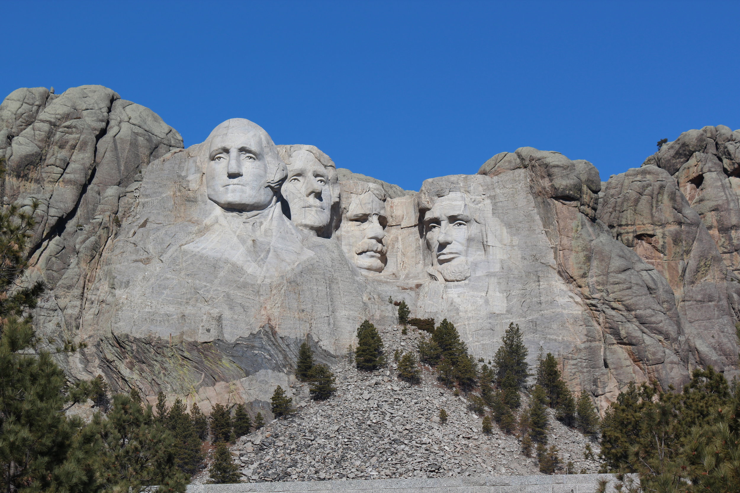
Mount Rushmore
Other Places to View Mount Rushmore
The best place to view the monument head on is by going to the National Memorial. There are a few other places:
1) Profile of George Washington - To see the profile of just George Washington’s face, when you exit the park, go west on SD-244 about a mile. There is a pullout with a small parking lot.
2) Framed image of the four presidents through tunnels on Iron Mountain Road - To see the framed image of Mount Rushmore, you’ll need to drive into Custer State Park and travel along the Iron Mountain Road - 16A (highlighted in yellow below). This road starts in Custer State Park and ends at the National Monument.
Custer State Park
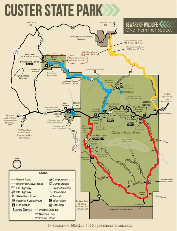
Map of Custer State Park. The Wildlife Loop is highlighted in red, Needles Highway is highlighted in blue, and Iron Mountain Road is highlighted in yellow. Here is the link to Custer State Park’s actual map (without the colors added): https://gfp.sd.gov/userdocs/custer-map.pdf
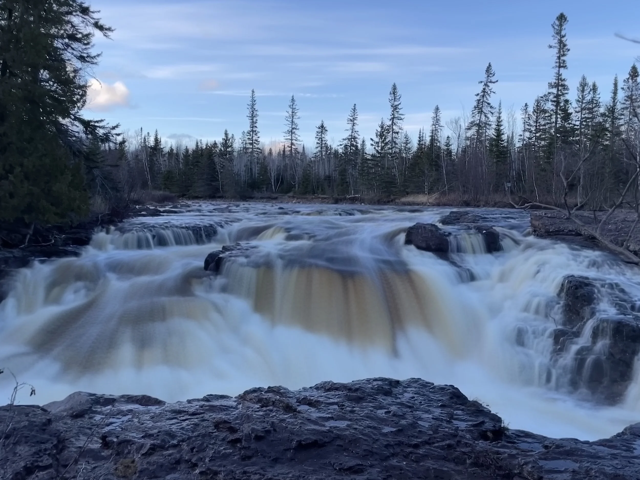
Wildlife Loop

Custer State Park - Wildlife Loop
The Wildlife Loop is an 18-mile drive through Custer State Park (highlighted in red in the above map). This road remains open in the winter. This drive can take an hour or so, depending on wildlife on the road and how many times you stop to take pictures.
Creatures you might find on our near the road include bison, burros, prairie dogs, antelope, and deer. Give the bison plenty of space if you see them on the road. The burro though are a different story - and they will be so bold as to walk up to your car and if your window is open, they might stick their head in. Don’t share any food with them. This only encourages them to continue this behavior.

Burro who came said “Hello” to us on one of our trips around the Wildlife Loop
Hikes
Badger Clark Historic Trail - Near Legion Lake, the trailhead takes off from Badger Clark Road. This is a 1 mile loop hike that was partially built by Badger Clark, a poet laureate. This hike goes through the forest and up a hillside. This is a great short hike option, but does not feature landscape views.
Creekside Trail - This is a paved surface 2-mile one way trail between Game Lodge Campground and Grace Coolidge Campground
Legion Lake Shore Trail - 1 mile loop hike around Legion Lake. There is a nearby trail called Legion Lake Trail, which does not go around the lake and only includes views of the lake.
Lover’s Leap Trail - This 3-mile loop trail is more strenuous. It starts at the Peter Norbeck Visitor Center, across Highway 16A (behind the schoolhouse).
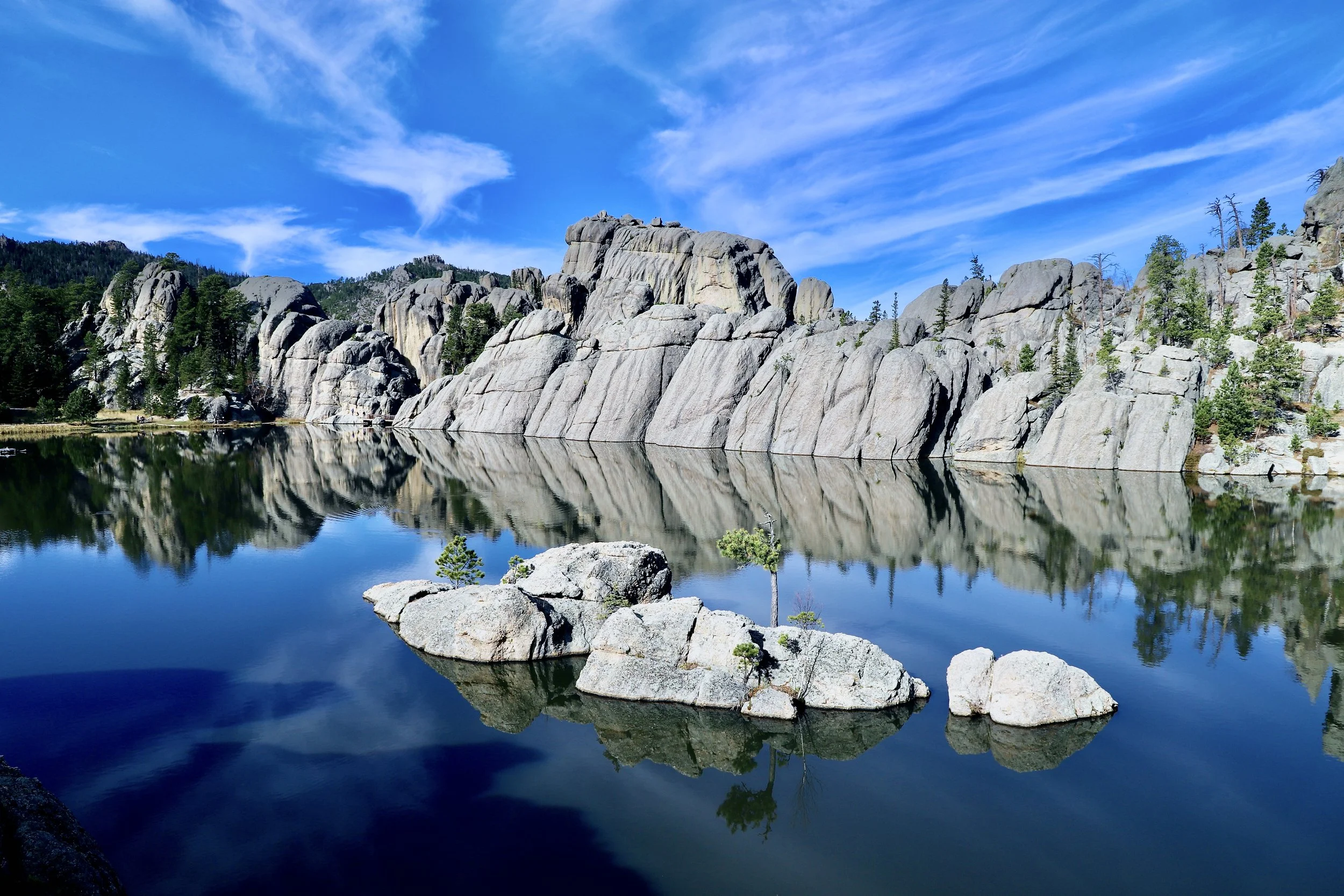
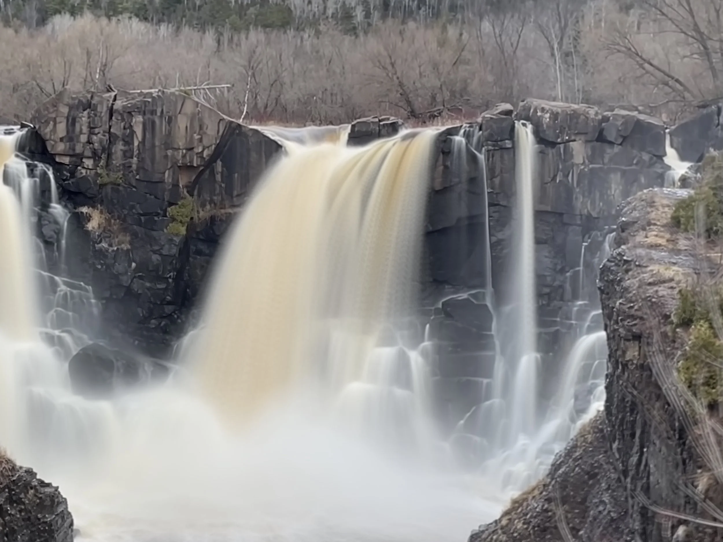
Needles Highway

Needles Highway
Needles Highway is a 14-mile road (highlighted in blue in the above map) which is not maintained in the winter. It is generally open April-October. It starts at Sylvan Lake and ends near Legion Lake. This is an incredible drive with amazing views of rock spires, including the iconic Needle’s Eye. Expect the drive to take 45 minutes to an hour. This is a very windy road. If you tend to have car sickness, this might not be the ideal road to travel on.

Needle’s Eye
Hikes
Cathedral Spires - From Sylvan Lake, drive 2.2 miles along SD-87 to get to the trailhead. There is a small parking lot for the trail. This trail is 1.5 miles one-way. Despite it’s shorter length, this is a strenuous hike and includes climbing over boulders.
This trail has options of connecting with Sylvan Lake, Little Devil’s Tower, and Black Elk Peak (formerly named Harney Peak).

Sylvan Lake
Sylvan Lake is the stunningly beautiful lake featured in National Treasure 2, although the projected map within the movie of how the mountains, lakes, and Mount Rushmore are laid out with respect to one another is not at all correct. Sylvan Lake is the perfect place for an afternoon with hiking, swimming, and boat rental (canoe, kayak, paddle board) options.

Hikes
Sylvan Lake Shore Trail - There is a large parking lot at Sylvan Lake. The Sylvan Lake Shore Trail is a 1-mile flat loop around the lake. This is the easiest hike at Sylvan Lake.
Sunday Gulch Trail - This trail is a strenuous 2.8-mile loop hike that starts by following the Sylvan Lake Shore Trail to the dam and then splits off. This trail includes hiking over sometimes slick boulders and the trail can be submerged at times under the water as the trail crosses over a stream several times. Hiking sandals would be a good idea.
Black Elk Peak (formerly Harney Peak)

View from Black Elk Peak
Black Elk Peak is the highest point in South Dakota at 7,242ft. At the top of the peak is a fire tower that you can climb. There are two routes to Black Elk Peak, both rated moderate, and both start from the Sylvan Lake parking area. The shorter of the two trails is trail #9 which starts at the footbridge leading to the swimming area at Sylvan lake. This is a 3.3-mile one way trail. The other way to get to the top is by taking trail #4, which first Little Devil’s Tower. This is a 3.5-mile one way trail, plus 0.8 miles more (0.4 miles one way) more to go on the spur to little Devil’s Tower. Below is a map of the trails in the Sylvan Lake area. Note that there are a few intersecting trails. Pay close attention to ensure you stay on your intended trail.

Black Elk Trail
Also note that you can do a loop-ish hike and go up one trail and down the other.
The screenshot below if from the GPS app I like to use - Gaia GPS. I download the map of the area I plan to hike when I have access to the internet, and the GPS will continue to work while I hike, even without access to the internet.
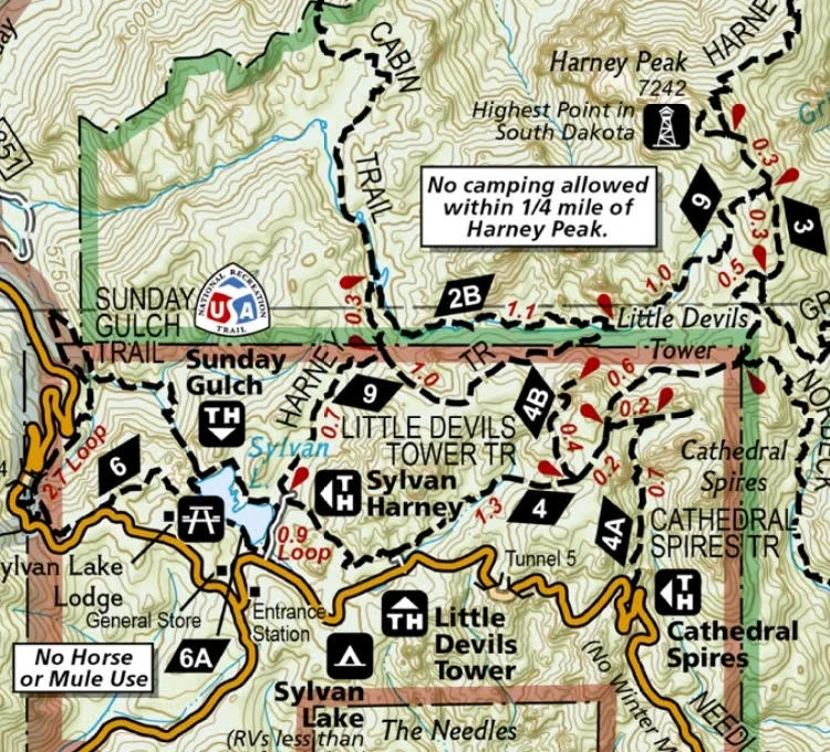
Sylvan Lake Trail Map - Screen Shot from Gaia GPS App
Jewel Cave National Monument
Jewel Cave is 13 miles west of Custer, SD, along US-16. Jewel Cave is still being explored today, and thus far over 200 miles have been mapped, making it 3rd longest cave in the world, and there are still areas yet to be discovered.
Jewel Cave has been identified as a cave that may have bats infected with White Nose Syndrome. This means any clothing worn inside Jewel Cave may not be worn inside another cave (including nearby Wind Cave) so wear footwear and a jacket that are not your favorite and bring a second pair on your vacation if you plan to hike in Wind Cave (or hike in Wind Cave first).
To get cave tour tickets, go to the National Monument website. https://www.nps.gov/jeca/planyourvisit/guidedtours.htm
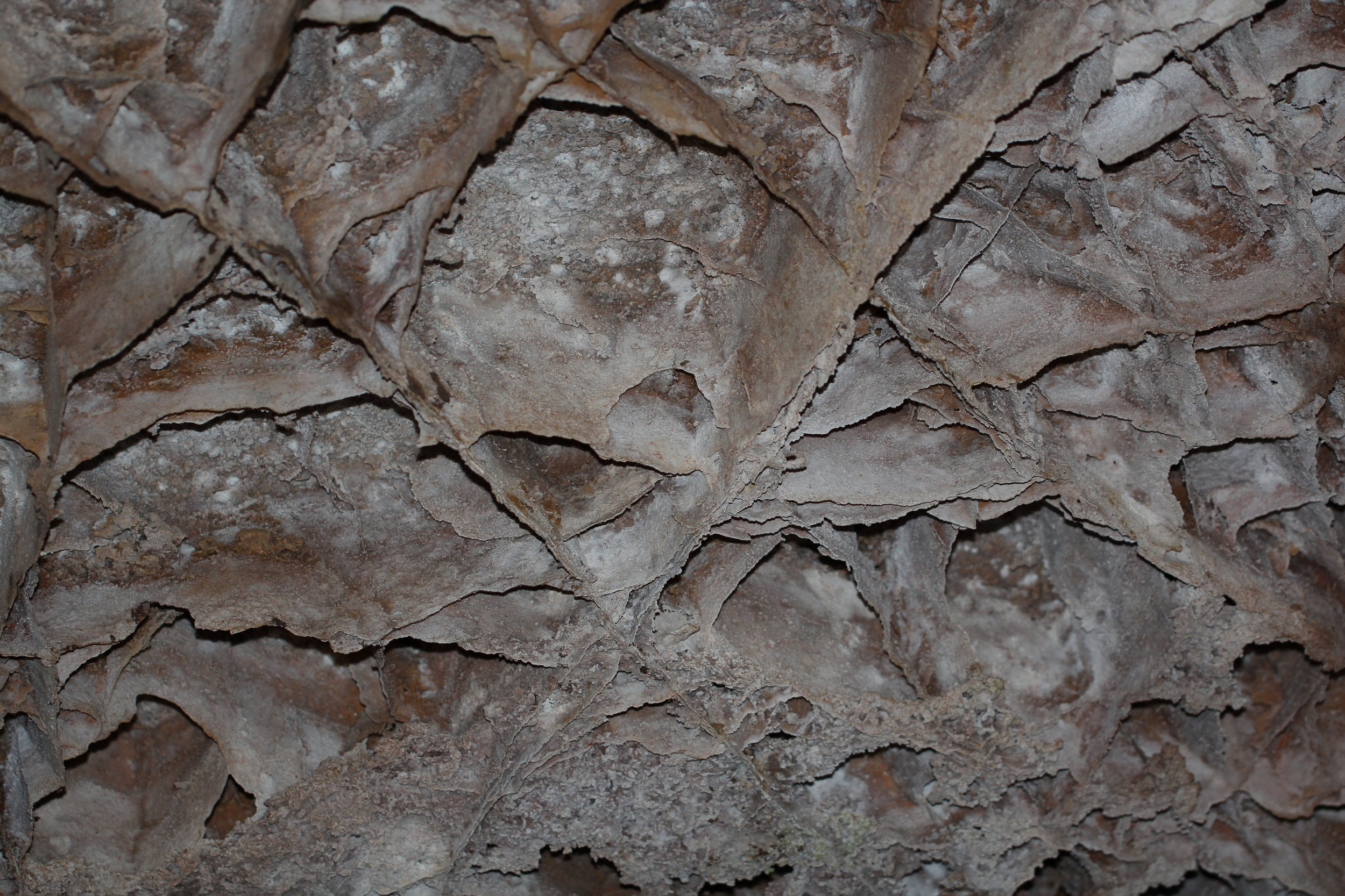
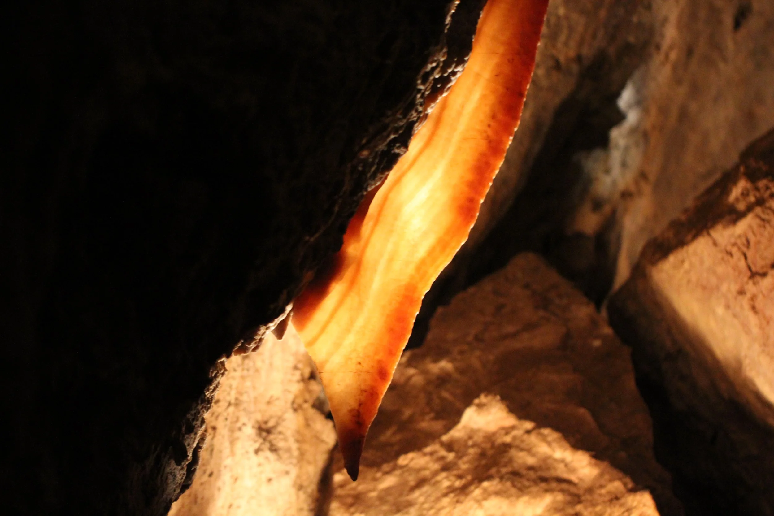
There are two primary tours. The Scenic Tour is the most popular and lasts approximately 80 minutes. This tour is about a half mile and includes more than 700 stairs. This is a colorful cave known for stalactites, stalagmites, cave popcorn, and cave bacon.

Jewel Cave - Cave Bacon
The other main tour is the Lantern Tour. You will enter and leave the cave through the historic entrance and all light on the tour is provided by lanterns carried by the individuals on the cave. All children need to be at least 8 to attend this tour.
There is a third cave tour option for participants 16 years of age and older, which is the Wild Cave Tour. This tour involves cave spelunking and lasts 3-4 hours. My children aren’t old enough to go on this tour yet, but it is on our list of things to do in 9 years.
Wind Cave National Park
Wind Cave Boxwork
Wind Cave is known for it’s extensive boxwork. If you are only able to pick one cave to visit on your trip, I would recommend Jewel Cave over Wind Cave due to the prettier colors in Jewel Cave. That said though, Wind Cave is another large cave network with several interesting features, and similar to Jewel Cave has multiple tour options. See the park’s website for a schedule of tours: https://www.nps.gov/wica/planyourvisit/guidedtours.htm
The easiest tour is the Garden of Eden, which lasts 60 minutes along a 1/3 mile trail. This tour starts in an elevator.
The Natural Entrance Tour lasts 80 minutes and travels 2/3 mile underground. This tour starts in a natural entry point. This is the most common tour for families.
The Fairgrounds Tour is 90 minutes, also travels 2/3 mile and starts with an elevator. This trail includes more stair steps than the other tours.
Similar to Jewel Cave, there are also two specialty tours. A Candlelight Tour with a minimum age of 8, and a Wild Cave Tour (spelunking) with a minimum age of 16.
Crazy Horse Memorial

Crazy Horse Memorial
Crazy Horse Memorial is the largest mountain carving in the world and it is still in the process of being built. Crazy Horse is north of Custer along US-385. Admission to the site includes viewing access to the monument and a cultural center full of information on Crazy Horse, the people of the Black Hills, and how the monument is being formed.
Mammoth Dig Site
If you are looking for an educational non-hiking option, the Mammoth Site in Hot Springs is a fun choice. This is the site of an ancient sink hole, that mammoths and other animals fell into, lured by warm water in the Ice Age, and were unable to climb out of. Thus far 61 different mammoths have been discovered through excavations. There is a 30-minute guided tour around the mammoth site which continues to be an active dig site.
If you have children ages 4-12, there is a separate Junior Paleontology program. Link below:
https://www.mammothsite.org/what-we-do/education/summer-classes.html

Mammoth Dig Site - Junior Paleontologist Excavation
Within a nearby classroom, there are four large pits of sand with recasted mammoth bones hidden. The children are given tools real paleontologists use. They learn the basics of excavation, and then they participated in a simulated dig. My older son was 10 when we did this. I was worried that he might be on the upper end of the age and might think it was a bit hokey. I was happily surprised - he had an amazing time digging, and it was one of his favorite things we did on vacation. I would highly recommend stopping here. I learned a lot and my kids both had a great time.
Reptile Gardens
https://www.reptilegardens.com/
Another non-hiking educational opportunity is Reptile Gardens, south of Rapid City, SD, along US-16. Animals featured included snakes, crocodiles, and giant tortoises. There are several shows throughout the day to learn more about these animals.
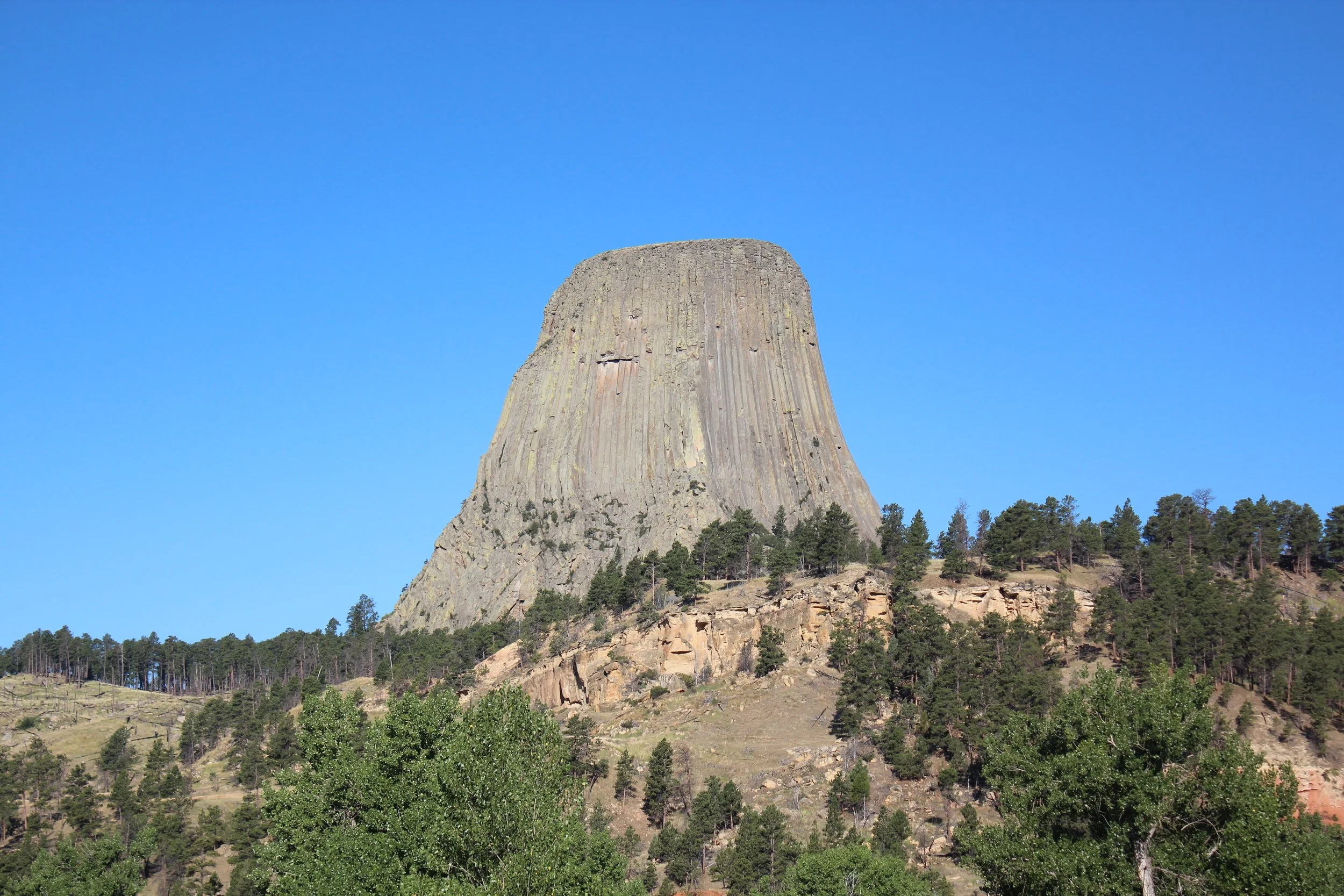
Devil’s Tower National Monument
Similar to the Badlands along I-90 on the east side of the Black Hills, I would recommend stopping at Devil’s Tower National Monument if you are traveling along I-90 west of the Black Hills. This is more of a detour though than the Black Hills. To get to Devil’s Tower, you will need to drive 25 miles once you leave I-90.

Devil’s Tower National Monument
When you first enter Devil’s Tower National Monument along WY-110, you will drive past a prairie dog town (if you aren’t yet tired of these adorable playful animals, but I get it - there are a lot of them on this trip). There are two main hikes, both of which loop around the monument.
Tower Trail - The Tower Trail is the closest trail to the monument. This is a 1.3-mile loop hike.
Red Beds Trail - This loop trail is further from the monument and quite a bit longer at 3 miles.
Other Posts from NatureImpactsUs.com


Everything you need to know about planning a trip to South Dakota’s Black Hills - Including guides to the Badlands, Mount Rushmore, Crazy Horse, Custer State Park, Needles Highway, Wildlife Loop, Sylvan Lake, Black Elk Peak, Jewel Cave, and Wind Cave.